Showing posts with label missouri. Show all posts

Friday, May 2, 2014

Big Oak Tree State Park: Take A Stroll With Giants.

 
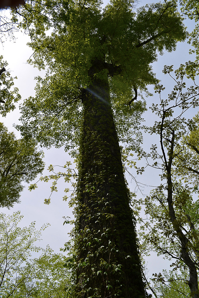
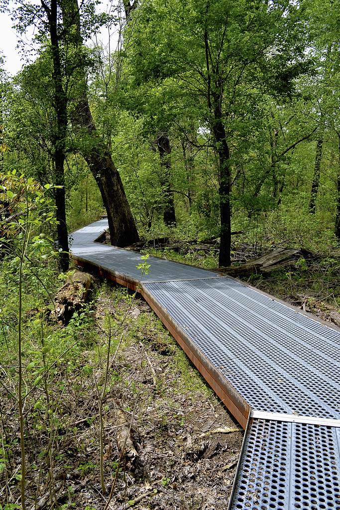
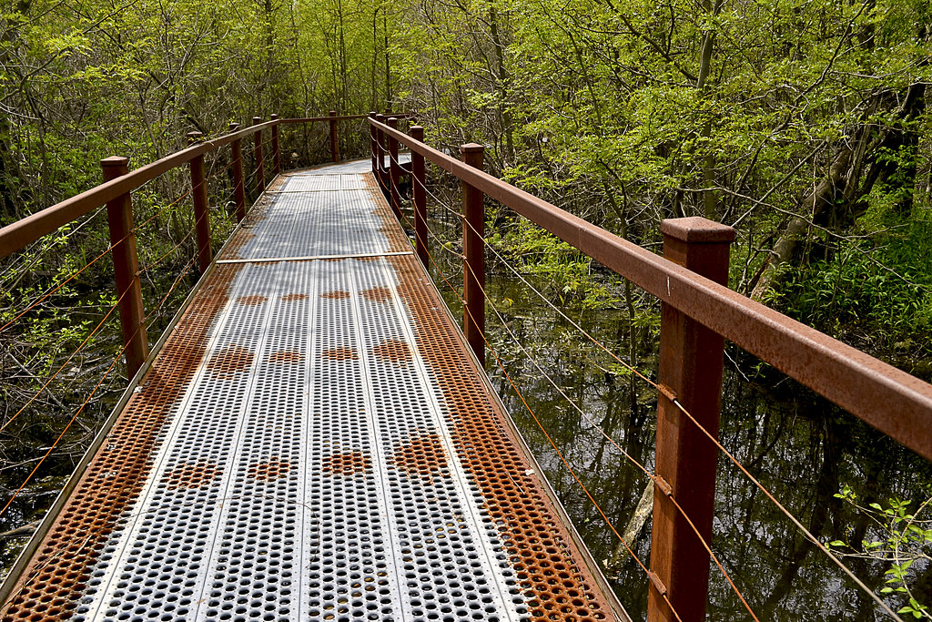
Real-life giants reside in a small conservation area near East Prairie, Missouri. These behemoths tower silently over the swampy land. As we strolled among these quiet colossi we gained a unique, native view of Southeast Missouri and were afforded a free trip back in time; as Big Oak Tree State Park is one of few areas that reflects the original swampy land that the early Native Americans and settlers explored and lived in centuries before us, earning it a Missouri tag as a Natural Area. As we journeyed over the Boardwalk Trail it was amazing to see traditional Missouri hardwood forest with exquisite oak, hickory, sweet gum and sugarberry transform into an environment that would seem to be more at home in Louisiana; a soupy swamp featuring a champion pumpkin ash, bald cypress, swamp privet, button bush, swamp locust, and large black willows, all within a just few yards. After a tour of Big Oak Tree State Park visitors can certainly see why we locals call the bootheel "Swampeast" Missouri.

The Park of Champions! 
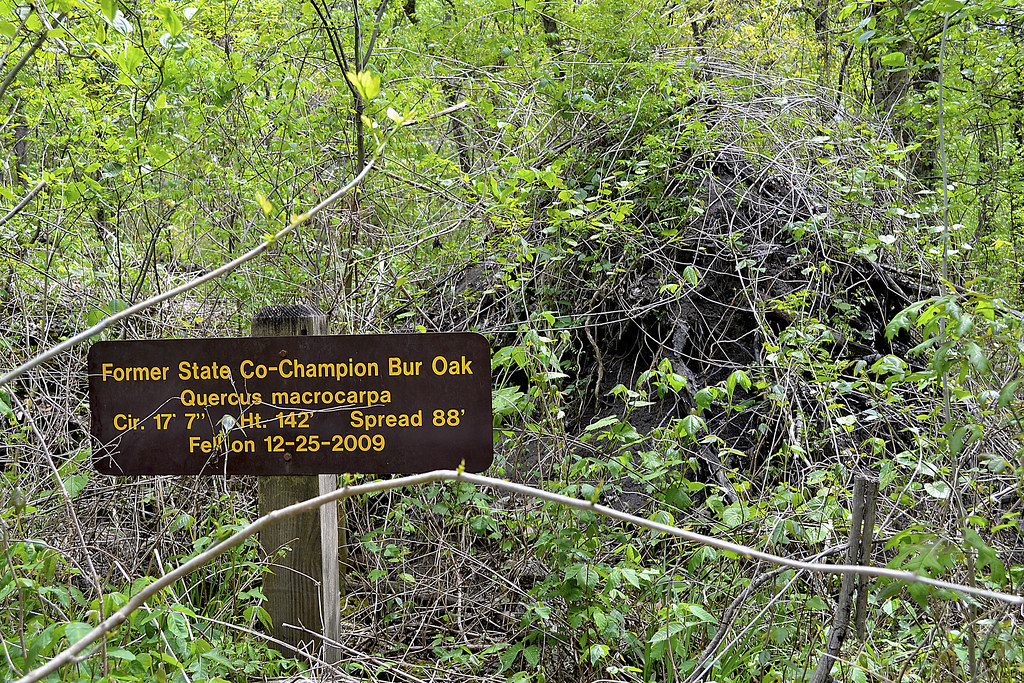
Many current and past champion trees call Big Oak Tree State Park home. In fact, this Missouri state park boasts more champion trees than any other location in Missouri, earning it the nickname "The Park of Champions". According to what I have read the park's two National Champion trees are a Pumpkin Ash with a 118 foot circumference that stands over 150 foot tall and a Persimmon that is 97 foot in circumference and reaches 133 foot in height. Just to provide a quick comparison of just how mighty these mammoths are, an average Persimmon tree stands about 60 foot tall, the noble Persimmon Champion in Big Oak Tree State Park more than doubles that figure! If you want to see the champion Persimmon you will need to take the1.5 mile Bottomland Trail. I'll be honest, even the VINES here are MASSIVE! You can find vines growing up these majestic giants that are reminiscent of creeping vegetation I've only seen in Indiana Jones movies. Be careful though, some of those vines are poison ivy; others include wild grape, peppervine and Virginia creeper.

A unique native habitat provides for diverse life.
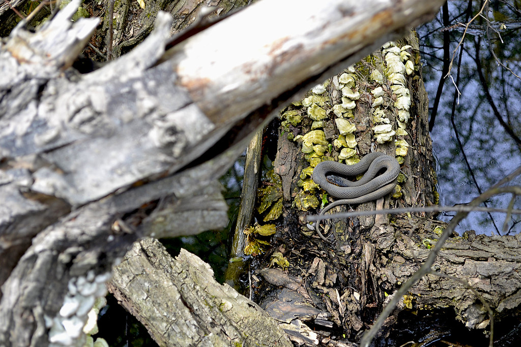
As you hike through Big Oak Tree State Park you may spot wildlife and plantlife that you may not see again or at any other park in Missouri. As you journey through this unique environment, be sure to keep an eye out for the swamp rabbit, who has been placed on the conservation concern list due to its habitat continuing to be drained in Missouri. This unique and sometimes large rabbit loves to swim in the soupy Southeast Missouri swamplands, if pursued they will take to the water to avoid their pursuer and can frequently be seen resting on logs and sticks in the middle of swampland. Birdwatchers from near and far can also be found as over 150 species of birds may be seen here; including the brightly colored prothonotary warbler and my personal favorite, the pileated woodpecker, which can be heard tapping upon the Big Oak Tree giants in search of  a meal. There are snakes in the swamp as well, although there have NOT been any documented sightings of any venomous water snakes such as the water moccasin (cottonmouth) according to the Missouri State Park's Plants and Animals page. You may also keep an ear out for the chorus of croaks, as the frogs serenade for mates in the spring and summer. If you would like to know how to identify the type of frog by it's song, here is a great video for you:


Be sure to bring the kids...
Big Oak Tree State Park is a perfect place to take the kids and have a great day out. The park itself boasts a large picnic area that is near both of the trails and feature barbeque grills, picnic tables, playground, and a large shelter (just in case the weather changes). The Boardwalk Trail is a beautiful and easy walk, the suspended metal trail keeps you dry and your shoes dry as you make your way through the bottomland forest and into a real Southeast Missouri swamp. However, if you are looking for the Interpretive Center which is located at the trailhead for the Boardwalk Trail, it is closed, with a No Trespassing sign blocking the stairs.

But keep in mind...
There are plenty of birds singing, frogs leaping, and even a few snakes slithering in the swamp, but the trail should keep you above any danger. Remember though, you're in a real patch of the "Swampeast" here, and mosquitoes just LOVE all that muddy stagnant water, so don't forget the bug repellent you may want to read my critically acclaimed "Better Safe Than Swarmed - Homemade Bug Spray"  and make your very own (ok, so just my mother acclaimed it, but she's a critic, right?). And my "Tiny. Tenacious. Terrible. Ticks." post will help you properly remove any unwanted bloodsucking hitchhikers that may feel the need to tag along. You may also want to tack a glance at How to Take a Great Dayhike as well, to help you prepare for a great family or solo hike. If you're looking for a trail longer and more "natural" than the Boardwalk Trail, you'll want to hit the Bottomland Trail, which is accessible via a spur that leads to the picnic area and the official trailhead which is near the park's lake. The Missouri Department of Natural Resources has also produced a nice YouTube video that features Big Oak Tree Park, watch it below:


Thank you for reading, I hope to see you out on the trail!


More Information:
Big Oak Tree State Park - MDC page
Big Oak Tree State Park Topographic Map  
Visit Local Treks on facebook!
Go See A Champion - A site listing Champion trees throughout the US
Better Safe Than Swarmed! - A How-To for homemade bug repellen
Tips: How To Take A Great Dayhike
Tiny. Tenacious. Terrible. Ticks.
National Geographic "Backyard Bird Identifier" 
MDC Field Guide - An EXCELLENT resource to local wildlife

Wednesday, April 30, 2014

American Hiking Society's National Trails Day June 7th


American Hiking Society’s National Trails Day® 2014
American Hiking Society’s National Trails Day® will bring together outdoor enthusiasts across the country on Saturday, June 7, 2014, for the 22nd annual celebration of America's magnificent trail system and its countless supporters and volunteers. More than 2,000 nationwide events will take place including trail maintenance, hiking, paddling, biking, horseback riding, bird watching, running, trail celebrations and more!   To find an event near you, visit http://www.americanhiking.org/ntd-events/

National Trails Day® encourages all Americans to connect with local outdoor clubs, businesses, community groups, and parks and recreation departments as well as federal land managing agencies to experience, appreciate, and share the natural places we cherish. "Twenty years ago, American Hiking built National Trails Day® around the idea that for one day each year we should come together outdoors and give back to our favorite trails.  Since then, people from all walks of life have been coming out in increasing numbers on NTD to celebrate our trails and the great outdoors,” said Gregory Miller, American Hiking Society president.

Since 1993, National Trails Day® has inspired millions of individuals and community groups to take part in activities that promote healthy living and mental well-being, protect green space, educate youth and adults on the importance of trails, and instill excitement for the outdoors. Plan now to host or attend an event in your area, visit http://www.americanhiking.org/national-trails-day/ for more information or to host your own event! 

Looking to get outside and on the trail right now? Currently the American Hiking Society 2014 Trails Day Challenge is in full swing and is a GREAT lead up to National Trails Day! Visit http://www.americanhiking.org/national-trails-day/2014-challenge/ to see if there is a hike location near you! Then just "take a hike", snap a photo of yourself on the trail, tweet the pic to @Americanhiking and tag either @Americanhiking or @MenashaRidge with the hashtag #NationalTrailsDay. How easy is that?

American Hiking Society’s National Trails Day® is a nationally recognized trail awareness program that occurs annually on the first Saturday of June and inspires the public to discover, learn about, and celebrate trails while participating in outdoor activities, clinics, and trail stewardship projects.  National Trails Day® is a registered trademark of American Hiking Society.

Founded in 1976, American Hiking Society is the only national, recreation-based nonprofit organization dedicated to promoting and protecting America’s hiking trails, their surrounding natural areas and the hiking experience.   

To learn more about American Hiking Society and its mission and programs, visit www.AmericanHiking.org or call (301) 565-6704.

Sunday, March 2, 2014

Wilderness Areas: Let's Get WILD!

Local Treks: Sapling

Wouldn't you like to get away? Away from the streets teeming with exhaust spewing mechanical monsters, the constant ringing of cell phones, crowded restaurants, the dinging of emails in your inbox, the clamor of people as they march to and fro... Don't you deserve a break? A chance to leave technology and other people behind, a chance to take in a bit of nature's splendor in solitude?

Heck yea you do, and it's easier than you think, you just need to get out and experience your local wilderness areas!

Why (or why not) The Wilderness?
Local Treks: Lower Rock Creek formationsSome of you may be asking, "But why go to a Wilderness Area and not a regular State or Federal Park or recreation area?" I enjoy the Wilderness Areas because they are generally more remote, more secluded and less traveled than other conservation areas or general locations within our Federal or State Parks. Many times when I've been hiking or visiting these Wilderness Areas in Missouri I won't see another human being, I don't hear a hum of an engine (in fact, it is generally illegal to operate a motorized or mechanical vehicle inside a Wilderness Area), just the sweet songs and melodies of nature. Remember these areas are set aside to maintain and preserve the "wildness" of the landscape and wildlife, you are just a visitor.

Now, if you like having the thought that there are others out there and enjoy seeing people from time to time on your hike or backpacking trip, you may want to reconsider visiting the Wilderness Areas. I will be very honest when I say that I have not yet bumped into another person on a trail within the areas I have explored. If not seeing other people on your adventures sets your Spidey-Senses to tingling, you may be better served in one of the excellent conservation or recreation areas available.

Also, be sure to see if the outdoor activity you are looking to do is even available in the Wilderness Area you are looking to visit. In 1986, the Wilderness Act was reinterpreted to ban bicycles from these areas, so that means no mountain biking. Some areas restrict camping areas as well.

Where Can I Find Wilderness Areas?
Local Treks: A wooded trail.
A great source for finding a Wilderness Area near you is to visit Wilderness.Net at http://www.wilderness.net/. This site features a great collection of information on Wilderness Areas near you, features maps and is searchable by state, name, and more.

For those of you in Missouri, here are the Wilds near you!
I am looking forward to writing up some entries soon on
the Rockpile Mountain Wilderness and the Irish Wilderness! So stay tuned.

I certainly don't want to forget my neighbors across the river either. For my Illinoisan hiking pals here's a list of your wilds!
Links to Wilderness.net entries and some of my blog entries listed below.

Wilderness Manners.
Local Treks: Shedding Snake
It may sound odd or maybe even like a bit of an oxymoron, but there are certainly a set of Wilderness Manners that you need to observe when enjoying the acres and acres of designated Wilderness. Always keep in mind that these areas were set aside to preserve nature in as close to an "untouched" state as possible. Here are a few of them:
  • ALWAYS LET SOMEONE KNOW IF YOU ARE GOING TO BE IN THE WILDERNESS. GIVE THEM A TIME FOR YOUR RETURN. TELL THEM YOUR APPROXIMATE SCHEDULE, ROUTE, AND INTENDED CAMPING LOCATIONS.
  • Practice "Leave No Trace". Be sure to tread lightly so that nature may repair and endure for others to enjoy. If you pack it in, pack it out.
  • Pick up your trash. Pick up any other trash you may find as well and pack out with you whenever possible.
  • Always dispose of human waste at a minimum of 100 feet way from your campsite and at least 200 feet away from any water source, in a small, shallow hole (also called a cathole).Read more here, meow....
  • Be sure to use the self-registration boxes at the trailheads. This may very well save your life.
  • Try to find lesser used areas for resting and camping. Popular spots (sometimes referred to a user camps) and the constant use of these camping areas make it harder for nature to replenish herself in some areas. By finding alternative spots you can make her recovery a bit easier and find your very own bit of heaven.
  • Always try to camp out of sight.
  • Be prepared. Have a first aid kit, plenty of water, bug repellent (I have a recipe of one you can drink!), a map of the area, compass, the right clothing and shoes as well. Think ahead.
  • Don't count on your cell phone to rescue you. Many of these areas are outside of the cell service range. Don't forget, you came here for a reason, so don't turn it on unless you really need it or at least keep it on silent.
  • As often as possible stay on the trail when hiking. 
  • Limit your group size to 10 or less.
  • Many of these areas are surrounded by private property, ALWAYS respect these boundaries and the land owners as well.
  • Keep campfires (if needed at all) small. Fire rings should be avoided as they show man was present. Small gas or chemical stoves are preferred. Always practice extreme fire safety and be aware of the current conditions.
  • DO NOT TRANSPORT WOOD FROM HOME for campfires.
  • Leave what you find. Don't take it with you. Take a picture instead.
  • It's worth mentioning again, if you pack it in, you pack it out.
Most of all enjoy the solitude, enjoy the lack of urban sounds, and enjoy those you are with in the Wilderness.

History & Today
The Wilderness Act just celebrated its 50th Anniversary this year! It looks pretty darn good for 50, wouldn't you say? Wilderness areas came about in 1964, when Congress passed The Wilderness Act of 1964 and President Lyndon Johnson signed the bill into law. This act created a legal definition of what a wilderness is in the United States and set aside 9.1 million acres of land aside under federal protection. It also provided us with an eloquent definition of a United States Wilderness Area:
“A wilderness, in contrast with those areas where man and his own works dominate the landscape, is hereby recognized as an area where the earth and its community of life are untrammeled by man, where man himself is a visitor who does not remain.
Lyndon Johnson signing the Wilderness Act of 1964
President Lyndon Johnson finishes signing
The Wilderness Act of 1964
The act itself had taken over 8 years of work and gone through more than 60 drafts and spanning three presidencies. Today the Wilderness Act protects over 106 million acres of federal land and these areas are administered by four federal agencies; The National Park Service, U.S. Forest Service, U.S. Fish and Wildlife Service, and The Bureau of Land Management. The National Park Service covers the largest amount of Wilderness areas at 43,616,250 acres, with the U.S. Forest Service in second with 34,867,591 acres, then the U.S. Fish and Wildlife Service at 20,699,108 acres, and Bureau of Land Management with 6,512,227 acres.

Congress considers adding additional Wilderness Areas each and every year, with some being recommended by concerned citizen groups,federal agencies, grassroots organizations and others. In fact, Congress voted unanimously to protect over 32,000 acres of Sleeping Bear Dunes (in Michigan), the first wilderness area to be added in five years. There are also rumors that the administration is making plans to preserve two additional areas as well: The Organ Mountains-Desert Peaks area in New Mexico and Point Arena-Stornetta Public Lands in California.

More Information:
Visit Local Treks on facebook!
Wilderness.net The BEST source I know of to locate a Wilderness near you.
Full Information on The Wilderness Act of 1964 via Wilderness.net
Wikipedia on The Wilderness Act of 1964
Leave No Trace: Center for Outdoor Ethics an EXCELLENT resource on outdoor manners.
Wilderness Manners: Sierra Club another EXCELLENT resource on outdoor manners.

Wednesday, August 28, 2013

How To Take A GREAT Day Hike

Local Treks Hiking: Single Red Leaf

We've all been here. The TV weatherperson just called the upcoming weekend the "very best ever!" and the smiling sun graphic behind them has you wanting to get out, get in touch with nature, breathe in a bit of fresh air and nab some exercise while you're at it. If you're looking to hit every one of those points out of the park, get on out and take a day hike. If you follow a few simple steps, I'm sure you'll find that a day hike is simple, easy and TONS of fun.

Local Treks Hiking: Millstream View
Where do you want to go?

This is the most important question you can ask yourself before getting into the "meat" of your potential hike. Head to the internet and search your local state and national parks, or better yet read a review or two right here on the blog. If you haven't hiked much you may want to keep your hike short, seeking out 1-2 mile "loop" style trails, be sure to allow yourself plenty of time to soak in the beauty of your surroundings. A loop trail will make a circle and upon completion should take you right back where you started, at the trail head.It is always best to find a topographic map as well, be sure to look at the elevation as every mile hiked up 1000 feet will feel like three miles hiked flat.

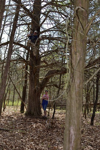
Local Treks Hiking: Climbing Tree
Wear the right clothes.

I like to wear loose fitting clothes, not so loose that they may get in my way in an attempt to trip me, but loose enough that they don't bind me or feel restrictive when I walk, climb or scramble over rocks and boulders. If you want your clothing to run double duty for you be sure to wear light colored clothing, to help avoid ticks. You may also want to spray your clothing down with an insect repellent that contains 20% DEET or make your own homemade bug repellent to keep nasty insects at bay as well, keep in mind, insect repellant doesn't last forever, you'll have to re-apply (usually after 2-3 hours). You may find some good deals on outdoor clothing online, I've found some good deals at The Clymb (you'll need to register though).

Local Treks Hiking: Hiking Shoes
Wear the right shoes.

You don't have to wear hiking boots when hiking, in fact, I don't even own a pair. Personally, I prefer a pair of trail running shoes (or just regular tennis shoes), they are light, responsive and I've found that they grip the trail and rocks quite well. Just be sure that these shoes are comfortable and for the love of Pete, don't ever, ever, ever wear a brand spanking new pair of shoes or boots into the woods. You're begging for them to be ruined and get some wicked blisters as well, always be sure to "wear in" your shoes before really tackling any trail mileage.

Local Treks Hiking: Little Grand Canyon Trail

Find some hiking buddies.

If you're able, grab a few friends and take them with you, bonus points are given (but not rewarded) for nabbing up pals that are experienced hikers. Better yet hop on the Local Treks facebook page and see if anyone else is interested in meeting up! For my fellow hikers that love to take to trail with friends of the hairy and four-legged design, pay special attention when researching your hike as not all state or national park areas allow for pets, even leashed. Let other folks know that you are leaving, even if you're heading out with a group, be sure to indicate where you are heading and what time you expect to be back.

But, I "Vant to be alone"...

Ok there Garbo, not everyone enjoys the outdoors with others. I know that some seek the solace and tranquility that can only truly be attained through absolute "aloneness" and from time to time I dig doing this myself. But before you leave, be sure to let friends and family know where you are going, what time you expect to return and tell them you'll call them once home. Should something happen to you while you're out hiking you'll thank your lucky stars you did this.

Local Treks Hiking: Cut Tree Trail

Pack smart and pack light.

Going on a day hike with a 25 pound pack on your back, most likely, isn't going to result in a "good time". No one is the same, so be sure to make a checklist of what you need to take with you. When I hit the trail I take a small backpack (the same type that kids truck their books to and from school with, a cheap old Jansport):
  • A pocket knife: Conveniently placed, you guessed it, in my pocket...
  • A lighter: I don't smoke, but should something go wrong I want to be able to start a fire, for signaling, warmth or cooking. Also conveniently placed in my pocket.
  • A cell phone: Turned off and placed in my pocket. Nothings more annoying to you or other hikers than your ringtone of awesomeness over the sounds of nature.
  • A compass: It's always comforting to have one of these with you, learn to use a compass and map (it's easy) correctly. Placed in my pocket.
  • A printed map of the area: This is a must. Don't hike without a map of the area, it's that simple. If you get lost this could save your bacon. Maps usually have interesting sites and attractions marked as well, so it helps to keep an eye out for landmarks and potential, slightly off trail, sites. Folded and stuck in my pocket.
  • Water: I've heard that 3 liters per hiker is adequate, I take a 2 liter Stanley vacuum bottle filled with ice water and another 1.5 liter stainless steel water bottle on my hikes and that is plenty of water for me. When hiking with the family, I'm the mule, although my wife will carry water as well. Please don't drink the water on your hike unfiltered, unless you absolutely dig diarrhea, and cramps, and pain, and possible death.
  • Food/Snacks: I love peanut butter crackers. Love em. They make it into every single pack I take with me. I generally only pack food that can be consumed and safely carried at room temperature, so apples, beef jerky (mmmmm), trail mix, pears, oranges, fruit snacks, etc. However, just because you're eating a piece of fruit doesn't make you immune to "pack out what you pack in", keep those cores and peels until you can dispose of them properly in a trash can.
  • A small, but effective first aid kit: Here's what I have in mine; Band-aids, a few Ibruprofen, antibacterial ointment, rain poncho (can double as a little shelter if absolutely needed), 10' of para-cord, gauze, and medical tape.
  • A camera: It's simple. I don't hit a trail with out either my Nikon D3100 (and maybe a lens or two) or my little Canon point and shoot, depending on the length and difficulty of the hike.
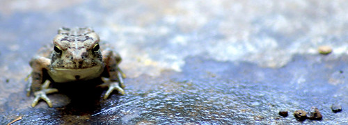
Local Treks Hiking: Hypno Toad

Thank you for reading, hopefully this will help you the next time you decide to hit the trail.

Am I missing something? If you have any questions or comments or if you have something for me to add to the list above, just let us know, either here on the blog or on the Local Treks Facebook page.

Cheers!
More Information:
Map Compass 101 on YouTube by Packrat556
Leave No Trace - Wikipedia (Pack In, Pack Out)
The Clymb: A site to find good deals on outdoor products and clothing

Thursday, August 22, 2013

Washington State Park: Take 1000 Steps Back In Time


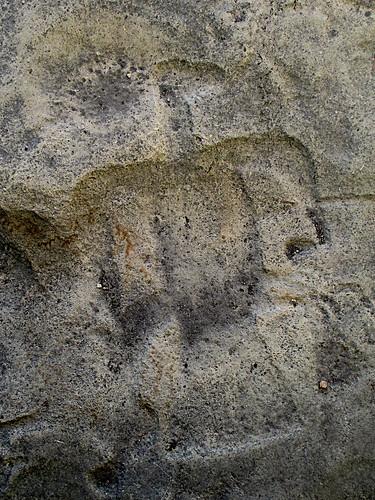
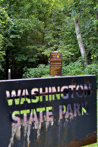
Washington State Park in DeSoto, Missouri, is absolutely amazing. Today the park features a park store, water craft rentals (canoes, rafts, tubes, and kayaks), gravel river banks to river swim from, rental cabins, campgrounds, swimming pool, playgrounds, trails and so much more; it is hard to imagine that it was once home to a group of Mississippian Indians over 600 years ago. It was these Native Americans that literally left their mark on the area in the form of fantastic petroglyphs, which are (for the most part) still undecipherable even today and the petroglyphs here make up 2/3 of the known Missouri carvings! For the outdoor trekkers you'll find the park is home to three trails: the 1.5 mile 1000 Steps Trail, the 2.5 mile Opossum Trail and the 6 mile Rockywood Trail (backpackers will find a camp on this trail). Although the family and I wanted to "hit em all", for our visit, we concentrated on taking time exploring the petroglyphs, park amenities and then took foot to the 1000 Step Trail.

The 1000 Steps Trail begins just across
the lot from the Thunderbird Lodge.
To reach the 1000 Step Trail follow the signs to the Thunderbird Lodge, which is an outstanding example of the African American Civil Conservation Corps handiwork, and park in the lot there. Now, I absolutely must give out a bit history here, because this trail is so unique and beautiful that credit simply has to be given to the Civil Conservation Corps (CCC). The African American Civil Conservation Corps Company 1743 began developing the park land soon after the land was aquired in 1936. Without their skill and stone-masonry most of the buildings (including the Thunderbird Lodge where the company's main camp was located) would not exist and the 1000 Steps Trail would not have a single hand carved step to its name. You will pass by many examples of their work throughout the park, but will find three awesome examples on this hike; Thunderbird Lodge, the steps themselves on the trail and a gorgeous overlook shelter that practically begs you to take a photo of the Big River and the lush valley that contains the float-tastic river. These buildings were placed on the National Register of Historic Places in 1985. Ok, now let's get to hiking!

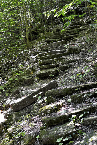
The steps blend perfectly with the woods,
complimenting them rather than competing.
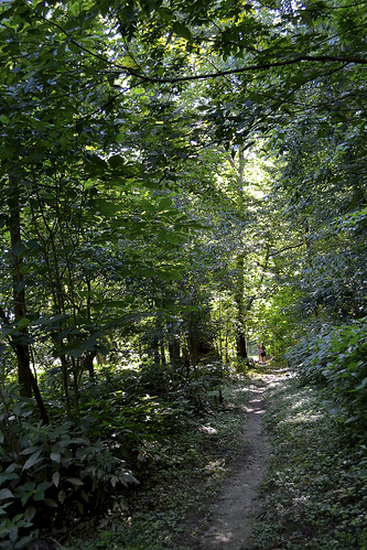
After checking out the Thunderbird Lodge, and maybe booking a float trip for later, you will quickly find the trail head for the 1000 Step Trail just across the parking lot from the lodge. The hike begins quite easy, with a well maintained dirt path (watch out for tree roots) that skirts the road and provides a ground level view of the Big River out in the distance. You will soon reach the loop portion of the trail where we took the left path and followed the Yellow (1000 Step Trail) Blazes. The trees that quickly envelop you are large and seemingly ancient, providing much needed shade for a summer's hike and (I would imagine) would provide a beautiful palate of oranges, reds and yellows during the fall. As we progressed you will see small examples of the CCC's attention to detail, with rocks that line the trail fading in and out, and small bridges that cross spans that are easy to hop. As you continue on and the Big River begins to disappear and the hardwood and pine woods surround you, the first of many CCC placed steps will reveal themselves, yet seem dissolve into the very environment in which they are contained, a perfect example of man working in coordination with nature. Now, while climbing these steps you will quickly notice the carpet of moss, lichens and plant-life, these may make the steps slippery so climb with a touch of caution.

As you make your way on the trail (primarily uphill that is), you may find turkey, deer, mischievous squirrels and other small mammals, as well as small toads and frogs (always a family favorite!), but keep a particular keen eye out during summer as the eastern collared lizard can be found skittering and leaping, upright on their hind legs, from rock to rock. The hardwood forest, consisting of towering Oak, Hickory, Kentucky coffee, sugar maple and slippery elm, has a good undergrowth of pawpaw trees, and if you're lucky you may even find a bit of fruit on one of those pawpaws (if the squirrels and deer haven't found them first). About halfway along the loop, the forest will begin to thin as you approach an opening near the nature center and the restrooms (both constructed by the CCC), during this bit of the hike you may find some wonderful wildflowers, including: Blue-Eyed Marys, Bluebells, Trilliums, Violets and Poppies a particularly lucky and keen eye may even find a rare Primrose, Fremont's Leather Flower and the ever so delicate Blue-Violet Nemastylis.

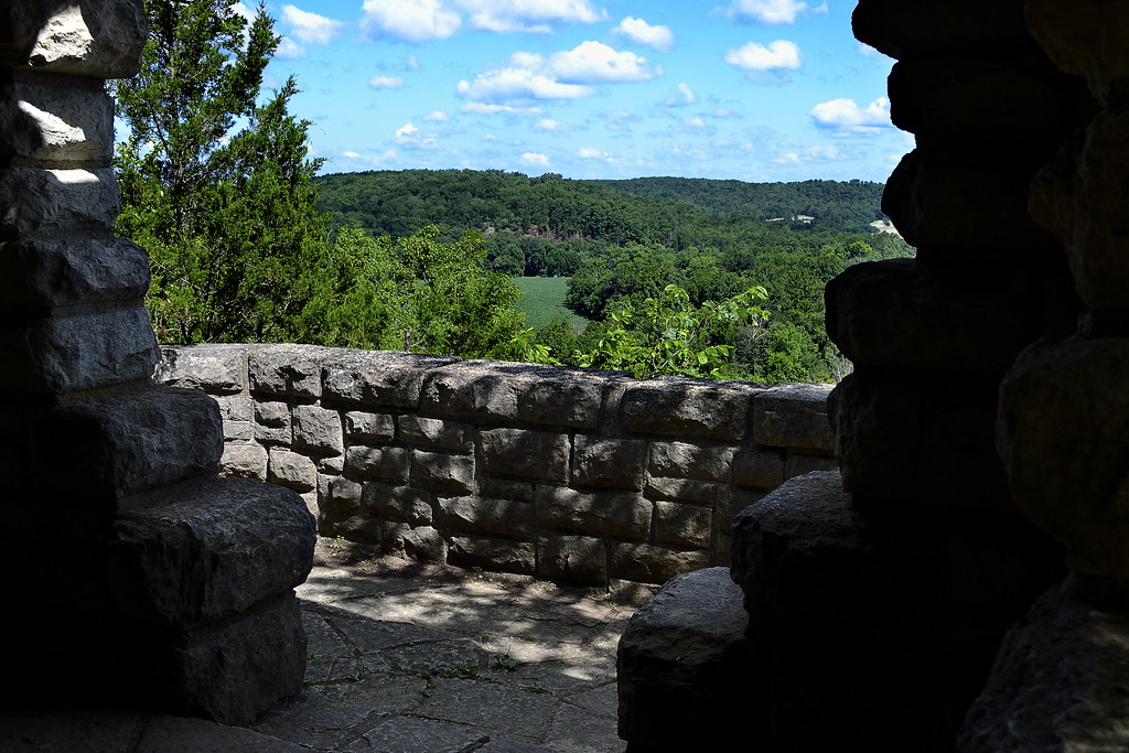
After searching for wildflowers and re-emerging into the forest, be sure to take the right fork to stay on the 1000 Steps Trail, unless you're looking for a place to picnic, then head left, as it takes you to a nice picnic shelter. As you continue on the trail you will soon come to one of the best scenic overlooks I've visited. The view allows for a panoramic glimpse of the Big River and the valley through which it runs and, when under clear blue skies that contrast the lush green of the valley, it's a hard view to beat. Better yet, you can enjoy the view from the quaint CCC constructed overlook building, which melds in perfectly with the surrounding bluffs upon which the site rests. At the overlook building you can also catch a refreshing breeze and closely examine the skill with which each block was cut, placed and set.

You may even "off trail" as small trail runs near the overlook.
After giving your soul a chance to absorb a bit of the Big River horizon, you can continue down the trail which will take you down a dolomite bluff, where rocks have separated from the face and some have tumbled onto the path. Watch your footing here as the rocks can easily slide out from underfoot and send you swiftly to the sitting position, perhaps bruising your pride and your tailbone. As you continue, be sure to look at the path itself, the small rocks imbedded and loose on the trail may be hiding a plethora of quartz crystals in their geode like folds and holes. Just before the end of the trail there is a perfect place to sit on the steps and simply take in the last bits of the serenity that surrounds you, breathe it in, take a few pictures and head back to the trail head.

After hiking the 1000 Steps Trail, and really being introduced to all the outstanding things to do in the park, we can't wait to return to Washington State Park. Next up with most likely be a backpacking trip through Rockywood Trail to view the quarry used by the CCC for the local buildings and a search for the elusive Missouri tarantula!
The overlook absolutely BEGS you to take photos here!
As always, thank you for reading. If you're interested in meeting up for hikes, sharing your hiking experiences and find great locations to explore please visit us on Facebook and give us a like.
More Information:
Like Local Treks on Facebook
Flickr Gallery of photos
Washington State Park
City of DeSoto, Missouri Webpage
Area Events (DeSoto, MO)
Local Weather Conditions

View Larger Map

Friday, August 16, 2013

For the Birds: Juden Creek Conservation Area & More!

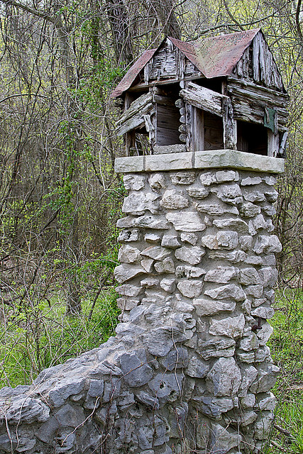
We had passed the bird house topped ancient gate and the small sign, pointing the way to Juden Creek hundreds of times. It seemed each time we took a jaunt to Trail of Tears State Park we would say, "We really should drop by there" and then pass on by... But, something was different on a particular Sunday, something made us turn in to Juden Creek Conservation Area, and I'm glad that whatever unforeseen force pushed us to visit the small park did, because the questions raised on our hike provided me a better vision and understanding of the area and even a bit of its history.

First, here's the HIKE!
In order to get to the trail head, you will take Hwy 177 (Big Bend Road) north through Cape Girardeau, MO. You'll then turn right (East) on old Missouri Route V, then turn right on Cape Rock road. You'll discover the parking lot for the trail on your right. This fairly worn trail will take you through Twin Trees Park, across a narrow band of Juden Creek Conservation Area, and then ending (somewhat abruptly) in the Kelso Sanctuary Natural Area. This trail does have inclines/declines to it and is not surfaced, so I would consider it to be a "moderate" hike.

As we approached the trail head we were instantly aware of the wildlife, particularly the numerous songbirds, who chirped and sang as we began our journey. It wasn't far up the short ascent that the canopy of the hardwood forest quickly enveloped us as we made our way through the Twin Trees Park portion of the trail. A quick survey of the American Beech that are scattered throughout the woods provided me an explanation of why so many songbirds were to be heard here, as they love to devour the fruit of this tree. Interesting note on these Beech trees is that this is about as far West as you will find them, and one of the few places that they grow naturally in Missouri.

As we continued we noticed TONS of wildflowers just beginning to emerge along the trail, with nearly every color of nature's vivid palette brilliantly brushed on to their petals. I would find out only later, that this area is known for the migratory birdwatching and the wildflowers. In fact, Wildflower Walks are sometimes provided during spring by the Cape Girardeau Conservation Nature Center so be sure to check their page if you're heading out there!

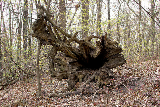
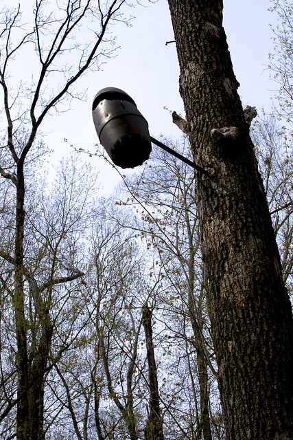
In the trees we would occasionally spot odd, dark, egg-shaped canisters that we assumed were installed to serve as bird houses, in order to attract even more birds to the area, so that they may sing even more songs for trail goers. Many of these bird house seemed to have their entrances widened via the teeth of some squirrels or perhaps they were there to attract a different type of wildlife and had the entrances widened by man. If you may know what these canisters are there for, or what particular birds they may be attracting, please let me know. Despite my lack of knowledge as to whether or not man had widened these holes there was a distinct sign of man's impact on the landscape, the ravages of a suspicious 2009 brush fire, can still be seen on many of the trees and shrubs that line a good portion of the trail as it passes through the Juden Creek area.

Springdale Bird Sanctuary? Hmm.....
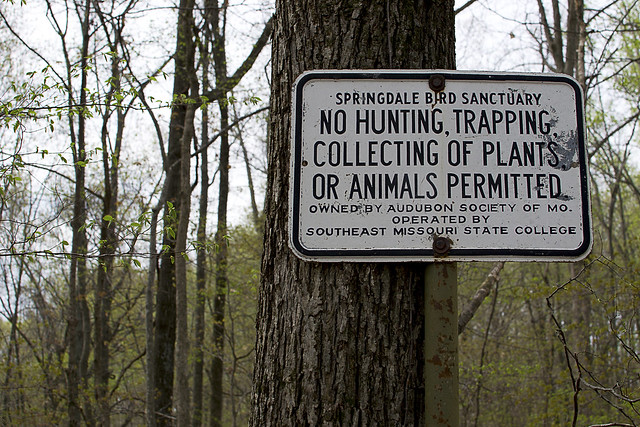
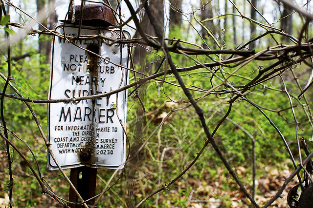
As we continued something else caught my eye. We began to see a scattering of signs for the "Springdale Bird Sanctuary", firmly attached to trees, yet I had never heard of such a place. Many of the signs were weathered and bent, some with the paint peeling, and others peppered with pellet holes. I began to wonder if we had somehow ventured into another park or conservation area, or worse, if I had begun to tread (unknowingly) onto private property. After doing a quick search of the area, and finding no evidence of us being on private property, we continued on the trail, noticing a small pond, just barely noticeable through the trees that the trail seemed to be winding around. This particular area seemed absolutely THICK with pileated woodpeckers, who seemed to stay close enough for us to catch quick, brilliant glimpses of their beauty, but quickly flying away milliseconds before my camera could fully focus on them. We would discover yet another type of sign, one indicating a nearby survey marker, but we could not find the marker the sign was designed to protect (or perhaps it protected the marker too well). Our journey on the trail ended at an old building foundation, with a man gazing at us from his backyard... We decided then it was time to head back.

Note that this is NOT a loop trail, or at least, it was not a loop trail on our experience. We did not go off trail and stuck only to the most worn portion, upon finishing our exploration of the old building foundation and waving to the staring man in his backyard, we simply doubled back and made our way back through the woods to the parking lot. But as we headed back, my mind was awash in questions on exactly what Springdale Bird Sanctuary was and why there was a gate topped with a single bird house, so...

Warning... History stuff below:
Kelso Sanctuary Natural Area began its life in 1937 as the Springdale Bird Sanctuary, when Judge and Mrs. I.R. Kelso donated 20 acres of land to the Audubon Society of Missouri in June of 1937, an additional 7 acres was added soon after. At some time during the 1960's or 1970's the area changed names to the I.R. Kelso Wildlife Sanctuary and I assume later changed to its current designation. As of today, the area consists of 23 acres of wooded area (according to the Missouri Department of Conservation), which is owned by the Audubon Society of Missouri and managed by the Biology department of Southeast Missouri State University. I have also read that the University has leased the land from the Audubon Society of Missouri for a dollar per year since 1962, that sounds like a pretty good deal to me! The Kelso Sanctuary has had multiple bridges, all of which crossed Juden Creek, and all of which no longer exist due to flooding. However, only one (of two originally) of the small birdhouses still tops the gate that led to the entrance and can easily be spotted from Hwy 177 (Big Bend Road) as you approach the Juden Creek Conservation Area turn. Rumor has it that there is a geocache located nearby as well...

More Information:
Juden Creek Hiking Map
Juden Creek Conservation Area
Kelso Sanctuary Natural Area
Cape Girardeau Conservation Nature Center
Audubon Society of Missouri Checklist for Juden Creek
Juden Creek Hike Set on Flickr

f/8 and Be There (blog on Springdale Bird Sanctuary history by Fred Lynch of the Southeast Missourian Newspaper)
Southeast Missourian Photo Gallery of Juden Creek Fire (Photos by Kit Doyle)
This is NOT the Home of the Birds (blog entry by Ken Steinhoff)


View Larger Map

Friday, August 9, 2013

Groovin' At Hippie Hole: Amidon Memorial Conservation Area

Looking downstream at the Hippie Hole
Taking the Right Fork...
Just a few weeks ago I did a short write up on the Castor River Shut Ins of Amidon, which were located just off the left fork in the road as we entered the Amidon Memorial Conservation Area. It was a quick jaunt down the well groomed and maintained trail to get a look at those gorgeous, smooth pink granite boulders that had been shaped and sculpted for years by the Castor River. After finishing the Jekyll and Hyde trail that looped the left area, I left a little "cliff hanger"... What was down the right fork?

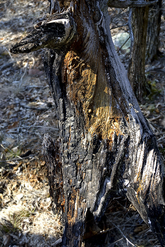
A firestruck tree we found searching
for the mystery concrete foundation.
Well, I suppose I'll retrace my steps a bit, and get you out to the area again with a bit of old fashioned written directions. From St. Louis, you'll take I-55 South to US 67 South towards Bonne Terre/Farmington. After about 50 or so miles you'll need to take MO-72/US-67 BUS toward Fredricktown. At the roundabout (traffic circle) you'll want to continue on Missouri Highway 72, and follow to US-72/Missouri OO where you'll turn right, continuing on US-72 until you see a turnoff on Route J, you'll turn left onto Route J and then keep an eye out for Route W, which you'll take a right on. Follow Route W until you reach County Road 208 (CR 208) and follow that until it turns to a gravel/dirt road and you reach a fork in the road at Amidon Memorial Conservation Area, this time, we'll bear right and continue on CR 208!

Not far down the road from the fork, you'll find a parking lot on your left. If you "dig" (no pun originally intended) gravestones and old family graveyard plots, you can park here and search out the two small cemeteries that are located in the field. We searched for them both, but were only able to find one. We discovered it by hiking directly west of the parking lot to a small grove of cedars. There, in the shade of the evergreens were a few gravestones, to be honest, I haven't investigated those that are entombed there... That may provide another bit of an adventure.

Taking a pause by Hippie Hole in the Fall.
If you hop back in your vehicle and continue down further on CR 208 you'll come to what the area map has labeled as a "Deep Fjord-Caution". This is, in fact, an unaided crossing of the Castor River, think you're up to it? Let me begin with one quick note, never, ever, ever cross flooded, deep or rapidly moving water. Do not cross it on foot, do not cross it in a car, do not attempt upon a lamb and do not cross with green eggs and ham. In all seriousness, don't cross it, you could die. Now, with the pleasantries of possible death taken care of let's get to how you might be able to tell all your friends that you crossed the Castor River in your car! It's simple, after you've established that the water isn't too deep or flooded, find a line and then slowly cross. Don't fire it up there Evel Knievel style and gun it in an attempt to skip across, if you do that you'll run a risk of driving the water into your engine and killing it, just take it easy with slow steady pressure and poof, you'll be safely across. If it looks too deep or you're just a bit frightened of crossing a river in your car (perhaps it's the thought that the river may end up running through your car), you can safely park your car off the road and walk across if you like. In fact, if you just want to play in the water, this crossing area is a great spot to cool off and search for some crawdads hiding underneath rocks. But the real refresher lies about a half mile upstream, at a place a local swimmer we met called the "Hippie Hole".

Keep your eyes up too, you never know what may be up there!
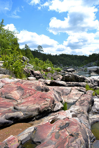
Once you've crossed the Castor River, keep an eye out for a possible second crossing over Stannett Creek very soon after, same rules apply to this crossing, be safe please. After the short crossing of Stannett Creek look for a gravel parking lot to your left, this will be were you may begin your short trek to the Hippie Hole! The trail head begins there at the parking lot and will begin by taking you just on the outskirts of a cleared field. Here wildflower abound during the spring and birds seem to be nearly everywhere. Once to the far edge of the field you will enter into a more wooded area, here the trail is clearly visible, but be careful of exposed roots from the trees that line the trail, they can easily trip you up. This trail will wind alongside the Castor River, with a full canopy of hardwood trees surrounding you as you get closer to Hippie Hole. When the canopy opens up and you hit a gigantic solid mass of pink granite (like in the picture up top) you've arrived at the Hippie Hole. This is a great place to take a dip or even a jump or two!

Love these big pink boulders!
Once you've arrived at the Hippie Hole the trail, for the most part, ends. But don't let that stop you if you're up for a bit of adventure! We continued on, constantly keeping the river within view through the trees, heading ever northward. A local swimmer we met upon our initial arrival had told us of an old building foundation, somewhere "up there" with full finger pointing proximity, and despite our best efforts, we were unable to find it during our extended hike. However, we did find some absolutely beautiful rocks, some chock full of quartz crystals of different colors, and plenty of huge boulders to climb, jump and impersonate Spiderman upon! Also, if you're quiet (and we were), you may even walk up on some whitetail deer in this area. We came across a small herd of 5-6 as we crested a hill, and all of us had a bit of a shock! There are also plenty of squirrels, birds, small reptiles and wild turkey that play in the woods here. You could hike up to the Castor River Shut Ins by just continuing to follow the river upstream a bit over a mile or so, as well if you like.

Now, I referred to this area Hippie Hole and I'm no local. I've heard there are some that call it different names, while others have Hippie Hole in a different location all together... All I can do is count on that one local swimmer's account for the naming of this area, but of course, his directions to that concrete foundation weren't so great, so he may have been a bit off... But with cool waters to tread in and rocks to take a plunge from, I'll just call it a great old fashioned swimmin' hole!

More Information:
Amidon Memorial Conservation Area Homepage
Amidon Area Map (may want to refer to this as you drive from Fredricktown to Amidon for directions*)
Audubon Society of Missouri Amidon Bird Check List

*Note on map below... Google seems to use different terminology on some roads/rural highways, the path below should still get you to the area from St. Louis.

View Larger Map

Friday, August 2, 2013

An Absolute Hidden Gem: Cathedral Canyon (Dark Hollow or Lower Rock Creek)

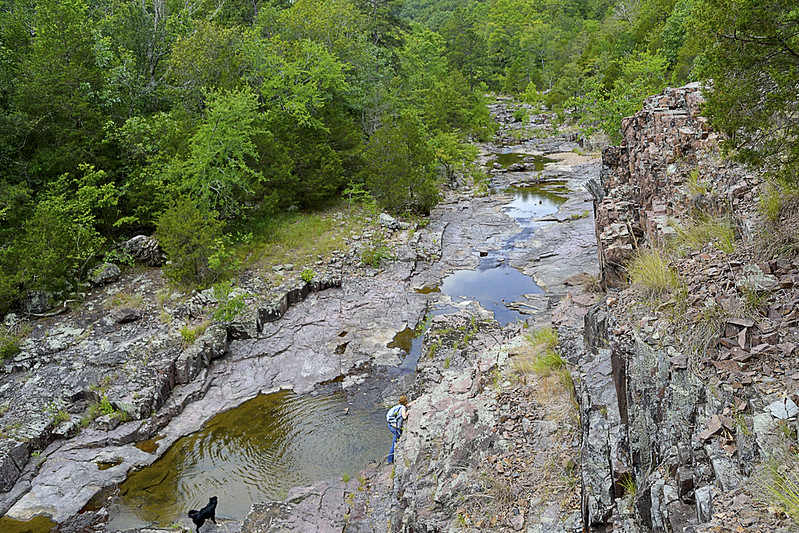
A birds eye view from a bluff overlooking Lower Rock Creek.

Cathedral Canyon is a gorgeous and seemingly remote part of the Mark Twain National Forest, that goes by many names.  I prefer to call the area Cathedral Canyon because the serenity and staggering beauty there may only be truly matched by a quiet cathedral. Other hikers and soul seekers may refer to it as Dark Hollow, Lower Rock Creek (this seems to be one of the most accepted names), or even the Trackler Mountain trail, I believe that no matter what you want to call this remote and relatively undisturbed forest, you'll leave calling it magical.

A little something left as thanks for a great hike!
Now, I'm going to be completely honest... I almost didn't write this post. The reason behind my potential omission was wholly selfish. Due to the sheer beauty of the area and the pure lack of any real, discernible trace of human influence on the landscape, I simply didn't want to let others know about it. On our hike we found no trash (so if you visit, please keep it this way), no well trampled trail and heard not a single unnatural noise or sound. So, I admit, I wanted to keep it secret, keep it hidden, keep it "remote" for just a bit longer, but that simply isn't fair to anyone (or the Mark Twain National Forest for that matter).

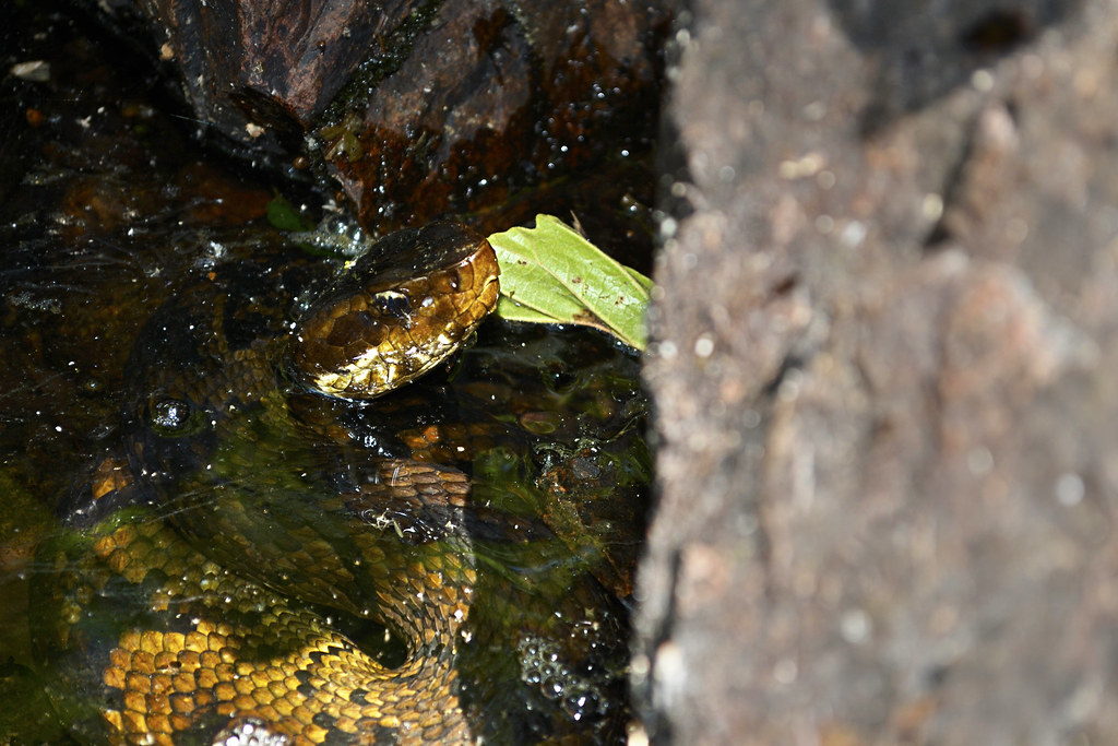
These guys (and gals) are everywhere in Lower Rock Creek.
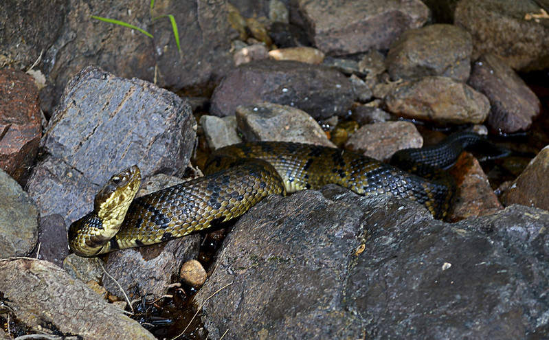
Since I've decided to share my precious hideaway, let me start with one reason you may not want to visit in spring, summer, and early fall... Snakes. And I'm talking a lot of snakes, lots and lots of poisonous snakes. So if you have an Indiana Jones like fear of our scaly, legless, cold blooded, slitherers, don't come here until winter or late fall (it's still beautiful then). On our hike we spotted a couple of copperheads, a timber rattlesnake and countless cottonmouths. The cottonmouths (water moccasins) were so thick, I nearly stepped on one while stepping over another. I am not exaggerating here, go ahead and Google it, I'll wait... See?

The gate and bullet ridden reflective sign
mark the trail head. Nothing says "C'mon in" like bulletholes!
Still here? Still Reading? Still want to go? Ok, I thought that may scare you, but you are very brave, very brave indeed! So onto the directions... Coming from St. Louis (I know, I usually start everyone at Cape Girardeau), you'll take I-55 South to highway 67. Take highway 67 South to highway E. When you hit Fredricktown, you'll go West (which is on the right) on highway E. Continue on highway E for about 10 or so miles, and be on the look out for County Road 511 (CR 511), it will be on your right. Turn right on CR 511, and travel about a mile, when you cross over a low water bridge take an immediate left on the unmarked road there. BE CAREFUL, this unmarked, heavily forested road is VERY, VERY rough! Find a place to park, out of the way of the way of the unmarked road, and walk to the "trail head" marked by a traffic style gate with a reflective sign on it.

The beginning of the trail.
Once you've found the trail head, you will set trek on a wondrous journey on a rarely traveled trail (some call this trail the Jeep trail or path) through an evergreen and deciduous forest that creates an exquisite canopy overhead. You will soon reach a small fork in the trail, mere yards after the gate, we took the left fork and it worked for us. As you travel be sure take note of your surroundings, look for wildflowers, perhaps discover some wild blackberries (as we did), or Ozark witch hazel and listen for local wildlife (which may even included black bears, we didn't see any of these) moving through the undergrowth. I mention to be sure to take note of your surroundings because the trail may disappear from time to time, due strictly to the fact that not many travel or hike upon it, so do take note of interesting features (trees, flowers, rock formations, whatever floats your boat) and other hikers trail markings just in case, you may need them to navigate back later. The wooded portion of the trail winds for about a mile or so, then the canopy opens up and you will find yourself on the rocky banks of Lower Rock Creek!

Be sure to search for a marker as you emerge from the trail to Lower Rock Creek.
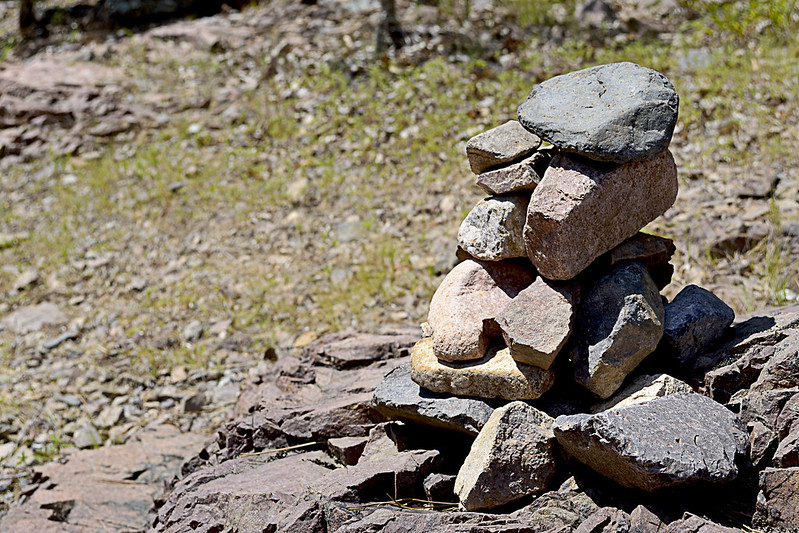
We used this existing rock cairn as our marker, thanks to whomever left it behind!
At this junction, given the remoteness of the area, my wife and I spied a rock cairn already built that conveniently marked where we had emerged from the trail so we took note straight away. This pile of rocks would be the marker we would search for to find our way back. If you aren't lucky enough to have a small cairn already built for you, heck, make your own, it's like nature's Jenga! Or you could place a dead branch pointing to the trail on the rocky shore as well, just be sure that you mark the trail so that you can return easily. Now, if you headed left, or downstream, you could actually follow the Lower Rock Creek until it runs into the St. Francois River and I'm pretty sure that could be a great hike in itself. However, we turned our sights upstream (right) as a steep and climbable bluff had quickly caught my attention.

The step-like formations.
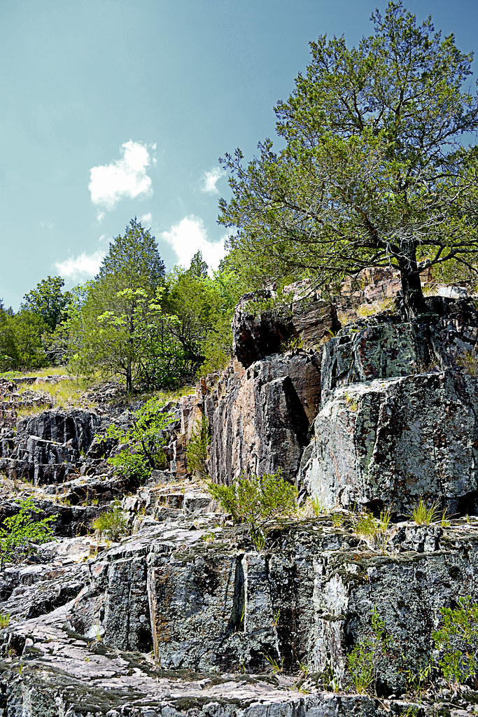
If you decide to climb a few of these bluffs as well, be very careful, in spots the rhyolite bedrock and pinkish colored igneous rock will slip and shatter underfoot and although it may not look like a long fall from the base of your climb, it will certainly not feel good to take rapid descent caused by a slip or fall to the creek floor. The sharp, angular fractures of the rock lining the canyon walls provide fantastic foot, toe and hand holds for your ascent though, just be sure they are solid before placing your full weight on them. If you've made it up to the top, be prepared for a fantastic view of the canyon floor and winding Lower Rock Creek. You may even chance upon a collared lizard or two up here.

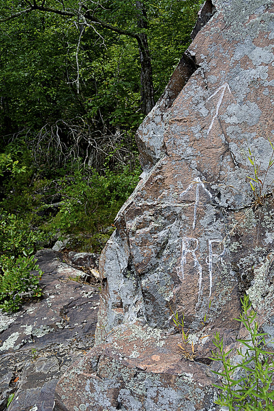
RR: Rattlesnake Ridge?
As we headed upstream the snakes became more and more prevalent, for a spell I was paying far more attention to the snakes than the scenery, simply because they seemed to be on every horizontal surface, basking in the summer sun. Interspersed with the cottonmouths were a copperhead and a timber rattle snake, the latter we found just before heading back into the forest on a trail marked by RR inscribed on a nearby rock. After a few jokes about the RR standing for Rattlesnake Ridge, we continued onto the trail. This trail quickly faded, within about 30 or so yards so of the marker, so we decided to gingerly create our own, winding up and down the hill side, seeking the easiest path sometimes following game trails (deer and other game always seem to find the easiest way about the area). We found more wildflowers and fantastic spots to climb rocks and boulders as we made our way further.

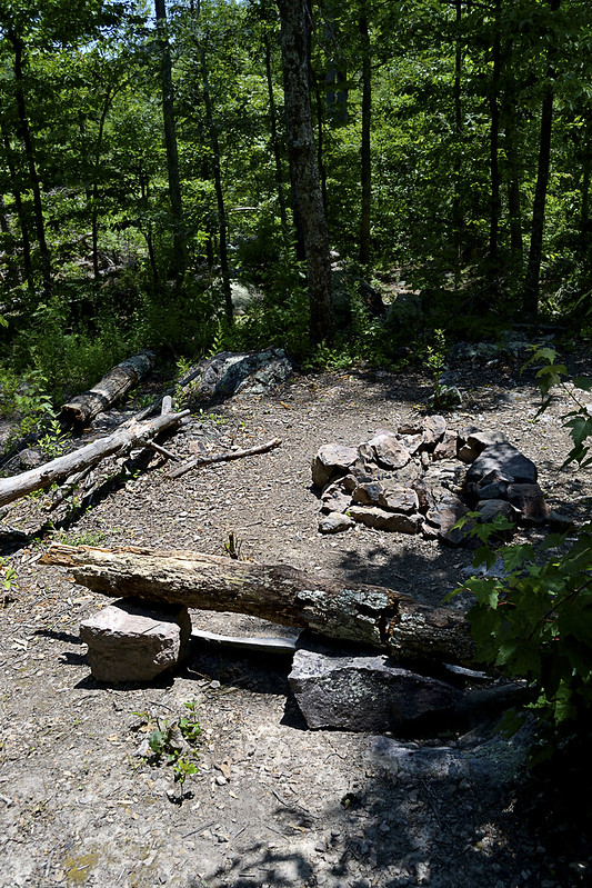
Time to camp!
Now, for all you campers out there (backpackers too) we came upon an absolutely beautiful spot to camp, complete with a rock lined fire pit, comfortable log bench and a smooth, level patch of earth just begging for a tent to be pitched. As we took our own rest here, enjoying a bit of trail mix and peanut butter crackers, I was struck by the views this site offered. The exposed bluffs glistened white in the sun's rays, dotted with evergreens, while the Lower Rock Creek provided a steady beat of water gurgling, with the songbirds providing chorus. For a moment I had reached outdoor nirvana, everything coming together perfectly, with pinpoint timing and I was able to share that with my wife... That's what hiking is to me. Finding those moments and being able to share them with someone else, with bonus points for being someone you love...

Well, we poked and prodded a bit around the campsite area and even found a small container that had some camping equipment (pots, pans, etc.) located near the camp site. Of course I had to take the short journey from the campsite to a nearly chest deep pool of water, created by huge boulders and the flow of the Lower Rock Creek, to take a bit of a refresher before we headed back downstream. The journey back was every bit as fun as the trip up, our eyes scanning for snakes lining the creek when not fully focused on the beauty that surrounded us.

The remoteness and serenity of this area is absolutely unsurpassed for me, I haven't been able to find a spot like this anywhere else. So untouched and unaltered, I have read elsewhere that the University of Missouri has described this area as the most significant remaining example of the St. Francois Mountain watershed landscape. I can't think of another place that I so desperately can't wait to return to, and once you've taken a trip here, I'm confident you'll be looking to schedule a return visit too! But you may not be telling all your friends... You may want to keep it, "secret".

As always, thanks for reading!


More Information:

View Larger Map