Showing posts with label Local Trek. Show all posts

Thursday, May 22, 2014

Taking In A Meteor Shower: The Camelopardalids Meteor Shower

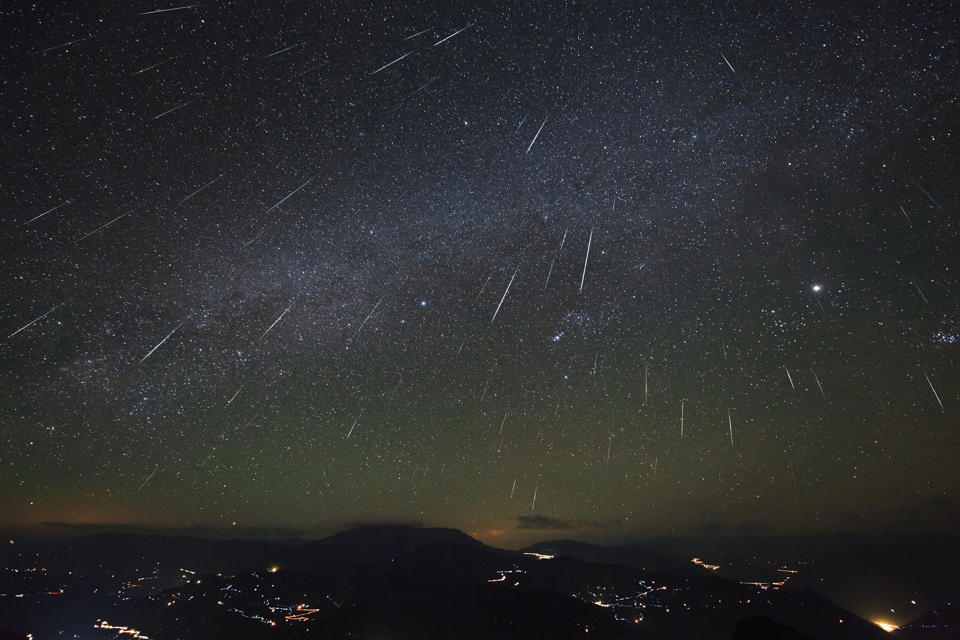
The Geminid Meteor Shower 2012 (Jeff Dai) @ nasa.gov
*UPDATE Friday, May 23 10:53 pm CST: Listening live to the coverage on slooh.com they are advising to keep an eye out for the show to begin at around 2-4 a.m. Eastern or 1-3 a.m. Central... I really advise listening to the coverage, very intelligent, very informative.

Astronomers are predicting that this Friday and Saturday's Camelopardalids meteor shower may be this year's most extraordinary universal display. Currently the experts are predicting between 100-400 meteors per hour, which is far more than normal showers and dwarfs the most recent Lyrid shower which peaked at a measly 20 or so meteors per hour and we are in a PRIME spot here in the states to take it all in!

Not actually 209E/LINEAR, but you
get the idea... right?
Halleys Comet: nasa.gov
The Camelopardalids meteor shower is brought to you by it's proud momma, a comet named 209P/LINEAR which has a rather melodic sound to it doesn't it? This comet will be streaking near Earth on May 29, blowing us a flame streaking kiss from a scant 8.3 million kilometers away. It's due to this petite (209P/LINEAR is only 600 meters around, slim and trim by comet standards) comet's passing that we will find our Earthly trajectory passing right in her debris field, which is what will actually create this spacial display. The meteors we'll see this year are actually left over interplanetary grains, pebbles, rocks and junk from previous 209P/LINEAR visits, ejected over years from her nucleus. This year we'll find ourselves going through many of her old debris fields and as all of bits and bobs smack our atmosphere here on Earth it burns up, creating those sweet flaming meteors that may make some of us think of Aerosmith.

Easy Step By Step Directions For Viewing Camelopardalids

  1. Pray for a clear night.* Don't pray? Then wish. Don't wish? Then birthday's must stink at your house...
  2. Wait until dark on Friday, May 23. Take note of where the sun set.
  3. Open your front door.
  4. Walk outside.
  5. Put down a blanket and take a seat.
  6. Face where the sun went down.
  7. Turn 90 degrees to your right, it should face you north.
  8. Look up. If you don't see anything, try repeating the steps above every 30 minutes or so.
  9. Commence your thoughts of how small you are in relation to the cosmos or how cute Liv Tyler was in Armageddon as the meteors streak across the sky.
*Didn't get a clear night? Don't worry, you can hop online and watch the show live over on Slooh Community Observatory's webpage. Go ahead and put down your blanket, turn out the lights and pop that cold beverage anyway as you watch.

More Specific Directions For Viewing Camelopardalids

For best viewing any meteor shower your should try to get as far away from artificial light sources as possible, so go out and ruin Make Out Point for a night, sending those teens to smooch somewhere else, or just take a drive out from town, find a quiet public place that is open and sit on your hood to enjoy the show (I'm talking about the meteors here, not the smooching teenagers). If the furthest you can roam from home is your own porch or yard, just turn out as many lights as possible and find the darkest area of your own personal space.

Once you've procured your favorite spot, and perhaps laid down a blanket, or popped a cold beverage it's time to terrify the children with stories of how the meteors are actually brain eating aliens preparing to land, bent on world domination and hungering for the fresh grey matter of children. No, on second thought don't do that last step... Terrifying children, although fun, can have horrible results on their adult lives.

From Nasa's Image Gallery
Now, the meteor shower is named Camelopardalids after the relatively obscure constellation of, you guessed it, Camelopardalids or "the giraffe" (you thought camel, didn't you?). Given that this is the first time I've ever heard of this particular constellation, I wanted to get a better bead on exactly where to look for the meteors, and as luck would have it, the giraffe is pretty darn close to that blazing star Polaris, better known as the North Star. So, now I know to find the brightest star in the heavens and fix my gaze that-a-way. However, with the prediction of so many meteors, you should be able to find the most active area relatively easily.

So, you've waited for dark, found a nice spot, laid down your blanket, popped open a cold beverage and found the brightest star in the sky... What's next? Well, give your eyes a few seconds to adjust, watch for streaks, say ooh and aah, and maybe take a few pictures. Wondering how to take pictures of the meteor shower, well that's a bit out of my wheelhouse, here's a good article though. The last thing to do, and this is completely optional (but I feel very important); have someone else there to revel and marvel in the celestial beauty, wonder and amaze at how distant rocks and debris can put on such a splendid show, seemingly just for you.

Useless Trivia That May Make You Sound Smart

Up there a few paragraphs above I told you the meaning of the name Camelopardalids is the giraffe. But, I'm sure that you looked at that name and thought, "How the heck did they get giraffe from Camelopardalids?" Well, here's the skinny and I'm not talking about the knobby knees of the giraffe here. The name camelopardalids is actually Roman, and it comes from their attempt to describe this crazy animal they had found in Africa. This animal, which was "part leopard" and "part camel" became the camelopardalids. As G.I. Joe would say, "knowing is half the battle", use this information tonight to sound super smart as you take in the shower.

Happy meteoric trails and thanks, as always, for reading!

More Information

Slooh Community Observatory Homepage - A great place to watch the meteors, should clouds try to ruin your night.
Steve's Digicams: Digital Photography 101: How to photograph meteor showers
Sky and Telescope: Ready for May's Surprise Meteor Shower?
NASA's Sweet Gallery of Meteor Shower Images - To get you in the mood

Tuesday, May 13, 2014

Finding Inspiration: Yosemite HD II Released

If you haven't had a chance to see the video created by filmmakers Colin Delehanty and Sheldon Neill, you're missing out on one of the most inspirational and downright beautiful clip I've ever come across. These two embarked upon a 200 plus mile backpacking trip through the Yosemite National Park in order to capture the breathtaking time-lapse video seen in Yosemite HD II. As if the wonders of the park itself are not overwhelming in their own right, the duo shot the footage utilizing 4K UHD (also called 2160p) which offers FOUR TIMES the definition of 1080p... Pretty impressive, right?


The beauty of Yosemite really shines in this piece as they shoot locations such as Yosemite Valley, Half Dome (which is what originally inspired the filmmakers!), El Capitan, Mount Watkins, Yosemite Falls, Vernal Falls, Ribbon Falls, Turtleback Dome, Glacier Point, May Lake, Cathedral Lakes and many, many more iconic Yosemite destinations. These two truly did a bang up job capturing these locations in their very best light and the time-lapse pans are flat out insane.

Looking at their camera gear I was impressed with what they were using: A Canon 5D Mark III, Sony FS700, Stage 1 Dolly from Dynamic Perception (which had to have been integral in the beautiful time-lapse pans), Canon 16-35mm f/2.8L II lens, Canon 70-200mm f/2.8 IS II lens, and Lee .9 ND Gradient filters. That's much, much less than what I would have thought they used out there on the trail, but when it comes to backpacking in that gear I certainly can't believe they got these results! Truly awesome.

With the combination of the filmmakers vision, the gob-smacking natural beauty of Yosemite, and fantastic use of gear and raging resolution this video is about as close as you can get to being there. So, go ahead, check out the video above and marvel at the sites of Yosemite and be sure to click that little gear icon in the lower right hand corner and bump up the resolution as high as possible. Then, if you can, scrunch your face in close to your monitor and perhaps maybe, just maybe, you can trick yourself into thinking you are actually there.

I hope you enjoy.

More On Project Yosemite:

Project Yosemite Homepage
A List of Shooting Locations and Gear

Thursday, May 8, 2014

Breathe Deep: The Black Locusts Are Blooming!


We certainly hope you are as fortunate as we feel right now. As we take our daily "urban hike" down sidewalk on Hopper Road in Cape Girardeau, we are lucky enough to have the fresh scents of the Black Locust (Robina pseudoacacia and may also go by the less commonly used False Acacia) floating on the breeze for us to enjoy throughout our trek. In the rare spots that we cannot smell the sweet fragrance from the Black Locust the fresh Honeysuckle fills our senses instead. The smell is so intense and so sweet, I wish I could bottle it to refresh my memory of a warmer time during the Midwestern winters...

How To Identify A Black Locust

Above is a photo of the very Black Locust blossoms that have been providing us so much olfactory satisfaction this May. You may identify the trees by their compound leaves, raceme hanging white to purple blossoms, and, of course, that highly noticeable aroma. These trees may reach a height of over 70 feet and are similar in appearance to the Honey Locust, although the Black Locust lacks those frightening looking thorns! The Black Locust is native in the United States from Pennsylvania to northern Georgia and stretches its home as far to the west as Arkansas and Oklahoma.

Tuesday, May 6, 2014

Celebrate National Wildflower Week! May 5 - 11

There's more to some wildflowers than meets the eye!

Wildflowers are blooming everywhere (as I'm sure anyone with allergies can certainly attest) and it's just in time for the 26th Anniversary of National Wildflower Week! National Wildflower Week, was established to remind you to get out and marvel at the beauty of wildflowers and also bring attention to the issues that are currently effecting your local fauna, such as loss of local habitat. You don't have to get out into the wilds to sneak glimpses of wildflowers, just look out your window on your commute to work, check in your backyard or go on a quick neighborhood walk to discover the wildflowers that call your area home. So go ahead, set aside a bit of time to take a quick stroll, be it down a dirt trail, down your neighborhood street, or just down your driveway and keep an eye out for the wild beauty that surrounds you.

Share With Us

If you take any photos please feel free to share them with us on our facebook page or tweet them at us on our twitter feed, we'd love to see them. If you'd like us to put some up right here in our blog you can send a link to us at localtreks@gmail.com too. Enjoy the weather, enjoy the wild flowers, enjoy life!

Thanks for reading and happy trails to you!

More Information:
National Wildflower Week Homepage
The National Forest Service Wildflower Week Page

Sunday, April 20, 2014

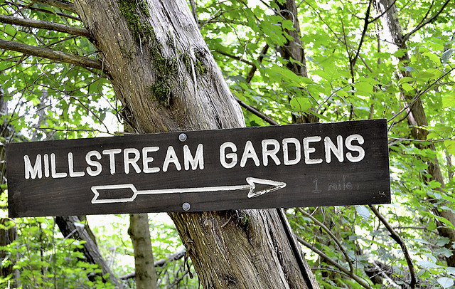
Millstream Gardens: Well Shut Me In!

Local Treks: Millstream Gardens Sign
More of my pictures from Millstream Gardens Atta'Way---->
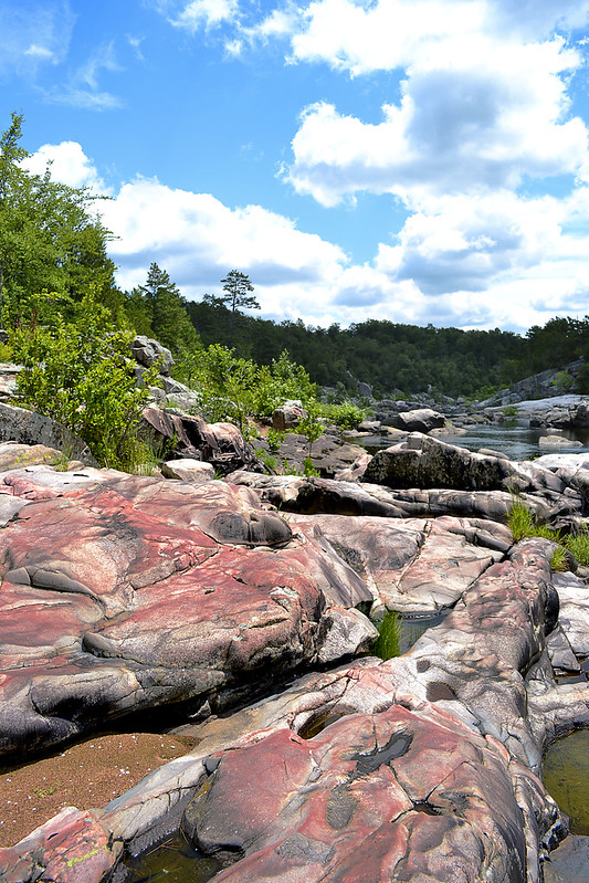
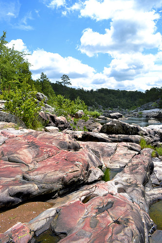
Millstream Gardens is 916 acres of pure magic. The area holds wonders for nearly every outdoor enthusiast and boasts an appearance more reminiscent of the rushing rivers of Colorado than the rolling hills of Missouri. The wonder and natural beauty of Millstream Gardens and the Tiemann Shut-ins contained therein, beg you to take it slow, absorb in the natural majesty and savor every sound, especially the steady sound of rare Missouri whitewater, rushing through the smooth carved granite.

Local Treks: Millstream Gardens Blackberries
As you enter the Millstream Gardens Conservation Area, located just off of hwy 72 between Arcadia and Fredricktown, MO, you will come to a fork in the road. Turning left at the fork takes you to the "official" trail head for the Millstream Gardens trail. From the official trail head the hike runs for about one and a half miles through the woodlands and along the St. Francois River, connecting Millstream Gardens to the Silver Mines Recreation Area. This trail is not a loop trail, so once you've made the journey to the Silver Mines, you'll be heading on back on the same trail, making the trip a three mile trek.

Local Treks: Tiemann Shut Ins at Millstream Gardens
Local Treks: Tiemann Shut-Ins
For hikers with small children and disabilities you will LOVE the beginning of this trail, which hosts a half to three quarters of a mile of paved trail, featuring benches nearly every 100-200 feet. The paved trail also features a very unique low wooden bridge, which crosses a shallow creek, zigging and zagging back and forth creating an interesting crossing. While walking along this portion of the trail, keep a keen eye out for wild blackberries, I spotted them nearly everywhere on a summer trip to the area. At the end of the pavement you will come to a large wooden patio, which provides a perfect vantage point to take in a particularly beautiful section of Tiemann Shut-Ins (pronounced Tee-Man, according to the locals we spoke with). Why is it called a shut-in? Well here's a real "Ozark" answer: The term shut in comes from the stream or river being "shut in" or confined within a deep channel. Forcing the St. Francois River into this channel creates some decent rapids, and that's why the kayaking crews LOVE this portion of the river.

Local Treks: My border collie at Millstream Gardens
Who's a happy boy?
You'll want to spend some time here for sure. The scenery is absolutely astounding and you may find yourself snapping far more pictures than you ever imagined right here at this spot. It is also a perfect spot to dip your toes into the St. Francis River, let the kids (or yourself) splash around in the chilly water, leap from boulder to boulder, take in a quick snack or just sit, and let the sounds of the rushing water simply sooth you. On my first visit to this area, I can assure you that if my border collie, Hyatt, could speak he would have asked to never leave this spot. He splashed from rock to rock and along the sandy shores with the largest smile to ever grace a canine's face. Those of you with dogs will need to take care however, your shoes may give you ample grip on the smooth igneous rocks that form the shut-ins, but your pooch's pads and nails will not, Hyatt slipped into the water frequently as he attempted to follow the same route as myself.

Local Treks: Shark's Fin at Millstream Gardens
Heading East from the overlook you will find the beginning of the Millstream Gardens hiking trail, which is unpaved. As you make your way down the dirt path the trail you will find signs calling attention to landmarks such as Shark's Fin rock, a large angular rock, jutting up from St. Francis River, perhaps to take a bite or two out of some of the kayakers as they shoot the rapids. Other labeled points of interest you will find in this beginning section of the trail are Pine Rock Overlook and Double Drop Rapids. Pine Rock Overlooks provides a perfect perch to steal a few photos of the shut-ins as well. As you continue, ever eastward, you will begin to leave the Tiemann Shut-Ins area and enter the more heavily wooded portion of the trail.

Local Treks: Beautiful Dinner
I caught this bug nabbing a snack!
After the beauty of Tiemann Shut-Ins, don't fret! There is much to be found in the forested area of the trail as well, Millstream Gardens isn't all just pink igneous rock, river and shut-ins. As you continue your hike along the trail you will find majestic oak, hickory and shortleaf pine in the upland woods, complimented by ash, elm and maple trees near the banks of the St. Francois River. The steady sounds of the river can nearly always be heard through the hike; providing a perfect background accompaniment to the bird solos and chorus provided by the wind blowing through the canopy. I spotted beautiful wildflowers nearly everywhere and took a great deal of photos of each, then upon looking at them closer at home, noticed that nearly every single flower hosted some type of stinging or biting insect. I'm certainly glad I didn't go sticking my nose straight in them! Other wildlife to keep an eye out for is white-tailed deer, turkey and... snakes during the warm months.

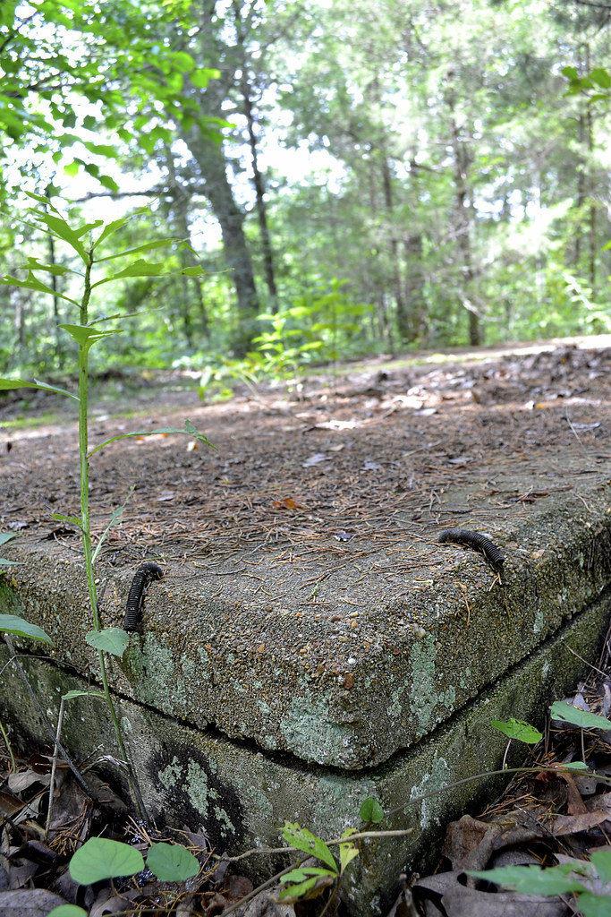
Local Treks: Mystery foundation at Millstream Gardens
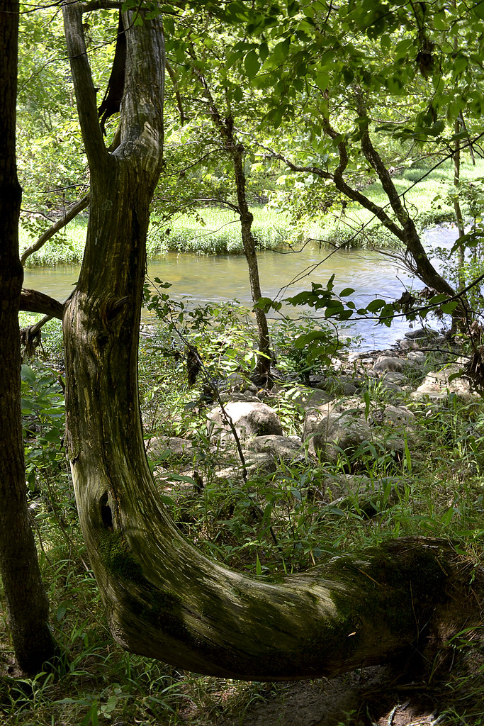
The trail through the wooded area is relatively flat, with only a few hills that reside near the midway point of the hike. In the "hilly" areas, be careful of your footing as there is loose rock and occasional water trickling through or over the trail. When you find yourself approximately three quarters of a mile east from the Tiemann Shut-In patio, you may notice a lonely concrete foundation, just before the trail begins to follow the St. Francis once again. I scoured the area for any indication as to what the foundation may have been, but only confounded myself more, spotting three cylindrical concrete forms 15-20 yards to the east of the foundation on the north side of the trail. I've continued to look online and even ask locals around the area, but have yet to discover what the foundation may have been prior. The trail may seem to "split" here at the foundation, but the path that leads west is just a slight spur that will take you to a scenic little area of the river, that features a splendid view of a tall bluff that forces the St. Francis River to flow on its northern side.

Local Treks: Scenic Tree and St. Francis River Millstream Gardens
From here the trail continues eastward to the Silver Mines and Mark Twain National Forest. As the trail nears the banks of the St. Francis be aware that you may have to make slight deviations from the path, as rising water sometimes pools in these areas or deposits branches, twigs, trees and other objects that may block your path. Don't be too wary though, you will not have to step more than a few yards from the clear trail in order to get around these small "trail-blockers". If you've brought a picnic lunch the large open field at the Silver Mines provides not only a wonderful place to take in the scenery and spot TONS of wildflowers, but also many picnic tables as well so that you may sit alongside the St. Francis River, take a reprieve and prepare for the wonderful return trip to Millstream.

In fact, upon your return to Millstream you may want to take the path that leads west from the Tiemann Shut-Ins overlook. This trail will lead you to another perfect picnic spot, this one featuring a vista over looking the St. Francis River, a picnic pavilion, and one of the most twisted pine trees I've ever seen, just check it out below!
Local Treks: Millstreams Garden picnic pavillion and twisted pine
Enjoy a picnic with a view of the river and one TWISTED pine!

As with any trip into the woods there are ticks in this area, so you may want to brush up on what keeps them at bay and how to remove one should it embed. And of course if you're taking children along, you may want  to check out some tips on how to take a GREAT Day Hike. Thanks for reading, be sure to leave a comment down below or check us out on facebook!

 
More Information:
Mill Streams Garden Conservation Area on mdconline
Millstream Gardens Area Map
My Flickr Gallery of Images
Local Treks on facebook
White Water and Rock Hounding: Silver Mines Recreational Area
Tiny. Tenacious. Terrible. Ticks. - How to keep those bloodsuckers at bay!
How To Take A GREAT Day Hike


Monday, March 10, 2014

Panther Den: Don't Forget Your Map!

Local Treks: Panther Den Wilderness Boundry Sign

Panther Den Wilderness may be the smallest wilderness area in the state of Illinois, but it packs in some of the most distinctive and maze-like rock formations you may ever see! This distinctive and unique area boasts over 820 acres of land and is bordered by Crab Orchard Wilderness, which offers an additional 4050 acres of Illinois wilderness to its north. Before you read on, you may want to brush up on Wilderness Areas (Let's Get WILD) is and print yourself off a map of the area.

How To Get There
Finding Panther Den Wilderness may be, in itself, a bit of an adventure. If you have been searching for directions I'm sure you've encountered a thousand different versions out on the internet. Some talking about private land others talking about washed out creeks, heck some may even be saying you'd better just float on in from the north on one of the fingers of Devil's Kitchen Lake. I guess I'll go ahead and add another way to get there, ours was simple and fairly straight forward.

From Cape Girardeau, MO we started across the Emerson Bridge into Illinois and followed highway 146 East through Anna, IL turning left on Lick Creek Road near the outskirts of town. After traveling about eight miles down Lick Creek Road, we veered off to the left onto Grandview Road, following it until again veering left onto Hall Church Road. Follow Hall Church Road until you are able to turn right on Rocky Comfort Road, enjoy this last bit of paved road. Continue down Rocky Comfort Road for about three miles until you can make a right turn onto Panther Den ROAD. Welcome to the gravel my friend! Now, follow Panther Den ROAD for a bit over a mile or so, until you see
Panther Den LANE on the left. You'll notice this road is in pretty rough shape (or at least it was in 2013-14), keep to the right as it is a one lane road, and you will see the parking lot at the end of the road on the right.
Local Treks: Panther Den Trail Markers 001 & 371
Pay attention to the trail markers out here:
The Panther Den loop is 389,
the trail back to the lot is 371,
and the River to River Trail is 001.
See the Quick Trail Note below.
The Trail
One of the first things you may notice as you approach the trailhead is that there is a complete lack of information and maps on the Panther Den Informational Board (or at least there was on all of our visits in 2013-14). I don't know if all the information fell off, was stolen, or if a pack of wild dingos with a taste for maps and information strolled in and devoured all postings. So be sure to print off a map of the area before you leave home, read my cautionary tales below if you don't think having a map is important...

The trail itself begins as a mixture of gravel and dirt, featuring many planned switchbacks which help to reduce the wear and tear of erosion on the trail and wilderness. The switchbacks also make the hilly terrain a bit easier to traverse. The rolling downhill hike will bottom out with a small creek crossing, be alert here as we have found this a fantastic place to find local wildlife visiting for a refreshing drink. From here you'll travel up a small hill be sure to veer left at the trail intersection and that will take you to a welcome sign for the area. You can now follow the trail around the Panther Den or, better yet, go inside the magnificent sandstone formations for which the entire wilderness area is named!

Quick Trail Note:
The Panther Den loop makes use of the 389 white diamond trail markers/blazes, however these markers are sometime sparse and, I suspect, stolen by idiots. You may see markers up for 389-A and 389-B, both of which are small spurs, these spurs seem to be old, abandoned trails. My experience is that 389-A and 389-B are generally overgrown and hard to navigate (I became pretty lost on what I believe now to be 389-B). I'd suggest staying on the main 389 trail and then following the 371 trail marker back to the parking area. 001 is the designation for the River To River Trail, which runs through and connects Panther Den Wilderness and Crab Orchard Wilderness.

Enter The Den!
Local Treks: A "Room" at Panther Den
One of the many "rooms" within the
Panther Den rock formations.
Inside Panther Den, you'll find these huge sandstone formations seem to form rooms, hallways, and even floors. Some of these formations are so angular that you may have an "Ancient Aliens" like feeling, wondering if perhaps some ancient astronauts visited the area eons ago in order to lay down rock foundations and rooms to inhabit. One particular "room" in Panther Den seems to even have a poured foundation. In reality though, aliens didn't have anything to do with it, all of the formations are natural... Or are they?

You can easily spend hours inside of Panther Den, leaping from cliff to cliff, poking into every crack and crag, squeezing through narrow crevices and splits or just running your hands over the smoothness of the sandstone. There are small waterfalls to be discovered, side trails to be explored, cairns to be constructed and plenty of places to hide as well; so you can jump out and scare the wits out of your friends and family. And, although you won't find any panthers in Panther Den (at least not since the 1870's) you may spot some other local wildlife such as whitetail deer, turkey, muskrats, beaver, and skunks. If you are really lucky, you may even get a rare glimpse of a bobcat or mink. So be sure to keep your eyes peeled!

Local Treks: Panther Den Meeting Cairn
Be sure to set a meeting place up.
Just in case.
You will also find many sandstone "coveys" carved into the rock in the area around Panther Den. These sandstone overhangs offer shelter to an uncommon wildflower, French's shooting star (Dodecatheon frenchii). Unfortunately we didn't spot a single one on any of our hikes. But, if you would like to see or find one I would suggest hitting the area in May or June and seeking out sandstone overhangs near running water. Although the French's shooting star is not currently on Illinois Threatened and Endangered list, it is still considered a sensitive species in the state. So if you are lucky enough to find a colony of these beautiful little wildflowers, please take only pictures so that others may be able to enjoy their beauty as well.

You may also want to stick together while exploring the inside of the formations, or at the least set a place and time to meet up in case someone gets separated. It is very easy to get lost within the maze-like formations of Panther Den. Children (and parents) may freak out if they suddenly find themselves separated from the rest of the group. If you become horribly lost remember that a distress signal in the woods consists of three successive sounds; be they yells, shots, claps, whistles, or any other signal.

Camping
There is so much to be explored in Panther Den that you may even consider camping within the area. If you do, remember that you are within a wilderness area. You do not need a permit and the US Forest Service asks only that you practice "Leave No Trace" ethics and camp a minimum of 300 feet from any established trails. Most of the "user" camps that you will encounter are far too close to established trails and have left obvious marks on the landscape. You are encouraged not to use these campsites so that these overused areas may recover. Of course, you may want to read up on what a wilderness is and always remember to practice your very best Wilderness Manners.

Now that I've told you of how beautiful and truly distinct Panther Den Wilderness is, I'd like to give you two quick stories of warning. 

Story One: Our First Trip
Local Treks: Panther Den Natural Hallway
On our first outing at Panther Den Wilderness we became lost. Very lost. Playing victim to many of the "trails" as we ventured further into the wilderness. We had inadvertently stumbled upon an old, abandoned equestrian trail that twisted and turned through rugged terrain. As I continued to notice the decline in the quality of the trail, I became (silently) alarmed. I could tell we were no longer on an established trail and we had taken so many lefts and rights, I could not recall from which way we had come. Luckily I had my phone, turned off, in my pocket. No bars. We continued to hike and I continued to quietly check my phone. A bar lit. I stopped and instantly hit the button for Google Maps. Once it loaded I found our heading and took note of where the trailhead was on that small, smart phone screen. Had it not been for that stroke of luck we may have been lost for hours in Panther Den Wilderness. This is the experience that taught me to never, ever, set out on a trail without a map and an idea of the route I wish to travel.

Story Two: Stranger on the Road
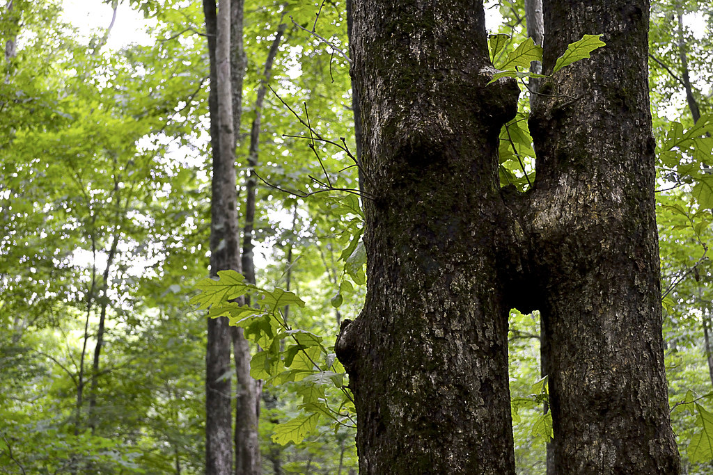
Local Treks: Kissing Trees at Panther Den
Panther Den Wilderness is for tree lovers...
On our second visit to Panther Den Wilderness we made our way down the gravel road toward Panther Den Wilderness, when we noticed a man wandering aimlessly nearly a mile from the trailhead. It was apparent to me that he was lost and I slowed down to see if he needed any assistance. He sheepishly admitted to us that he too had fell victim to one of the "false" trails of Panther Den and as we drove him back to the trailhead, he told us he had been wandering for hours, without a phone or map, happening upon the road by pure chance. I could tell he was embarrassed, as I had been just a few months prior, of becoming so lost. He was an outdoorsman, confident in his abilities to maintain a heading and follow a trail, it was this over confidence (which I too had suffered) that led to his unintended side adventure, and his catching a ride with us back to his truck. His last words to us were, "I can never let my wife know about this."

So now, please, take this map. Print it. Fold it. Put it in your pocket. It's simple. If you plan to visit Panther Den Wilderness and truly explore the area I cannot stress the importance of having a map on hand enough. Safely experiencing the beauty and sheer uniqueness of the area is worth the ink!


More Information:
CLICK HERE AND PRINT THIS MAP!
Visit Local Treks on facebook!
Wilderness Areas: Let's Get WILD!
Tips: How To Take A Great Dayhike  
Illinois Wildflowers (online guide with pictures)
A Conservation Assessment for the French's Shooting Star (warning: good read, pretty scientific)
National Geographic "Backyard Bird Identifier"
Sunday, March 2, 2014

Wilderness Areas: Let's Get WILD!

Local Treks: Sapling

Wouldn't you like to get away? Away from the streets teeming with exhaust spewing mechanical monsters, the constant ringing of cell phones, crowded restaurants, the dinging of emails in your inbox, the clamor of people as they march to and fro... Don't you deserve a break? A chance to leave technology and other people behind, a chance to take in a bit of nature's splendor in solitude?

Heck yea you do, and it's easier than you think, you just need to get out and experience your local wilderness areas!

Why (or why not) The Wilderness?
Local Treks: Lower Rock Creek formationsSome of you may be asking, "But why go to a Wilderness Area and not a regular State or Federal Park or recreation area?" I enjoy the Wilderness Areas because they are generally more remote, more secluded and less traveled than other conservation areas or general locations within our Federal or State Parks. Many times when I've been hiking or visiting these Wilderness Areas in Missouri I won't see another human being, I don't hear a hum of an engine (in fact, it is generally illegal to operate a motorized or mechanical vehicle inside a Wilderness Area), just the sweet songs and melodies of nature. Remember these areas are set aside to maintain and preserve the "wildness" of the landscape and wildlife, you are just a visitor.

Now, if you like having the thought that there are others out there and enjoy seeing people from time to time on your hike or backpacking trip, you may want to reconsider visiting the Wilderness Areas. I will be very honest when I say that I have not yet bumped into another person on a trail within the areas I have explored. If not seeing other people on your adventures sets your Spidey-Senses to tingling, you may be better served in one of the excellent conservation or recreation areas available.

Also, be sure to see if the outdoor activity you are looking to do is even available in the Wilderness Area you are looking to visit. In 1986, the Wilderness Act was reinterpreted to ban bicycles from these areas, so that means no mountain biking. Some areas restrict camping areas as well.

Where Can I Find Wilderness Areas?
Local Treks: A wooded trail.
A great source for finding a Wilderness Area near you is to visit Wilderness.Net at http://www.wilderness.net/. This site features a great collection of information on Wilderness Areas near you, features maps and is searchable by state, name, and more.

For those of you in Missouri, here are the Wilds near you!
I am looking forward to writing up some entries soon on
the Rockpile Mountain Wilderness and the Irish Wilderness! So stay tuned.

I certainly don't want to forget my neighbors across the river either. For my Illinoisan hiking pals here's a list of your wilds!
Links to Wilderness.net entries and some of my blog entries listed below.

Wilderness Manners.
Local Treks: Shedding Snake
It may sound odd or maybe even like a bit of an oxymoron, but there are certainly a set of Wilderness Manners that you need to observe when enjoying the acres and acres of designated Wilderness. Always keep in mind that these areas were set aside to preserve nature in as close to an "untouched" state as possible. Here are a few of them:
  • ALWAYS LET SOMEONE KNOW IF YOU ARE GOING TO BE IN THE WILDERNESS. GIVE THEM A TIME FOR YOUR RETURN. TELL THEM YOUR APPROXIMATE SCHEDULE, ROUTE, AND INTENDED CAMPING LOCATIONS.
  • Practice "Leave No Trace". Be sure to tread lightly so that nature may repair and endure for others to enjoy. If you pack it in, pack it out.
  • Pick up your trash. Pick up any other trash you may find as well and pack out with you whenever possible.
  • Always dispose of human waste at a minimum of 100 feet way from your campsite and at least 200 feet away from any water source, in a small, shallow hole (also called a cathole).Read more here, meow....
  • Be sure to use the self-registration boxes at the trailheads. This may very well save your life.
  • Try to find lesser used areas for resting and camping. Popular spots (sometimes referred to a user camps) and the constant use of these camping areas make it harder for nature to replenish herself in some areas. By finding alternative spots you can make her recovery a bit easier and find your very own bit of heaven.
  • Always try to camp out of sight.
  • Be prepared. Have a first aid kit, plenty of water, bug repellent (I have a recipe of one you can drink!), a map of the area, compass, the right clothing and shoes as well. Think ahead.
  • Don't count on your cell phone to rescue you. Many of these areas are outside of the cell service range. Don't forget, you came here for a reason, so don't turn it on unless you really need it or at least keep it on silent.
  • As often as possible stay on the trail when hiking. 
  • Limit your group size to 10 or less.
  • Many of these areas are surrounded by private property, ALWAYS respect these boundaries and the land owners as well.
  • Keep campfires (if needed at all) small. Fire rings should be avoided as they show man was present. Small gas or chemical stoves are preferred. Always practice extreme fire safety and be aware of the current conditions.
  • DO NOT TRANSPORT WOOD FROM HOME for campfires.
  • Leave what you find. Don't take it with you. Take a picture instead.
  • It's worth mentioning again, if you pack it in, you pack it out.
Most of all enjoy the solitude, enjoy the lack of urban sounds, and enjoy those you are with in the Wilderness.

History & Today
The Wilderness Act just celebrated its 50th Anniversary this year! It looks pretty darn good for 50, wouldn't you say? Wilderness areas came about in 1964, when Congress passed The Wilderness Act of 1964 and President Lyndon Johnson signed the bill into law. This act created a legal definition of what a wilderness is in the United States and set aside 9.1 million acres of land aside under federal protection. It also provided us with an eloquent definition of a United States Wilderness Area:
“A wilderness, in contrast with those areas where man and his own works dominate the landscape, is hereby recognized as an area where the earth and its community of life are untrammeled by man, where man himself is a visitor who does not remain.
Lyndon Johnson signing the Wilderness Act of 1964
President Lyndon Johnson finishes signing
The Wilderness Act of 1964
The act itself had taken over 8 years of work and gone through more than 60 drafts and spanning three presidencies. Today the Wilderness Act protects over 106 million acres of federal land and these areas are administered by four federal agencies; The National Park Service, U.S. Forest Service, U.S. Fish and Wildlife Service, and The Bureau of Land Management. The National Park Service covers the largest amount of Wilderness areas at 43,616,250 acres, with the U.S. Forest Service in second with 34,867,591 acres, then the U.S. Fish and Wildlife Service at 20,699,108 acres, and Bureau of Land Management with 6,512,227 acres.

Congress considers adding additional Wilderness Areas each and every year, with some being recommended by concerned citizen groups,federal agencies, grassroots organizations and others. In fact, Congress voted unanimously to protect over 32,000 acres of Sleeping Bear Dunes (in Michigan), the first wilderness area to be added in five years. There are also rumors that the administration is making plans to preserve two additional areas as well: The Organ Mountains-Desert Peaks area in New Mexico and Point Arena-Stornetta Public Lands in California.

More Information:
Visit Local Treks on facebook!
Wilderness.net The BEST source I know of to locate a Wilderness near you.
Full Information on The Wilderness Act of 1964 via Wilderness.net
Wikipedia on The Wilderness Act of 1964
Leave No Trace: Center for Outdoor Ethics an EXCELLENT resource on outdoor manners.
Wilderness Manners: Sierra Club another EXCELLENT resource on outdoor manners.

Monday, February 24, 2014

320 Millions Years Well Spent: Garden of the Gods, IL

Garden of the Gods, Sit and Overlook
Be sure to take time to soak in the natural beauty of the area.

The exquisite sandstone formations located at Garden of the Gods Recreation Area, located in Illinois, took nearly 320 million years to form and, in my opinion, every single second has been very, very well spent. The area boasts truly awe inspiring vistas that beg to be fully taken in, small well worn trails that beckon you to lay tread to, and unique formations that are instantly recognizable, such as; Camel, Mushroom, and Anvil Rock formations. This true Illinois treasure is one of the most awe inspiring locations I have laid eyes upon, and was reminiscent of views I experienced in South Dakota and Colorado, only far, far closer to home!

Devil's Smokestack, Garden of the Gods IL
You can't miss the Devil's Smokestack!
Garden of the Gods Recreation Area boasts over 3300 acres of forest in the counties of Pope, Saline, and Hardin, with 5.5 miles of interconnecting trails spread throughout. However, the most popular trail by far is the quarter mile long Observation Trail. This well maintained and traveled interpretive trail will have you gazing at some very interesting rock formations such as Monkey Face, Mushroom Rock, Table Rock, Camel Rock and the Devil's Smokestack. In just a few short seconds, you'll easily be able to make out each of the namesake rocks as you stroll along the trail, take care and watch your step though, the smooth sandstone beneath your feet may be slippery when wet. Before venturing down the trail be sure to read the large informational signboard that contains background on the natural history and geology of the area, there will be additional interpretive signs along the trail as well pointing out even more interesting formations and history. Honestly, I don't want to give away too much on this short hike, it is a path best experienced rather than explained.

Interesting outcrop
Interesting outcrops are EVERYWHERE!
If you are heading out to the Garden of the Gods be sure to wear comfortable shoes because the rocks, cliffs, and chasms BEG to be climbed upon and explored. No matter your age, I can guarantee that you will hear a small voice from within asking "What do you think you can see from up there?" and before you can even consciously reply, your body will be moving forward, ready to discover the answer. I'd also suggest that you pack a lunch as there are many places along the trail to stop and rest, allowing you to really soak in the surrounding beauty, and these spots are perfect for small picnics (just be sure to keep the area beautiful by picking up all your trash, please, remember ).

Scenic overlook after scenic overlook is what you can expect.
I also want to let you know that this area is one of the busier parks that we have visited, on any given nice day I can assure you that you will see many other hikers and nature lovers out on this trail. In fact, on our summer visit the area was downright crowded in some spots (but you can always find some spots to have to yourself for a bit). So if seclusion and solitude is what you seek, you may want to hit a portion of the River to River Trail, which runs through Garden of the Gods. However, I can't stress how splendid the views are from the Observation Trail and missing them is darn near criminal...

Ever wonder what a tree eats?
For those of you interested in longer journeys, this makes a fantastic starting area to traverse a portion of the 160 mile River to River Trail, which blazes through the Garden of the Gods Recreation Area. The Garden of the Gods Recreation Area can also satisfy those of you looking to "rough it" a bit, with year round camping at the Pharaoh Campgrounds, but be sure to bring what you need with you as the nearest town, Elizabethtown is about a 20 minute drive away. Campsites are rented for $10 on a first come, first served basis.

Garden of the Gods Recreation Area and the Observation Trail make an absolutely fantastic family friendly day trip. I can assure you that after a day of bouncing among the boulders, shimmying along the outcrops, and traveling the quarter mile trail, your curtain climbers will be tuckered! Just be sure to pack a light snack or lunch and follow some of these tips for a great day hike. You may want to include a couple of band-aids though, just in case of a scraped knee. Just be sure to take time to revel in the splendor of the area and have fun!


More Information:
Visit Local Treks on facebook!
Tips: How To Take A Great Dayhike 
Shawnee National Forest - Garden of the Gods
Pharaoh Campground Information (Nearly halfway down the page)
My Flickr Garden of the Gods Photos
Garden of the Gods Trail Map (via ShawneeNationalForest.com)
Illinois Wildflowers (online guide with pictures)
National Geographic "Backyard Bird Identifier"


View Larger Map

Thursday, September 5, 2013

A Protected Slither On Snake Road: Shawnee National Forest


The Shawnee National Forest office in Illinois announced that "Snake Road" (also known as LaRue Road 345) will be closed to traffic between mile post 3.0 and mile post 5.8 during the upcoming annual snake migration, August 30 - October 30. If these coldblooded slitherers don't give you the heebie-jeebies, you can take a trek on foot to catch the migration which draws observers from all over the US! Please note, if you head out, some of the species in this migration have been identified as threatened and endangered by the state of Illinois and the U.S. Forest Service, so please let nature take its slithery course.

I spoke with the Shawnee National Forest office today and found that the best time to have a chance to see see the action is over a sustained period of cooler weather, lower 80's and 70's, so late September and early October may be perfect (especially if the leaves are turning). So keep an eye on the mercury if you want to see the snakes and amphibians as they migrate to their winter hibernation habitats be sure to take a camera.


You can call the Shawnee National Forest office for more information at (618) 833-8576 or read the press release on the Shawnee National Forest Website.

Wednesday, August 28, 2013

How To Take A GREAT Day Hike

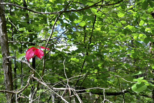
Local Treks Hiking: Single Red Leaf

We've all been here. The TV weatherperson just called the upcoming weekend the "very best ever!" and the smiling sun graphic behind them has you wanting to get out, get in touch with nature, breathe in a bit of fresh air and nab some exercise while you're at it. If you're looking to hit every one of those points out of the park, get on out and take a day hike. If you follow a few simple steps, I'm sure you'll find that a day hike is simple, easy and TONS of fun.

Local Treks Hiking: Millstream View
Where do you want to go?

This is the most important question you can ask yourself before getting into the "meat" of your potential hike. Head to the internet and search your local state and national parks, or better yet read a review or two right here on the blog. If you haven't hiked much you may want to keep your hike short, seeking out 1-2 mile "loop" style trails, be sure to allow yourself plenty of time to soak in the beauty of your surroundings. A loop trail will make a circle and upon completion should take you right back where you started, at the trail head.It is always best to find a topographic map as well, be sure to look at the elevation as every mile hiked up 1000 feet will feel like three miles hiked flat.

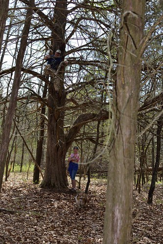
Local Treks Hiking: Climbing Tree
Wear the right clothes.

I like to wear loose fitting clothes, not so loose that they may get in my way in an attempt to trip me, but loose enough that they don't bind me or feel restrictive when I walk, climb or scramble over rocks and boulders. If you want your clothing to run double duty for you be sure to wear light colored clothing, to help avoid ticks. You may also want to spray your clothing down with an insect repellent that contains 20% DEET or make your own homemade bug repellent to keep nasty insects at bay as well, keep in mind, insect repellant doesn't last forever, you'll have to re-apply (usually after 2-3 hours). You may find some good deals on outdoor clothing online, I've found some good deals at The Clymb (you'll need to register though).

Local Treks Hiking: Hiking Shoes
Wear the right shoes.

You don't have to wear hiking boots when hiking, in fact, I don't even own a pair. Personally, I prefer a pair of trail running shoes (or just regular tennis shoes), they are light, responsive and I've found that they grip the trail and rocks quite well. Just be sure that these shoes are comfortable and for the love of Pete, don't ever, ever, ever wear a brand spanking new pair of shoes or boots into the woods. You're begging for them to be ruined and get some wicked blisters as well, always be sure to "wear in" your shoes before really tackling any trail mileage.

Local Treks Hiking: Little Grand Canyon Trail

Find some hiking buddies.

If you're able, grab a few friends and take them with you, bonus points are given (but not rewarded) for nabbing up pals that are experienced hikers. Better yet hop on the Local Treks facebook page and see if anyone else is interested in meeting up! For my fellow hikers that love to take to trail with friends of the hairy and four-legged design, pay special attention when researching your hike as not all state or national park areas allow for pets, even leashed. Let other folks know that you are leaving, even if you're heading out with a group, be sure to indicate where you are heading and what time you expect to be back.

But, I "Vant to be alone"...

Ok there Garbo, not everyone enjoys the outdoors with others. I know that some seek the solace and tranquility that can only truly be attained through absolute "aloneness" and from time to time I dig doing this myself. But before you leave, be sure to let friends and family know where you are going, what time you expect to return and tell them you'll call them once home. Should something happen to you while you're out hiking you'll thank your lucky stars you did this.

Local Treks Hiking: Cut Tree Trail

Pack smart and pack light.

Going on a day hike with a 25 pound pack on your back, most likely, isn't going to result in a "good time". No one is the same, so be sure to make a checklist of what you need to take with you. When I hit the trail I take a small backpack (the same type that kids truck their books to and from school with, a cheap old Jansport):
  • A pocket knife: Conveniently placed, you guessed it, in my pocket...
  • A lighter: I don't smoke, but should something go wrong I want to be able to start a fire, for signaling, warmth or cooking. Also conveniently placed in my pocket.
  • A cell phone: Turned off and placed in my pocket. Nothings more annoying to you or other hikers than your ringtone of awesomeness over the sounds of nature.
  • A compass: It's always comforting to have one of these with you, learn to use a compass and map (it's easy) correctly. Placed in my pocket.
  • A printed map of the area: This is a must. Don't hike without a map of the area, it's that simple. If you get lost this could save your bacon. Maps usually have interesting sites and attractions marked as well, so it helps to keep an eye out for landmarks and potential, slightly off trail, sites. Folded and stuck in my pocket.
  • Water: I've heard that 3 liters per hiker is adequate, I take a 2 liter Stanley vacuum bottle filled with ice water and another 1.5 liter stainless steel water bottle on my hikes and that is plenty of water for me. When hiking with the family, I'm the mule, although my wife will carry water as well. Please don't drink the water on your hike unfiltered, unless you absolutely dig diarrhea, and cramps, and pain, and possible death.
  • Food/Snacks: I love peanut butter crackers. Love em. They make it into every single pack I take with me. I generally only pack food that can be consumed and safely carried at room temperature, so apples, beef jerky (mmmmm), trail mix, pears, oranges, fruit snacks, etc. However, just because you're eating a piece of fruit doesn't make you immune to "pack out what you pack in", keep those cores and peels until you can dispose of them properly in a trash can.
  • A small, but effective first aid kit: Here's what I have in mine; Band-aids, a few Ibruprofen, antibacterial ointment, rain poncho (can double as a little shelter if absolutely needed), 10' of para-cord, gauze, and medical tape.
  • A camera: It's simple. I don't hit a trail with out either my Nikon D3100 (and maybe a lens or two) or my little Canon point and shoot, depending on the length and difficulty of the hike.
Local Treks Hiking: Hypno Toad

Thank you for reading, hopefully this will help you the next time you decide to hit the trail.

Am I missing something? If you have any questions or comments or if you have something for me to add to the list above, just let us know, either here on the blog or on the Local Treks Facebook page.

Cheers!
More Information:
Map Compass 101 on YouTube by Packrat556
Leave No Trace - Wikipedia (Pack In, Pack Out)
The Clymb: A site to find good deals on outdoor products and clothing