Showing posts with label Camp. Show all posts

Wednesday, July 16, 2014

Sam A. Baker Park: Shut Ins Trail


Sam A. Baker is a popular Missouri State Park, let me stress popular... and why the heck not?! This park really seems to have it all, from zipping along on bicycle trails, grilling hotdogs over a campfire, popping a tent at one of two huge camping areas, taking a cooling dip in the clear St. Francis River, to hiking on one of four trails, there is a little something for everyone. There is an added bonus to Sam A. Baker too, if you happen to forget something back at home, the area boasts a Park Store that has just about anything you may need. But keep in mind, with so much to offer at Sam A. Baker, there are many who seek to really take advantage of it, and by that I mean, it may be a bit... crowded.

First Impressions of the Park

My initial impressions of Sam A. Baker were fantastic, as we made our way down Highway 143 the trees began to envelop the road, creating a tunnel of green gently leading us toward our initial destination, Campground 1. The campground was very nice, and despite the recent rains, our campsite (number 5) was relatively dry with only a few low spots gathering puddles. After pitching the tent we decided to take a nice, leisurely stroll through the campground. Making our way just a bit to the South we found the cool St. Francis River, nearly a clear as a window, carving out its gravel banks and creating perfect places to wade and swim in its refreshing waters. As we explored the campground further we found a very well traversed and well maintained Paved Bike Trail to the North, which is quite a perk for the visiting camping jogger. This trail stretches 1.5 miles and travels from campground 1 all the way to the park store, it travels along State Highway 143 and allows for some picturesque views of Big Creek as well.

It's All About the Amenities!

After exploring the campground we journeyed over to the park store (which is VERY handy if you have found yourself forgetting something at home) and the park lodge. As Sam A. Baker does not allow you to transport your own firewood into the park, due to the emerald ash borer, so if you plan to have a campfire, be sure to pick up some wood at the store. Then while you're out you may like to take a quick stop at the Park Office and Visitor Center. There they will provide recreational equipment, free of charge, that you may use by simply checking the items out. After taking quick tours of the amenities we returned back to our campsite, flush with wood for a cozy campfire, ice cold sodas and some delicious chips from the store.

"Nocturnal Calls" and Camping

Once back at our campsite we started up our fire (due to the damp wood this was quite the undertaking, thank the heavens for lighter fluid) and roasted up some hotdogs, marveled as the fireflies faint green glow lit the night, told a few stories and then decided to get a good rest so we could explore the park even more the next day. After zipping up the tent, lying atop my sleeping bag I soon found myself being "gently" lulled to sleep with the echoing "Whoo HOOO" and "I'm SOOOOO Drunk" mating calls of the Migrating Midwestern Hooter, which were interrupted only by the heavy and constant "Ker-Thunk!" of the all to closely located latrine door. We did have a laugh out loud moment as our border collie, Hyatt, spotted a huge raccoon that had made its way onto our picnic table and attempted to leap through the mesh window of our tent in order to chase the raccoon away.

Upon awaking the next morning and with the migratory mating calls of the night now behind us, we decided to escape some of the more popular areas, in a desperate bid to get at least a small taste of the park's beauty without the crowds or noise. So we checked our area map and chose to set foot upon the Shut Ins Trail, a quick mile and a quarter hike out from just behind the Park Lodge, to see if we could find a slightly more secluded swimming hole.

The Shut Ins Trail

The Shut Ins Trail is wonderfully maintained; consisting of a well worn dirt path, sometimes sprinkled with gravel, and features low water bridges, handrails, and steps along the way. Children will find an easy hike on most of this route, and there are plenty of sights to see and share on your way along the path. We began our journey by heading downhill along the blue blazed trail with (what I believe to be) Big Creek bordering us just to the East. As we hiked about half a mile through the Sycamores, Cottonwoods and Sweet Gums we came upon a small off-shooting path, which we decided to investigate. Boy am I glad we did, because at the end of that path we found a gorgeous little waterfall, that wound its way through and over the large, moss covered dellenite boulders.

After getting our fill of scrambling over the boulders we headed back to the main trail and continued on, with all of summer's colors seemingly on display as wildflowers competed for our attention along the trail. We followed the trail for nearly another half mile until we came to a fork, one path leading to the Big Creek shut ins (to the right) and another path leading up the hill toward a connection with the Mudlick Trail. The path that led to the Mudlick Trail boasted a Shelter, which marked the intersection of the two trails, but also heads up a steeper incline. After a short bit of consideration we chose to head towards the Big Creek shut ins for a refreshing dip. Seriously, could there have been any other decision to be made on a hot summer's day?

The Big Creek shut ins seemed almost too good to be true, the area was wide, with water plenty deep enough for swimming and there were some low, flat cliffs that just begged to be jumped off. In fact, the water was at an almost perfect depth that day, but if you choose not to swim you could easily wade the shut ins, whose water was just a bit over chest high on our visit. We quickly found it was too good to be true, such a naturally beautiful swimmin' hole had spoken out and many had answered its call, within just a few minutes of our arrival the Big Creek shut in transformed from a peaceful watery respite to a rowdy outdoor roadhouse complete with Swazye'esque mullets to boot. We swam for a bit more then decided to make our way back to camp for a spot of lunch. As we headed back down the trail, making our way toward the Park Lodge, we passed a steady stream of like minded visitors who may have been just like us, looking for that little hide-a-way in the middle of a very, very popular Missouri State Park.

Final Thoughts

With so much to offer its no surprise that Sam A. Baker is so appealing to so many and there is no doubt that we'll return sometime and the 5.5 mile Mudlick Trail certainly looks very, very appealing, especially the Backpacker Camp located on a small spur of the Hike Only Section.. But the overall experience, for me, was it seemed simply too crowded. Sam A. Baker seemed (to me) more like a nature theme park than actual State Park and the campground, while very well maintained, was just a bit too... popular.

More Information: 

Sam A. Baker State Park Homepage
Sam A. Baker Hiking Trails
 - Shut In Trail Map
Fishing Report and Prospects: St. Francis River (above Wappappello Lake)
Local Treks on facebook 
Tiny. Tenacious. Terrible. Ticks. - A post on how to keep those bloodsuckers at bay!
How To Take A GREAT Day Hike - Hitting the trail? Then you may want to check out these tips.

Monday, May 19, 2014

Rock Pile Mountain: A Great Place To Get "Lost"

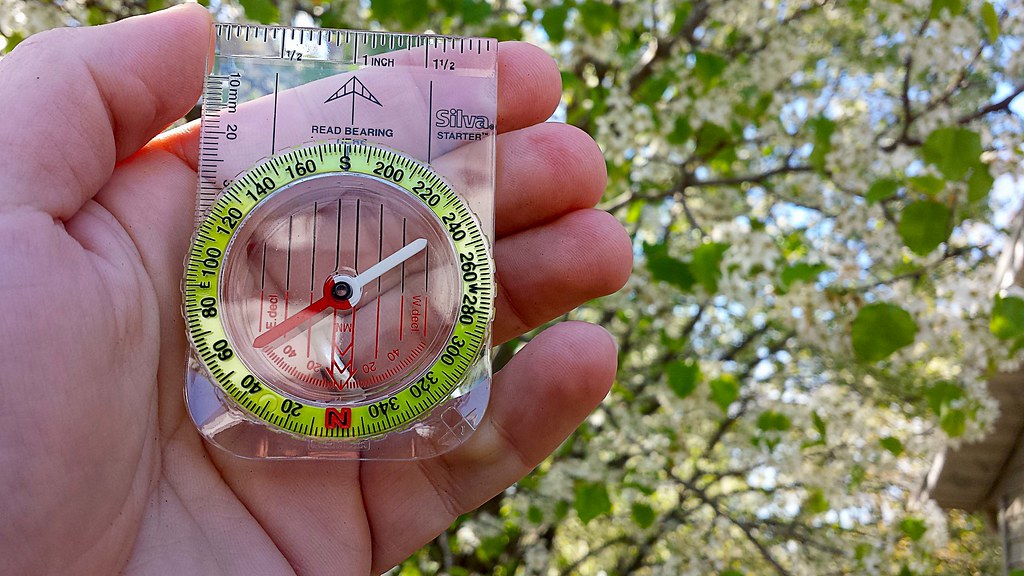
Local Treks: Compass

A "Link" Between Gaming And Hiking...

Growing up I loved playing The Legend of Zelda. The hero Link, in all of his 8-bit glory, began his journey when you led him into a cave and met a kindly old man positioned between two flickering flames. As he entered the cavern, the screen scrolled up and text formed over the elderly man's head revealing infamous words that stick with me to this very day, "IT'S DANGEROUS TO GO ALONE! TAKE THIS." Then Link was presented a wooden sword, the first weapon I would use on my epic elementary school quest to defeat the Evil Gannon. Later I would begin to explore dungeons in the game, here two items were of great importance; a compass and a map. Rock Pile Mountain Wilderness reminded me of this piece of my childhood, as it really can be dangerous to go alone, especially into a wilderness area and when you head out into these protected areas you should always take a compass and a map and know how to use them.

4,238 Acres And This Is A SMALL Wilderness?

Rock Pile Mountain Wilderness holds the distinction of being Missouri's smallest wilderness area, weighing in at 4,238 acres of beautiful forest located outside of Fredricktown. The trailhead is located off of County Road 406 on Forest Road 2124 in Madison County. I can assure you, finding the trailhead for the wilderness may provide you a journey in itself! We traveled easily enough south, down Highway 67 from Fredricktown and turned right onto Highway C. Next we turned right on County Road 406, using the directions provided by the Mark Twain Forest recreational opportunity guide, however we found the very last portion of the directions very difficult to find... The left turn on Forest Road 2124. This road does NOT have a traditional style street sign, instead it is a very small, skinny, brown stake-like sign, that is off on the left side of County Road 406 by at least 5-8 yards. We passed this turn twice before finding it. Unfortunately, I didn't measure the distance, but if you turn on County Road 406 from C, it is approximately 2 miles down the dirt road and will be on your left, it does look like it is fairly well traveled.

Road Conditions May Vary...

Some reports on other websites and resources put Forest Road 2124 in a nearly complete state of disrepair, some have tales of ditches large enough to swallow cars, mud so deep that the Swamp Thing dwells somewhere in their depths, and trees the size of Redwoods have fallen over the rural gravel road. When we visited on April 18, 2014 the road was in very good condition. In fact, I was a bit disappointed that the road wasn't a challenge to be overcome, I wasn't going to be able to use the drive as a badge of honor to earn. However, I will say this, I can CERTAINLY see how this road may fall into a state of utter decay, signs of downed trees did litter the ditches and clear ruts were left by water as it cascaded over the road in spots during previous rains, cutting portions of the road away. But we easily made it, in an old four cylinder, two-wheel drive RAV4, that was born in 1998. We didn't even need the extra clearance the aging RAV4 provided over a standard car on our trip. The small ruts were easily avoided and we putted right on up Forest Road 2124 to the trailhead at the top of Little Grassy Mountain.

Be Sure To Bring Your Own Map.
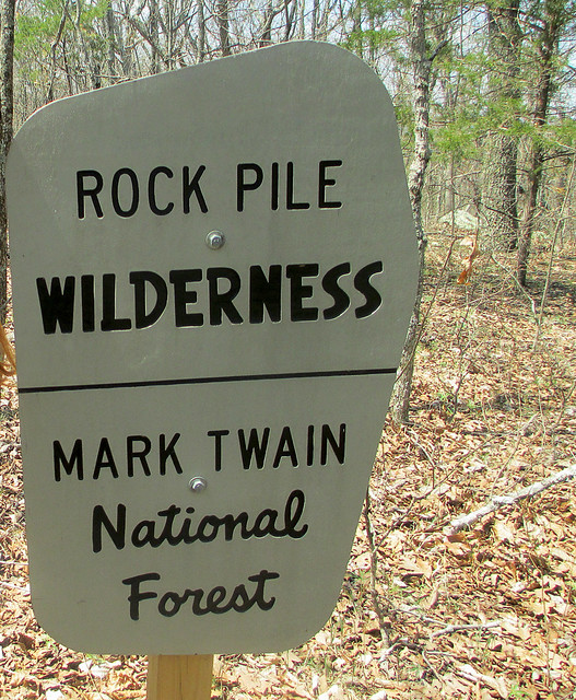
Local Treks: Rock Pile Wilderness Sign
As we neared the peak of Little Grassy Mountain, we were surprised to find another car parked just off the turnaround at the trailhead. Of all the reports I had read, none had ever mentioned bumping into another hiker while out on the trail. We pulled on in next to the other car (another, far newer RAV4), parked and began to stretch our legs, exploring the trailhead and reading the postings on the information board. I filled out a quick registration card and placed it in the collection box, near the information board. Honestly, there isn't much information available at the information board, and sadly I've become used to this in the Mark Twain National Forest. Please don't take this as a "knock" against the National Parks, but I've found them to be far more lacking in upkeep than our local State Parks, perhaps it is just that the Missouri Department of Conservation (MDC) does such a fantastic job of maintaining our local parks and trails that it makes the National Parks in Missouri look worse in comparison, but that is enough of a side tangent. There are NO maps available at the trailhead information board and some information seemed to have been torn off, but as I stated before, I expected this and in anticipation of finding another mapless information board, I had printed out two copies from the internet at home, marked them both up and brought them along with a compass.

Local Treks: Rock Pile Mountain Rock
Just a few steps from the information board is a great place for a photo opportunity. A large stone with Rock Pile Mountain Wilderness boldly chiseled into it just begs for you to hop in front of it and snap a selfie! However, be careful near this rock, as it seems that this trailhead may also be a popular late night spot to do a bit of "celebrating", as broken shards of glass are as plentiful here as tile in a bathroom  and on the topic of bathrooms, there are no facilities here, as it is a wilderness area. Also, be especially vigilant as you explore the trailhead if you have a dog, no matter how tough their pads are, they are no match for the slivers of broken glass here. Once we snapped our photos by the rock, we unloaded our packs from the car, strapped up,and were ready to embark upon our backpacking adventure through the Rock Pile Mountain Wilderness. We caught a quick view of a pseudo rock pile in a clearing, just before reaching the official trail and that made us a bit excited to see the real rock pile, for which the mountain and the wilderness area have been named.

Into The Wilds We Go!
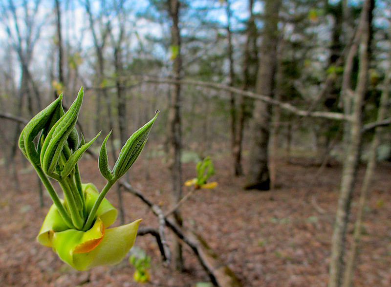
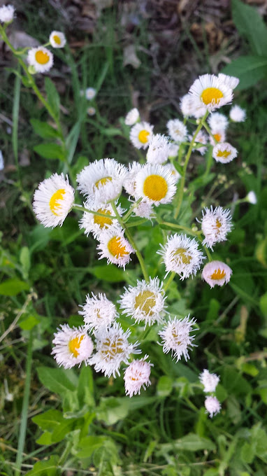
local treks spring is springing
As we pass the patented National Forest sign, indicating the entrance to the Rock Pile Mountain Wilderness, the trail begins as a well worn dirt and stone trail, curving into an elongated C on our map as it winds down the Little Grassy Mountain. The "maintained" portion of the trail stretches for two miles and can be difficult to spot from time to time. As we hiked I noticed many false and game trails that lead to the east and west that could easily trick an unsuspecting hiker into following them for yards, or possibly miles. Because of all the false trails, I checked my compass frequently and compared my surroundings to the map I had packed and marked before venturing out. At approximately the one and a half mile mark on the maintained trail you reach the summit of a small hill, the rock formations and pines here provide a perfect place to take a quick rest, snatch a snack, enjoy a breeze and breathe in the lightly pine scented air. It is also a great place to find yourself veering off trail, completely by accident. It was here that we met a local hiker, out to enjoy the weather and a crisp hike through the wilderness. As we hiked, I corrected his path a few times, as he nearly went off course here at the top of the hill.

We Meet Another Trekker.

Local Treks: Backpacking
Given the difficulty of being assured we were following the trail, our new found hiking partner let us in on some great bits of insight pointing out a few local landmarks by which I could triangulate myself on my map should we become very lost. In fact, on the map, as we descended down the hill, he noted the way the "maintained" trail bent, to the southeast, just before ending and then pointed at purple markings on the trees. Those purple markings indicated the private property lines of the adjacent landowners, and also provided a great way to know that we were quickly approaching the backwoods trail in less than a quarter of a mile or so. It also helped me to gather a specific measurement of how far we had hiked and the near exact point of our location on the map. He also pointed out orange blazes on trees noting they had been left there by the local fire department who had been called out to Rock Pile Mountain to rescue lost hikers the year before.

Watch Out For Obstacles, Remember That Map?

Local Treks: Marked up map
Scribbling on your map is a'ok!
I had to remind myself of downed trees and other landmarks.
We continued hiking with our local partner for about a mile or so, until we hit another navigational hazard, downed trees. Lots and lots of downed trees. These obstacles had been somewhat more frequent than we were used to and began to get even worse and more frequent as we left the "maintained" portion of the trail. The downed trees could not have come at a worse place either, unknown by us, the trail splits here. Hidden underneath these trees was the actual split, and we originally headed to the east in order to get around them and back to the trail. When we skirted around the trees and picked back up the trail, I noticed that we were heading due east, opposed to southwest as the map indicated and after about 25 yards I stopped, knowing that we had either picked up a false or game trail. We all doubled back and decided to look for the trail again. At this point, our hiking partner, who was heading to a different destination than us, decided to simply head due west, confident that he would pick up the trail soon enough and we decided to navigate back toward the northwest to find the original trail and last known good location instead, and so we all bid farewell and happy trails.

Remember: Getting Away From It All Is Only  Fun If You Get Back...

Where we were actually at was the first of three official splits in the trail, shown on the map. Once we navigated back to our last known good location we opted to circle the downed trees to the west this time and sure enough, we were able to pick back up on the trail. With a quick check of the compass and glance at the map, we knew we were back on course to make it to the summit of Rock Pile Mountain. We were also lucky enough to spot the actual split, buried under a few trees, marked by an aged fence post with a rock set atop it. Although we would not see our local hiking companion again, we would spot evidence of his trail as we continued.

I've Never Been Happier To See A Color.
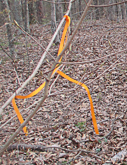
Local Treks: Orange tags
My new favorite color! Follow Me Orange.
Remember those orange blazes our local friend had pointed out earlier? The ones left by the fire department as they mounted a search for lost hikers? These came in EXTREMELY handy for us. Although I am a fairly competent navigator, these blazes seemed to be placed at just the right spots to remind me that we were, indeed, on course for the summit of Rock Pile Mountain. Just as self doubt would begin to enter, the trail would seem to disappear, or trees had once again forced us off the scantly viewable trail, these tiny bits of plastic would set my mind back at ease and assure us that we were on the "right path". However, realize that these markings will not last forever and there were very, very few other markings that would distinguish the actual trail from the numerous game trails that cross it, we were just lucky to have these navigational beacons for our hike, so please do not count on them to still be there. However, I'll mention here that we were able to get cellular reception throughout most of our hike, losing a signal only once as we were in a depression navigating around another obstacle to our path.

Our Final Destination And A Possible Ancient Relic.
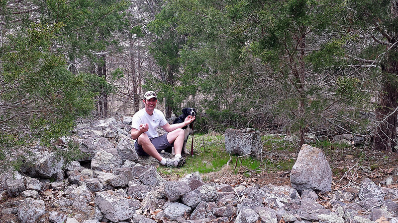
Local Treks: Me in rock pile
Finding a spot of enlightenment and my center, in the Rock Pile.
We would spot more orange blazes as we finally approached our final and ultimate destination, the peak of Rock Pile Mountain itself. A word of warning, there are many different "rock piles" on the peak of this mountain, obviously created either as a cruel joke or as an homage to the real rock pile itself. If you have GPS, here are the coordinates - 37°25.222' N, 90°25.199' W - I took from the center of the "real" Rock Pile. For those without GPS assistance, it lays just to the northwest of a large granite clearing, search, I assure you will find it. Keep in mind it is not located on the very tip-top of the mountain, but very close. According to what I've read this ancient circle of granite rock is believed to have been piled near the very peak of Rock Pile Mountain by some earlier man. The original Rock Pile, for which this entire area and mountain was named, was over four foot tall. However, according to some accounts I have read, due to present day travelers and inconsiderate visitors the Rock Pile now is just over a foot or two in areas, but you can certainly see that it is created by man, for some purpose... The exact purpose, well, we'll most likely never know.

Overall Thoughts: I LOVE This Place.

Overall, our hike to Rock Pile Mountain was fantastic. We could not have asked for a better day and botanists would fall in love with the variation in local trees here; as the wilderness supports basswood, butternut, Kentucky coffee tree, walnut, sugar maple, and magnificent white and red oaks. If you find yourself hiking in Spring, as we did, you'll also notice as you near the man made ponds the sing-songs of frogs as they serenade in hopes of a mate. Evidence of white-tailed deer, turkey, and other large game abound, we spotted many tracks for the deer and heard them as they escaped, just out of view, on our return hike. Another thing to watch out for, although we found no tracks or evidence, are black bears. There have been quite a few spotting of these bears in the Rock Pile Mountain Wilderness, so please keep this in mind, particularly if you are camping in the area as you should suspend your food items in a bear bag, high in a tree. The last thing you would want during a wonderful camping trip would be a humongous hairy camp crasher.

Keep In Mind: I'm A Wilderness Fan-Boy...

Local Treks: The Rock Pile
I'll admit, I'm partial to wilderness areas. I enjoy the relative solitude, the complete lack of crowds and the feeling of truly being alone and yet one, with nature. The lone hiker we encountered was the solitary exception to the general experiences I've had in the Missouri and Illinois wilderness areas and the other hikers (remember the newer RAV4 at the trailhead?) we never spotted, and once our traveling companion went out of sight at the downed trees, we never spotted him again either. In our wilderness areas I find that the birds sing a bit bolder, nature takes an extra second before darting for cover, the general fresh air seems fresher, and Rock Pile Mountain Wilderness was certainly no exception. I can't recommend this area enough if you're looking to get away for a day hike or if you're planning a remote backpacking trip, just don't forget to print a map and take a compass. Remember, GPS devices may run out of battery, so if you're using one be sure to bring extra batteries. In fact, that is the reason that I did not take many pictures during our visit here, I had reserved my phone for an emergency only, turning it off as we hit the trail in order to conserve all battery life. I hope you decide to visit this great wilderness area, I'm sure you'll enjoy it just as much as we did!

One Last Thing...

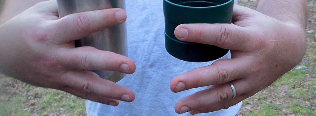
All packs are not created equal. One thing to keep in mind, if you are back packing like we did, keep your load light and properly adjusted or, well, there's a picture below. My fingers became pretty swollen due to hiking with too much weight on my shoulders and not enough on the hip belt. Hopefully you'll get as big of a snicker at this as my wife did... Happy trails to you!

Local Treks: Swollen fingers from backpacking


More Information: 

Local Treks on facebook 
Mark Twain National Forest: Rock Pile Wilderness
Rock Pile Mountain Wilderness on Wilderness.net
Mark Twain National Forest Brochure of Rock Pile Mountain Wilderness (with trail map)
Mark Twain National Forest Recreational Opportunity Guide for Rock Pile Mountain Wilderness (with trail map and driving directions as well)
Official USGS Rock Pile Mountain Quadrangle Map (use with the trail maps above)
  - Note the USGS map above is a HUGE file and in pdf format.
Wilderness Areas: Let's Get WILD! (post on wilderness manners and what to expect in a wilderness)
The Official USGS Maps Page (helpful for all types of maps, and FREE!)
Tiny. Tenacious. Terrible. Ticks. - A post on how to keep those bloodsuckers at bay!
How To Take A GREAT Day Hike

Coordinates:

Trailhead GPS Location: 37°27.811' N, 90°24.311' W (taken with Samsung Galaxy S4)
Rock Pile GPS Location: 37°25.222' N, 90°25.199' W(taken with Samsung Galaxy S4)
 

Wednesday, August 14, 2013

Tiny. Tenacious. Terrible. Ticks.

A blacklegged tick, photo provided by: CDC/ James Gathany; William Nicholson

Did you feel that? That little tickle, running up your leg, or maybe that traveling tingle up your neck... You can feel it now can't you? Even though your certain they aren't on you... They're tiny. They're tenacious. They're TICKS and if you're out in the woods (or even your own backyard) you'll most likely see them.

A questing Lone Star Tick.
Photo Courtesy: CDC/ Dr. Amanda Loftis,
Dr. William Nicholson, Dr. Will Reeves,
& Dr. Chris Paddock
What the heck are they?
Believe it or not, ticks are arachnids, relatives of those other infamous creepy crawlers, spiders! Most ticks will go through four life stages: beginning with an egg, emerging as a larva (which has only six legs, not eight), then an eight legged nymph, and finally a full on,  breeding adult. After emerging from their egg stage, ticks require a blood dinner or two at each stage to continue their parasitic little lives. In fact, most ticks cannot progress into the next life stage until they have fed. Being equal opportunity blood suckers, ticks will feed on mammals, reptiles, birds and amphibians, but they do prefer certain hosts during their different life stages, if you'd like to see if you are the current soup du jour as you take your trek, see this diagram courtesy of the Centers for Disease Control (CDC), but make no mistake, ticks are opportunistic and will take any host that will provide. Life for a tick is pretty simple, feed or die. In order to find a host, the tick will usually "quest". A questing tick will position itself on the edge of a leaf, stick, blade of grass, or other vegetation and then stretch out their first two pairs of legs and awaits a host to brush against them. Ticks don't just quest blindly, in fact, they use signals such as CO2 levels and (for some) their eyesight to decide where to "hang" around for a meal. To figure out what types of ticks you should keep an eye out for visit the CDC's Geographic Distribution page.


The easiest way to avoid ticks while
hiking is to simply stay on the trail,
avoiding weeds, leaf litter and
low lying branches that may contain
ticks.
How do I keep them off of me?
Good question. While there is no 100% sure fire way to keep ticks from burying their nasty capitulum (it looks a lot like a head) into your skin, you can certainly take steps to make yourself as a less appealing meal (like kids and broccoli). First you can avoid wooded areas and heavy leaf litter, ticks dig those places, along with dense areas of large leafed plants (it's nice and humid under there) such as the invasive Kudzu vine. To lessen your chances of picking up a blood sucking hitchhiker while hiking, walk in the center of the trail, avoiding contact with underbrush, weeds, leaf litter and low hanging branches whenever possible. You can also spray your skin and clothing down with an insect repellant that contains 20-30% DEET (follow the instructions on the can), and if you're looking for even more protection spray a bit of permethrin on your clothing (this is POWERFUL MOJO and will stay on the clothing for multiple washings, DO NOT SPRAY ON YOUR SKIN), and of course you could try out one of the homemade concoctions that are right here on the blog as well. Clothing helps, long sleeves, pants, a hat and even wearing light colored clothing will help lower the amount of ticks that can use you as a buffet. Ticks are generally most active during the warm months, April - September, but they are out there, looking for a meal, year round so always be vigilant.

Don't forget about your hairy buddy!
Photo Credit: CDC/ Dawn Arlotta / Cade Martin
1 o'clock...2 o'clock...
Tick Check!

As you hike be sure to take intermittent "tick checks" no longer than every two hours, paying special attention to your: underarm area, under socks, ears, belly button, behind your knees, around your waist (especially your belt area), and hair. Before you leave an area be sure to check yourself, pets and gear for ticks, they may be loose and seek you out later (maybe in the car...cringe!). Once home take a shower and perform another check in a full length mirror (if possible), paying particular attention to places you didn't want hanging out on the trail and your hair. Always be sure to trust your body, if you feel something crawling take note and examine to see if it is a tick (sometimes you may creep yourself out though and your body will "crawl" for a while after finding one). And if you have a hairy hiking buddy (or a dog), be sure to check your best buddy for ticks and give him (or her) a good washing when you get home, checking for ticks as you rub them down. For more ways to prevent ticks on your pets, visit the Center for Disease Control's page.

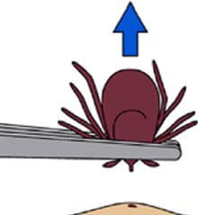
Apply steady, even pressure and pull tick
up and out. Illustration: CDC website
AHHH! It's on me, it's on me!
WHAT DO I DO?

First, keep calm, there's no reason to panic (unless the tick is over 20 pounds. In that case, call Guinness, then panic). If you are panicking, and happen to like Country music and Brad Paisley you could listen to this to calm yourself. There are plenty of tick removing methods out there (and even more old wives tales), but the most effective tick removal system to date requires only your fingers and a pair of pointy tweezers, pretty high tech, huh? With your tweezers in hand, here's what to do:
  1. Disinfect the pointy tweezers with a bit of rubbing alcohol or a bit of flame (allow tweezers to cool if flame is used). We use the pointy type because you run less of a risk of squishing the tick with the pointy ones than with the thick ended pairs.
  2. Use the tweezers to get a grip on the tick's "head" (capitulum), as close to your skin as possible. Try not to squeeze the tick's body, as that may lead to the tick secreting its body fluids into you.
  3. After establishing a decent grip on the parasite, pull up with steady, even pressure. DON'T twist the tick, DON'T jerk the tick, by manipulating the tick that way you may break off the tick's mouth parts leaving them lodged in your skin. Didn't listen to me or have the mouth parts break off anyway? Don't worry. Attempt to establish a grip on the severed mouth parts and remove them from your skin, again, use steady even pressure. If they still will not come out, leave the area alone and allow your skin to heal, if you notice any abnormalities contact your physician.
  4. After you've removed the blood sucker, be sure to wipe the area down with rubbing alcohol, iodine or some other disinfectant. I follow that up with a touch of triple antibiotic ointment and disinfect the tweezers as well.
  5. Keep an eye on the area. If you find yourself with a rash, fever, muscle/joint soreness, fatigue or other symptom call your doctor and be sure to tell them about your recent tick bite.
There are some old wives tales that claim to be best and I'm sure you've heard of them; burn them, rub alcohol on them, smother them with Vaseline, rub them down with Icy Hot ointment or other mentholated rubs, squirt them with nail polish remover and so on... Now, concerning those old wives tales of how to remove a tick, here's why you DON'T want to do them, those methods may actually induce the tick to VOMIT (regurgitate, puke, etc.) the contents of its stomach into your body. Gross you out? Good. Then just grab a pair of disinfected tweezers to get that sucker off of you.

A "Bulls Eye" rash, usually indicates the
presence of Borrelia burgdorferi the
bacterium responsible for Lyme disease.
Photo: CDC
Why that dirty little parasite!
What could it have given me?

Tickborne illnesses have many of the same symptoms, and these symptoms usually show themselves within 30 days.
  • A fever and/or chills - The degree and extent vary.
  • Aches and pains - The most common are headaches, fatigue and muscle pains. Joint pain is a common complaint additional symptom from those suffering from Lyme disease.
  • A rash - Treat any rash near the tick bite as serious and visit your doctor. Some tickborne illnesses have distinct rashes, that usually precede a fever.
  • An example of the Rocky Mountain
    Spotted Fever rash type.
    Photo: CDC
    • Lyme Disease: A "Bulls Eye" rash (see photo to above right) may appear 3-30 days after the tick bite. A fever is usually not far behind the appearance of the rash. 70-80% of patients will exhibit the rash if infected, so just because you don't see a rash doesn't mean you may not have it.
    • Southern Tick Associated Rash Illness (STARI): Shows a "Bulls Eye" rash similar to Lyme disease, and will originate from the bite site of the lone star tick.
    • Rocky Mountain Spotted Fever: Most often a rash of small, flat, pink, non-itchy spots begins to appear on the infected person's wrists, ankles and forearms 2-5 days after the bite. The rash may spread slowly to the trunk and the palms of the hands and soles of the feet. 10% of patients with Rocky Mountain Spotted Fever never develop a rash.
    • Tularemia: Those infected with Tularemia will usually form an ulcer at the tick bite site. The infection will sometimes spread to nearby lymph nodes as well, such as those located in the groin and armpit areas.
  • Paralysis - Tick paralysis is a very rare tickborne disease, thought to be brought about by toxins contained in the tick's saliva. The symptoms may be confused with other neurological diseases and maladies. Once the tick is found and removed the paralysis usually subsides within 24 hours.
So, if you begin to show any signs or symptoms above, immediately get thee to the doctor. All of the tick related illnesses are reversible and curable. For a more developed list of tickborne diseases visit the CDC's Tickborne Diseases of the U.S. page.

But don't stay out of the woods!
Ticks should not be any reason to keep you out of the woods or off the trails, with a bit of prevention and spot tick checks often, you can continue to enjoy the outdoors, all you really need is light colored clothing and insect repellent to keep your treks relatively tick free!

I hope you enjoyed this entry, if you have any questions or comments, post them below and don't forget to follow on facebook at: https://www.facebook.com/LocalTreks

Additional Information and Websites referred to:
Center for Disease Control & Prevention: Ticks
HowStuffWorks: "How Ticks Work"
Missouri Department of Conservation: Ticks

Friday, August 2, 2013

An Absolute Hidden Gem: Cathedral Canyon (Dark Hollow or Lower Rock Creek)

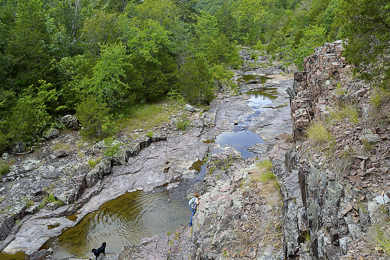
A birds eye view from a bluff overlooking Lower Rock Creek.

Cathedral Canyon is a gorgeous and seemingly remote part of the Mark Twain National Forest, that goes by many names.  I prefer to call the area Cathedral Canyon because the serenity and staggering beauty there may only be truly matched by a quiet cathedral. Other hikers and soul seekers may refer to it as Dark Hollow, Lower Rock Creek (this seems to be one of the most accepted names), or even the Trackler Mountain trail, I believe that no matter what you want to call this remote and relatively undisturbed forest, you'll leave calling it magical.

A little something left as thanks for a great hike!
Now, I'm going to be completely honest... I almost didn't write this post. The reason behind my potential omission was wholly selfish. Due to the sheer beauty of the area and the pure lack of any real, discernible trace of human influence on the landscape, I simply didn't want to let others know about it. On our hike we found no trash (so if you visit, please keep it this way), no well trampled trail and heard not a single unnatural noise or sound. So, I admit, I wanted to keep it secret, keep it hidden, keep it "remote" for just a bit longer, but that simply isn't fair to anyone (or the Mark Twain National Forest for that matter).

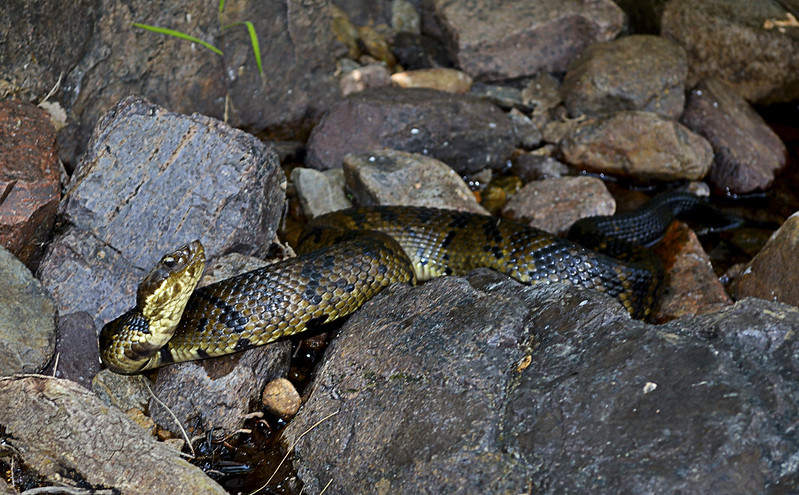
These guys (and gals) are everywhere in Lower Rock Creek.
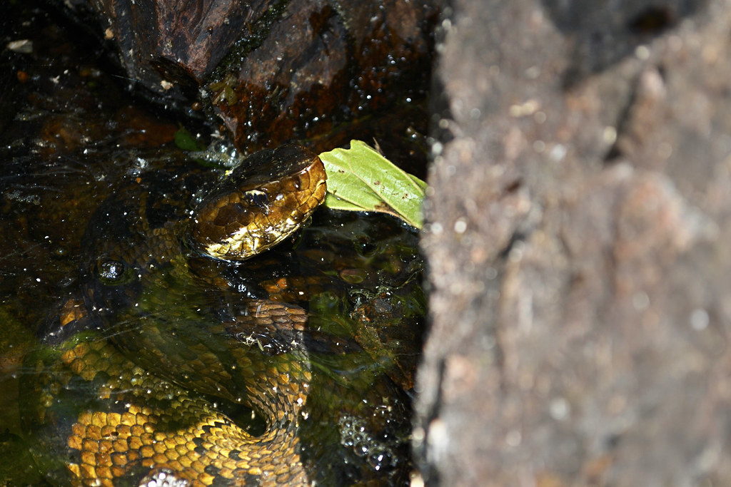
Since I've decided to share my precious hideaway, let me start with one reason you may not want to visit in spring, summer, and early fall... Snakes. And I'm talking a lot of snakes, lots and lots of poisonous snakes. So if you have an Indiana Jones like fear of our scaly, legless, cold blooded, slitherers, don't come here until winter or late fall (it's still beautiful then). On our hike we spotted a couple of copperheads, a timber rattlesnake and countless cottonmouths. The cottonmouths (water moccasins) were so thick, I nearly stepped on one while stepping over another. I am not exaggerating here, go ahead and Google it, I'll wait... See?

The gate and bullet ridden reflective sign
mark the trail head. Nothing says "C'mon in" like bulletholes!
Still here? Still Reading? Still want to go? Ok, I thought that may scare you, but you are very brave, very brave indeed! So onto the directions... Coming from St. Louis (I know, I usually start everyone at Cape Girardeau), you'll take I-55 South to highway 67. Take highway 67 South to highway E. When you hit Fredricktown, you'll go West (which is on the right) on highway E. Continue on highway E for about 10 or so miles, and be on the look out for County Road 511 (CR 511), it will be on your right. Turn right on CR 511, and travel about a mile, when you cross over a low water bridge take an immediate left on the unmarked road there. BE CAREFUL, this unmarked, heavily forested road is VERY, VERY rough! Find a place to park, out of the way of the way of the unmarked road, and walk to the "trail head" marked by a traffic style gate with a reflective sign on it.

The beginning of the trail.
Once you've found the trail head, you will set trek on a wondrous journey on a rarely traveled trail (some call this trail the Jeep trail or path) through an evergreen and deciduous forest that creates an exquisite canopy overhead. You will soon reach a small fork in the trail, mere yards after the gate, we took the left fork and it worked for us. As you travel be sure take note of your surroundings, look for wildflowers, perhaps discover some wild blackberries (as we did), or Ozark witch hazel and listen for local wildlife (which may even included black bears, we didn't see any of these) moving through the undergrowth. I mention to be sure to take note of your surroundings because the trail may disappear from time to time, due strictly to the fact that not many travel or hike upon it, so do take note of interesting features (trees, flowers, rock formations, whatever floats your boat) and other hikers trail markings just in case, you may need them to navigate back later. The wooded portion of the trail winds for about a mile or so, then the canopy opens up and you will find yourself on the rocky banks of Lower Rock Creek!

Be sure to search for a marker as you emerge from the trail to Lower Rock Creek.
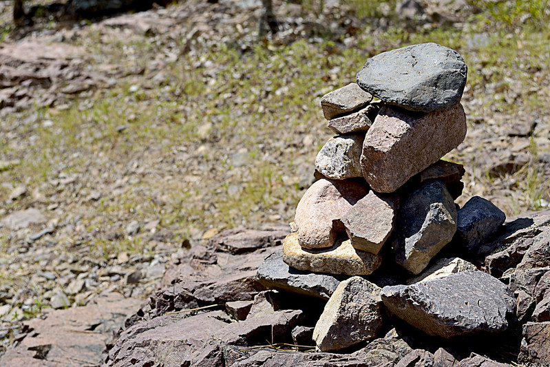
We used this existing rock cairn as our marker, thanks to whomever left it behind!
At this junction, given the remoteness of the area, my wife and I spied a rock cairn already built that conveniently marked where we had emerged from the trail so we took note straight away. This pile of rocks would be the marker we would search for to find our way back. If you aren't lucky enough to have a small cairn already built for you, heck, make your own, it's like nature's Jenga! Or you could place a dead branch pointing to the trail on the rocky shore as well, just be sure that you mark the trail so that you can return easily. Now, if you headed left, or downstream, you could actually follow the Lower Rock Creek until it runs into the St. Francois River and I'm pretty sure that could be a great hike in itself. However, we turned our sights upstream (right) as a steep and climbable bluff had quickly caught my attention.

The step-like formations.
If you decide to climb a few of these bluffs as well, be very careful, in spots the rhyolite bedrock and pinkish colored igneous rock will slip and shatter underfoot and although it may not look like a long fall from the base of your climb, it will certainly not feel good to take rapid descent caused by a slip or fall to the creek floor. The sharp, angular fractures of the rock lining the canyon walls provide fantastic foot, toe and hand holds for your ascent though, just be sure they are solid before placing your full weight on them. If you've made it up to the top, be prepared for a fantastic view of the canyon floor and winding Lower Rock Creek. You may even chance upon a collared lizard or two up here.

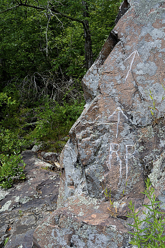
RR: Rattlesnake Ridge?
As we headed upstream the snakes became more and more prevalent, for a spell I was paying far more attention to the snakes than the scenery, simply because they seemed to be on every horizontal surface, basking in the summer sun. Interspersed with the cottonmouths were a copperhead and a timber rattle snake, the latter we found just before heading back into the forest on a trail marked by RR inscribed on a nearby rock. After a few jokes about the RR standing for Rattlesnake Ridge, we continued onto the trail. This trail quickly faded, within about 30 or so yards so of the marker, so we decided to gingerly create our own, winding up and down the hill side, seeking the easiest path sometimes following game trails (deer and other game always seem to find the easiest way about the area). We found more wildflowers and fantastic spots to climb rocks and boulders as we made our way further.

Time to camp!
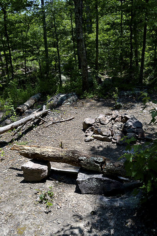
Now, for all you campers out there (backpackers too) we came upon an absolutely beautiful spot to camp, complete with a rock lined fire pit, comfortable log bench and a smooth, level patch of earth just begging for a tent to be pitched. As we took our own rest here, enjoying a bit of trail mix and peanut butter crackers, I was struck by the views this site offered. The exposed bluffs glistened white in the sun's rays, dotted with evergreens, while the Lower Rock Creek provided a steady beat of water gurgling, with the songbirds providing chorus. For a moment I had reached outdoor nirvana, everything coming together perfectly, with pinpoint timing and I was able to share that with my wife... That's what hiking is to me. Finding those moments and being able to share them with someone else, with bonus points for being someone you love...

Well, we poked and prodded a bit around the campsite area and even found a small container that had some camping equipment (pots, pans, etc.) located near the camp site. Of course I had to take the short journey from the campsite to a nearly chest deep pool of water, created by huge boulders and the flow of the Lower Rock Creek, to take a bit of a refresher before we headed back downstream. The journey back was every bit as fun as the trip up, our eyes scanning for snakes lining the creek when not fully focused on the beauty that surrounded us.

The remoteness and serenity of this area is absolutely unsurpassed for me, I haven't been able to find a spot like this anywhere else. So untouched and unaltered, I have read elsewhere that the University of Missouri has described this area as the most significant remaining example of the St. Francois Mountain watershed landscape. I can't think of another place that I so desperately can't wait to return to, and once you've taken a trip here, I'm confident you'll be looking to schedule a return visit too! But you may not be telling all your friends... You may want to keep it, "secret".

As always, thanks for reading!


More Information:

View Larger Map