The Castor River Shut-Ins of Amidon
Gorgeous. Absolutely, unequivocal beauty. That is what I honestly think about the Castor River Shut-ins area of the
Amidon Memorial Conservation Area. In fact, I'm not sure those words can even do it justice, we may need to come up with a new word, just to describe the beauty of the flowing waters and brilliant pink granite rocks that are found there.
In order to get to the lot that contains the trail head for the Cedar Glade Trail, you'll need to take Route J east of Fredricktown, MO to Route W (make a right), then head East on County Road 208 (CR 208). CR 208 will turn into a dirt/gravel road while you ride along, so don't fear any toothless banjo players, but you should always keep your eye out for em', just in case... As you scoot down CR 208 you will come to a fork in the road, and in the middle of that fork you'll see a real grist stone from one of the old mills that used to be located on the land here, so take a second to park along the side of the road and take a peek, it is a pretty nifty piece of history. Once you're finished checking out the grist stone, take the fork to the left, County Road 253 (CR 253) and then look for a parking lot on your right, there you'll find the trail head of the Cedar Glade Trail that will take you to the Castor River Shut-ins. Did I confuse you? Then take a peek at this
area map, it may help sort it out for you and, of course there is a map at the bottom of this post that will take you to the
Google Maps version.
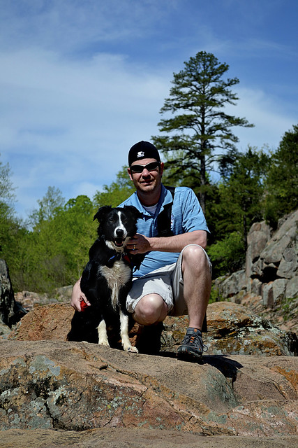 |
| I swear Hyatt's smiling big here... |
Now, the Cedar Glade Trail, a 1 mile long loop trail, has a bit of a Jekyll and Hyde personality to it. The Dr. Jekyll side, or the "good" side, is a beautiful, wide and well trampled trail that leads from the parking lot to the Castor River Shut-ins. The hike takes you through a forest of mixed hardwood trees, dotted with short leaf pine growth, you may notice some extremely large oak trees which have fallen over, root ball included on the sides of the trail. I don't know exactly what caused these mighty hardwood trees to topple, but they certainly were old growth. Keep an eye out for turkey, squirrel and deer as the area contains a decent population of them out here, we even observed the ever elusive domestic short haired cat, which sent ol' Hyatt (our border collie) into a frenzy. The Dr. Jekyll portion will finally empty you out at the Castor River Shut-ins and I'm sure you'll be just as impressed with the river as we were.
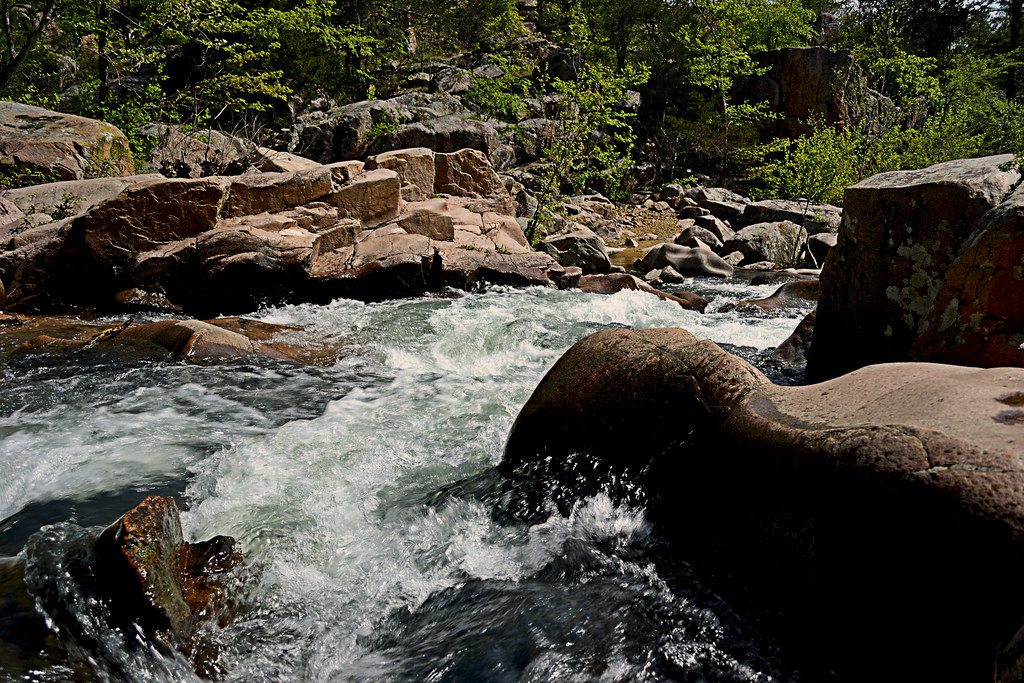 |
| The smooth granite boulders of the shut-ins. |
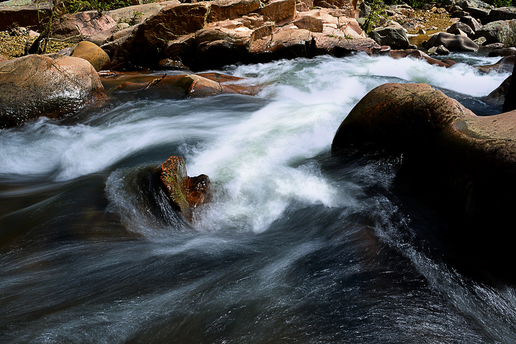
Here you'll see the Castor River as it carves through the baby's bottom smooth pink granite. The rocks are gorgeous and the river may even have a bit of a blue or green tinge to it, making the whole scene absolutely picturesque. As always, beautiful smooth rock and water are a combination for slips and falls, so watch your step as you traverse the pink granite boulders. After you have, lets say, dipped your toes into the free flowing Castor River and felt the warmth of the summer sun as you rest on one of the pink boulders, you should be ready to take on the last bit of the Cedar Glade Trail... The Mr. Hyde portion.
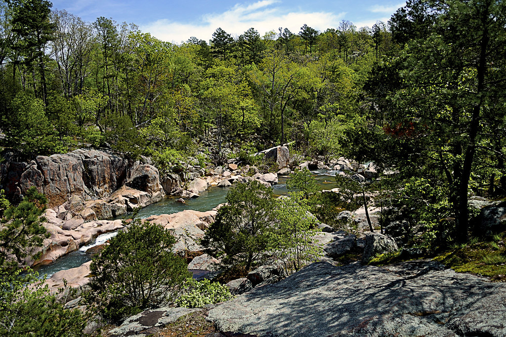 |
| Photos can't do justice to the scenery here. |
The Mr. Hyde portion of the trail is the more "difficult" in terrain, as you will be walking on some of the smooth (and most likely wet) granite rock surfaces and navigating a bit of a loosely packed rock trail that heads up in elevation. The trail here is not as well maintained and some of the rocks will slip from underfoot as you make your way up, however, the pay off is nearly as grand as the view of the Shut-ins was for the first portion, this portion of the trail offers an over look that provides a vantage of all that you just observed up close and personal. As you finish the loop, be sure to visit the restoration of the glades areas here, you'll find some beautiful wildflowers blooming in spring!

Now, it is a short trail, and when it ends you will most likely want more, we certainly did. But don't worry, there is more to explore at Amidon, remember that fork in the road from earlier. Well what do you think is down the right fork? I hope to write more soon on that right fork of Amidon, such as a little spot to swim called "Hippie Hole" and some free range exploring. So get your bathing suit ready and I hope you're not afraid of some crawdads and bit of river crossing in a car!!
More Information:
Amidon Memorial Conservation Area
Amidon Area Map
View Larger Map
Love your blog and thank you for great information!
ReplyDeleteThanks for reading! We really love hitting up all these wonderful places in Missouri and Illinois. I hope all your trails are happy.
ReplyDelete