Showing posts with label Wilderness. Show all posts

Monday, May 19, 2014

Rock Pile Mountain: A Great Place To Get "Lost"

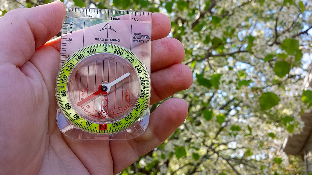
Local Treks: Compass

A "Link" Between Gaming And Hiking...

Growing up I loved playing The Legend of Zelda. The hero Link, in all of his 8-bit glory, began his journey when you led him into a cave and met a kindly old man positioned between two flickering flames. As he entered the cavern, the screen scrolled up and text formed over the elderly man's head revealing infamous words that stick with me to this very day, "IT'S DANGEROUS TO GO ALONE! TAKE THIS." Then Link was presented a wooden sword, the first weapon I would use on my epic elementary school quest to defeat the Evil Gannon. Later I would begin to explore dungeons in the game, here two items were of great importance; a compass and a map. Rock Pile Mountain Wilderness reminded me of this piece of my childhood, as it really can be dangerous to go alone, especially into a wilderness area and when you head out into these protected areas you should always take a compass and a map and know how to use them.

4,238 Acres And This Is A SMALL Wilderness?

Rock Pile Mountain Wilderness holds the distinction of being Missouri's smallest wilderness area, weighing in at 4,238 acres of beautiful forest located outside of Fredricktown. The trailhead is located off of County Road 406 on Forest Road 2124 in Madison County. I can assure you, finding the trailhead for the wilderness may provide you a journey in itself! We traveled easily enough south, down Highway 67 from Fredricktown and turned right onto Highway C. Next we turned right on County Road 406, using the directions provided by the Mark Twain Forest recreational opportunity guide, however we found the very last portion of the directions very difficult to find... The left turn on Forest Road 2124. This road does NOT have a traditional style street sign, instead it is a very small, skinny, brown stake-like sign, that is off on the left side of County Road 406 by at least 5-8 yards. We passed this turn twice before finding it. Unfortunately, I didn't measure the distance, but if you turn on County Road 406 from C, it is approximately 2 miles down the dirt road and will be on your left, it does look like it is fairly well traveled.

Road Conditions May Vary...

Some reports on other websites and resources put Forest Road 2124 in a nearly complete state of disrepair, some have tales of ditches large enough to swallow cars, mud so deep that the Swamp Thing dwells somewhere in their depths, and trees the size of Redwoods have fallen over the rural gravel road. When we visited on April 18, 2014 the road was in very good condition. In fact, I was a bit disappointed that the road wasn't a challenge to be overcome, I wasn't going to be able to use the drive as a badge of honor to earn. However, I will say this, I can CERTAINLY see how this road may fall into a state of utter decay, signs of downed trees did litter the ditches and clear ruts were left by water as it cascaded over the road in spots during previous rains, cutting portions of the road away. But we easily made it, in an old four cylinder, two-wheel drive RAV4, that was born in 1998. We didn't even need the extra clearance the aging RAV4 provided over a standard car on our trip. The small ruts were easily avoided and we putted right on up Forest Road 2124 to the trailhead at the top of Little Grassy Mountain.

Be Sure To Bring Your Own Map.

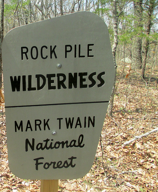
Local Treks: Rock Pile Wilderness Sign
As we neared the peak of Little Grassy Mountain, we were surprised to find another car parked just off the turnaround at the trailhead. Of all the reports I had read, none had ever mentioned bumping into another hiker while out on the trail. We pulled on in next to the other car (another, far newer RAV4), parked and began to stretch our legs, exploring the trailhead and reading the postings on the information board. I filled out a quick registration card and placed it in the collection box, near the information board. Honestly, there isn't much information available at the information board, and sadly I've become used to this in the Mark Twain National Forest. Please don't take this as a "knock" against the National Parks, but I've found them to be far more lacking in upkeep than our local State Parks, perhaps it is just that the Missouri Department of Conservation (MDC) does such a fantastic job of maintaining our local parks and trails that it makes the National Parks in Missouri look worse in comparison, but that is enough of a side tangent. There are NO maps available at the trailhead information board and some information seemed to have been torn off, but as I stated before, I expected this and in anticipation of finding another mapless information board, I had printed out two copies from the internet at home, marked them both up and brought them along with a compass.

Local Treks: Rock Pile Mountain Rock
Just a few steps from the information board is a great place for a photo opportunity. A large stone with Rock Pile Mountain Wilderness boldly chiseled into it just begs for you to hop in front of it and snap a selfie! However, be careful near this rock, as it seems that this trailhead may also be a popular late night spot to do a bit of "celebrating", as broken shards of glass are as plentiful here as tile in a bathroom  and on the topic of bathrooms, there are no facilities here, as it is a wilderness area. Also, be especially vigilant as you explore the trailhead if you have a dog, no matter how tough their pads are, they are no match for the slivers of broken glass here. Once we snapped our photos by the rock, we unloaded our packs from the car, strapped up,and were ready to embark upon our backpacking adventure through the Rock Pile Mountain Wilderness. We caught a quick view of a pseudo rock pile in a clearing, just before reaching the official trail and that made us a bit excited to see the real rock pile, for which the mountain and the wilderness area have been named.

Into The Wilds We Go!

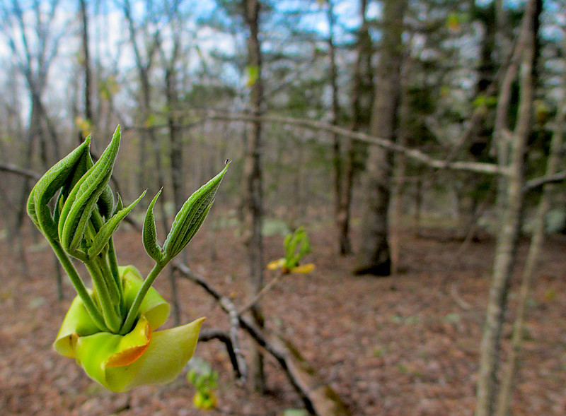
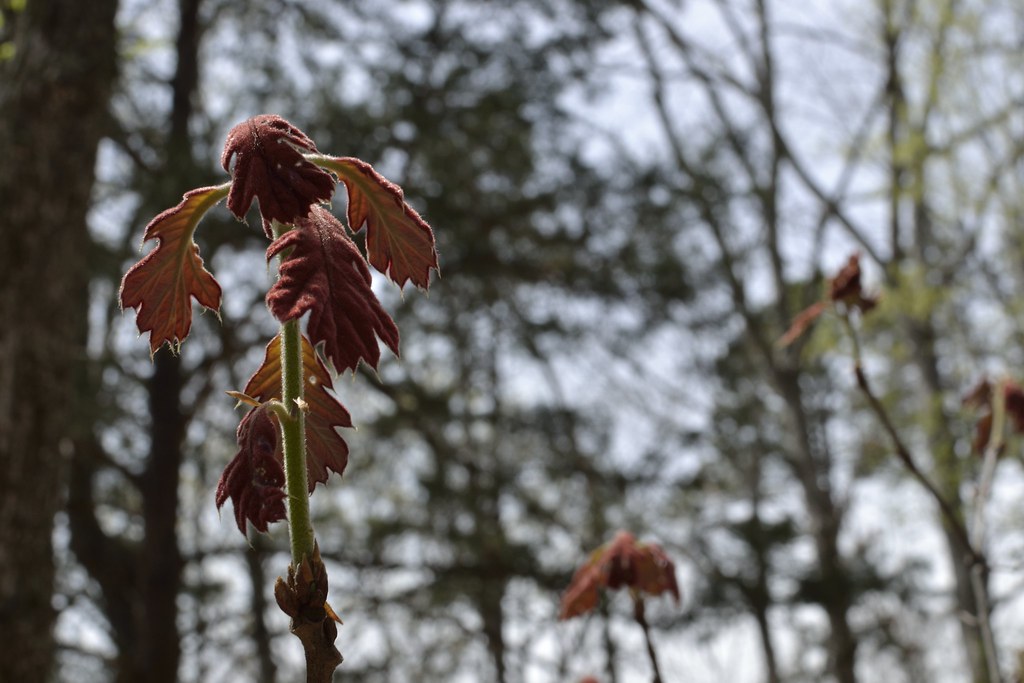
local treks spring is springing
As we pass the patented National Forest sign, indicating the entrance to the Rock Pile Mountain Wilderness, the trail begins as a well worn dirt and stone trail, curving into an elongated C on our map as it winds down the Little Grassy Mountain. The "maintained" portion of the trail stretches for two miles and can be difficult to spot from time to time. As we hiked I noticed many false and game trails that lead to the east and west that could easily trick an unsuspecting hiker into following them for yards, or possibly miles. Because of all the false trails, I checked my compass frequently and compared my surroundings to the map I had packed and marked before venturing out. At approximately the one and a half mile mark on the maintained trail you reach the summit of a small hill, the rock formations and pines here provide a perfect place to take a quick rest, snatch a snack, enjoy a breeze and breathe in the lightly pine scented air. It is also a great place to find yourself veering off trail, completely by accident. It was here that we met a local hiker, out to enjoy the weather and a crisp hike through the wilderness. As we hiked, I corrected his path a few times, as he nearly went off course here at the top of the hill.

We Meet Another Trekker.

Local Treks: Backpacking
Given the difficulty of being assured we were following the trail, our new found hiking partner let us in on some great bits of insight pointing out a few local landmarks by which I could triangulate myself on my map should we become very lost. In fact, on the map, as we descended down the hill, he noted the way the "maintained" trail bent, to the southeast, just before ending and then pointed at purple markings on the trees. Those purple markings indicated the private property lines of the adjacent landowners, and also provided a great way to know that we were quickly approaching the backwoods trail in less than a quarter of a mile or so. It also helped me to gather a specific measurement of how far we had hiked and the near exact point of our location on the map. He also pointed out orange blazes on trees noting they had been left there by the local fire department who had been called out to Rock Pile Mountain to rescue lost hikers the year before.

Watch Out For Obstacles, Remember That Map?

Local Treks: Marked up map
Scribbling on your map is a'ok!
I had to remind myself of downed trees and other landmarks.
We continued hiking with our local partner for about a mile or so, until we hit another navigational hazard, downed trees. Lots and lots of downed trees. These obstacles had been somewhat more frequent than we were used to and began to get even worse and more frequent as we left the "maintained" portion of the trail. The downed trees could not have come at a worse place either, unknown by us, the trail splits here. Hidden underneath these trees was the actual split, and we originally headed to the east in order to get around them and back to the trail. When we skirted around the trees and picked back up the trail, I noticed that we were heading due east, opposed to southwest as the map indicated and after about 25 yards I stopped, knowing that we had either picked up a false or game trail. We all doubled back and decided to look for the trail again. At this point, our hiking partner, who was heading to a different destination than us, decided to simply head due west, confident that he would pick up the trail soon enough and we decided to navigate back toward the northwest to find the original trail and last known good location instead, and so we all bid farewell and happy trails.

Remember: Getting Away From It All Is Only  Fun If You Get Back...

Where we were actually at was the first of three official splits in the trail, shown on the map. Once we navigated back to our last known good location we opted to circle the downed trees to the west this time and sure enough, we were able to pick back up on the trail. With a quick check of the compass and glance at the map, we knew we were back on course to make it to the summit of Rock Pile Mountain. We were also lucky enough to spot the actual split, buried under a few trees, marked by an aged fence post with a rock set atop it. Although we would not see our local hiking companion again, we would spot evidence of his trail as we continued.

I've Never Been Happier To See A Color.
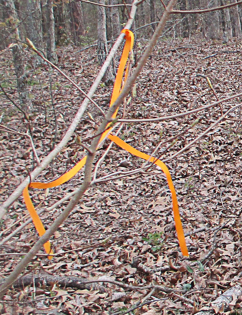
Local Treks: Orange tags
My new favorite color! Follow Me Orange.
Remember those orange blazes our local friend had pointed out earlier? The ones left by the fire department as they mounted a search for lost hikers? These came in EXTREMELY handy for us. Although I am a fairly competent navigator, these blazes seemed to be placed at just the right spots to remind me that we were, indeed, on course for the summit of Rock Pile Mountain. Just as self doubt would begin to enter, the trail would seem to disappear, or trees had once again forced us off the scantly viewable trail, these tiny bits of plastic would set my mind back at ease and assure us that we were on the "right path". However, realize that these markings will not last forever and there were very, very few other markings that would distinguish the actual trail from the numerous game trails that cross it, we were just lucky to have these navigational beacons for our hike, so please do not count on them to still be there. However, I'll mention here that we were able to get cellular reception throughout most of our hike, losing a signal only once as we were in a depression navigating around another obstacle to our path.

Our Final Destination And A Possible Ancient Relic.
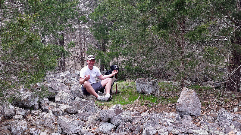
Local Treks: Me in rock pile
Finding a spot of enlightenment and my center, in the Rock Pile.
We would spot more orange blazes as we finally approached our final and ultimate destination, the peak of Rock Pile Mountain itself. A word of warning, there are many different "rock piles" on the peak of this mountain, obviously created either as a cruel joke or as an homage to the real rock pile itself. If you have GPS, here are the coordinates - 37°25.222' N, 90°25.199' W - I took from the center of the "real" Rock Pile. For those without GPS assistance, it lays just to the northwest of a large granite clearing, search, I assure you will find it. Keep in mind it is not located on the very tip-top of the mountain, but very close. According to what I've read this ancient circle of granite rock is believed to have been piled near the very peak of Rock Pile Mountain by some earlier man. The original Rock Pile, for which this entire area and mountain was named, was over four foot tall. However, according to some accounts I have read, due to present day travelers and inconsiderate visitors the Rock Pile now is just over a foot or two in areas, but you can certainly see that it is created by man, for some purpose... The exact purpose, well, we'll most likely never know.

Overall Thoughts: I LOVE This Place.

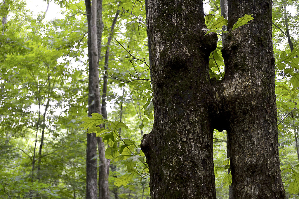
Overall, our hike to Rock Pile Mountain was fantastic. We could not have asked for a better day and botanists would fall in love with the variation in local trees here; as the wilderness supports basswood, butternut, Kentucky coffee tree, walnut, sugar maple, and magnificent white and red oaks. If you find yourself hiking in Spring, as we did, you'll also notice as you near the man made ponds the sing-songs of frogs as they serenade in hopes of a mate. Evidence of white-tailed deer, turkey, and other large game abound, we spotted many tracks for the deer and heard them as they escaped, just out of view, on our return hike. Another thing to watch out for, although we found no tracks or evidence, are black bears. There have been quite a few spotting of these bears in the Rock Pile Mountain Wilderness, so please keep this in mind, particularly if you are camping in the area as you should suspend your food items in a bear bag, high in a tree. The last thing you would want during a wonderful camping trip would be a humongous hairy camp crasher.

Keep In Mind: I'm A Wilderness Fan-Boy...

Local Treks: The Rock Pile
I'll admit, I'm partial to wilderness areas. I enjoy the relative solitude, the complete lack of crowds and the feeling of truly being alone and yet one, with nature. The lone hiker we encountered was the solitary exception to the general experiences I've had in the Missouri and Illinois wilderness areas and the other hikers (remember the newer RAV4 at the trailhead?) we never spotted, and once our traveling companion went out of sight at the downed trees, we never spotted him again either. In our wilderness areas I find that the birds sing a bit bolder, nature takes an extra second before darting for cover, the general fresh air seems fresher, and Rock Pile Mountain Wilderness was certainly no exception. I can't recommend this area enough if you're looking to get away for a day hike or if you're planning a remote backpacking trip, just don't forget to print a map and take a compass. Remember, GPS devices may run out of battery, so if you're using one be sure to bring extra batteries. In fact, that is the reason that I did not take many pictures during our visit here, I had reserved my phone for an emergency only, turning it off as we hit the trail in order to conserve all battery life. I hope you decide to visit this great wilderness area, I'm sure you'll enjoy it just as much as we did!

One Last Thing...

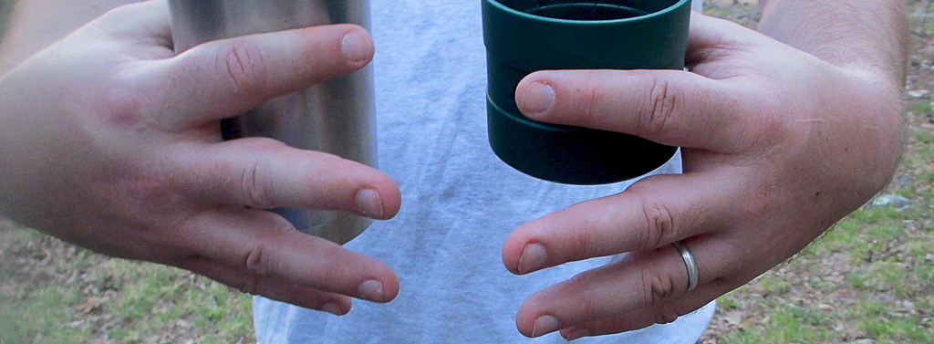
All packs are not created equal. One thing to keep in mind, if you are back packing like we did, keep your load light and properly adjusted or, well, there's a picture below. My fingers became pretty swollen due to hiking with too much weight on my shoulders and not enough on the hip belt. Hopefully you'll get as big of a snicker at this as my wife did... Happy trails to you!

Local Treks: Swollen fingers from backpacking


More Information: 

Local Treks on facebook 
Mark Twain National Forest: Rock Pile Wilderness
Rock Pile Mountain Wilderness on Wilderness.net
Mark Twain National Forest Brochure of Rock Pile Mountain Wilderness (with trail map)
Mark Twain National Forest Recreational Opportunity Guide for Rock Pile Mountain Wilderness (with trail map and driving directions as well)
Official USGS Rock Pile Mountain Quadrangle Map (use with the trail maps above)
  - Note the USGS map above is a HUGE file and in pdf format.
Wilderness Areas: Let's Get WILD! (post on wilderness manners and what to expect in a wilderness)
The Official USGS Maps Page (helpful for all types of maps, and FREE!)
Tiny. Tenacious. Terrible. Ticks. - A post on how to keep those bloodsuckers at bay!
How To Take A GREAT Day Hike

Coordinates:

Trailhead GPS Location: 37°27.811' N, 90°24.311' W (taken with Samsung Galaxy S4)
Rock Pile GPS Location: 37°25.222' N, 90°25.199' W(taken with Samsung Galaxy S4)
 

Monday, March 10, 2014

Panther Den: Don't Forget Your Map!

Local Treks: Panther Den Wilderness Boundry Sign

Panther Den Wilderness may be the smallest wilderness area in the state of Illinois, but it packs in some of the most distinctive and maze-like rock formations you may ever see! This distinctive and unique area boasts over 820 acres of land and is bordered by Crab Orchard Wilderness, which offers an additional 4050 acres of Illinois wilderness to its north. Before you read on, you may want to brush up on Wilderness Areas (Let's Get WILD) is and print yourself off a map of the area.

How To Get There
Finding Panther Den Wilderness may be, in itself, a bit of an adventure. If you have been searching for directions I'm sure you've encountered a thousand different versions out on the internet. Some talking about private land others talking about washed out creeks, heck some may even be saying you'd better just float on in from the north on one of the fingers of Devil's Kitchen Lake. I guess I'll go ahead and add another way to get there, ours was simple and fairly straight forward.

From Cape Girardeau, MO we started across the Emerson Bridge into Illinois and followed highway 146 East through Anna, IL turning left on Lick Creek Road near the outskirts of town. After traveling about eight miles down Lick Creek Road, we veered off to the left onto Grandview Road, following it until again veering left onto Hall Church Road. Follow Hall Church Road until you are able to turn right on Rocky Comfort Road, enjoy this last bit of paved road. Continue down Rocky Comfort Road for about three miles until you can make a right turn onto Panther Den ROAD. Welcome to the gravel my friend! Now, follow Panther Den ROAD for a bit over a mile or so, until you see
Panther Den LANE on the left. You'll notice this road is in pretty rough shape (or at least it was in 2013-14), keep to the right as it is a one lane road, and you will see the parking lot at the end of the road on the right.

Local Treks: Panther Den Trail Markers 001 & 371
Pay attention to the trail markers out here:
The Panther Den loop is 389,
the trail back to the lot is 371,
and the River to River Trail is 001.
See the Quick Trail Note below.
The Trail
One of the first things you may notice as you approach the trailhead is that there is a complete lack of information and maps on the Panther Den Informational Board (or at least there was on all of our visits in 2013-14). I don't know if all the information fell off, was stolen, or if a pack of wild dingos with a taste for maps and information strolled in and devoured all postings. So be sure to print off a map of the area before you leave home, read my cautionary tales below if you don't think having a map is important...

The trail itself begins as a mixture of gravel and dirt, featuring many planned switchbacks which help to reduce the wear and tear of erosion on the trail and wilderness. The switchbacks also make the hilly terrain a bit easier to traverse. The rolling downhill hike will bottom out with a small creek crossing, be alert here as we have found this a fantastic place to find local wildlife visiting for a refreshing drink. From here you'll travel up a small hill be sure to veer left at the trail intersection and that will take you to a welcome sign for the area. You can now follow the trail around the Panther Den or, better yet, go inside the magnificent sandstone formations for which the entire wilderness area is named!

Quick Trail Note:
The Panther Den loop makes use of the 389 white diamond trail markers/blazes, however these markers are sometime sparse and, I suspect, stolen by idiots. You may see markers up for 389-A and 389-B, both of which are small spurs, these spurs seem to be old, abandoned trails. My experience is that 389-A and 389-B are generally overgrown and hard to navigate (I became pretty lost on what I believe now to be 389-B). I'd suggest staying on the main 389 trail and then following the 371 trail marker back to the parking area. 001 is the designation for the River To River Trail, which runs through and connects Panther Den Wilderness and Crab Orchard Wilderness.

Enter The Den!
Local Treks: A "Room" at Panther Den
One of the many "rooms" within the
Panther Den rock formations.
Inside Panther Den, you'll find these huge sandstone formations seem to form rooms, hallways, and even floors. Some of these formations are so angular that you may have an "Ancient Aliens" like feeling, wondering if perhaps some ancient astronauts visited the area eons ago in order to lay down rock foundations and rooms to inhabit. One particular "room" in Panther Den seems to even have a poured foundation. In reality though, aliens didn't have anything to do with it, all of the formations are natural... Or are they?

You can easily spend hours inside of Panther Den, leaping from cliff to cliff, poking into every crack and crag, squeezing through narrow crevices and splits or just running your hands over the smoothness of the sandstone. There are small waterfalls to be discovered, side trails to be explored, cairns to be constructed and plenty of places to hide as well; so you can jump out and scare the wits out of your friends and family. And, although you won't find any panthers in Panther Den (at least not since the 1870's) you may spot some other local wildlife such as whitetail deer, turkey, muskrats, beaver, and skunks. If you are really lucky, you may even get a rare glimpse of a bobcat or mink. So be sure to keep your eyes peeled!

Local Treks: Panther Den Meeting Cairn
Be sure to set a meeting place up.
Just in case.
You will also find many sandstone "coveys" carved into the rock in the area around Panther Den. These sandstone overhangs offer shelter to an uncommon wildflower, French's shooting star (Dodecatheon frenchii). Unfortunately we didn't spot a single one on any of our hikes. But, if you would like to see or find one I would suggest hitting the area in May or June and seeking out sandstone overhangs near running water. Although the French's shooting star is not currently on Illinois Threatened and Endangered list, it is still considered a sensitive species in the state. So if you are lucky enough to find a colony of these beautiful little wildflowers, please take only pictures so that others may be able to enjoy their beauty as well.

You may also want to stick together while exploring the inside of the formations, or at the least set a place and time to meet up in case someone gets separated. It is very easy to get lost within the maze-like formations of Panther Den. Children (and parents) may freak out if they suddenly find themselves separated from the rest of the group. If you become horribly lost remember that a distress signal in the woods consists of three successive sounds; be they yells, shots, claps, whistles, or any other signal.

Camping
There is so much to be explored in Panther Den that you may even consider camping within the area. If you do, remember that you are within a wilderness area. You do not need a permit and the US Forest Service asks only that you practice "Leave No Trace" ethics and camp a minimum of 300 feet from any established trails. Most of the "user" camps that you will encounter are far too close to established trails and have left obvious marks on the landscape. You are encouraged not to use these campsites so that these overused areas may recover. Of course, you may want to read up on what a wilderness is and always remember to practice your very best Wilderness Manners.

Now that I've told you of how beautiful and truly distinct Panther Den Wilderness is, I'd like to give you two quick stories of warning. 

Story One: Our First Trip
Local Treks: Panther Den Natural Hallway
On our first outing at Panther Den Wilderness we became lost. Very lost. Playing victim to many of the "trails" as we ventured further into the wilderness. We had inadvertently stumbled upon an old, abandoned equestrian trail that twisted and turned through rugged terrain. As I continued to notice the decline in the quality of the trail, I became (silently) alarmed. I could tell we were no longer on an established trail and we had taken so many lefts and rights, I could not recall from which way we had come. Luckily I had my phone, turned off, in my pocket. No bars. We continued to hike and I continued to quietly check my phone. A bar lit. I stopped and instantly hit the button for Google Maps. Once it loaded I found our heading and took note of where the trailhead was on that small, smart phone screen. Had it not been for that stroke of luck we may have been lost for hours in Panther Den Wilderness. This is the experience that taught me to never, ever, set out on a trail without a map and an idea of the route I wish to travel.

Story Two: Stranger on the Road
Local Treks: Kissing Trees at Panther Den
Panther Den Wilderness is for tree lovers...
On our second visit to Panther Den Wilderness we made our way down the gravel road toward Panther Den Wilderness, when we noticed a man wandering aimlessly nearly a mile from the trailhead. It was apparent to me that he was lost and I slowed down to see if he needed any assistance. He sheepishly admitted to us that he too had fell victim to one of the "false" trails of Panther Den and as we drove him back to the trailhead, he told us he had been wandering for hours, without a phone or map, happening upon the road by pure chance. I could tell he was embarrassed, as I had been just a few months prior, of becoming so lost. He was an outdoorsman, confident in his abilities to maintain a heading and follow a trail, it was this over confidence (which I too had suffered) that led to his unintended side adventure, and his catching a ride with us back to his truck. His last words to us were, "I can never let my wife know about this."

So now, please, take this map. Print it. Fold it. Put it in your pocket. It's simple. If you plan to visit Panther Den Wilderness and truly explore the area I cannot stress the importance of having a map on hand enough. Safely experiencing the beauty and sheer uniqueness of the area is worth the ink!


More Information:
CLICK HERE AND PRINT THIS MAP!
Visit Local Treks on facebook!
Wilderness Areas: Let's Get WILD!
Tips: How To Take A Great Dayhike  
Illinois Wildflowers (online guide with pictures)
A Conservation Assessment for the French's Shooting Star (warning: good read, pretty scientific)
National Geographic "Backyard Bird Identifier"

Sunday, March 2, 2014

Wilderness Areas: Let's Get WILD!

Local Treks: Sapling

Wouldn't you like to get away? Away from the streets teeming with exhaust spewing mechanical monsters, the constant ringing of cell phones, crowded restaurants, the dinging of emails in your inbox, the clamor of people as they march to and fro... Don't you deserve a break? A chance to leave technology and other people behind, a chance to take in a bit of nature's splendor in solitude?

Heck yea you do, and it's easier than you think, you just need to get out and experience your local wilderness areas!

Why (or why not) The Wilderness?
Local Treks: Lower Rock Creek formationsSome of you may be asking, "But why go to a Wilderness Area and not a regular State or Federal Park or recreation area?" I enjoy the Wilderness Areas because they are generally more remote, more secluded and less traveled than other conservation areas or general locations within our Federal or State Parks. Many times when I've been hiking or visiting these Wilderness Areas in Missouri I won't see another human being, I don't hear a hum of an engine (in fact, it is generally illegal to operate a motorized or mechanical vehicle inside a Wilderness Area), just the sweet songs and melodies of nature. Remember these areas are set aside to maintain and preserve the "wildness" of the landscape and wildlife, you are just a visitor.

Now, if you like having the thought that there are others out there and enjoy seeing people from time to time on your hike or backpacking trip, you may want to reconsider visiting the Wilderness Areas. I will be very honest when I say that I have not yet bumped into another person on a trail within the areas I have explored. If not seeing other people on your adventures sets your Spidey-Senses to tingling, you may be better served in one of the excellent conservation or recreation areas available.

Also, be sure to see if the outdoor activity you are looking to do is even available in the Wilderness Area you are looking to visit. In 1986, the Wilderness Act was reinterpreted to ban bicycles from these areas, so that means no mountain biking. Some areas restrict camping areas as well.

Where Can I Find Wilderness Areas?
Local Treks: A wooded trail.
A great source for finding a Wilderness Area near you is to visit Wilderness.Net at http://www.wilderness.net/. This site features a great collection of information on Wilderness Areas near you, features maps and is searchable by state, name, and more.

For those of you in Missouri, here are the Wilds near you!
I am looking forward to writing up some entries soon on
the Rockpile Mountain Wilderness and the Irish Wilderness! So stay tuned.

I certainly don't want to forget my neighbors across the river either. For my Illinoisan hiking pals here's a list of your wilds!
Links to Wilderness.net entries and some of my blog entries listed below.

Wilderness Manners.
Local Treks: Shedding Snake
It may sound odd or maybe even like a bit of an oxymoron, but there are certainly a set of Wilderness Manners that you need to observe when enjoying the acres and acres of designated Wilderness. Always keep in mind that these areas were set aside to preserve nature in as close to an "untouched" state as possible. Here are a few of them:
  • ALWAYS LET SOMEONE KNOW IF YOU ARE GOING TO BE IN THE WILDERNESS. GIVE THEM A TIME FOR YOUR RETURN. TELL THEM YOUR APPROXIMATE SCHEDULE, ROUTE, AND INTENDED CAMPING LOCATIONS.
  • Practice "Leave No Trace". Be sure to tread lightly so that nature may repair and endure for others to enjoy. If you pack it in, pack it out.
  • Pick up your trash. Pick up any other trash you may find as well and pack out with you whenever possible.
  • Always dispose of human waste at a minimum of 100 feet way from your campsite and at least 200 feet away from any water source, in a small, shallow hole (also called a cathole).Read more here, meow....
  • Be sure to use the self-registration boxes at the trailheads. This may very well save your life.
  • Try to find lesser used areas for resting and camping. Popular spots (sometimes referred to a user camps) and the constant use of these camping areas make it harder for nature to replenish herself in some areas. By finding alternative spots you can make her recovery a bit easier and find your very own bit of heaven.
  • Always try to camp out of sight.
  • Be prepared. Have a first aid kit, plenty of water, bug repellent (I have a recipe of one you can drink!), a map of the area, compass, the right clothing and shoes as well. Think ahead.
  • Don't count on your cell phone to rescue you. Many of these areas are outside of the cell service range. Don't forget, you came here for a reason, so don't turn it on unless you really need it or at least keep it on silent.
  • As often as possible stay on the trail when hiking. 
  • Limit your group size to 10 or less.
  • Many of these areas are surrounded by private property, ALWAYS respect these boundaries and the land owners as well.
  • Keep campfires (if needed at all) small. Fire rings should be avoided as they show man was present. Small gas or chemical stoves are preferred. Always practice extreme fire safety and be aware of the current conditions.
  • DO NOT TRANSPORT WOOD FROM HOME for campfires.
  • Leave what you find. Don't take it with you. Take a picture instead.
  • It's worth mentioning again, if you pack it in, you pack it out.
Most of all enjoy the solitude, enjoy the lack of urban sounds, and enjoy those you are with in the Wilderness.

History & Today
The Wilderness Act just celebrated its 50th Anniversary this year! It looks pretty darn good for 50, wouldn't you say? Wilderness areas came about in 1964, when Congress passed The Wilderness Act of 1964 and President Lyndon Johnson signed the bill into law. This act created a legal definition of what a wilderness is in the United States and set aside 9.1 million acres of land aside under federal protection. It also provided us with an eloquent definition of a United States Wilderness Area:
“A wilderness, in contrast with those areas where man and his own works dominate the landscape, is hereby recognized as an area where the earth and its community of life are untrammeled by man, where man himself is a visitor who does not remain.
Lyndon Johnson signing the Wilderness Act of 1964
President Lyndon Johnson finishes signing
The Wilderness Act of 1964
The act itself had taken over 8 years of work and gone through more than 60 drafts and spanning three presidencies. Today the Wilderness Act protects over 106 million acres of federal land and these areas are administered by four federal agencies; The National Park Service, U.S. Forest Service, U.S. Fish and Wildlife Service, and The Bureau of Land Management. The National Park Service covers the largest amount of Wilderness areas at 43,616,250 acres, with the U.S. Forest Service in second with 34,867,591 acres, then the U.S. Fish and Wildlife Service at 20,699,108 acres, and Bureau of Land Management with 6,512,227 acres.

Congress considers adding additional Wilderness Areas each and every year, with some being recommended by concerned citizen groups,federal agencies, grassroots organizations and others. In fact, Congress voted unanimously to protect over 32,000 acres of Sleeping Bear Dunes (in Michigan), the first wilderness area to be added in five years. There are also rumors that the administration is making plans to preserve two additional areas as well: The Organ Mountains-Desert Peaks area in New Mexico and Point Arena-Stornetta Public Lands in California.

More Information:
Visit Local Treks on facebook!
Wilderness.net The BEST source I know of to locate a Wilderness near you.
Full Information on The Wilderness Act of 1964 via Wilderness.net
Wikipedia on The Wilderness Act of 1964
Leave No Trace: Center for Outdoor Ethics an EXCELLENT resource on outdoor manners.
Wilderness Manners: Sierra Club another EXCELLENT resource on outdoor manners.

Friday, August 2, 2013

An Absolute Hidden Gem: Cathedral Canyon (Dark Hollow or Lower Rock Creek)

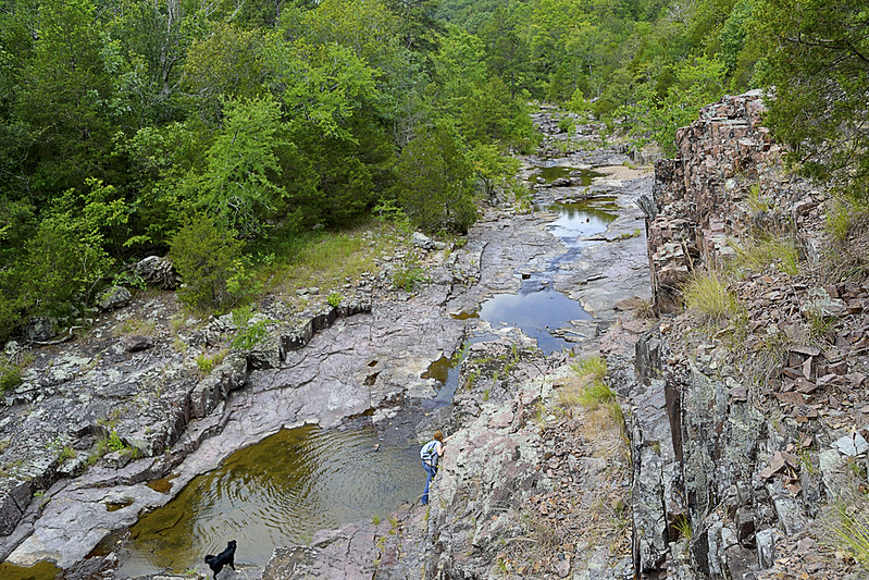
A birds eye view from a bluff overlooking Lower Rock Creek.

Cathedral Canyon is a gorgeous and seemingly remote part of the Mark Twain National Forest, that goes by many names.  I prefer to call the area Cathedral Canyon because the serenity and staggering beauty there may only be truly matched by a quiet cathedral. Other hikers and soul seekers may refer to it as Dark Hollow, Lower Rock Creek (this seems to be one of the most accepted names), or even the Trackler Mountain trail, I believe that no matter what you want to call this remote and relatively undisturbed forest, you'll leave calling it magical.

A little something left as thanks for a great hike!
Now, I'm going to be completely honest... I almost didn't write this post. The reason behind my potential omission was wholly selfish. Due to the sheer beauty of the area and the pure lack of any real, discernible trace of human influence on the landscape, I simply didn't want to let others know about it. On our hike we found no trash (so if you visit, please keep it this way), no well trampled trail and heard not a single unnatural noise or sound. So, I admit, I wanted to keep it secret, keep it hidden, keep it "remote" for just a bit longer, but that simply isn't fair to anyone (or the Mark Twain National Forest for that matter).

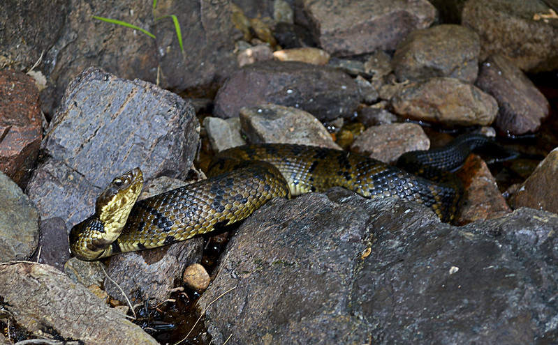
These guys (and gals) are everywhere in Lower Rock Creek.
Since I've decided to share my precious hideaway, let me start with one reason you may not want to visit in spring, summer, and early fall... Snakes. And I'm talking a lot of snakes, lots and lots of poisonous snakes. So if you have an Indiana Jones like fear of our scaly, legless, cold blooded, slitherers, don't come here until winter or late fall (it's still beautiful then). On our hike we spotted a couple of copperheads, a timber rattlesnake and countless cottonmouths. The cottonmouths (water moccasins) were so thick, I nearly stepped on one while stepping over another. I am not exaggerating here, go ahead and Google it, I'll wait... See?

The gate and bullet ridden reflective sign
mark the trail head. Nothing says "C'mon in" like bulletholes!
Still here? Still Reading? Still want to go? Ok, I thought that may scare you, but you are very brave, very brave indeed! So onto the directions... Coming from St. Louis (I know, I usually start everyone at Cape Girardeau), you'll take I-55 South to highway 67. Take highway 67 South to highway E. When you hit Fredricktown, you'll go West (which is on the right) on highway E. Continue on highway E for about 10 or so miles, and be on the look out for County Road 511 (CR 511), it will be on your right. Turn right on CR 511, and travel about a mile, when you cross over a low water bridge take an immediate left on the unmarked road there. BE CAREFUL, this unmarked, heavily forested road is VERY, VERY rough! Find a place to park, out of the way of the way of the unmarked road, and walk to the "trail head" marked by a traffic style gate with a reflective sign on it.

The beginning of the trail.
Once you've found the trail head, you will set trek on a wondrous journey on a rarely traveled trail (some call this trail the Jeep trail or path) through an evergreen and deciduous forest that creates an exquisite canopy overhead. You will soon reach a small fork in the trail, mere yards after the gate, we took the left fork and it worked for us. As you travel be sure take note of your surroundings, look for wildflowers, perhaps discover some wild blackberries (as we did), or Ozark witch hazel and listen for local wildlife (which may even included black bears, we didn't see any of these) moving through the undergrowth. I mention to be sure to take note of your surroundings because the trail may disappear from time to time, due strictly to the fact that not many travel or hike upon it, so do take note of interesting features (trees, flowers, rock formations, whatever floats your boat) and other hikers trail markings just in case, you may need them to navigate back later. The wooded portion of the trail winds for about a mile or so, then the canopy opens up and you will find yourself on the rocky banks of Lower Rock Creek!

Be sure to search for a marker as you emerge from the trail to Lower Rock Creek.
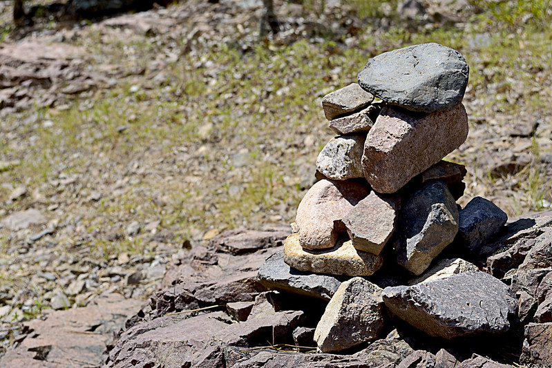
We used this existing rock cairn as our marker, thanks to whomever left it behind!
At this junction, given the remoteness of the area, my wife and I spied a rock cairn already built that conveniently marked where we had emerged from the trail so we took note straight away. This pile of rocks would be the marker we would search for to find our way back. If you aren't lucky enough to have a small cairn already built for you, heck, make your own, it's like nature's Jenga! Or you could place a dead branch pointing to the trail on the rocky shore as well, just be sure that you mark the trail so that you can return easily. Now, if you headed left, or downstream, you could actually follow the Lower Rock Creek until it runs into the St. Francois River and I'm pretty sure that could be a great hike in itself. However, we turned our sights upstream (right) as a steep and climbable bluff had quickly caught my attention.

The step-like formations.
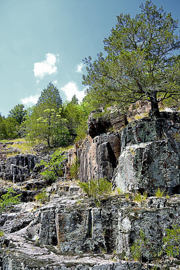
If you decide to climb a few of these bluffs as well, be very careful, in spots the rhyolite bedrock and pinkish colored igneous rock will slip and shatter underfoot and although it may not look like a long fall from the base of your climb, it will certainly not feel good to take rapid descent caused by a slip or fall to the creek floor. The sharp, angular fractures of the rock lining the canyon walls provide fantastic foot, toe and hand holds for your ascent though, just be sure they are solid before placing your full weight on them. If you've made it up to the top, be prepared for a fantastic view of the canyon floor and winding Lower Rock Creek. You may even chance upon a collared lizard or two up here.

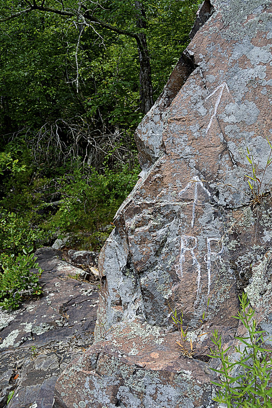
RR: Rattlesnake Ridge?
As we headed upstream the snakes became more and more prevalent, for a spell I was paying far more attention to the snakes than the scenery, simply because they seemed to be on every horizontal surface, basking in the summer sun. Interspersed with the cottonmouths were a copperhead and a timber rattle snake, the latter we found just before heading back into the forest on a trail marked by RR inscribed on a nearby rock. After a few jokes about the RR standing for Rattlesnake Ridge, we continued onto the trail. This trail quickly faded, within about 30 or so yards so of the marker, so we decided to gingerly create our own, winding up and down the hill side, seeking the easiest path sometimes following game trails (deer and other game always seem to find the easiest way about the area). We found more wildflowers and fantastic spots to climb rocks and boulders as we made our way further.

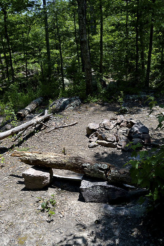
Time to camp!
Now, for all you campers out there (backpackers too) we came upon an absolutely beautiful spot to camp, complete with a rock lined fire pit, comfortable log bench and a smooth, level patch of earth just begging for a tent to be pitched. As we took our own rest here, enjoying a bit of trail mix and peanut butter crackers, I was struck by the views this site offered. The exposed bluffs glistened white in the sun's rays, dotted with evergreens, while the Lower Rock Creek provided a steady beat of water gurgling, with the songbirds providing chorus. For a moment I had reached outdoor nirvana, everything coming together perfectly, with pinpoint timing and I was able to share that with my wife... That's what hiking is to me. Finding those moments and being able to share them with someone else, with bonus points for being someone you love...

Well, we poked and prodded a bit around the campsite area and even found a small container that had some camping equipment (pots, pans, etc.) located near the camp site. Of course I had to take the short journey from the campsite to a nearly chest deep pool of water, created by huge boulders and the flow of the Lower Rock Creek, to take a bit of a refresher before we headed back downstream. The journey back was every bit as fun as the trip up, our eyes scanning for snakes lining the creek when not fully focused on the beauty that surrounded us.

The remoteness and serenity of this area is absolutely unsurpassed for me, I haven't been able to find a spot like this anywhere else. So untouched and unaltered, I have read elsewhere that the University of Missouri has described this area as the most significant remaining example of the St. Francois Mountain watershed landscape. I can't think of another place that I so desperately can't wait to return to, and once you've taken a trip here, I'm confident you'll be looking to schedule a return visit too! But you may not be telling all your friends... You may want to keep it, "secret".

As always, thanks for reading!


More Information:

View Larger Map