Showing posts with label state park. Show all posts

Wednesday, March 2, 2016

Taum Sauk Mountain State Park: Welcome to the Top of Missouri!


A little over a year ago I took on "Big Buford"... No, not the delicious arterial clogging burger they sell at Rally's/Checkers, but Buford Mountain, located just a few miles outside of Ironton, Mo. Buford Mountain is the 3rd highest point in Missouri and was a well earned victory as I took on it's 10.6 mile loop trail and enjoyed every single second of it. But I have to admit, the very second I finished the Buford Mountain trail loop and I began my ride home my mind was instantly alight with visions of taking on Taum Sauk Mountain, which is officially Missouri's highest point. I needed to make some calls, I would need oxygen, heavy parkas and perhaps a Sherpa or two... Right?

No oxygen tanks or Sherpa needed...
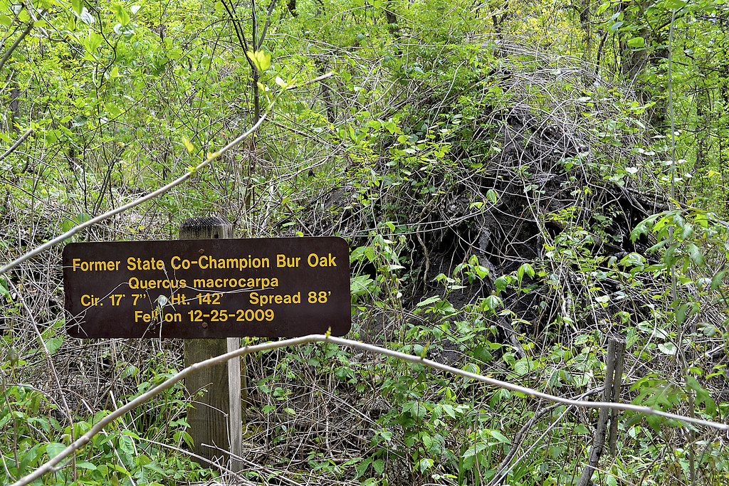
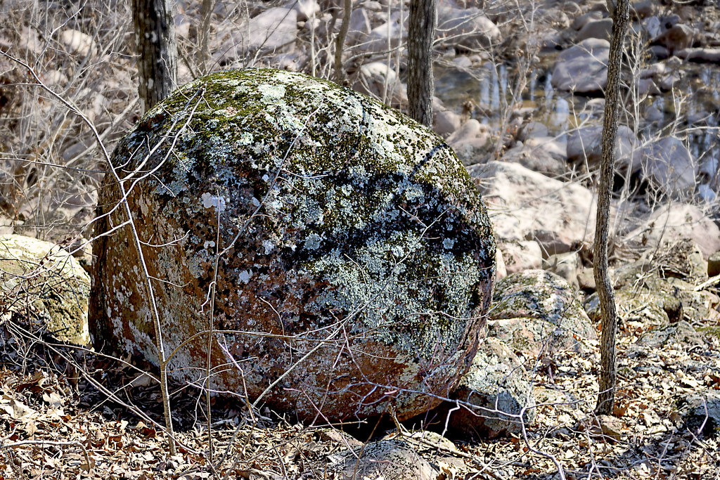
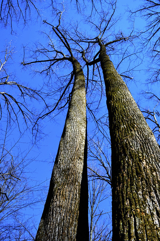
Taum Sauk Mountain makes up one of many mountains found in the St. Francois mountain range created by a Precambrian igneous uplift that is far, far older than the Appalachians. In fact, many geologists believe that Taum Sauk may be one of the few areas within the United States that has never been covered by ancient seas, most likely existing as islands during that time. Topping out at 1,772 feet, accomplishing Taum Sauk's summit was a bit easier than cresting Big Buford. To reach the official top of Missouri it was actually a short walk from the parking lot, only 1,000 feet down a paved trail, to a granite marker near a large boulder. I thought that may rob a bit of the "coolness" from the accomplishment, but honestly... It didn't. I was still at the top of Missouri, so a selfie was in order. But soon I thought, I really came to hike with my furry friend Hyatt, what should we do, where can we go? And it was then that I remembered, Taum Sauk Mountain State Park hosts not only the highest point in all of Missouri, but it also contains the state's highest waterfall, Mina Sauk Falls and I had heard tail that this trail was not quite as "accessible". So, after snapping a few pictures we made our way down the trail, anxious to view the falls.

Want to "earn it"? Take the Mina Sauk Falls trail...
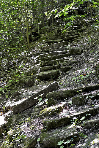
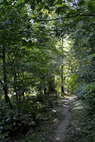
I'll reiterate my desire to have a bit of a hike so that my hiker pride would feel as though the accomplishment of visiting Taum Sauk Mountain was not one of great ease, but earned through the sweat of my brow and the protesting of calves and quads. As I followed the trail to Mina Sauk Falls, it became apparent that this hike would be earned as the trail faded from paved trail, to rock lined trail, to gravel trail and finally to a foot worn path of Earth, leading through the forest toward our watery goal. Now, those who are "in the know" realize that Mina Sauk Falls only run in wet weather, which is one of the reasons I timed my trip here after we had received some rain during the week, so that foot worn path became very, very sloppy. In spots the trail greedily ate my entire shoe, replying only with a "splooch" as I pried my foot from its grip. My hairy buddy however, was absolutely in his element, galloping and prancing in the mud and muck as I could only think about how much fun it would be driving home with a wet and muddy pooch...


From the mud to stone...
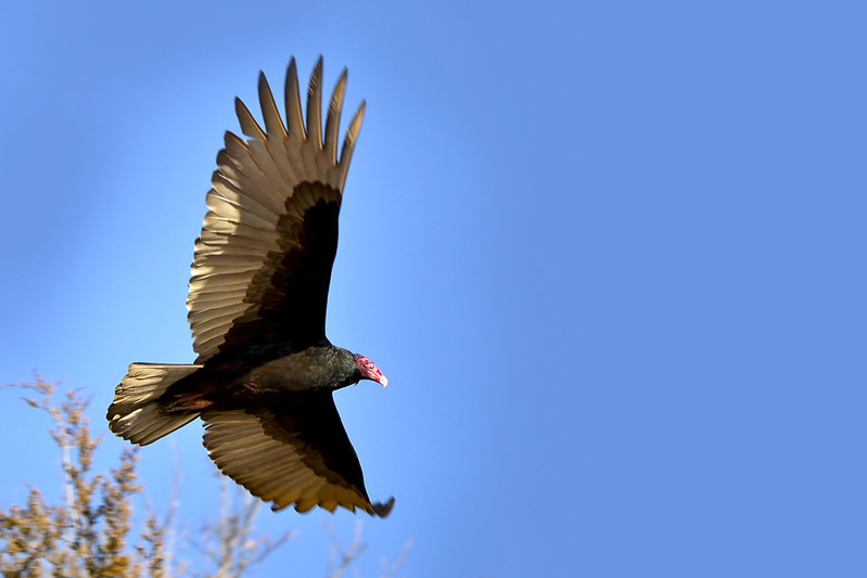
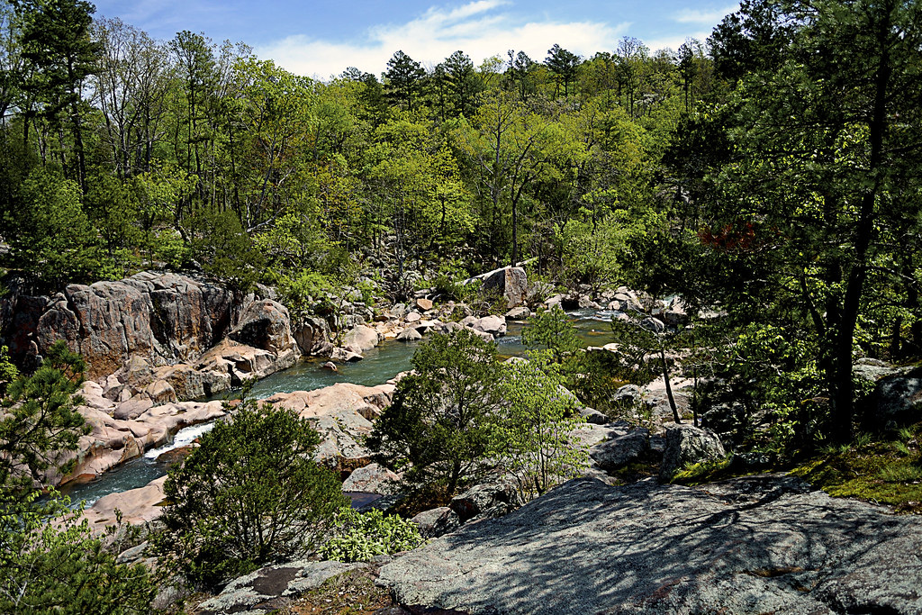
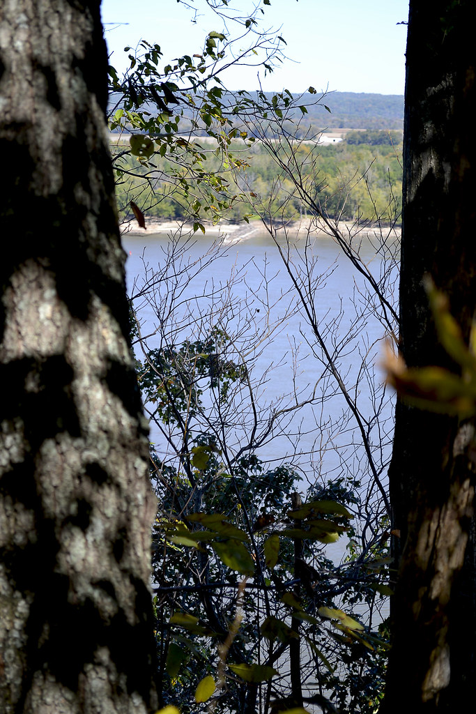
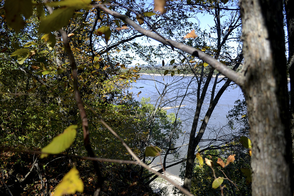
The muddy, Oak and Hickory lined wooded trail gave way to our first glade, where a keen eyed hiker may find life better suited for a desert lying about the warm, barren rock. Lizards normally dart across this empty expanse, searching for their insect prey. But it was far too cold for our reptile friends to be emerging just yet. So we enjoyed the melodies of the feathered inhabitants, which drifted easily to our ears, serenading us as we made our way over the stony floor. As we moved forward along the trail I had to pay particular attention to my footing as the rock was very slippery in spots due to the rain water still draining from the mountain, so please, pay particular attention here for wet spots. I will readily admit, it was very hard to look down at my feet, concentrating on my footing with such a stunning view of the Arcadia Valley sweeping in a nearly full 360 panorama. I had to stop, pause and take in an eyeful, so I found myself a nice boulder to perch on and enjoyed a cool drink of water, allowing all my senses to be filled, enjoying the view as the songbirds created the score for this outstanding scene. But my hairy buddy was ready to go, so I was brought back to task by wet tongue and muddy paws upon me. Before we pressed on though I had to snap a photo... or two.

Onward to Mina Sauk Falls
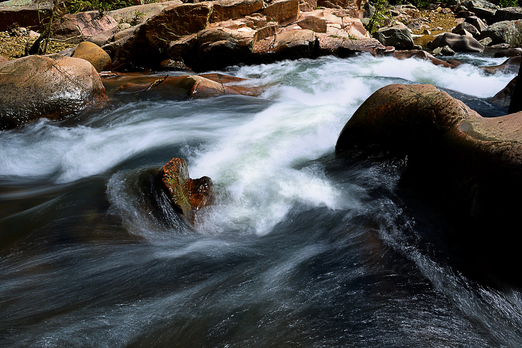
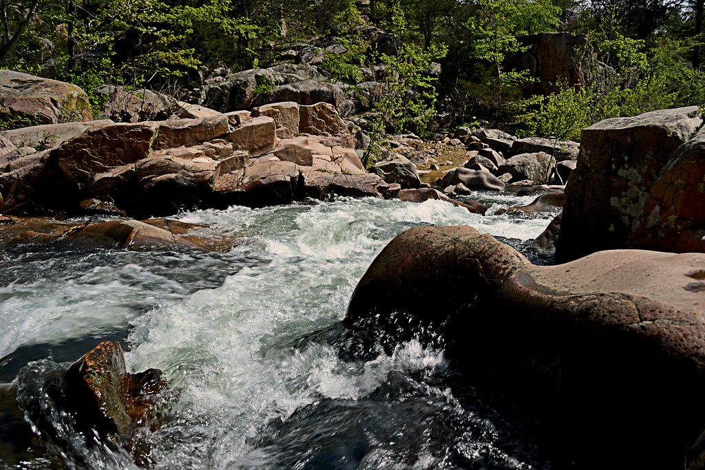
The trail to the falls continued to waver from earth to rock and back again as it continued downhill, and was fairly well marked. However, at one particular point there seemed the foot worn trail led straight, and had it not been for a well placed timber, I would have missed my turn to remain on the trail, so do pay attention as the trail may fade in and out in spots. As the path began to follow the gentle curves of the mountain I could hear rushing water and my mind was awash in anticipation of what was just out of sight. As the trail led slightly back uphill and around a huge, precariously perched boulder, I caught my first sight of Mina Sauk Falls and the crystal clear waters cascading from the top of the fall, stream over a series of ledges and finally end its journey down 132 below. There is something about a waterfall that fills not only my senses, but also my soul. Honestly, I feel completely at peace and find absolute solace in listening intently to the crashing of the water while being cooled by the mist rising from the impact. After soaking in the falls, I realized that I had forgotten a few things, most notably the filter I use to create the cascading fall pictures and my tripod, however the falls washed away any concern of that and I snapped the photos I could with my camera but left with even more vivid pictures taken with my mind's eye. I followed the Ozark Trail down the mountain, being very careful to avoid loose and wet rock in order to gain different perspectives on the falls. It was at the base of those falls that I simply sat, for how long I honestly don't know, and watched the falls simply...  fall. From here I could carry on for another mile and see another great wonder of the area, the Devil's Tollgate or journey another ten miles to reach Johnson's Shut Ins, but I was running short on time, so I began my ascent back up to the top of Mina Sauk Falls to begin my uphill return hike.

A tragic legend for the beautiful falls
As I made my way back down the mile and a half trail, I thought of the legend of Mina Sauk Falls. How the chief, Sauk-Ton-Qua and the Piankashaw Indians once called this wondrous land home. In fact it was chief Sauk-Ton-Qua for which this mountain was named, who the white man called Taum Sauk, because his name was hard to pronounce. The Piankashaw lived in peace on these lands, but would fiercely repel any invasions made by other tribes, in particular the advancements of the Osage. It was said that Sauk-Ton-Qua had a beautiful daughter, Mina Sauk, who fell in love with an Osage warrior. One day Mina Sauk was caught in the young Osage warriors arms and taken prisoner. Sauk-Ton-Qua sentenced the young man to death, despite his daughter's pleas to spare his life. It is said that later that day the young man was executed on the very slopes of Taum Sauk Mountain. He was tossed from the crest of the mountain, crashing from ledge to ledge below with the spears of warriors, until finally coming to rest at the base of the mountain, battered, bleeding and dying. As Mina Sauk watched her lover she could no longer contain her grief and as her Osage suitor lie at the bottom of the mountain, breathing his last breaths, she cast herself from the summit as well, plunging over Taum Sauk's ledges to her death. It was then, that the great spirit became so moved by the lovers deaths that the very Earth trembled and shook, and Taum Sauk Mountain began to crack. Then a flood of water streamed forth, flowing over the very same stones as the lovers, washing away their blood. Such a tragic legend to explain such beauty... There are other versions of this legend, some change the name of the daughter, others create the falls with a thunderous lightning bolt, but all seem to suggest the falls were created by the great spirit's response to the treatment of the young lovers.

Pro-Tips for Taum Sauk Mountain State Park
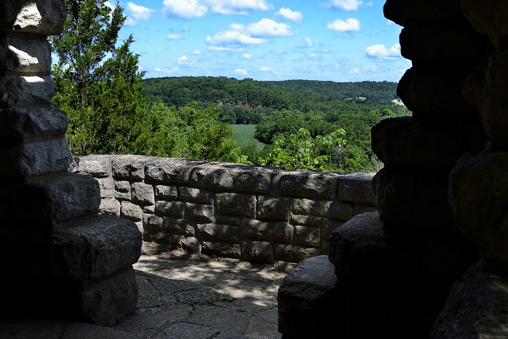
I truly enjoyed every second I spent at Taum Sauk Mountain, from the thrill of being taller than every single Missourian for a few brief seconds to experiencing the peace that streams from Mina Sauk Falls (despite the star crossed legend) I can't recommend this park enough. I would suggest that you aim to visit the park after there has been a period of rain, especially if you want to see Mina Sauk Falls and snatch your own moment of zen from this busy, noisy world. Be sure to wear a comfortable pair of shoes that you don't mind getting absolutely covered in mud and muck. Which brings me to this... Bring a towel for your car, especially if you are bringing a four legged companion, I'm still finding bits and pieces of Taum Sauk Mountain in my truck. Also, keep an eye out for the watchtower. I didn't see it, or know it existed until I had finished my hike, returned home and began to type up this entry. I'll certainly be looking to take some shots from it on my next visit! Finally, be sure you have enough time. I didn't expect the hike to Mina Sauk to take as long as it did, and once there I didn't have enough time to press on to the Devil's Tollgate. The area is rich in wildlife, views, sights and sounds so be sure to provide yourself ample time to really take it all in.

I can't wait to go back to Taum Sauk Mountain and I will certainly make time to search for the watchtower and also make my way further down the Ozark Trail to see the Devil's Tollgate. I hope you enjoyed the write up about the area and let me know if you have any questions or suggestions down there in the comments. As always, happy trails to you!

Directions


More Information:
Local Treks on facebook 

MO State Parks: Taum Sauk Mountain Webpage
MO State Parks: Taum Sauk Mountain Hiking Trails
MO State Parks: Mina Sauk Hiking Trail Map
MO State Parks: Taum Sauk Section of the Ozark Trail Map
Missouri Department of Conservation: Taum Sauk Mountain Webpage

Wednesday, July 16, 2014

Sam A. Baker Park: Shut Ins Trail


Sam A. Baker is a popular Missouri State Park, let me stress popular... and why the heck not?! This park really seems to have it all, from zipping along on bicycle trails, grilling hotdogs over a campfire, popping a tent at one of two huge camping areas, taking a cooling dip in the clear St. Francis River, to hiking on one of four trails, there is a little something for everyone. There is an added bonus to Sam A. Baker too, if you happen to forget something back at home, the area boasts a Park Store that has just about anything you may need. But keep in mind, with so much to offer at Sam A. Baker, there are many who seek to really take advantage of it, and by that I mean, it may be a bit... crowded.

First Impressions of the Park

My initial impressions of Sam A. Baker were fantastic, as we made our way down Highway 143 the trees began to envelop the road, creating a tunnel of green gently leading us toward our initial destination, Campground 1. The campground was very nice, and despite the recent rains, our campsite (number 5) was relatively dry with only a few low spots gathering puddles. After pitching the tent we decided to take a nice, leisurely stroll through the campground. Making our way just a bit to the South we found the cool St. Francis River, nearly a clear as a window, carving out its gravel banks and creating perfect places to wade and swim in its refreshing waters. As we explored the campground further we found a very well traversed and well maintained Paved Bike Trail to the North, which is quite a perk for the visiting camping jogger. This trail stretches 1.5 miles and travels from campground 1 all the way to the park store, it travels along State Highway 143 and allows for some picturesque views of Big Creek as well.

It's All About the Amenities!

After exploring the campground we journeyed over to the park store (which is VERY handy if you have found yourself forgetting something at home) and the park lodge. As Sam A. Baker does not allow you to transport your own firewood into the park, due to the emerald ash borer, so if you plan to have a campfire, be sure to pick up some wood at the store. Then while you're out you may like to take a quick stop at the Park Office and Visitor Center. There they will provide recreational equipment, free of charge, that you may use by simply checking the items out. After taking quick tours of the amenities we returned back to our campsite, flush with wood for a cozy campfire, ice cold sodas and some delicious chips from the store.

"Nocturnal Calls" and Camping

Once back at our campsite we started up our fire (due to the damp wood this was quite the undertaking, thank the heavens for lighter fluid) and roasted up some hotdogs, marveled as the fireflies faint green glow lit the night, told a few stories and then decided to get a good rest so we could explore the park even more the next day. After zipping up the tent, lying atop my sleeping bag I soon found myself being "gently" lulled to sleep with the echoing "Whoo HOOO" and "I'm SOOOOO Drunk" mating calls of the Migrating Midwestern Hooter, which were interrupted only by the heavy and constant "Ker-Thunk!" of the all to closely located latrine door. We did have a laugh out loud moment as our border collie, Hyatt, spotted a huge raccoon that had made its way onto our picnic table and attempted to leap through the mesh window of our tent in order to chase the raccoon away.

Upon awaking the next morning and with the migratory mating calls of the night now behind us, we decided to escape some of the more popular areas, in a desperate bid to get at least a small taste of the park's beauty without the crowds or noise. So we checked our area map and chose to set foot upon the Shut Ins Trail, a quick mile and a quarter hike out from just behind the Park Lodge, to see if we could find a slightly more secluded swimming hole.

The Shut Ins Trail

The Shut Ins Trail is wonderfully maintained; consisting of a well worn dirt path, sometimes sprinkled with gravel, and features low water bridges, handrails, and steps along the way. Children will find an easy hike on most of this route, and there are plenty of sights to see and share on your way along the path. We began our journey by heading downhill along the blue blazed trail with (what I believe to be) Big Creek bordering us just to the East. As we hiked about half a mile through the Sycamores, Cottonwoods and Sweet Gums we came upon a small off-shooting path, which we decided to investigate. Boy am I glad we did, because at the end of that path we found a gorgeous little waterfall, that wound its way through and over the large, moss covered dellenite boulders.

After getting our fill of scrambling over the boulders we headed back to the main trail and continued on, with all of summer's colors seemingly on display as wildflowers competed for our attention along the trail. We followed the trail for nearly another half mile until we came to a fork, one path leading to the Big Creek shut ins (to the right) and another path leading up the hill toward a connection with the Mudlick Trail. The path that led to the Mudlick Trail boasted a Shelter, which marked the intersection of the two trails, but also heads up a steeper incline. After a short bit of consideration we chose to head towards the Big Creek shut ins for a refreshing dip. Seriously, could there have been any other decision to be made on a hot summer's day?

The Big Creek shut ins seemed almost too good to be true, the area was wide, with water plenty deep enough for swimming and there were some low, flat cliffs that just begged to be jumped off. In fact, the water was at an almost perfect depth that day, but if you choose not to swim you could easily wade the shut ins, whose water was just a bit over chest high on our visit. We quickly found it was too good to be true, such a naturally beautiful swimmin' hole had spoken out and many had answered its call, within just a few minutes of our arrival the Big Creek shut in transformed from a peaceful watery respite to a rowdy outdoor roadhouse complete with Swazye'esque mullets to boot. We swam for a bit more then decided to make our way back to camp for a spot of lunch. As we headed back down the trail, making our way toward the Park Lodge, we passed a steady stream of like minded visitors who may have been just like us, looking for that little hide-a-way in the middle of a very, very popular Missouri State Park.

Final Thoughts

With so much to offer its no surprise that Sam A. Baker is so appealing to so many and there is no doubt that we'll return sometime and the 5.5 mile Mudlick Trail certainly looks very, very appealing, especially the Backpacker Camp located on a small spur of the Hike Only Section.. But the overall experience, for me, was it seemed simply too crowded. Sam A. Baker seemed (to me) more like a nature theme park than actual State Park and the campground, while very well maintained, was just a bit too... popular.

More Information: 

Sam A. Baker State Park Homepage
Sam A. Baker Hiking Trails
 - Shut In Trail Map
Fishing Report and Prospects: St. Francis River (above Wappappello Lake)
Local Treks on facebook 
Tiny. Tenacious. Terrible. Ticks. - A post on how to keep those bloodsuckers at bay!
How To Take A GREAT Day Hike - Hitting the trail? Then you may want to check out these tips.

Friday, June 20, 2014

The 100 Missouri Miles Challenge. Think You Can Do It?


There is a lot to be proud of here in Missouri, and our State Parks and the miles and miles of well maintained hiking trails they offer are just one of the many, many cool things that many Missourians (including myself) may take for granted from time to time. Well, we may let our appreciation of the Missouri trail system slip from time to time, but American Trails (a national, non-profit organization that works on behalf of our country's hiking, biking, and riding trails) named little ol' MO the distinction of "Best Trails State" for 2013-14 and our Missouri State Parks had a HUGE impact in Missouri receiving that distinction as they accounted for nearly 1,000 miles of Missouri's trails! Now, be sure to keep in mind that the the Missouri Department of Conservation also oversees approximately 600 miles of trails and Federal Agencies (such as the National Park Service, US Fish and Wildlife, and US Forest Service) account for 700 miles of trails, so I'm certainly not calling them slouches as all.

Well, all this hub-bub about the quality of Missouri Trails set into motion a challenge from our Governor, Jay Nixon, to get Missourians off the couch and onto one of our awesome state trails in 2013. The gauntlet was tossed as he asked for residents to take in countless lungfuls of fresh air, some of the most spectacular scenery in the state, and memories that will reside with them for a lifetime as they logged 100 miles on Missouri's trails. The response was enormous and we racked up over 1.1 MILLION Missouri miles in 2013. The Governor is hopeful that we will beat that amount this year as the challenge was once again put forth on March 20th.


So if you plan to hike, run, walk, paddle, bike, hop, skip, jump, roll or plan any other form of locomotion on Missouri's trails why don't you join the challenge today? Just hop over to 100missourimiles.com today and sign up. There is still plenty of time for you to put in your own #100MoMiles!

More Information

How To: Take A GREAT Day Hike
100 Missouri Miles Homepage
Missouri State Parks
Missouri Department of Conservation Homepage

Friday, May 2, 2014

Big Oak Tree State Park: Take A Stroll With Giants.

 
Real-life giants reside in a small conservation area near East Prairie, Missouri. These behemoths tower silently over the swampy land. As we strolled among these quiet colossi we gained a unique, native view of Southeast Missouri and were afforded a free trip back in time; as Big Oak Tree State Park is one of few areas that reflects the original swampy land that the early Native Americans and settlers explored and lived in centuries before us, earning it a Missouri tag as a Natural Area. As we journeyed over the Boardwalk Trail it was amazing to see traditional Missouri hardwood forest with exquisite oak, hickory, sweet gum and sugarberry transform into an environment that would seem to be more at home in Louisiana; a soupy swamp featuring a champion pumpkin ash, bald cypress, swamp privet, button bush, swamp locust, and large black willows, all within a just few yards. After a tour of Big Oak Tree State Park visitors can certainly see why we locals call the bootheel "Swampeast" Missouri.

The Park of Champions! 
Many current and past champion trees call Big Oak Tree State Park home. In fact, this Missouri state park boasts more champion trees than any other location in Missouri, earning it the nickname "The Park of Champions". According to what I have read the park's two National Champion trees are a Pumpkin Ash with a 118 foot circumference that stands over 150 foot tall and a Persimmon that is 97 foot in circumference and reaches 133 foot in height. Just to provide a quick comparison of just how mighty these mammoths are, an average Persimmon tree stands about 60 foot tall, the noble Persimmon Champion in Big Oak Tree State Park more than doubles that figure! If you want to see the champion Persimmon you will need to take the1.5 mile Bottomland Trail. I'll be honest, even the VINES here are MASSIVE! You can find vines growing up these majestic giants that are reminiscent of creeping vegetation I've only seen in Indiana Jones movies. Be careful though, some of those vines are poison ivy; others include wild grape, peppervine and Virginia creeper.

A unique native habitat provides for diverse life.
As you hike through Big Oak Tree State Park you may spot wildlife and plantlife that you may not see again or at any other park in Missouri. As you journey through this unique environment, be sure to keep an eye out for the swamp rabbit, who has been placed on the conservation concern list due to its habitat continuing to be drained in Missouri. This unique and sometimes large rabbit loves to swim in the soupy Southeast Missouri swamplands, if pursued they will take to the water to avoid their pursuer and can frequently be seen resting on logs and sticks in the middle of swampland. Birdwatchers from near and far can also be found as over 150 species of birds may be seen here; including the brightly colored prothonotary warbler and my personal favorite, the pileated woodpecker, which can be heard tapping upon the Big Oak Tree giants in search of  a meal. There are snakes in the swamp as well, although there have NOT been any documented sightings of any venomous water snakes such as the water moccasin (cottonmouth) according to the Missouri State Park's Plants and Animals page. You may also keep an ear out for the chorus of croaks, as the frogs serenade for mates in the spring and summer. If you would like to know how to identify the type of frog by it's song, here is a great video for you:


Be sure to bring the kids...
Big Oak Tree State Park is a perfect place to take the kids and have a great day out. The park itself boasts a large picnic area that is near both of the trails and feature barbeque grills, picnic tables, playground, and a large shelter (just in case the weather changes). The Boardwalk Trail is a beautiful and easy walk, the suspended metal trail keeps you dry and your shoes dry as you make your way through the bottomland forest and into a real Southeast Missouri swamp. However, if you are looking for the Interpretive Center which is located at the trailhead for the Boardwalk Trail, it is closed, with a No Trespassing sign blocking the stairs.

But keep in mind...
There are plenty of birds singing, frogs leaping, and even a few snakes slithering in the swamp, but the trail should keep you above any danger. Remember though, you're in a real patch of the "Swampeast" here, and mosquitoes just LOVE all that muddy stagnant water, so don't forget the bug repellent you may want to read my critically acclaimed "Better Safe Than Swarmed - Homemade Bug Spray"  and make your very own (ok, so just my mother acclaimed it, but she's a critic, right?). And my "Tiny. Tenacious. Terrible. Ticks." post will help you properly remove any unwanted bloodsucking hitchhikers that may feel the need to tag along. You may also want to tack a glance at How to Take a Great Dayhike as well, to help you prepare for a great family or solo hike. If you're looking for a trail longer and more "natural" than the Boardwalk Trail, you'll want to hit the Bottomland Trail, which is accessible via a spur that leads to the picnic area and the official trailhead which is near the park's lake. The Missouri Department of Natural Resources has also produced a nice YouTube video that features Big Oak Tree Park, watch it below:


Thank you for reading, I hope to see you out on the trail!


More Information:
Big Oak Tree State Park - MDC page
Big Oak Tree State Park Topographic Map  
Visit Local Treks on facebook!
Go See A Champion - A site listing Champion trees throughout the US
Better Safe Than Swarmed! - A How-To for homemade bug repellen
Tips: How To Take A Great Dayhike
Tiny. Tenacious. Terrible. Ticks.
National Geographic "Backyard Bird Identifier" 
MDC Field Guide - An EXCELLENT resource to local wildlife


Thursday, August 22, 2013

Washington State Park: Take 1000 Steps Back In Time


Washington State Park in DeSoto, Missouri, is absolutely amazing. Today the park features a park store, water craft rentals (canoes, rafts, tubes, and kayaks), gravel river banks to river swim from, rental cabins, campgrounds, swimming pool, playgrounds, trails and so much more; it is hard to imagine that it was once home to a group of Mississippian Indians over 600 years ago. It was these Native Americans that literally left their mark on the area in the form of fantastic petroglyphs, which are (for the most part) still undecipherable even today and the petroglyphs here make up 2/3 of the known Missouri carvings! For the outdoor trekkers you'll find the park is home to three trails: the 1.5 mile 1000 Steps Trail, the 2.5 mile Opossum Trail and the 6 mile Rockywood Trail (backpackers will find a camp on this trail). Although the family and I wanted to "hit em all", for our visit, we concentrated on taking time exploring the petroglyphs, park amenities and then took foot to the 1000 Step Trail.

The 1000 Steps Trail begins just across
the lot from the Thunderbird Lodge.
To reach the 1000 Step Trail follow the signs to the Thunderbird Lodge, which is an outstanding example of the African American Civil Conservation Corps handiwork, and park in the lot there. Now, I absolutely must give out a bit history here, because this trail is so unique and beautiful that credit simply has to be given to the Civil Conservation Corps (CCC). The African American Civil Conservation Corps Company 1743 began developing the park land soon after the land was aquired in 1936. Without their skill and stone-masonry most of the buildings (including the Thunderbird Lodge where the company's main camp was located) would not exist and the 1000 Steps Trail would not have a single hand carved step to its name. You will pass by many examples of their work throughout the park, but will find three awesome examples on this hike; Thunderbird Lodge, the steps themselves on the trail and a gorgeous overlook shelter that practically begs you to take a photo of the Big River and the lush valley that contains the float-tastic river. These buildings were placed on the National Register of Historic Places in 1985. Ok, now let's get to hiking!

The steps blend perfectly with the woods,
complimenting them rather than competing.
After checking out the Thunderbird Lodge, and maybe booking a float trip for later, you will quickly find the trail head for the 1000 Step Trail just across the parking lot from the lodge. The hike begins quite easy, with a well maintained dirt path (watch out for tree roots) that skirts the road and provides a ground level view of the Big River out in the distance. You will soon reach the loop portion of the trail where we took the left path and followed the Yellow (1000 Step Trail) Blazes. The trees that quickly envelop you are large and seemingly ancient, providing much needed shade for a summer's hike and (I would imagine) would provide a beautiful palate of oranges, reds and yellows during the fall. As we progressed you will see small examples of the CCC's attention to detail, with rocks that line the trail fading in and out, and small bridges that cross spans that are easy to hop. As you continue on and the Big River begins to disappear and the hardwood and pine woods surround you, the first of many CCC placed steps will reveal themselves, yet seem dissolve into the very environment in which they are contained, a perfect example of man working in coordination with nature. Now, while climbing these steps you will quickly notice the carpet of moss, lichens and plant-life, these may make the steps slippery so climb with a touch of caution.

As you make your way on the trail (primarily uphill that is), you may find turkey, deer, mischievous squirrels and other small mammals, as well as small toads and frogs (always a family favorite!), but keep a particular keen eye out during summer as the eastern collared lizard can be found skittering and leaping, upright on their hind legs, from rock to rock. The hardwood forest, consisting of towering Oak, Hickory, Kentucky coffee, sugar maple and slippery elm, has a good undergrowth of pawpaw trees, and if you're lucky you may even find a bit of fruit on one of those pawpaws (if the squirrels and deer haven't found them first). About halfway along the loop, the forest will begin to thin as you approach an opening near the nature center and the restrooms (both constructed by the CCC), during this bit of the hike you may find some wonderful wildflowers, including: Blue-Eyed Marys, Bluebells, Trilliums, Violets and Poppies a particularly lucky and keen eye may even find a rare Primrose, Fremont's Leather Flower and the ever so delicate Blue-Violet Nemastylis.

After searching for wildflowers and re-emerging into the forest, be sure to take the right fork to stay on the 1000 Steps Trail, unless you're looking for a place to picnic, then head left, as it takes you to a nice picnic shelter. As you continue on the trail you will soon come to one of the best scenic overlooks I've visited. The view allows for a panoramic glimpse of the Big River and the valley through which it runs and, when under clear blue skies that contrast the lush green of the valley, it's a hard view to beat. Better yet, you can enjoy the view from the quaint CCC constructed overlook building, which melds in perfectly with the surrounding bluffs upon which the site rests. At the overlook building you can also catch a refreshing breeze and closely examine the skill with which each block was cut, placed and set.

You may even "off trail" as small trail runs near the overlook.
After giving your soul a chance to absorb a bit of the Big River horizon, you can continue down the trail which will take you down a dolomite bluff, where rocks have separated from the face and some have tumbled onto the path. Watch your footing here as the rocks can easily slide out from underfoot and send you swiftly to the sitting position, perhaps bruising your pride and your tailbone. As you continue, be sure to look at the path itself, the small rocks imbedded and loose on the trail may be hiding a plethora of quartz crystals in their geode like folds and holes. Just before the end of the trail there is a perfect place to sit on the steps and simply take in the last bits of the serenity that surrounds you, breathe it in, take a few pictures and head back to the trail head.

After hiking the 1000 Steps Trail, and really being introduced to all the outstanding things to do in the park, we can't wait to return to Washington State Park. Next up with most likely be a backpacking trip through Rockywood Trail to view the quarry used by the CCC for the local buildings and a search for the elusive Missouri tarantula!
The overlook absolutely BEGS you to take photos here!
As always, thank you for reading. If you're interested in meeting up for hikes, sharing your hiking experiences and find great locations to explore please visit us on Facebook and give us a like.
More Information:
Like Local Treks on Facebook
Flickr Gallery of photos
Washington State Park
City of DeSoto, Missouri Webpage
Area Events (DeSoto, MO)
Local Weather Conditions

View Larger Map

Friday, August 9, 2013

Groovin' At Hippie Hole: Amidon Memorial Conservation Area

Looking downstream at the Hippie Hole
Taking the Right Fork...
Just a few weeks ago I did a short write up on the Castor River Shut Ins of Amidon, which were located just off the left fork in the road as we entered the Amidon Memorial Conservation Area. It was a quick jaunt down the well groomed and maintained trail to get a look at those gorgeous, smooth pink granite boulders that had been shaped and sculpted for years by the Castor River. After finishing the Jekyll and Hyde trail that looped the left area, I left a little "cliff hanger"... What was down the right fork?

A firestruck tree we found searching
for the mystery concrete foundation.
Well, I suppose I'll retrace my steps a bit, and get you out to the area again with a bit of old fashioned written directions. From St. Louis, you'll take I-55 South to US 67 South towards Bonne Terre/Farmington. After about 50 or so miles you'll need to take MO-72/US-67 BUS toward Fredricktown. At the roundabout (traffic circle) you'll want to continue on Missouri Highway 72, and follow to US-72/Missouri OO where you'll turn right, continuing on US-72 until you see a turnoff on Route J, you'll turn left onto Route J and then keep an eye out for Route W, which you'll take a right on. Follow Route W until you reach County Road 208 (CR 208) and follow that until it turns to a gravel/dirt road and you reach a fork in the road at Amidon Memorial Conservation Area, this time, we'll bear right and continue on CR 208!

Not far down the road from the fork, you'll find a parking lot on your left. If you "dig" (no pun originally intended) gravestones and old family graveyard plots, you can park here and search out the two small cemeteries that are located in the field. We searched for them both, but were only able to find one. We discovered it by hiking directly west of the parking lot to a small grove of cedars. There, in the shade of the evergreens were a few gravestones, to be honest, I haven't investigated those that are entombed there... That may provide another bit of an adventure.

Taking a pause by Hippie Hole in the Fall.
If you hop back in your vehicle and continue down further on CR 208 you'll come to what the area map has labeled as a "Deep Fjord-Caution". This is, in fact, an unaided crossing of the Castor River, think you're up to it? Let me begin with one quick note, never, ever, ever cross flooded, deep or rapidly moving water. Do not cross it on foot, do not cross it in a car, do not attempt upon a lamb and do not cross with green eggs and ham. In all seriousness, don't cross it, you could die. Now, with the pleasantries of possible death taken care of let's get to how you might be able to tell all your friends that you crossed the Castor River in your car! It's simple, after you've established that the water isn't too deep or flooded, find a line and then slowly cross. Don't fire it up there Evel Knievel style and gun it in an attempt to skip across, if you do that you'll run a risk of driving the water into your engine and killing it, just take it easy with slow steady pressure and poof, you'll be safely across. If it looks too deep or you're just a bit frightened of crossing a river in your car (perhaps it's the thought that the river may end up running through your car), you can safely park your car off the road and walk across if you like. In fact, if you just want to play in the water, this crossing area is a great spot to cool off and search for some crawdads hiding underneath rocks. But the real refresher lies about a half mile upstream, at a place a local swimmer we met called the "Hippie Hole".

Keep your eyes up too, you never know what may be up there!
Once you've crossed the Castor River, keep an eye out for a possible second crossing over Stannett Creek very soon after, same rules apply to this crossing, be safe please. After the short crossing of Stannett Creek look for a gravel parking lot to your left, this will be were you may begin your short trek to the Hippie Hole! The trail head begins there at the parking lot and will begin by taking you just on the outskirts of a cleared field. Here wildflower abound during the spring and birds seem to be nearly everywhere. Once to the far edge of the field you will enter into a more wooded area, here the trail is clearly visible, but be careful of exposed roots from the trees that line the trail, they can easily trip you up. This trail will wind alongside the Castor River, with a full canopy of hardwood trees surrounding you as you get closer to Hippie Hole. When the canopy opens up and you hit a gigantic solid mass of pink granite (like in the picture up top) you've arrived at the Hippie Hole. This is a great place to take a dip or even a jump or two!

Love these big pink boulders!
Once you've arrived at the Hippie Hole the trail, for the most part, ends. But don't let that stop you if you're up for a bit of adventure! We continued on, constantly keeping the river within view through the trees, heading ever northward. A local swimmer we met upon our initial arrival had told us of an old building foundation, somewhere "up there" with full finger pointing proximity, and despite our best efforts, we were unable to find it during our extended hike. However, we did find some absolutely beautiful rocks, some chock full of quartz crystals of different colors, and plenty of huge boulders to climb, jump and impersonate Spiderman upon! Also, if you're quiet (and we were), you may even walk up on some whitetail deer in this area. We came across a small herd of 5-6 as we crested a hill, and all of us had a bit of a shock! There are also plenty of squirrels, birds, small reptiles and wild turkey that play in the woods here. You could hike up to the Castor River Shut Ins by just continuing to follow the river upstream a bit over a mile or so, as well if you like.

Now, I referred to this area Hippie Hole and I'm no local. I've heard there are some that call it different names, while others have Hippie Hole in a different location all together... All I can do is count on that one local swimmer's account for the naming of this area, but of course, his directions to that concrete foundation weren't so great, so he may have been a bit off... But with cool waters to tread in and rocks to take a plunge from, I'll just call it a great old fashioned swimmin' hole!

More Information:
Amidon Memorial Conservation Area Homepage
Amidon Area Map (may want to refer to this as you drive from Fredricktown to Amidon for directions*)
Audubon Society of Missouri Amidon Bird Check List

*Note on map below... Google seems to use different terminology on some roads/rural highways, the path below should still get you to the area from St. Louis.

View Larger Map

Friday, July 26, 2013

Get Into The Flow: Amidon Memorial Conservation Area

The Castor River Shut-Ins of Amidon
Gorgeous. Absolutely, unequivocal beauty. That is what I honestly think about the Castor River Shut-ins area of the Amidon Memorial Conservation Area. In fact, I'm not sure those words can even do it justice, we may need to come up with a new word, just to describe the beauty of the flowing waters and brilliant pink granite rocks that are found there.

In order to get to the lot that contains the trail head for the Cedar Glade Trail, you'll need to take Route J east of Fredricktown, MO to Route W (make a right), then head East on County Road 208 (CR 208). CR 208 will turn into a dirt/gravel road while you ride along, so don't fear any toothless banjo players, but you should always keep your eye out for em', just in case... As you scoot down CR 208 you will come to a fork in the road, and in the middle of that fork you'll see a real grist stone from one of the old mills that used to be located on the land here, so take a second to park along the side of the road and take a peek, it is a pretty nifty piece of history. Once you're finished checking out the grist stone, take the fork to the left, County Road 253 (CR 253) and then look for a parking lot on your right, there you'll find the trail head of the Cedar Glade Trail that will take you to the Castor River Shut-ins. Did I confuse you? Then take a peek at this area map, it may help sort it out for you and, of course there is a map at the bottom of this post that will take you to the Google Maps version.

I swear Hyatt's smiling big here...
Now, the Cedar Glade Trail, a 1 mile long loop trail, has a bit of a Jekyll and Hyde personality to it. The Dr. Jekyll side, or the "good" side, is a beautiful, wide and well trampled trail that leads from the parking lot to the Castor River Shut-ins. The hike takes you through a forest of mixed hardwood trees, dotted with short leaf pine growth, you may notice some extremely large oak trees which have fallen over, root ball included on the sides of the trail. I don't know exactly what caused these mighty hardwood trees to topple, but they certainly were old growth. Keep an eye out for turkey, squirrel and deer as the area contains a decent population of them out here, we even observed the ever elusive domestic short haired cat, which sent ol' Hyatt (our border collie) into a frenzy. The Dr. Jekyll portion will finally empty you out at the Castor River Shut-ins and I'm sure you'll be just as impressed with the river as we were.

The smooth granite boulders of the shut-ins.
Here you'll see the Castor River as it carves through the baby's bottom smooth pink granite. The rocks are gorgeous and the river may even have a bit of a blue or green tinge to it, making the whole scene absolutely picturesque. As always, beautiful smooth rock and water are a combination for slips and falls, so watch your step as you traverse the pink granite boulders. After you have, lets say, dipped your toes into the free flowing Castor River and felt the warmth of the summer sun as you rest on one of the pink boulders, you should be ready to take on the last bit of the Cedar Glade Trail... The Mr. Hyde portion.

Photos can't do justice to the scenery here.
The Mr. Hyde portion of the trail is the more "difficult" in terrain, as you will be walking on some of the smooth (and most likely wet) granite rock surfaces and navigating a bit of a loosely packed rock trail that heads up in elevation. The trail here is not as well maintained and some of the rocks will slip from underfoot as you make your way up, however, the pay off is nearly as grand as the view of the Shut-ins was for the first portion, this portion of the trail offers an over look that provides a vantage of all that you just observed up close and personal. As you finish the loop, be sure to visit the restoration of the glades areas here, you'll find some beautiful wildflowers blooming in spring!

Now, it is a short trail, and when it ends you will most likely want more, we certainly did. But don't worry, there is more to explore at Amidon, remember that fork in the road from earlier. Well what do you think is down the right fork? I hope to write more soon on that right fork of Amidon, such as a little spot to swim called "Hippie Hole" and some free range exploring. So get your bathing suit ready and I hope you're not afraid of some crawdads and bit of river crossing in a car!!

More Information:
Amidon Memorial Conservation Area
Amidon Area Map


View Larger Map

Wednesday, July 3, 2013

Trail of Tears State Park II: Peewah Trail


After experiencing the beauty of Trail of Tears State Park while exploring the three mile Sheppard's Point Trail, we knew that our family would be heading back soon, this time to tackle a more "formidable" foe... The nine mile long Peewah Trail. Now, I say that the Peewah Trail is ten miles, and it is, but the beauty of this trail is that it is split into two completely different trails with two seperate trail heads, that forms a full on (if a bit askew) figure eight. These two sections of the Peewah Trail are simply referred to as the East Loop and the West Loop.

The "boys", Hudson (brown & white) and Hyatt, taking in a quick refresher
from one of the numerous creek crossings on
the East Loop of the Peewah Trail
The East Loop: The East Loop is approximately 3.25 miles long and is easily identified by its yellow blazes. This loop climbs the ridges and bluffs that overlook the Mississippi to the East and even features a small spur that will take you out to a scenic overlook (located 1.5 miles East of the trail head for the East Loop) so that you can get a beautifully clear picture of the Mighty Mississippi, in fact, if you find that the scenic overlooks just off the roadside are full, this viewpoint and the vantage at Sheppard's Point are excellent alternatives, and all but guaranteed to be less crowded during Bald Eagle season. This trail is a perfect example of what goes up, must come down. As you follow the bluffs and ridges along the Mississippi eventually you'll come to the descent into the bottom-land, filled with wildflowers (in the spring/summer), giant cane and even a few creek crossings. Of course, with the creek crossings the possibility of washouts and flooding are a possibility depending upon the level of the Mississippi, so pay attention and use caution during any creek crossing. As you are on the Western side of the loop, keep an eye out for the black and white blaze, indicating the connector between the East Loop and the West Loop.

Twisted and snapped trees can be found
from the 2003 tornado damage.

The West Loop: To access the 5.75 mile long West Loop, you may hit the trail head, located along the Overlook Road, just north of Hill Road or you can hit the connector from the East Loop, mentioned above. As you hike through the region, marked clearly with red blazes, you will notice areas with beautiful oaks and hickories lining the ridgetops, while sweet gum and sycamore dominate the bottom-lands, with a health amount of native ferns thrown in just for measure. While taking in the beauty of these trees you may encounter areas that appear to be "stunted", but they are not, we had a tornado ravage the area in 2003 and this trail shows the clear evidence of the tornado's path. This is a perfect way to teach the destructive powers of a tornado, as the downed and twisted trees are still easily seen from the trail. Of course for a child, these downed trees provide a perfect and fun opportunity to increase their climbing skills too! This damage is a great example of the resiliency of the forest when taken care of.

Searching for
Now, for our family this was a pretty long hike and in order to spice up the nature for my then ten-year-old, we decided to search for a few geocaches while out on the trail. If you are unfamiliar with geocaching, or think I just made it up, head over to Geocaching-The Official Global GPS Cache Hunt Site for all the information you could ever want, and a quick and easy look up for geocaches near you or your prospective hikes. For our hunt, we simply took our car GPS unit into the field with us and used the coordinate look-up function to place the marker on our screen, of course your unit may be entirely different, but the fact is, we didn't need a fancy pants hand held unit and nearly all smart phones have a GPS function built in and numerous apps are available for you to use, such as the Geocaching Toolkit, I have used this one myself so I can vouch for it. Keep in mind, there is a Geocacher's Code of Ethics and be sure to bring along something to trade for an item that you may find interesting, be sure to read where others who have come before you are from, it is interesting to find so many others who found your little "secret" stash! Another quick note as you look over the geocache entries, a "Muggle" is someone that isn't out to find a geocache or someone unaware of geocaching even exists, I'm not a big fan of the Harry Potter series and it took me a bit to figure out what the heck a muggle was.

The West Loop has a few creek crossings as well, Indian Creek is prone to flooding its banks and flash flooding is always a possibility during rain storms, so please be careful as you cross these areas. As with any area rich in water and cover, there is a great chance to spot wildlife on both trails, keep an eye out for turkey, whitetail deer, foxes, fat little squirrels and more. Concerning the squirrels, keep an eye on the sky, as we were convinced that one particularly fat little bugger was chucking branches and nuts at us, funny till you catch one on the noggin.

You may notice on the Peewah Trail Map that the West Loop is nearly bisected by trail that leads to a backpack camp located dead center of the loop. We did not explore this camp, but I can assure you, we fully plan to! In fact, we hope to use this as a refresher before taking on some longer backpacking trips this fall and next spring, so stay tuned for more information as we experience it.

Overall both trails offer fantastic hiking, well maintained and clearly marked trails (provided you know what you are looking for, so please print out a map), some breathtaking views and scenic spaces. We only encountered one other group of people out on the trail, another family, and immediately after they were out of earshot we were instantly transferred back into the solitude and serenity of the wild acres. The boys enjoyed all the smells and nature along the trail, while we enjoyed the family togetherness you can only experience on a hike. Even though we went during the late fall/early winter period there was still PLENTY to see and take note of, however, this trail would be truly breathtaking in early fall as the leaves change and the bottom-lands truly come alive in the early spring with a plethora of local wildflowers in full bloom at that time. I certainly hope you'll make time to explore at least one of the two loops available on the Peewah Trail, I'm sure you'll find it just as enjoyable as we did.

As always thank you for reading and let me know if you have any questions on the trail. If you dig the blog be sure to give it a +1 up there or subscribe with your email address up top, it won't bug you until the next update then. Happy trails till next!

More Information:
Flickr Gallery of Shots
Click here for Peewah Trail Map
Click here for Trail Listing in Trail of Tears State Park
Trail of Tears State Park
429 Moccasin Springs
Jackson, MO 63755-8295
(573)290-5268(573)290-5268


View Larger Map

Sunday, June 30, 2013

Hike Through History: Trail of Tears State Park and Sheppard's Point Trail

Trail of Tears State Park, to me, is that "homely" girl in the sappy love movie. You know the one that no one pays any attention to and calls a geek, then, suddenly, she lets down her hair and takes off her glasses to reveal she's smokin' hot! For me, that is the tale of Trail of Tears State Park and this gal seems to have something for everyone: fishing, swimming, horse trails, picnicking, camping, backpacking, beautiful scenic overlooks, bird watching (people "flock" from all over to watch the Bald Eagle migration), Mississippi River access, hiking and so much more!


Now, I am no stranger to Trail of Tears, in college, friends and I would escape our campus confines and seek out the coolness of Lake Boutin for a dip or cast of the line, while partaking a few tasty cold beverages and observing the local bikini-clad "wildlife". Here's a quick note to those that may wish to also take a dip in Lake Boutin, wear shoes or water socks. There are still some old school pop tops (I put in this picture link because I realized a lot of folks may have no idea what that is) buried in some of the sand here so protect those tootsies! However, I was a trail virgin to over thirteen miles of pristine and well maintained trails the park harbored and after a quick internet search found that the three mile Sheppard's Point Trail could be a great "go to" hike for me and the family!
The parasitic beech drop.
Photo found on Wikipedia

Trail  of Tears State Park is very, very well marked and navigating from place to place within the park is very easy and directions are clear and evident. Upon arriving at the Sheppard's Point Trail Head, we noticed a few other cars, but we would never spot our fellow trail hikers (or hear them for that matter). We unloaded and leashed our "boys" Hudson and Hyatt, snatched our water bottles from the cooler, tightened up our laces and hit the dirt trail that headed straight into the hardwood forest. As we hiked, white oak, American beech, cucumber magnolia and beautiful tulip poplars lined the trail, as the dirt path took us to the tops of ridges and into deep valleys. Beneath the trees we saw brilliant green ferns and I took special note to look out for a rare plant, the parasitic beech drop, siphoning nutrients from the roots of the American beech.

The trail itself has some condition issues in spots (holes and root growth) and can be steep in places, but each incline of the trail is slowly adding up to one heck of a view! Nearly halfway through the hike is an awe inspiring vantage of the Mississippi River and a perfect place to take a quick rest and recharge while watching barges and tugboats navigate the mighty (and muddy) river. This point is also a prime observation point for bald eagles, particularly during the winter months. Also watch out below, there are some great drop offs that you can perch on to garner an even better view of the river, or peer directly over the edge to watch trains travel with their goods along the rails below.

After taking our break and watering both ourselves and the boys, we began to complete the Sheppard's Point loop and once back at the car, we all found that the trip was beyond enjoyable, if not a bit rough traveling up and down though. It seems as though we would be back, and soon to take a trip on another Trail of Tears hiking route... The Peewah Trail.

More Information:

Sheppard's Point Trail Map

Trail of Tears State Park
429 Moccasin Springs
Jackson, MO 63755-8295
(573) 290-5268(573) 290-5268


View Larger Map