Little Grand Canyon, tucked away in the Shawnee National Forest, was one of my very favorite hiking spots back in college. I discovered it on a field trip in my botany class back in 1998, I was impressed with the lush green beauty of the area, the "ruggedness" of the 3.6 mile hike and the relative feeling of remoteness as our instructor led class traversed the sandstone walled canyon trail in search of endangered local plant species. Would I feel the same sense of remoteness, would I encounter the same beauty, would the trail seem as "rugged" in a 2011 revisit with my family?
Before I get too far in, allow me add a little bit more to our 2011 revisit of the Little Grand Canyon, as many in the Midwest (particularly those who live in areas that are near the Mississippi River) will know, this area is near the historic flood levels that occurred in 2011 and that did cause a bit of issue with our hike. The issue was, we couldn't make the full loop. Upon traveling to the bottom of the canyon, we hiked as far as we could, swarmed by mosquitoes, up to our thighs in mud, hoping constantly that we "were through the worst of it"... We finally were forced to backtrack when our
hairy little buddy couldn't go any further due to the depth and consistency of the mud. However, given all of this, we still LOVED this area and I can't wait to return!
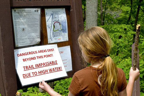
As we pulled into the parking lot we were greeted with what is becoming a rare sight at state and national parks, a bathroom and a well marked map of the area. However, we should have paid a bit more attention to the sign posted right next to the map exclaiming: "Trail Impassible Due To High Water!". But come on, that's for chumps, right? So we grabbed our walking sticks and prepared for our first foray as a family out into a small portion of the Shawnee National Forest.
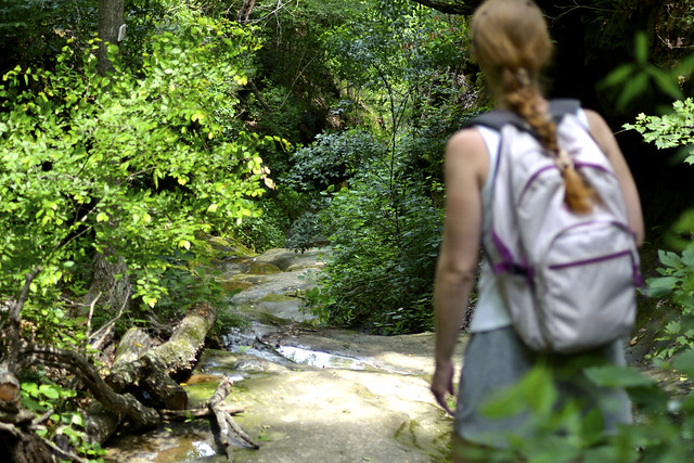
The initial trail from the parking lot is fairly easy going, consisting of a nice, wide, gravel trail that will lead the wanderer to the beginning of a 365 foot descent into the Little Grand Canyon. This portion of the trail is well maintained and well traversed and offers much to see in the way of trees and undergrowth. Oak and Hickory trees line the trail and, during our visit, they even lay across the trail which may inhibit some with disabilities from traveling further. We took our time walking this portion, pausing to identify some plants such as poison ivy (which my daughter was unfamiliar with), broad leafed ferns and the Celandine Poppy (
Wicked Witch of the West: Poppies... Poppies. Poppies will put them to sleep. Sleeeeep. Now they'll sleeeeep!).
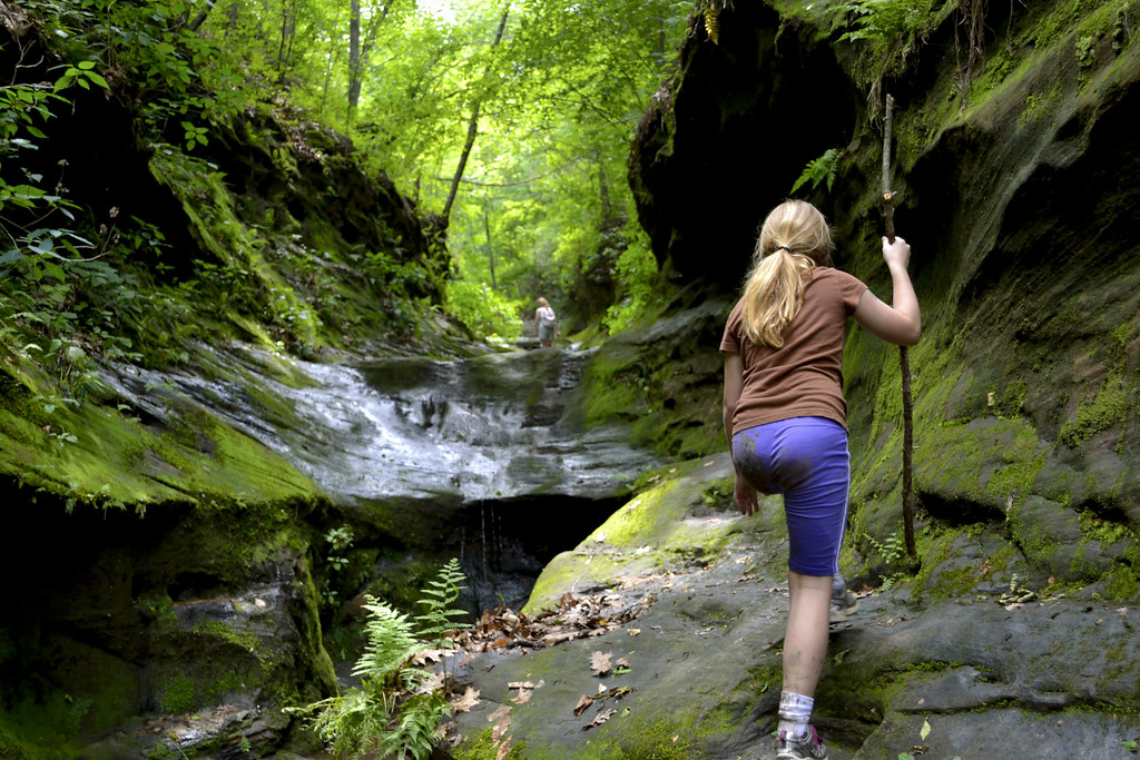
As the gravel ends your descent will begin and I'll provide you a warning, it can be slick, and I'm not being an overcautious old man here, it is slicker than snot in some spots especially following any rain. So, be sure to watch your footing, even on the steps that are carved into the sandstone, because if you slip in some areas you're in for a pretty rapid fall and possibly a not-so-fun slide ride to the bottom. But this also adds to the "ruggedness" of the trail, the little bit of slip fear that may enter your brain make this portion of the trail seem adventurous to some, perhaps even providing a bit of a story for those who haven't yet been out to the area.
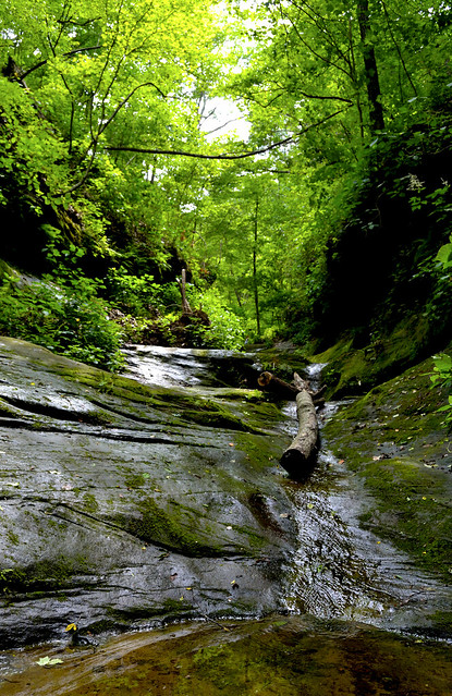
As we traveled down to the canyon floor, we passed
mini waterfalls,
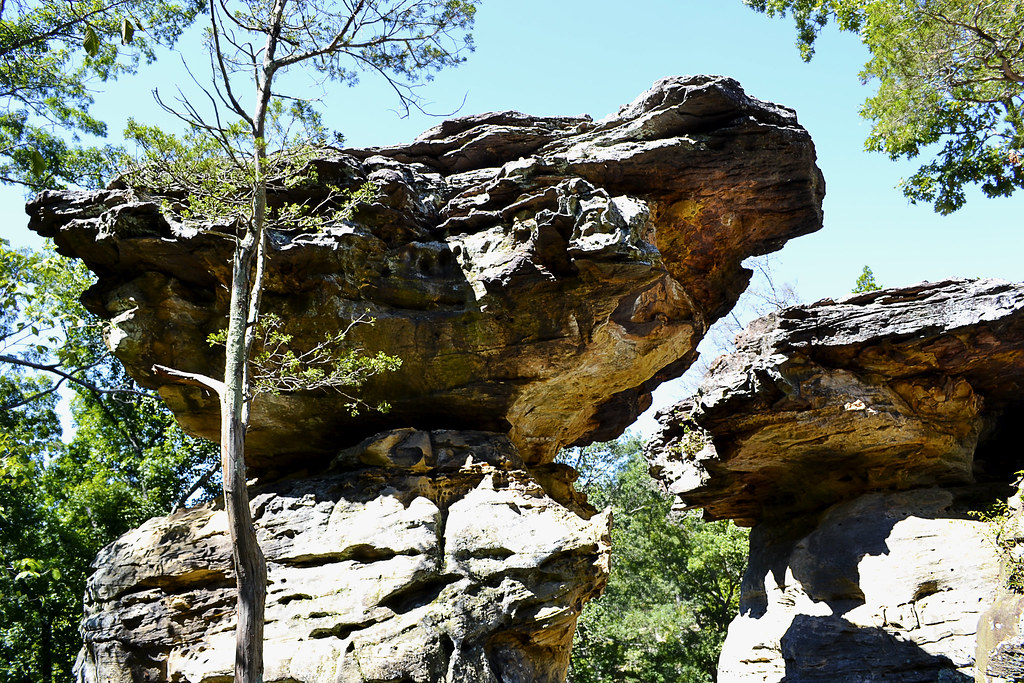
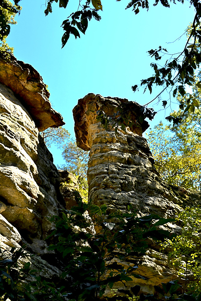
grottoes,
scurried across worn ledges and even did a few impressions of Sylvester Stallone from Cliffhanger, acting like we could fall at any minute. The steady sound of the water running through the area and birds calling were all that we could hear, and my mind went back to my class hike and the feeling as though we were the only ones out there. We paid special attention to the hand and foot holds carved into the sandstone by the Civilian Conservation Corps during the the Great Depression. I searched for more broad leafed ferns on the way down and added to the list a few liverworts and hairy cap moss. We kept an eye out for local wildlife too, and encountered a little guy we nicknamed the
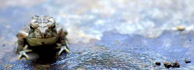
"Hypno-Toad" and we were treated to
a unique gathering of butterflies just as we reached the canyon floor.
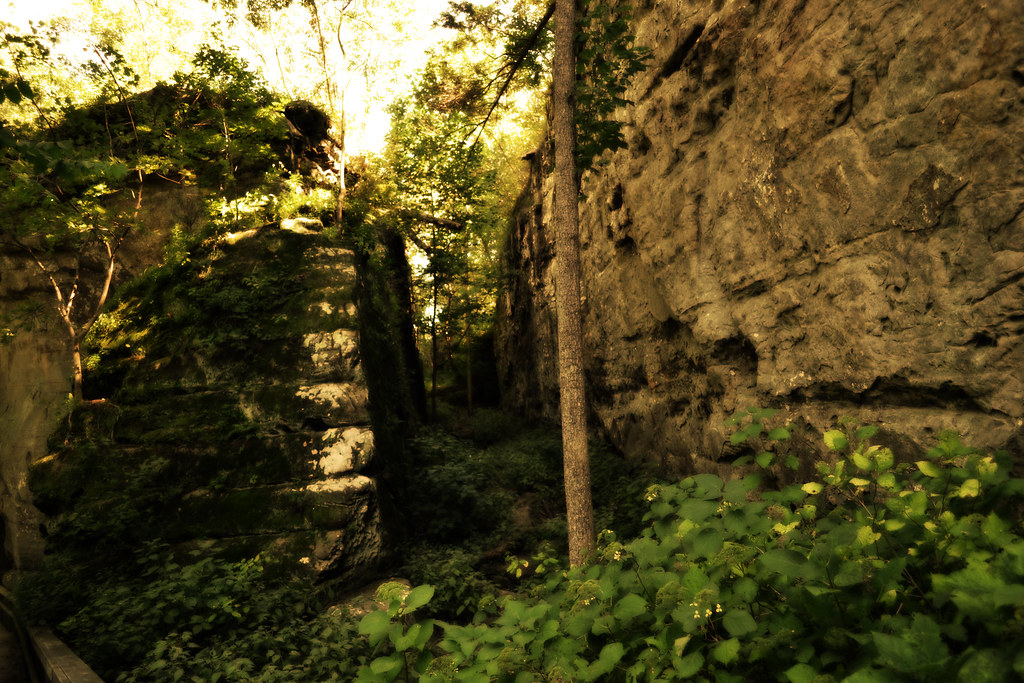
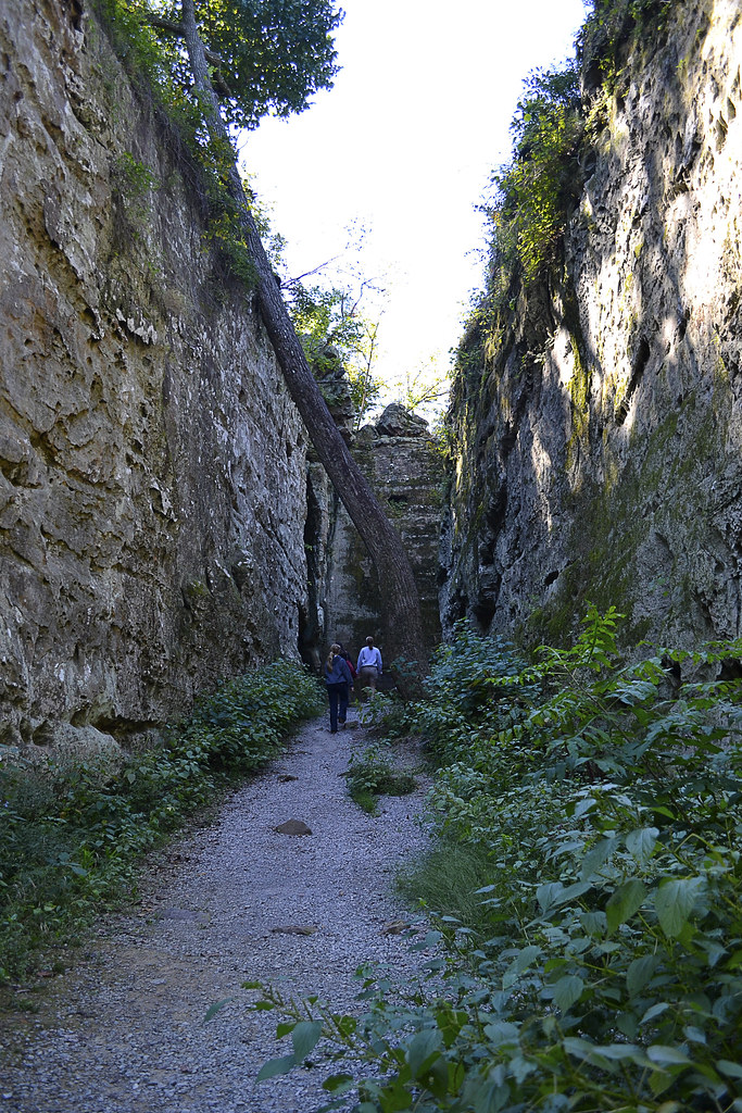
Upon reaching the canyon floor,
the now dirt trail, leveled out and we instantly noticed the
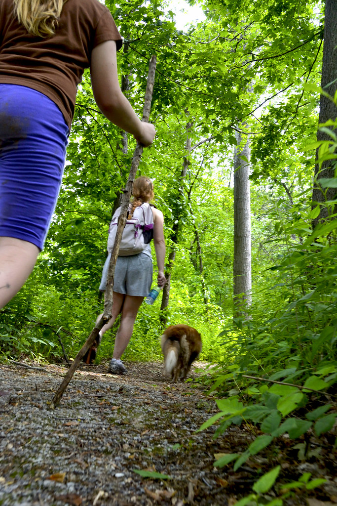
canyon walls, towering over 100 foot overhead. This is also where the mosquitoes began their relentless assault, dive-bombing and attacking in mass. They were of the large, black variety and you could actually feel each bite. I don't believe they are permanent residents to the area, at least not in the numbers we encountered, but I highly recommend a few sprays of a reliable mosquito repellent prior to taking this hike, better safe than swarmed... We followed the White Diamond marked trail for as long as were able, finally having to backtrack due to mud that was just too deep for our sheltie, Hudson, to continue on. As we backtracked, I made sure that we poked into a few of the overhangs and crags to see if we could discover any other little hidden gems such as this
Blue Diamond marked tree, a fallen tree missing its center and a few autographs we found in a shallow cave carved into the canyon stone.
We took a second to
wash up and then began our journey back up the Little Grand Canyon, disappointed that we couldn't make the loop this time, but excited for the chance to return and complete it then.
Since we visited in 2011, there was a forest fire that burned around 18 acres of the area located one quarter of a mile from the trail head in April of 2013. There is more information at the
Southern Illinoisan,
The Southeast Missourian and
WPSD (NBC).
More of our pictures from the area are available on my
Flickr Page
Find More Information (click to visit):
Shawnee National Forest (Little Grand Canyon)
Botany in Natural Areas of Southern Illinois
View Larger Map
Latitude: 37.68028
Longitude: -89.39472