 |
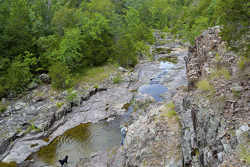
| A birds eye view from a bluff overlooking Lower Rock Creek. |
Cathedral Canyon is a gorgeous and seemingly remote part of the Mark Twain National Forest, that goes by many names. I prefer to call the area Cathedral Canyon because the serenity and staggering beauty there may only be truly matched by a quiet cathedral. Other hikers and soul seekers may refer to it as Dark Hollow, Lower Rock Creek (this seems to be one of the most accepted names), or even the Trackler Mountain trail, I believe that no matter what you want to call this remote and relatively undisturbed forest, you'll leave calling it magical.
 |
| A little something left as thanks for a great hike! |
Now, I'm going to be completely honest... I almost didn't write this post. The reason behind my potential omission was wholly selfish. Due to the sheer beauty of the area and the pure lack of any real, discernible trace of human influence on the landscape, I simply didn't want to let others know about it. On our hike we found no trash (so if you visit, please keep it this way), no well trampled trail and heard not a single unnatural noise or sound. So, I admit, I wanted to keep it secret, keep it hidden, keep it "remote" for just a bit longer, but that simply isn't fair to anyone (or the Mark Twain National Forest for that matter).
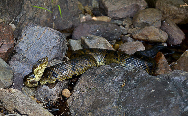 |
| These guys (and gals) are everywhere in Lower Rock Creek. |
|
Since I've decided to share
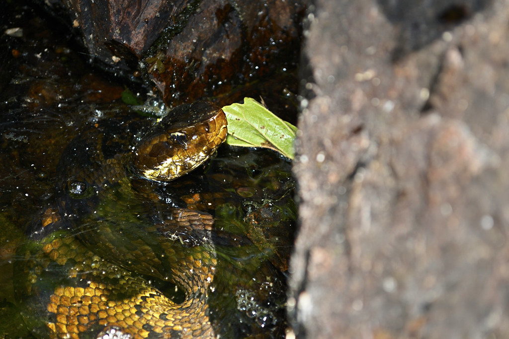
my precious hideaway, let me start with one reason you may not want to visit in spring, summer, and early fall... Snakes. And I'm talking a lot of snakes, lots and lots of poisonous snakes. So if you have an
Indiana Jones like fear of our scaly, legless, cold blooded, slitherers, don't come here until winter or late fall (it's still beautiful then). On our hike we spotted a couple of copperheads, a timber rattlesnake and
countless cottonmouths. The cottonmouths (water moccasins) were so thick, I nearly stepped on one while stepping over another. I am not exaggerating here, go ahead and
Google it, I'll wait... See?
 |
The gate and bullet ridden reflective sign
mark the trail head. Nothing says "C'mon in" like bulletholes! |
Still here? Still Reading? Still want to go? Ok, I thought that may scare you, but you are very brave, very brave indeed! So onto the directions... Coming from St. Louis (I know, I usually start everyone at Cape Girardeau), you'll take I-55 South to highway 67. Take highway 67 South to highway E. When you hit Fredricktown, you'll go West (which is on the right) on highway E. Continue on highway E for about 10 or so miles, and be on the look out for County Road 511 (CR 511), it will be on your right. Turn right on CR 511, and travel about a mile, when you cross over a low water bridge take an immediate left on the unmarked road there. BE CAREFUL, this unmarked, heavily forested road is VERY, VERY rough! Find a place to park, out of the way of the way of the unmarked road, and walk to the "trail head" marked by a traffic style gate with a reflective sign on it.
 |
| The beginning of the trail. |
Once you've found the trail head, you will set trek on a
wondrous journey on a rarely traveled trail (some call this trail the Jeep trail or path) through an evergreen and deciduous forest that creates an exquisite canopy overhead. You will soon reach a small fork in the trail, mere yards after the gate, we took the left fork and it worked for us. As you travel be sure take note of your surroundings, look for
wildflowers, perhaps discover some
wild blackberries (as we did), or
Ozark witch hazel and listen for local wildlife (which may even included
black bears, we didn't see any of these) moving through the undergrowth. I mention to be sure to take note of your surroundings because the trail may disappear from time to time, due strictly to the fact that not many travel or hike upon it, so do take note of interesting features (trees, flowers, rock formations, whatever floats your boat) and other hikers trail markings just in case, you may need them to navigate back later. The wooded portion of the trail winds for about a mile or so, then the canopy opens up and you will find yourself on the rocky banks of Lower Rock Creek!
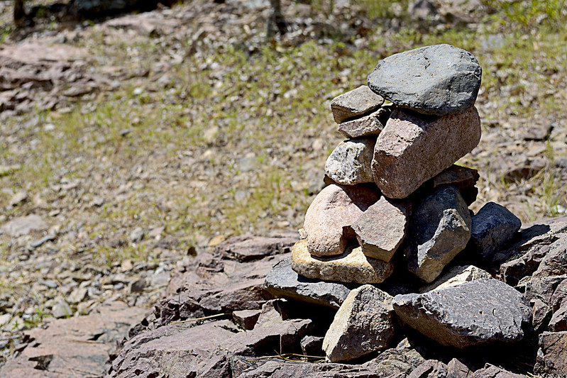 |
Be sure to search for a marker as you emerge from the trail to Lower Rock Creek.
We used this existing rock cairn as our marker, thanks to whomever left it behind! |
At this junction, given the remoteness of the area, my wife and I spied a rock cairn already built that conveniently marked where we had emerged from the trail so we took note straight away. This pile of rocks would be the marker we would search for to find our way back. If you aren't lucky enough to have a small cairn already built for you, heck, make your own, it's like nature's Jenga! Or you could place a dead branch pointing to the trail on the rocky shore as well, just be sure that you mark the trail so that you can return easily. Now, if you headed left, or
downstream, you could actually follow the Lower Rock Creek until it runs into the St. Francois River and I'm pretty sure that could be a great hike in itself. However, we turned our sights upstream (right) as a steep and climbable bluff had quickly caught my attention.
 |
| The step-like formations. |
If you decide to climb a few of these bluffs as well, be very careful, in spots the rhyolite bedrock and pinkish colored igneous rock will slip and shatter underfoot and although it may not look like a long fall from the base of your climb, it will certainly not feel good to take rapid descent caused by a slip or fall to the creek floor. The sharp, angular fractures of the rock lining the canyon walls provide fantastic foot, toe and hand holds for your ascent though, just be sure they are solid before placing your full weight on them. If you've made it up to the top, be prepared for a fantastic view of the canyon floor and winding Lower Rock Creek. You may even chance upon a collared lizard or two up here.
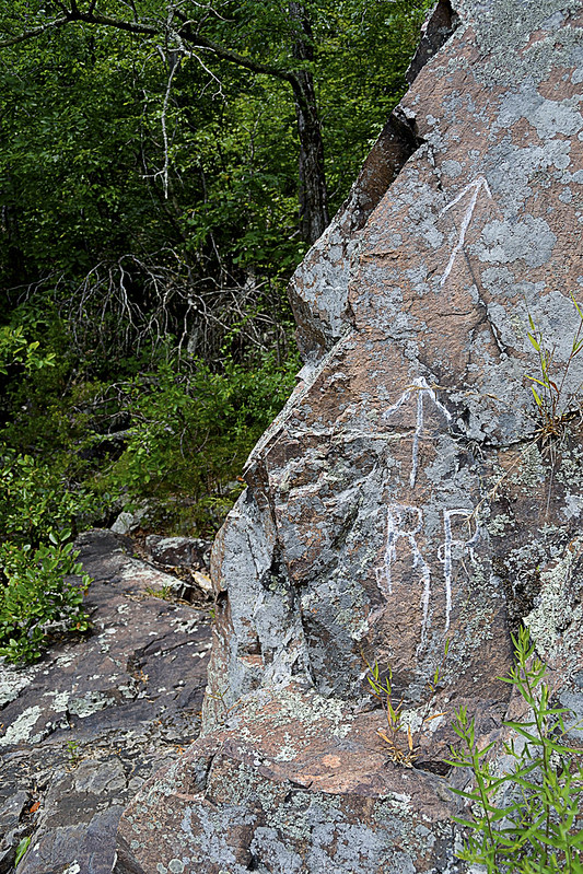 |
| RR: Rattlesnake Ridge? |
As we headed upstream the snakes became more and more prevalent, for a spell I was paying far more attention to the snakes than the scenery, simply because they seemed to be on every horizontal surface, basking in the summer sun. Interspersed with the cottonmouths were a copperhead and a timber rattle snake, the latter we found just before heading back into the forest on a trail marked by RR inscribed on a nearby rock. After a few jokes about the RR standing for Rattlesnake Ridge, we continued onto the trail. This trail quickly faded, within about 30 or so yards so of the marker, so we decided to gingerly create our own, winding up and down the hill side, seeking the easiest path sometimes following game trails (deer and other game always seem to find the easiest way about the area). We found more
wildflowers and fantastic spots to climb rocks and boulders as we made our way further.
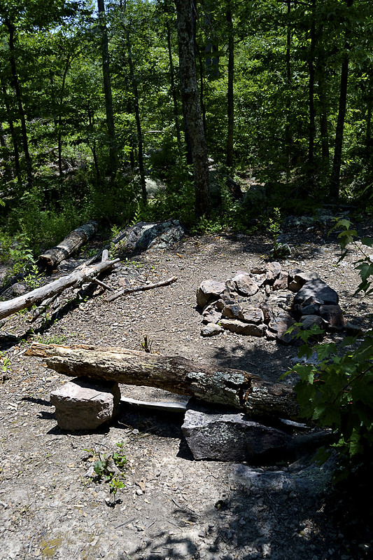 |
| Time to camp! |
Now, for all you campers out there (backpackers too) we came upon an absolutely beautiful spot to camp, complete with a rock lined fire pit, comfortable log bench and a smooth, level patch of earth just begging for a tent to be pitched. As we took our own rest here, enjoying a bit of trail mix and peanut butter crackers, I was struck by the views this site offered. The
exposed bluffs glistened white in the sun's rays, dotted with evergreens, while the Lower Rock Creek provided a steady beat of water gurgling, with the songbirds providing chorus. For a moment I had reached outdoor nirvana, everything coming together perfectly, with pinpoint timing and I was able to share that with my wife... That's what hiking is to me. Finding those moments and being able to share them with someone else, with bonus points for being someone you love...
Well, we poked and prodded a bit around the campsite area and even found a small container that had some camping equipment (pots, pans, etc.) located near the camp site. Of course I had to take the short journey from the campsite to a nearly chest deep pool of water, created by
huge boulders and the flow of the Lower Rock Creek, to take a bit of a refresher before we headed back downstream. The journey back was every bit as fun as the trip up, our eyes scanning for snakes lining the creek when not fully focused on the beauty that surrounded us.
The remoteness and serenity of this area is absolutely unsurpassed for me, I haven't been able to find a spot like this anywhere else. So untouched and unaltered, I have read elsewhere that the
University of Missouri has described this area as the most significant remaining example of the St. Francois Mountain watershed landscape. I can't think of another place that I so desperately can't wait to return to, and once you've taken a trip here, I'm confident you'll be looking to schedule a return visit too! But you may not be telling all your friends... You may want to keep it, "secret".
As always, thanks for reading!
More Information:
View Larger Map


Thanks for sharing
ReplyDeleteYour guide really very helpful for travelers who thinking to visit wonderful place, i glad to read your article, you can also visit historical monuments in india book now Golden Triangle Tour 5 Days 4 Nights
ReplyDeleteGood guide
ReplyDeleteGreat hike but even better kayak at higwater!
ReplyDelete