Showing posts with label nature. Show all posts

Wednesday, March 2, 2016

Taum Sauk Mountain State Park: Welcome to the Top of Missouri!


A little over a year ago I took on "Big Buford"... No, not the delicious arterial clogging burger they sell at Rally's/Checkers, but Buford Mountain, located just a few miles outside of Ironton, Mo. Buford Mountain is the 3rd highest point in Missouri and was a well earned victory as I took on it's 10.6 mile loop trail and enjoyed every single second of it. But I have to admit, the very second I finished the Buford Mountain trail loop and I began my ride home my mind was instantly alight with visions of taking on Taum Sauk Mountain, which is officially Missouri's highest point. I needed to make some calls, I would need oxygen, heavy parkas and perhaps a Sherpa or two... Right?

No oxygen tanks or Sherpa needed...
Taum Sauk Mountain makes up one of many mountains found in the St. Francois mountain range created by a Precambrian igneous uplift that is far, far older than the Appalachians. In fact, many geologists believe that Taum Sauk may be one of the few areas within the United States that has never been covered by ancient seas, most likely existing as islands during that time. Topping out at 1,772 feet, accomplishing Taum Sauk's summit was a bit easier than cresting Big Buford. To reach the official top of Missouri it was actually a short walk from the parking lot, only 1,000 feet down a paved trail, to a granite marker near a large boulder. I thought that may rob a bit of the "coolness" from the accomplishment, but honestly... It didn't. I was still at the top of Missouri, so a selfie was in order. But soon I thought, I really came to hike with my furry friend Hyatt, what should we do, where can we go? And it was then that I remembered, Taum Sauk Mountain State Park hosts not only the highest point in all of Missouri, but it also contains the state's highest waterfall, Mina Sauk Falls and I had heard tail that this trail was not quite as "accessible". So, after snapping a few pictures we made our way down the trail, anxious to view the falls.

Want to "earn it"? Take the Mina Sauk Falls trail...
I'll reiterate my desire to have a bit of a hike so that my hiker pride would feel as though the accomplishment of visiting Taum Sauk Mountain was not one of great ease, but earned through the sweat of my brow and the protesting of calves and quads. As I followed the trail to Mina Sauk Falls, it became apparent that this hike would be earned as the trail faded from paved trail, to rock lined trail, to gravel trail and finally to a foot worn path of Earth, leading through the forest toward our watery goal. Now, those who are "in the know" realize that Mina Sauk Falls only run in wet weather, which is one of the reasons I timed my trip here after we had received some rain during the week, so that foot worn path became very, very sloppy. In spots the trail greedily ate my entire shoe, replying only with a "splooch" as I pried my foot from its grip. My hairy buddy however, was absolutely in his element, galloping and prancing in the mud and muck as I could only think about how much fun it would be driving home with a wet and muddy pooch...


From the mud to stone...
The muddy, Oak and Hickory lined wooded trail gave way to our first glade, where a keen eyed hiker may find life better suited for a desert lying about the warm, barren rock. Lizards normally dart across this empty expanse, searching for their insect prey. But it was far too cold for our reptile friends to be emerging just yet. So we enjoyed the melodies of the feathered inhabitants, which drifted easily to our ears, serenading us as we made our way over the stony floor. As we moved forward along the trail I had to pay particular attention to my footing as the rock was very slippery in spots due to the rain water still draining from the mountain, so please, pay particular attention here for wet spots. I will readily admit, it was very hard to look down at my feet, concentrating on my footing with such a stunning view of the Arcadia Valley sweeping in a nearly full 360 panorama. I had to stop, pause and take in an eyeful, so I found myself a nice boulder to perch on and enjoyed a cool drink of water, allowing all my senses to be filled, enjoying the view as the songbirds created the score for this outstanding scene. But my hairy buddy was ready to go, so I was brought back to task by wet tongue and muddy paws upon me. Before we pressed on though I had to snap a photo... or two.

Onward to Mina Sauk Falls
The trail to the falls continued to waver from earth to rock and back again as it continued downhill, and was fairly well marked. However, at one particular point there seemed the foot worn trail led straight, and had it not been for a well placed timber, I would have missed my turn to remain on the trail, so do pay attention as the trail may fade in and out in spots. As the path began to follow the gentle curves of the mountain I could hear rushing water and my mind was awash in anticipation of what was just out of sight. As the trail led slightly back uphill and around a huge, precariously perched boulder, I caught my first sight of Mina Sauk Falls and the crystal clear waters cascading from the top of the fall, stream over a series of ledges and finally end its journey down 132 below. There is something about a waterfall that fills not only my senses, but also my soul. Honestly, I feel completely at peace and find absolute solace in listening intently to the crashing of the water while being cooled by the mist rising from the impact. After soaking in the falls, I realized that I had forgotten a few things, most notably the filter I use to create the cascading fall pictures and my tripod, however the falls washed away any concern of that and I snapped the photos I could with my camera but left with even more vivid pictures taken with my mind's eye. I followed the Ozark Trail down the mountain, being very careful to avoid loose and wet rock in order to gain different perspectives on the falls. It was at the base of those falls that I simply sat, for how long I honestly don't know, and watched the falls simply...  fall. From here I could carry on for another mile and see another great wonder of the area, the Devil's Tollgate or journey another ten miles to reach Johnson's Shut Ins, but I was running short on time, so I began my ascent back up to the top of Mina Sauk Falls to begin my uphill return hike.

A tragic legend for the beautiful falls
As I made my way back down the mile and a half trail, I thought of the legend of Mina Sauk Falls. How the chief, Sauk-Ton-Qua and the Piankashaw Indians once called this wondrous land home. In fact it was chief Sauk-Ton-Qua for which this mountain was named, who the white man called Taum Sauk, because his name was hard to pronounce. The Piankashaw lived in peace on these lands, but would fiercely repel any invasions made by other tribes, in particular the advancements of the Osage. It was said that Sauk-Ton-Qua had a beautiful daughter, Mina Sauk, who fell in love with an Osage warrior. One day Mina Sauk was caught in the young Osage warriors arms and taken prisoner. Sauk-Ton-Qua sentenced the young man to death, despite his daughter's pleas to spare his life. It is said that later that day the young man was executed on the very slopes of Taum Sauk Mountain. He was tossed from the crest of the mountain, crashing from ledge to ledge below with the spears of warriors, until finally coming to rest at the base of the mountain, battered, bleeding and dying. As Mina Sauk watched her lover she could no longer contain her grief and as her Osage suitor lie at the bottom of the mountain, breathing his last breaths, she cast herself from the summit as well, plunging over Taum Sauk's ledges to her death. It was then, that the great spirit became so moved by the lovers deaths that the very Earth trembled and shook, and Taum Sauk Mountain began to crack. Then a flood of water streamed forth, flowing over the very same stones as the lovers, washing away their blood. Such a tragic legend to explain such beauty... There are other versions of this legend, some change the name of the daughter, others create the falls with a thunderous lightning bolt, but all seem to suggest the falls were created by the great spirit's response to the treatment of the young lovers.

Pro-Tips for Taum Sauk Mountain State Park
I truly enjoyed every second I spent at Taum Sauk Mountain, from the thrill of being taller than every single Missourian for a few brief seconds to experiencing the peace that streams from Mina Sauk Falls (despite the star crossed legend) I can't recommend this park enough. I would suggest that you aim to visit the park after there has been a period of rain, especially if you want to see Mina Sauk Falls and snatch your own moment of zen from this busy, noisy world. Be sure to wear a comfortable pair of shoes that you don't mind getting absolutely covered in mud and muck. Which brings me to this... Bring a towel for your car, especially if you are bringing a four legged companion, I'm still finding bits and pieces of Taum Sauk Mountain in my truck. Also, keep an eye out for the watchtower. I didn't see it, or know it existed until I had finished my hike, returned home and began to type up this entry. I'll certainly be looking to take some shots from it on my next visit! Finally, be sure you have enough time. I didn't expect the hike to Mina Sauk to take as long as it did, and once there I didn't have enough time to press on to the Devil's Tollgate. The area is rich in wildlife, views, sights and sounds so be sure to provide yourself ample time to really take it all in.

I can't wait to go back to Taum Sauk Mountain and I will certainly make time to search for the watchtower and also make my way further down the Ozark Trail to see the Devil's Tollgate. I hope you enjoyed the write up about the area and let me know if you have any questions or suggestions down there in the comments. As always, happy trails to you!

Directions


More Information:
Local Treks on facebook 

MO State Parks: Taum Sauk Mountain Webpage
MO State Parks: Taum Sauk Mountain Hiking Trails
MO State Parks: Mina Sauk Hiking Trail Map
MO State Parks: Taum Sauk Section of the Ozark Trail Map
Missouri Department of Conservation: Taum Sauk Mountain Webpage

Wednesday, September 2, 2015

Cache River State Natural Area: Much More Than "Mud & Muck"


When you think of a wetlands area, there is no doubt that you may quickly conjure up an image of Swamp Thing's eerie home immediately. Or, perhaps you envision a marshy bog filled with savage spiders, slippery snakes and man-sized mosquitoes, each lying in wait under an ever present layer of fog, lurking within their secret hiding places until deciding to lurch forth for you, their unsuspecting victim. But in reality, wetlands are beautiful areas that also provide a home to more than a third of the species on the U.S. Endangered Species List and serve a variety of services to us as well; such as recharging our ground water supplies, providing a filter which removes pollution, and trapping flood waters. But beyond those important ecological benefits, you will find that wetlands may provide another intangible benefit to you. You may find your own soul reinvigorated, if just given a chance to step beyond the "mud and muck" of Cache River State Natural Area...

Cache River State Natural Area

This Cherrybark Oak
Champion may be found
on the Todd Fink
Heron Pond Trail
The Cache River State Natural Area is an absolutely stunning example of a well restored wetlands area. You will find this gem nestled within a floodplain, which was sculpted by the mighty flood waters of the Ohio River ages ago. The Cache River Wetlands is now fed by the Cache River and it's many tributaries and stretches over 14,960 acres in Johnson, Massac, and Pulaski counties in Southern Illinois. This scenic area also plays as a featured stop to many migratory bird species, including bald eagles, great blue herons and (a personal favorite) snowy egrets. In addition to the myriad of migratory birds you will undoubtedly catch an earful of the areas most vocal inhabitants as choirs of spring peepers, bullfrogs, bird-voiced tree frogs, American toads and more amphibians all sing together from the bogs to the boughs and everywhere in between. As you hike on the trails and boardwalks below you may also want to keep a keen eye trained for some of the larger warm blooded residents as many white tailed deer, squirrels, raccoon, beavers, foxes and mink call the area home as well.

On our visit we were lucky enough to hike three areas within the Cache River State Natural Area (click to visit individual pages or read more below): Big Cypress Tree Trail (250 feet), the Section 8 Wood Nature Preserve Boardwalk (475 feet) and the Todd Fink-Heron Pond Trail (1.5 miles). Each of these short hikes were absolutely stunning and completely unique in their own way. These short journeys also seriously whet my appetite for a return to visit areas such as the Marshall Ridge Trail (2.8 miles), Lookout Point Trail (1 mile), and the Lower Cache River Swamp Trail (2.5 miles), but that will have to be another post at another time I suppose.

Big Cypress Tree Trail

Although missing some of its mighty boughs,
the state champion is still an impressive sight!
Beyond the wildlife that inhabits these wetlands, the area also boasts some truly spectacular plant life. Throughout the Cache Area Wetlands you will discover ancient cypress trees with their flared bases and many "knees", which were mere saplings over 1,000 years ago, now standing sentinel over the rich, black-water swamps that still nourish them. On the short, 250 foot Big Cypress Tree Trail you will find one very special bald cypress. This particular cypress tree has been so nourished by the rich waters that it has developed a remarkable base (also referred to as a buttress) of over 40 feet in circumference, which has earned it recognition as a state champion. As you make your way to the enormous namesake of this trail be sure to take note of the other plants such as majestic tupelo trees and low lying thickets of button-bush that share the landscape with the silent cypress colossus.

Section 8 Wood Nature Preserve Boardwalk

The murky waters of Section 8 are haunting.
There is something nearly hypnotic about the chorus song of nature, in particular the melodies of the amphibious inhabitants of the wetlands. The soprano trills of the tree frogs blend with the rich baritones of the southern leopard frogs, while the deep bass of the bullfrogs seem to keep the beat and complete the scale, providing the perfect background accompaniment as you stroll the wooden Section 8 Boardwalk (click here for more "Swamp Music":). As you make your way over the 475 foot long boardwalk you will be enveloped by the cypress, tupelo and other varieties of marsh loving trees, many of which you will be able to identify thanks to the wonderful interpretive panels that are available along the path. Then, as you look out upon the muddy and murky waters, perhaps wondering exactly what may lie beneath its calm surface, you may also catch sight of another state champion, this time a tremendous water tupelo, which can be found at the very end of the boardwalk. Unfortunately I just could not snap a good picture of it, or I would have provided one here for you... Now I guess you'll just have to take this serenaded trip as well. :)

Todd Fink-Heron Pond Trail

See that cool "Zipper" effect?
This short, 1.5 mile, trail begins simply enough. You'll find yourself descending into a mix of hardwood forest comprised of a mix of oak, hickory and sweet gum. As you reach the bottom of your descent you will come to a small truss bridge over which you will make your way over a convergence of Dutchman's Creek and the Cache River. If you find yourself crossing this bridge without setting an eye just upstream, toward the actual meeting of these two streams of water, you are missing a truly magnificent sight. For it is here, just upstream, where the relatively clear waters of Dutchman's Creek and the rich muddy flow of the Cache River slowly merge, becoming one, but not before the waters dance together, swirling and circling, ebbing and flowing, creating an absolutely hypnotic effect. The trail continues on just the other side of the bridge, and closely follows the snaking trail of the Cache River. As you continue your hike you will find a fork in the trail, it is here that you will want to journey to the left and in just a few short yards you will find the Heron Pond boardwalk.

The Heron Pond boardwalk winds its way out and into the very heart of its namesake pond. The waters here were more clear than we found at the Section 8 boardwalk, which allowed us glimpses of turtles, fish, insects, frogs and more as they swam among the giant tupelo trees and "knees" of the cypress here. In areas we found duckweed would obscure our little windows into the private underwater world of the swamps residents, occasionally these serene green mats of aquatic carpet would erupt with a violent "POP" as an underwater assassin would hungrily burst through the thin layer of duckweed in pursuit of an insect.

Now, after you've taken the journey on the Heron Pond boardwalk you may think that's it... But you'd be wrong. Remember that fork, where we turned left? You may be wondering what exactly would have happened had we turned right instead. Well let not your heart be troubled, because had you turned right at that fork you would have taken a trail that would have led you directly to yet another state champion tree! This time you would have discovered the state champion cherrybark oak tree that has grown to a circumference of over 22 feet and 100 feet high! You may never have quite so much fun feeling so very, very small and believe me, it's worth a quick visit to set your eyes upon this towering titan, plus it is only a few yards up that right path...

Cache River Wetlands Center 

You may want to begin your entire adventure to the Cache River Wetlands Area at the Barkhausen-Cache River Wetlands Center. Unfortunately the visitor center was closed when we visited the park on a Monday, but it certainly seems to have many offerings for you to peruse. It is located at 8885 State Route 37, Cypress, IL, 62923 and is now open to the public five days a week, Wednesday through Sunday from 9:00 a.m. to 4:00 p.m.


Directions


More Information:


Local Treks on facebook 
Cache River State Natural Area: Big Cypress Tree Trail - Looking for the state champion bald cypress? Take this trail!
Cache River State Natural Area: Section 8 Nature Preserve Boardwalk - Take a stroll directly through a swamp without even getting your feet wet!
Cache River State Natural Area: Todd Fink-Heron Pond Trail - Another state champion tree and awesome boardwalk trail!
Cache River State Natural Area homepage 
Hiking Maps of the Area
Barkhausen-Cache River Wetlands Center
Barkhausen-Cache River Wetlands Center flyer - This little beauty has many of the cool features of the center listed. 
Cache River State Natural Area Map
Color Brochure of the Area

Friday, January 23, 2015

MDC Offering Free "Discover Nature Girls Camp" - Kansas City Area

Courtesy Missouri Department of Conservation

As a father of a wonderful twelve-year-old, I have to admit... It's sometimes tough making the outdoors interesting. I love long hikes, the sounds, the smells, the freedom calls to me like an old friend and I relish ever single "conversation" I get to have with the great outdoors. Every step finds me a different view from which to marvel at her beauty. Now, that's me and my conversation with . Here's the conversation my daughter has with Mother Nature during a long walk: "O... M... G... Will it end?" That's why I keep our hikes short and I scout out most areas as well, it has to pass the "is there something cool or a big payoff on this hike" test. But I think anyone will tell you that the best way for a girl to have fun, well, it's with other girls!

Enter the Discover Nature Girls Camp

If you are looking for a way to make the outdoors more interesting for your daughter (or niece, granddaughter or just over all great girl that you love) who is between the ages of 11 to 15 and you live near Chilhowee, Missouri, you will certainly want to check out the Discover Nature Girls Camp, being held at Camp Palestine in Johnson County (see Google Map below for directions). According to the MDC site this is "a three-day, two-night camp that will introduce girls to outdoor skills in a supportive learning environment". The campers will be participating in skills including: archery, firearms safety, fishing, canoeing and water safety, with the MDC providing all of the necessary gear and materials. Who can beat that? Seriously... Who?

Registration Is Limited, So Act Now!

With a free deal this good you know there HAS to be a catch... And there is. You need to act NOW if you would like your favorite girl to participate as the Discover Nature Girls Camp is limited to 32 campers, with only the first 32 being admitted to the program. To request an application and apply for the Discover Nature Girls Camp, contact Agent Bartlett at (816) 835-6087, or call the Missouri Department of Conservation's Regional Office at (816) 622-0900. To find other GREAT programs near you visit mdc.mo.gov.

More Information:


Local Treks on facebook 
MDC Discover Nature Girls Camp webpage


Tuesday, November 11, 2014

Giant City State Park: Giant City Nature Trail


There are times in which Mother Nature takes the subtle approach. She gently nudges you, providing you a wondrous moment or a special little insight to what makes her tick. And then there are times that she gets right in your face, causing you to be unable to look away, and assuring that you notice her grandeur, her beauty, her utter uniqueness... As you set tread to the Giant City Nature Trail be prepared, Mother Nature is moving in close, she'll be sure that after this short one mile loop trail you'll be fully aware of her rare and unique beauty.

The beauty of the Giant City Nature Trail certainly lies within its unique "streets". These passageways wind through colossal slabs of sandstone, which loom far above you and sending trees which look to grown upon their surface to grow quickly or never find the sun. Each of these large sandstone structures seem to form buildings which line the streets, with lines so straight they seem as though they could have only been carved by a master stonemason, as nature so often abhors presumed conformity and conventionality. But it is this seeming conformity, these straight, towering angular blocks which dwarf you and your fellow hikers, that make this area so unique from the rest of the park. In fact, this area is a bit reminiscent of the Panther Den Wilderness, only the Giant City Nature Trail is far more accessible and has a well worn trail to follow.

These massive stone structures have, no doubt, awed mankind for millennia, with man obviously attempting to leave behind their marks upon the stone, the same way that the stone had left its lasting mark upon them. If you inspect the walls carefully you may come upon a pair of names carved upon the sandstone walls in 1862, by Theodore Wilson and his brother Albert during the Civil War. The pair's stoney autographs have become a popular carving to seek out and if you look very carefully, you may be able to even make out the haunting face in the rock wall that opposes it. During our visit, someone had defaced the the Giant City Trail "face" by painting an outline around the image, hopefully with time the paint used will fade and the face will again become a bit more eerie. Time may slip by quickly as you read the many inscriptions upon the walls, searching those breadcrumbs left which bare silent witness to those explorers who shared this same trail, same route, same beauty with you decades before.

After you have gazed and searched the etchings of visitors past, you will walk through a small walkway bordered by sandstone and under a precariously perched boulder. As you make your way through, it is hard not to have a quick second of doubt as to whether you should pass under or not, as I will admit, I had a quick thought of, 'what if today is the day that rock decides to fall'? It is also another great place to take a few more family photos and makes for a great "look at what I'm holding up" props. There are still plenty of Giant City buildings left to awe and amaze you, and you may even find the opportunity to scramble your way upon them to gain an additional view of the Giant City streets on which you have now tread.


Directions (click the Google Map below to enter in your address)

Giant City State Park
235 Giant City Road
Makanda, IL 62958
(618) 457-4836

More Information: 

Local Treks on facebook 
Giant City State Park Stonefort Nature Trail - Be sure to hit this trail too!
Giant City State Park Devil's Standtable - Another GREAT trail in Giant City

Giant City State Park - Official IDNR Homepage
Giant City Trails -  A list of all eight established trails
Giant City Visitor Maps - Maps provided by the IDNR of the entire park
More Photos From Giant City State Park - My Flickr Album for Giant City State Park

Monday, November 10, 2014

Free Photography Class At Kirksville's MDC Office!


Personally, I love taking pictures and feel nearly naked on a hike if I don't have my handy Nikon by my side. I've caught wildlife at play, fragile local wildflowers blooming, and my family's adventures forever through the digital eye of my camera. I value every single snap of my camera's shutter, and I can now look back through those photos and find myself instantly teleported to that moment in time. If you too love photography or are just thinking about taking it up, you may want to read on about a free class the MDC is offering in Kirksville, MO.

If you're lucky enough to live near the Missouri Department of Conservation's Kirksville, MO office you can take advantage of a fantastic free class on nature photography this Saturday, November 15 at 1:00 p.m. The class is open to all ages, but children are required to be accompanied by an adult, and no registration is required. So bring your digital camera and dress for the season, who knows, you may very well find your inner Ansel Adams!

Directions & Address:


Missouri Department of Conservation: Northeast Regional Office
3500 S. Baltimore Street
Kirksville, MO 63501

For additional information or questions on this event, you can call MDC Naturalist Amanda Moore at (660) 785-2420 or visit the Missouri Department of Conservation's event page by clicking here.

Monday, November 3, 2014

Giant City State Park: Stonefort Nature Trail


Fried Chicken. More importantly, and according to a family friend, the World's Very Best Fried Chicken served in an all you can eat family style. That, is what truly brought me to Giant City State Park, located just outside of Carbondale, IL. But what I found, besides the absolutely delicious fried chicken, was an astoundingly gorgeous and completely unique area, filled with a hiker's wish list of things to do, see, explore and, of course, eat!

With so many different trails to explore in Giant City State Park I've decided to break them up into more easily "digestible" single review trails, starting here with the Stonefort Nature Trail...

We began our whole excursion in Giant City State Park pondering exactly what a "Stonefort" was, and since we all had a different idea of what it may actually be we decided to make the Stonefort Nature Trail our first official stop. Little did we know, but we actually caught a glimpse of the Stonefort Nature Trail's breathtaking observation point from atop an 80 foot sandstone bluff as we entered the main park.

So, Exactly What Is A "Stonefort"?

This one-third of a mile loop trail took us on a tour of an ancient "stonefort", one of ten wall-like structures, constructed entirely of heavy stone, believed to have been erected in the Late Woodland period between 600AD - 900AD in Southern Illinois. Each of these ancient arrangements have been discovered on top of hills or promontories and were once believed to have been used as some type of stone fortification, thus giving them the name "Stonefort". These unique walls, consisting of heavy stones, are now believed to have been constructed as meeting places or perhaps ceremonial locations. The original wall that sat atop this particular trail was actually removed, dismantled by early European settlers to the area, who used the heavy stones as building materials. The low stone base is all that really remains of the original site, however, in 1934 the Civilian Conservation Corps (whom I can't thank enough) rebuilt the wall into the site that we see today. During the reconstruction of the wall, the CCC found many Native American artifacts including a good deal of pottery. "I personally love sites like this that carry that hint of ancient mystery, sites such as this and Rock Pile Mountain always pique my curiosity of early Native Americans and, while marveling at their accomplishments and ingenuity, I also find myself theorizing on what these sites may have been used for.

But What About The Actual Trail?

The Stonefort Nature Trail itself is well worn, with many roots and rocks embedded in its surface, which some may find a bit difficult to walk on. The trail also winds it's way up the side of a small hill, where you instantly come upon the structure itself upon arriving at the top. If you continue the loop, around the top of the hill, you will come to a spectacular overlook from an 80 foot sandstone bluff which overlooks the park's entrance. A word of warning for those of you with small children and faint hearts, it is a STEEP, LONG drop to the bottom of this bluff and there are no handrails. The trail also narrows a bit here making it a somewhat dangerous portion of the trail. For those that continue along the loop, you'll find another overlook along the way along with a carpeting of moss, ferns and wildflowers, sheltered beneath a wide canopy of local hardwoods an evergreens. This trail is well worth the short hike, even if you decide the breathtaking 80 foot overlook perhaps steals a bit too much of your breath.

Directions (click the Google Map below to enter in your address)

Giant City State Park
235 Giant City Road, Makanda, IL 62958
(618) 457-4836

More Information: 

Local Treks on facebook 
Giant City State Park Devil's Standtable Nature Trail - Be sure to hit this trail too!
Giant City State Park - Official IDNR Homepage
Giant City Trails -  A list of all eight established trails
Giant City Visitor Maps - Maps provided by the IDNR of the entire park
More Photos From Giant City State Park - My Flickr Album for Giant City State Park

Thursday, August 14, 2014

Hawn State Park: The Happiness of Hawn


To me, the happiness of Hawn State Park lies completely in its pure variety of ways to enjoy it. Are you a rock lover? Visit Hawn to see one of Missouri's best examples of Lamotte Sandstone, an old, coarse-grained sandstone that overlies ancient igneous bedrock. Think Missouri State Parks should be "for the birds"? Well this location sees a great variety of our fine feathered friends, including pine warblers, chickadees, and short eared owls. Love the gentle gurgling of a crystal clear stream? You have to check out Pickle Creek, which has been designated an outstanding state water source due to its crystal clear waters, due in part to that Lamotte Sandstone above. Water lovers may also seek out the River Aux Vases, which meanders through the area, carving out steep valleys.

Then there are us hikers, and we're in for a particular treat as Hawn State Park presents us with four fantastic trails each of varying length and difficulty: the super short .70 mile Pickle Creek Trail, the 300 foot handicapped accessible Overlook Trail, the 9.75 mile Whispering Pines Trail, and the shorter 3.75 mile White Oaks Trail. Each of these well maintained trails allows us to take in all that Hawn has to offer including two backpacking camps on the Whispering Pines Trail for those who wish to take in the "wild" local nightlife, and that makes me happy!

This is the second time I've hiked the White Oaks Trail in Hawn State Park, once in the fall of 2013 with my family and now the summer of 2014 with only my four-legged hiking buddy Hyatt, and I enjoyed every step of each journey. As if the changing seasons couldn't possibly provide enough change and variety, the White Oaks Trail itself constantly changes scenery and trail conditions as you hike. Like a Hollywood star vying for your attention, this hike seems to constantly attempt to outdo itself searching for new, fresh looks to give you.

A GREAT Trailhead Begets a GREAT Journey

I'll start at the very beginning, because it is one of the most important parts of the trail to me, the trailhead. At the clearly marked White Oak trailhead I found a very well stocked information area, which offered literature on other Missouri State Parks, many area maps, a billboard with important informational postings, a very convenient vault toilet, and, on my summer trip, an absence of cars! It appeared as though I may have one of Missouri's prettiest State Parks, all to myself (well not completely myself I did share a bit with my canine companion).

Variety, Variety, Variety...

Just past the trailhead the White Oak Trail itself starts out a bit "rugged", featuring stones intertwined with rich, earthy roots comprising the first bit of surface. I found myself looking down frequently, to assure my footing along the first half mile of the trail due to the rocks and roots, despite the elevation changing very, very little, I'm always a bit overly cautious when hiking alone to not twist an ankle.

Continuing down the trail as you approach the first White Connector (WC1, which will lead you to the Whispering Pines Trail), the rocks and roots make way and the trail itself morphs into to a landlocked sandy beach-like trail, bordered by beautiful trees and undergrowth. As you continue to hike, past WC1, the sand particles become progressively larger and larger until they are no longer grains of sand but pebbles and small rocks. Then I catch one of my very favorite scents, pine, and the trail changes yet again, the scattered shortleaf pine needles cushioning my every step as I silently stride the trail's well worn path through majestic native shortleaf pines and cedars. It is here, among the piney giants, that I let a bit of nature's chorus swell around me, listening as the bird's tenor song crescendos, while rhythmic crickets keep measure. The only thing more amazing than the shifting scenery is that I have traveled only a mile to see it all!

Skullcap, it may sound scary it's actually quite beautiful.
Continuing down the trail you will find the second White Connector (WC2: which also leads to the Whispering Pines Trial), you'll want to continue to the right to stay on the White Oaks Trail. In just a few yards from WC2, you will find the official White Oaks Trail loop. The White Oaks Trail loop will continue your journey through ever changing surroundings featuring some creek crossings, rock overlooks, boulders on which to scramble and maybe even some sweet edibles such as wild blackberries, hiding in the underbrush. Also be sure to keep an eye out for some truly stunning wildflowers such as the wild yellow lady-slippers orchid (which I couldn't spy anywhere). But if you are lucky enough to find one of the yellow lady-slippers orchids, don't try to take it home, the orchid's roots are actually attached to fungal threads deep beneath the soil and once those threads are severed the orchid dies... plus you could net a $1,000 fine or win a fabulous stay in one of our finest concrete incarceration centers for digging them up as well (so I'd suggest taking lots of pictures instead, and maybe even sending some to us here).

With so much to see and do along the way, the White Oaks Trail is a great solo or family hiking destination. There are a plethora of opportunities to splash about in a creek, take a side "off-trail" adventure into the underbrush to forage, climb the branches of a gnarled old cedar tree, bound from boulder to boulder, perch upon rock ledges, and so much more that the 3.75 mile length may never even be noticed by most, resulting in less of the dreaded "are we there yet's". This trail is truly diverse, overwhelmingly beautiful and simply begging for you to enjoy. As always, thank you for reading and Happy Trails!

Something New: Google My Tracks

Below is a little something new I'm trying, Google's My Tracks. Hopefully you'll be able to garner at least a bit of information from the trail map below. Although the mileage at the White Oaks Trailhead stakes out the trail at 3.75 miles, My Tracks placed the mileage at 4.09 miles, maybe I took a bit of a wider trail than they measured, or perhaps my phone's GPS was off by a few feet here and there. I just hope you find the information below helpful and if you do, please let me know.


More Information: 

Local Treks on facebook 
White Oaks Trail Map (print it off and take it with you... just in case)
Hawn State Park homepage
How to Take a Great Dayhike
Tiny. Tenacious. Terrible. Ticks.
Missouri State Parks Homepage

Friday, June 20, 2014

The 100 Missouri Miles Challenge. Think You Can Do It?


There is a lot to be proud of here in Missouri, and our State Parks and the miles and miles of well maintained hiking trails they offer are just one of the many, many cool things that many Missourians (including myself) may take for granted from time to time. Well, we may let our appreciation of the Missouri trail system slip from time to time, but American Trails (a national, non-profit organization that works on behalf of our country's hiking, biking, and riding trails) named little ol' MO the distinction of "Best Trails State" for 2013-14 and our Missouri State Parks had a HUGE impact in Missouri receiving that distinction as they accounted for nearly 1,000 miles of Missouri's trails! Now, be sure to keep in mind that the the Missouri Department of Conservation also oversees approximately 600 miles of trails and Federal Agencies (such as the National Park Service, US Fish and Wildlife, and US Forest Service) account for 700 miles of trails, so I'm certainly not calling them slouches as all.

Well, all this hub-bub about the quality of Missouri Trails set into motion a challenge from our Governor, Jay Nixon, to get Missourians off the couch and onto one of our awesome state trails in 2013. The gauntlet was tossed as he asked for residents to take in countless lungfuls of fresh air, some of the most spectacular scenery in the state, and memories that will reside with them for a lifetime as they logged 100 miles on Missouri's trails. The response was enormous and we racked up over 1.1 MILLION Missouri miles in 2013. The Governor is hopeful that we will beat that amount this year as the challenge was once again put forth on March 20th.


So if you plan to hike, run, walk, paddle, bike, hop, skip, jump, roll or plan any other form of locomotion on Missouri's trails why don't you join the challenge today? Just hop over to 100missourimiles.com today and sign up. There is still plenty of time for you to put in your own #100MoMiles!

More Information

How To: Take A GREAT Day Hike
100 Missouri Miles Homepage
Missouri State Parks
Missouri Department of Conservation Homepage

Friday, May 30, 2014

Too Hot? Take In Some Nature Art This June.

Sorry, not by Marcus Janzow. But I wanted to have some type of picture here.
I'll admit, Midwestern Missouri summer days can be absolutely brutal and if it's too hot outside for you perhaps you may want to take in some local art at the Cape Girardeau Nature Center. Beginning in June you can see photographer and wildlife biologist, Marcus Janzow's photography exhibit, titled "Diverse Landscapes of Southeast Missouri".

Janzow concentrated on areas in Southeast Missouri, and the Missouri Department of Conservation hopes that after seeing the beautiful exhibit that you will want to get out and visit the areas photographed. And to be inspired by his photos simply stop by the (fully air conditioned) Cape Girardeau Nature Center during regular business hours in June, Tuesday through Saturday from 8 a.m. - 5 p.m. If you find it  cool enough you may even want to take to one of the trails located right outside of the Nature Center's doors as well, like the White Oak Trace trail.

Of course, I certainly hope you get out there and take to a trail to experience the great Missouri trail system as well, and I'd always love to see your pictures!

For more information on the June exhibit visit the Missouri Department of Conservation's release page here: http://mdc.mo.gov/node/28356.

Monday, May 19, 2014

Rock Pile Mountain: A Great Place To Get "Lost"

Local Treks: Compass

A "Link" Between Gaming And Hiking...

Growing up I loved playing The Legend of Zelda. The hero Link, in all of his 8-bit glory, began his journey when you led him into a cave and met a kindly old man positioned between two flickering flames. As he entered the cavern, the screen scrolled up and text formed over the elderly man's head revealing infamous words that stick with me to this very day, "IT'S DANGEROUS TO GO ALONE! TAKE THIS." Then Link was presented a wooden sword, the first weapon I would use on my epic elementary school quest to defeat the Evil Gannon. Later I would begin to explore dungeons in the game, here two items were of great importance; a compass and a map. Rock Pile Mountain Wilderness reminded me of this piece of my childhood, as it really can be dangerous to go alone, especially into a wilderness area and when you head out into these protected areas you should always take a compass and a map and know how to use them.

4,238 Acres And This Is A SMALL Wilderness?

Rock Pile Mountain Wilderness holds the distinction of being Missouri's smallest wilderness area, weighing in at 4,238 acres of beautiful forest located outside of Fredricktown. The trailhead is located off of County Road 406 on Forest Road 2124 in Madison County. I can assure you, finding the trailhead for the wilderness may provide you a journey in itself! We traveled easily enough south, down Highway 67 from Fredricktown and turned right onto Highway C. Next we turned right on County Road 406, using the directions provided by the Mark Twain Forest recreational opportunity guide, however we found the very last portion of the directions very difficult to find... The left turn on Forest Road 2124. This road does NOT have a traditional style street sign, instead it is a very small, skinny, brown stake-like sign, that is off on the left side of County Road 406 by at least 5-8 yards. We passed this turn twice before finding it. Unfortunately, I didn't measure the distance, but if you turn on County Road 406 from C, it is approximately 2 miles down the dirt road and will be on your left, it does look like it is fairly well traveled.

Road Conditions May Vary...

Some reports on other websites and resources put Forest Road 2124 in a nearly complete state of disrepair, some have tales of ditches large enough to swallow cars, mud so deep that the Swamp Thing dwells somewhere in their depths, and trees the size of Redwoods have fallen over the rural gravel road. When we visited on April 18, 2014 the road was in very good condition. In fact, I was a bit disappointed that the road wasn't a challenge to be overcome, I wasn't going to be able to use the drive as a badge of honor to earn. However, I will say this, I can CERTAINLY see how this road may fall into a state of utter decay, signs of downed trees did litter the ditches and clear ruts were left by water as it cascaded over the road in spots during previous rains, cutting portions of the road away. But we easily made it, in an old four cylinder, two-wheel drive RAV4, that was born in 1998. We didn't even need the extra clearance the aging RAV4 provided over a standard car on our trip. The small ruts were easily avoided and we putted right on up Forest Road 2124 to the trailhead at the top of Little Grassy Mountain.

Be Sure To Bring Your Own Map.

Local Treks: Rock Pile Wilderness Sign
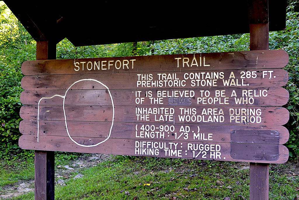
As we neared the peak of Little Grassy Mountain, we were surprised to find another car parked just off the turnaround at the trailhead. Of all the reports I had read, none had ever mentioned bumping into another hiker while out on the trail. We pulled on in next to the other car (another, far newer RAV4), parked and began to stretch our legs, exploring the trailhead and reading the postings on the information board. I filled out a quick registration card and placed it in the collection box, near the information board. Honestly, there isn't much information available at the information board, and sadly I've become used to this in the Mark Twain National Forest. Please don't take this as a "knock" against the National Parks, but I've found them to be far more lacking in upkeep than our local State Parks, perhaps it is just that the Missouri Department of Conservation (MDC) does such a fantastic job of maintaining our local parks and trails that it makes the National Parks in Missouri look worse in comparison, but that is enough of a side tangent. There are NO maps available at the trailhead information board and some information seemed to have been torn off, but as I stated before, I expected this and in anticipation of finding another mapless information board, I had printed out two copies from the internet at home, marked them both up and brought them along with a compass.

Local Treks: Rock Pile Mountain Rock
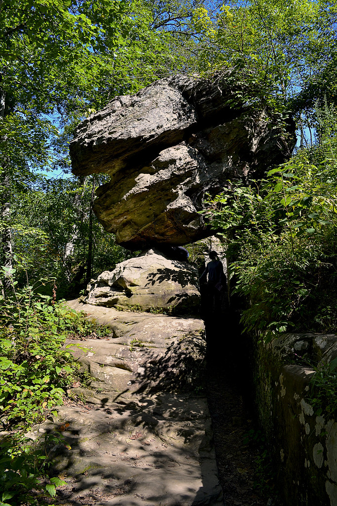
Just a few steps from the information board is a great place for a photo opportunity. A large stone with Rock Pile Mountain Wilderness boldly chiseled into it just begs for you to hop in front of it and snap a selfie! However, be careful near this rock, as it seems that this trailhead may also be a popular late night spot to do a bit of "celebrating", as broken shards of glass are as plentiful here as tile in a bathroom  and on the topic of bathrooms, there are no facilities here, as it is a wilderness area. Also, be especially vigilant as you explore the trailhead if you have a dog, no matter how tough their pads are, they are no match for the slivers of broken glass here. Once we snapped our photos by the rock, we unloaded our packs from the car, strapped up,and were ready to embark upon our backpacking adventure through the Rock Pile Mountain Wilderness. We caught a quick view of a pseudo rock pile in a clearing, just before reaching the official trail and that made us a bit excited to see the real rock pile, for which the mountain and the wilderness area have been named.

Into The Wilds We Go!

local treks spring is springing
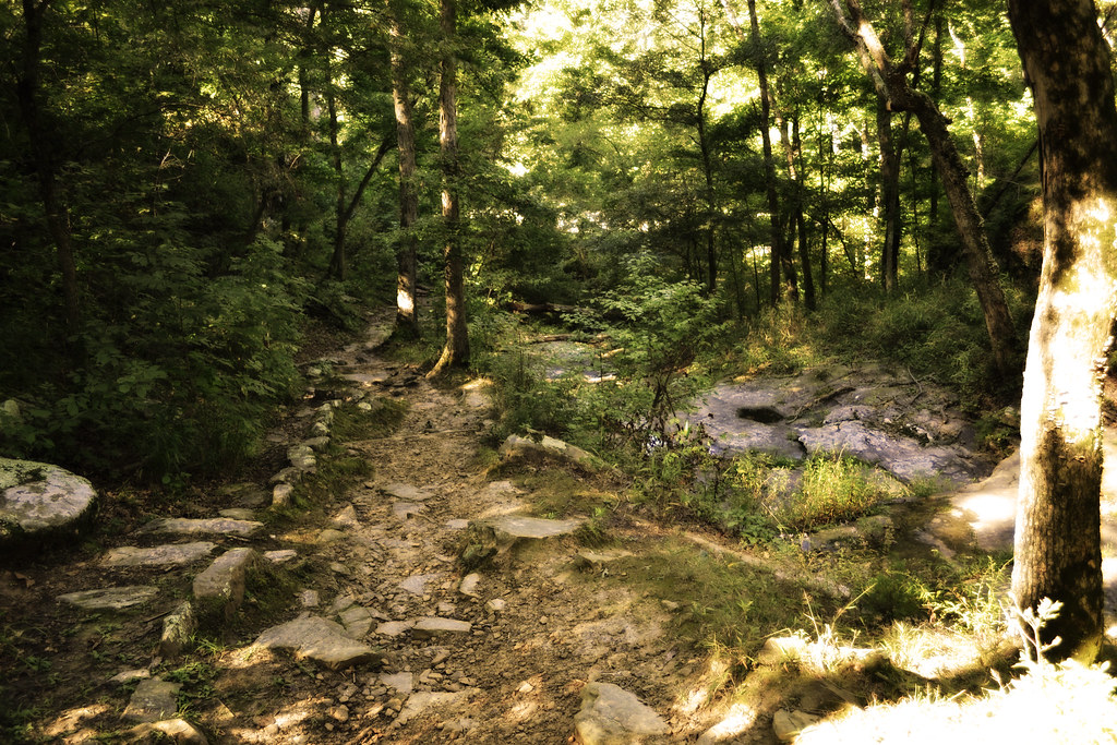
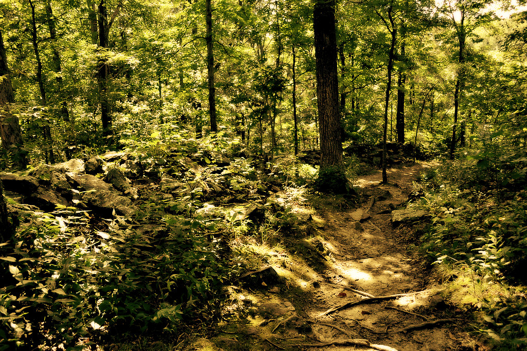
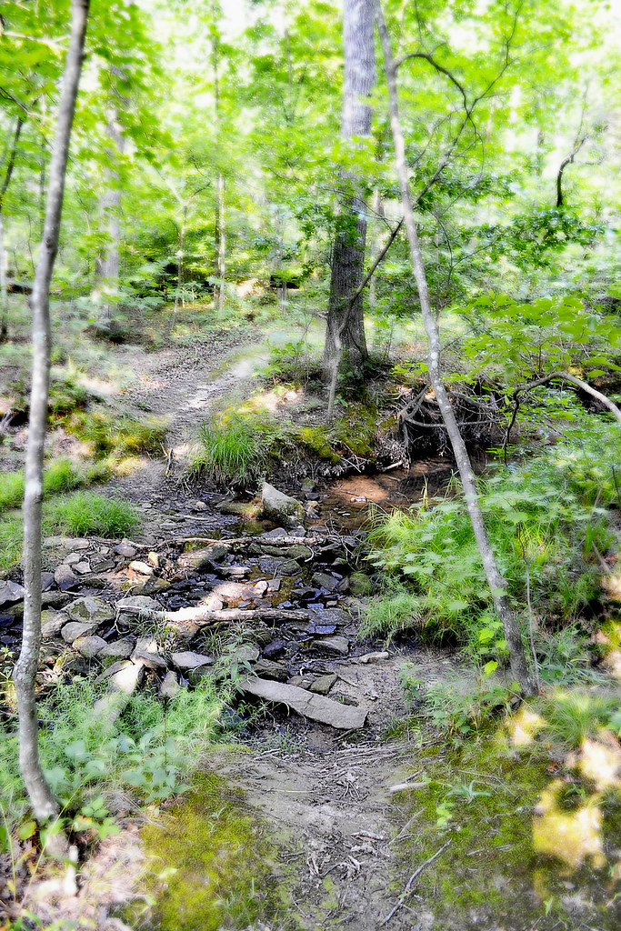
As we pass the patented National Forest sign, indicating the entrance to the Rock Pile Mountain Wilderness, the trail begins as a well worn dirt and stone trail, curving into an elongated C on our map as it winds down the Little Grassy Mountain. The "maintained" portion of the trail stretches for two miles and can be difficult to spot from time to time. As we hiked I noticed many false and game trails that lead to the east and west that could easily trick an unsuspecting hiker into following them for yards, or possibly miles. Because of all the false trails, I checked my compass frequently and compared my surroundings to the map I had packed and marked before venturing out. At approximately the one and a half mile mark on the maintained trail you reach the summit of a small hill, the rock formations and pines here provide a perfect place to take a quick rest, snatch a snack, enjoy a breeze and breathe in the lightly pine scented air. It is also a great place to find yourself veering off trail, completely by accident. It was here that we met a local hiker, out to enjoy the weather and a crisp hike through the wilderness. As we hiked, I corrected his path a few times, as he nearly went off course here at the top of the hill.

We Meet Another Trekker.

Local Treks: Backpacking
Given the difficulty of being assured we were following the trail, our new found hiking partner let us in on some great bits of insight pointing out a few local landmarks by which I could triangulate myself on my map should we become very lost. In fact, on the map, as we descended down the hill, he noted the way the "maintained" trail bent, to the southeast, just before ending and then pointed at purple markings on the trees. Those purple markings indicated the private property lines of the adjacent landowners, and also provided a great way to know that we were quickly approaching the backwoods trail in less than a quarter of a mile or so. It also helped me to gather a specific measurement of how far we had hiked and the near exact point of our location on the map. He also pointed out orange blazes on trees noting they had been left there by the local fire department who had been called out to Rock Pile Mountain to rescue lost hikers the year before.

Watch Out For Obstacles, Remember That Map?

Local Treks: Marked up map
Scribbling on your map is a'ok!
I had to remind myself of downed trees and other landmarks.
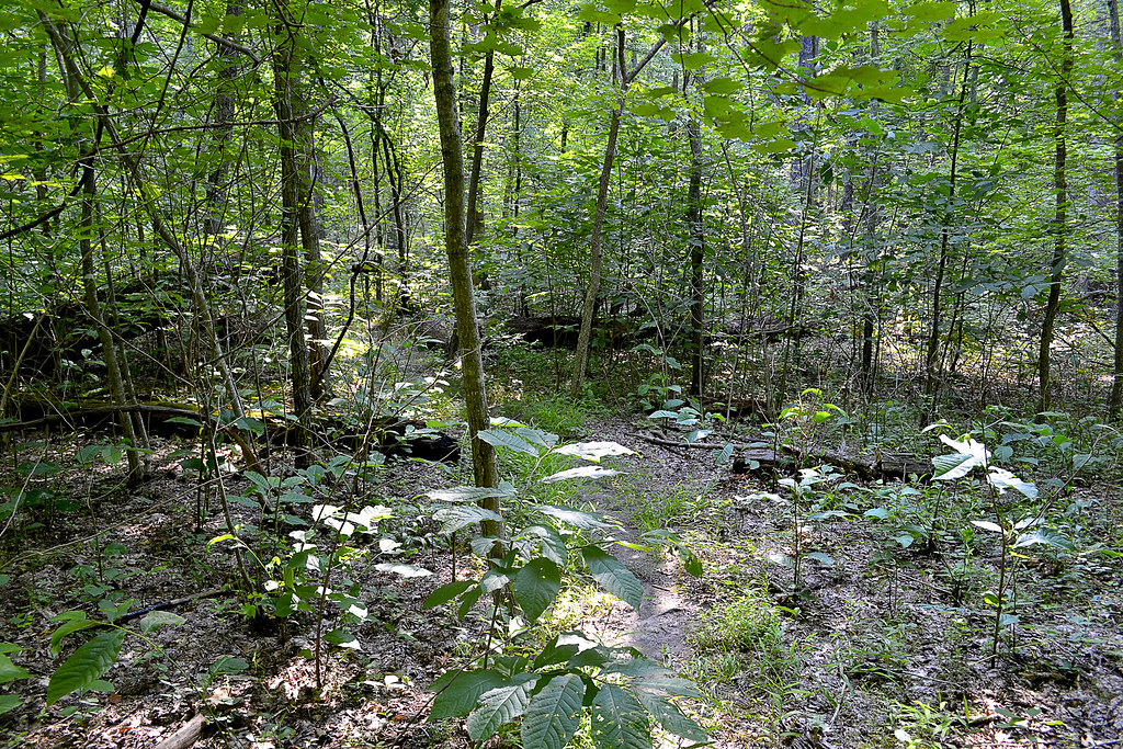
We continued hiking with our local partner for about a mile or so, until we hit another navigational hazard, downed trees. Lots and lots of downed trees. These obstacles had been somewhat more frequent than we were used to and began to get even worse and more frequent as we left the "maintained" portion of the trail. The downed trees could not have come at a worse place either, unknown by us, the trail splits here. Hidden underneath these trees was the actual split, and we originally headed to the east in order to get around them and back to the trail. When we skirted around the trees and picked back up the trail, I noticed that we were heading due east, opposed to southwest as the map indicated and after about 25 yards I stopped, knowing that we had either picked up a false or game trail. We all doubled back and decided to look for the trail again. At this point, our hiking partner, who was heading to a different destination than us, decided to simply head due west, confident that he would pick up the trail soon enough and we decided to navigate back toward the northwest to find the original trail and last known good location instead, and so we all bid farewell and happy trails.

Remember: Getting Away From It All Is Only  Fun If You Get Back...

Where we were actually at was the first of three official splits in the trail, shown on the map. Once we navigated back to our last known good location we opted to circle the downed trees to the west this time and sure enough, we were able to pick back up on the trail. With a quick check of the compass and glance at the map, we knew we were back on course to make it to the summit of Rock Pile Mountain. We were also lucky enough to spot the actual split, buried under a few trees, marked by an aged fence post with a rock set atop it. Although we would not see our local hiking companion again, we would spot evidence of his trail as we continued.

I've Never Been Happier To See A Color.

Local Treks: Orange tags
My new favorite color! Follow Me Orange.
Remember those orange blazes our local friend had pointed out earlier? The ones left by the fire department as they mounted a search for lost hikers? These came in EXTREMELY handy for us. Although I am a fairly competent navigator, these blazes seemed to be placed at just the right spots to remind me that we were, indeed, on course for the summit of Rock Pile Mountain. Just as self doubt would begin to enter, the trail would seem to disappear, or trees had once again forced us off the scantly viewable trail, these tiny bits of plastic would set my mind back at ease and assure us that we were on the "right path". However, realize that these markings will not last forever and there were very, very few other markings that would distinguish the actual trail from the numerous game trails that cross it, we were just lucky to have these navigational beacons for our hike, so please do not count on them to still be there. However, I'll mention here that we were able to get cellular reception throughout most of our hike, losing a signal only once as we were in a depression navigating around another obstacle to our path.

Our Final Destination And A Possible Ancient Relic.

Local Treks: Me in rock pile
Finding a spot of enlightenment and my center, in the Rock Pile.
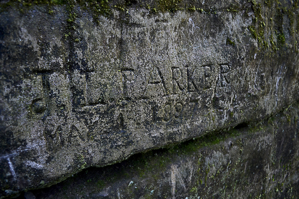
We would spot more orange blazes as we finally approached our final and ultimate destination, the peak of Rock Pile Mountain itself. A word of warning, there are many different "rock piles" on the peak of this mountain, obviously created either as a cruel joke or as an homage to the real rock pile itself. If you have GPS, here are the coordinates - 37°25.222' N, 90°25.199' W - I took from the center of the "real" Rock Pile. For those without GPS assistance, it lays just to the northwest of a large granite clearing, search, I assure you will find it. Keep in mind it is not located on the very tip-top of the mountain, but very close. According to what I've read this ancient circle of granite rock is believed to have been piled near the very peak of Rock Pile Mountain by some earlier man. The original Rock Pile, for which this entire area and mountain was named, was over four foot tall. However, according to some accounts I have read, due to present day travelers and inconsiderate visitors the Rock Pile now is just over a foot or two in areas, but you can certainly see that it is created by man, for some purpose... The exact purpose, well, we'll most likely never know.

Overall Thoughts: I LOVE This Place.

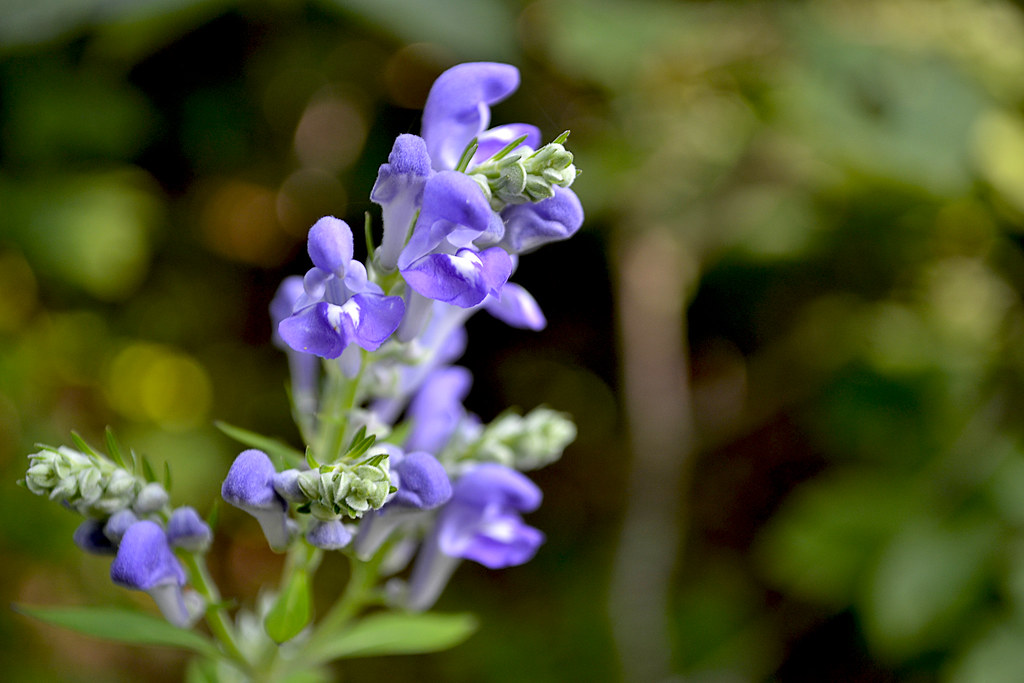
Overall, our hike to Rock Pile Mountain was fantastic. We could not have asked for a better day and botanists would fall in love with the variation in local trees here; as the wilderness supports basswood, butternut, Kentucky coffee tree, walnut, sugar maple, and magnificent white and red oaks. If you find yourself hiking in Spring, as we did, you'll also notice as you near the man made ponds the sing-songs of frogs as they serenade in hopes of a mate. Evidence of white-tailed deer, turkey, and other large game abound, we spotted many tracks for the deer and heard them as they escaped, just out of view, on our return hike. Another thing to watch out for, although we found no tracks or evidence, are black bears. There have been quite a few spotting of these bears in the Rock Pile Mountain Wilderness, so please keep this in mind, particularly if you are camping in the area as you should suspend your food items in a bear bag, high in a tree. The last thing you would want during a wonderful camping trip would be a humongous hairy camp crasher.

Keep In Mind: I'm A Wilderness Fan-Boy...

Local Treks: The Rock Pile
I'll admit, I'm partial to wilderness areas. I enjoy the relative solitude, the complete lack of crowds and the feeling of truly being alone and yet one, with nature. The lone hiker we encountered was the solitary exception to the general experiences I've had in the Missouri and Illinois wilderness areas and the other hikers (remember the newer RAV4 at the trailhead?) we never spotted, and once our traveling companion went out of sight at the downed trees, we never spotted him again either. In our wilderness areas I find that the birds sing a bit bolder, nature takes an extra second before darting for cover, the general fresh air seems fresher, and Rock Pile Mountain Wilderness was certainly no exception. I can't recommend this area enough if you're looking to get away for a day hike or if you're planning a remote backpacking trip, just don't forget to print a map and take a compass. Remember, GPS devices may run out of battery, so if you're using one be sure to bring extra batteries. In fact, that is the reason that I did not take many pictures during our visit here, I had reserved my phone for an emergency only, turning it off as we hit the trail in order to conserve all battery life. I hope you decide to visit this great wilderness area, I'm sure you'll enjoy it just as much as we did!

One Last Thing...

All packs are not created equal. One thing to keep in mind, if you are back packing like we did, keep your load light and properly adjusted or, well, there's a picture below. My fingers became pretty swollen due to hiking with too much weight on my shoulders and not enough on the hip belt. Hopefully you'll get as big of a snicker at this as my wife did... Happy trails to you!

Local Treks: Swollen fingers from backpacking


More Information: 

Local Treks on facebook 
Mark Twain National Forest: Rock Pile Wilderness
Rock Pile Mountain Wilderness on Wilderness.net
Mark Twain National Forest Brochure of Rock Pile Mountain Wilderness (with trail map)
Mark Twain National Forest Recreational Opportunity Guide for Rock Pile Mountain Wilderness (with trail map and driving directions as well)
Official USGS Rock Pile Mountain Quadrangle Map (use with the trail maps above)
  - Note the USGS map above is a HUGE file and in pdf format.
Wilderness Areas: Let's Get WILD! (post on wilderness manners and what to expect in a wilderness)
The Official USGS Maps Page (helpful for all types of maps, and FREE!)
Tiny. Tenacious. Terrible. Ticks. - A post on how to keep those bloodsuckers at bay!
How To Take A GREAT Day Hike

Coordinates:

Trailhead GPS Location: 37°27.811' N, 90°24.311' W (taken with Samsung Galaxy S4)
Rock Pile GPS Location: 37°25.222' N, 90°25.199' W(taken with Samsung Galaxy S4)
 

Thursday, May 8, 2014

Breathe Deep: The Black Locusts Are Blooming!


We certainly hope you are as fortunate as we feel right now. As we take our daily "urban hike" down sidewalk on Hopper Road in Cape Girardeau, we are lucky enough to have the fresh scents of the Black Locust (Robina pseudoacacia and may also go by the less commonly used False Acacia) floating on the breeze for us to enjoy throughout our trek. In the rare spots that we cannot smell the sweet fragrance from the Black Locust the fresh Honeysuckle fills our senses instead. The smell is so intense and so sweet, I wish I could bottle it to refresh my memory of a warmer time during the Midwestern winters...

How To Identify A Black Locust

Above is a photo of the very Black Locust blossoms that have been providing us so much olfactory satisfaction this May. You may identify the trees by their compound leaves, raceme hanging white to purple blossoms, and, of course, that highly noticeable aroma. These trees may reach a height of over 70 feet and are similar in appearance to the Honey Locust, although the Black Locust lacks those frightening looking thorns! The Black Locust is native in the United States from Pennsylvania to northern Georgia and stretches its home as far to the west as Arkansas and Oklahoma.

Wednesday, April 30, 2014

American Hiking Society's National Trails Day June 7th


American Hiking Society’s National Trails Day® 2014
American Hiking Society’s National Trails Day® will bring together outdoor enthusiasts across the country on Saturday, June 7, 2014, for the 22nd annual celebration of America's magnificent trail system and its countless supporters and volunteers. More than 2,000 nationwide events will take place including trail maintenance, hiking, paddling, biking, horseback riding, bird watching, running, trail celebrations and more!   To find an event near you, visit http://www.americanhiking.org/ntd-events/

National Trails Day® encourages all Americans to connect with local outdoor clubs, businesses, community groups, and parks and recreation departments as well as federal land managing agencies to experience, appreciate, and share the natural places we cherish. "Twenty years ago, American Hiking built National Trails Day® around the idea that for one day each year we should come together outdoors and give back to our favorite trails.  Since then, people from all walks of life have been coming out in increasing numbers on NTD to celebrate our trails and the great outdoors,” said Gregory Miller, American Hiking Society president.

Since 1993, National Trails Day® has inspired millions of individuals and community groups to take part in activities that promote healthy living and mental well-being, protect green space, educate youth and adults on the importance of trails, and instill excitement for the outdoors. Plan now to host or attend an event in your area, visit http://www.americanhiking.org/national-trails-day/ for more information or to host your own event! 

Looking to get outside and on the trail right now? Currently the American Hiking Society 2014 Trails Day Challenge is in full swing and is a GREAT lead up to National Trails Day! Visit http://www.americanhiking.org/national-trails-day/2014-challenge/ to see if there is a hike location near you! Then just "take a hike", snap a photo of yourself on the trail, tweet the pic to @Americanhiking and tag either @Americanhiking or @MenashaRidge with the hashtag #NationalTrailsDay. How easy is that?

American Hiking Society’s National Trails Day® is a nationally recognized trail awareness program that occurs annually on the first Saturday of June and inspires the public to discover, learn about, and celebrate trails while participating in outdoor activities, clinics, and trail stewardship projects.  National Trails Day® is a registered trademark of American Hiking Society.

Founded in 1976, American Hiking Society is the only national, recreation-based nonprofit organization dedicated to promoting and protecting America’s hiking trails, their surrounding natural areas and the hiking experience.   

To learn more about American Hiking Society and its mission and programs, visit www.AmericanHiking.org or call (301) 565-6704.