Showing posts with label trail. Show all posts

Sunday, April 20, 2014

Millstream Gardens: Well Shut Me In!

Local Treks: Millstream Gardens Sign
More of my pictures from Millstream Gardens Atta'Way---->
Millstream Gardens is 916 acres of pure magic. The area holds wonders for nearly every outdoor enthusiast and boasts an appearance more reminiscent of the rushing rivers of Colorado than the rolling hills of Missouri. The wonder and natural beauty of Millstream Gardens and the Tiemann Shut-ins contained therein, beg you to take it slow, absorb in the natural majesty and savor every sound, especially the steady sound of rare Missouri whitewater, rushing through the smooth carved granite.

Local Treks: Millstream Gardens Blackberries
As you enter the Millstream Gardens Conservation Area, located just off of hwy 72 between Arcadia and Fredricktown, MO, you will come to a fork in the road. Turning left at the fork takes you to the "official" trail head for the Millstream Gardens trail. From the official trail head the hike runs for about one and a half miles through the woodlands and along the St. Francois River, connecting Millstream Gardens to the Silver Mines Recreation Area. This trail is not a loop trail, so once you've made the journey to the Silver Mines, you'll be heading on back on the same trail, making the trip a three mile trek.

Local Treks: Tiemann Shut Ins at Millstream Gardens
Local Treks: Tiemann Shut-Ins
For hikers with small children and disabilities you will LOVE the beginning of this trail, which hosts a half to three quarters of a mile of paved trail, featuring benches nearly every 100-200 feet. The paved trail also features a very unique low wooden bridge, which crosses a shallow creek, zigging and zagging back and forth creating an interesting crossing. While walking along this portion of the trail, keep a keen eye out for wild blackberries, I spotted them nearly everywhere on a summer trip to the area. At the end of the pavement you will come to a large wooden patio, which provides a perfect vantage point to take in a particularly beautiful section of Tiemann Shut-Ins (pronounced Tee-Man, according to the locals we spoke with). Why is it called a shut-in? Well here's a real "Ozark" answer: The term shut in comes from the stream or river being "shut in" or confined within a deep channel. Forcing the St. Francois River into this channel creates some decent rapids, and that's why the kayaking crews LOVE this portion of the river.

Local Treks: My border collie at Millstream Gardens
Who's a happy boy?
You'll want to spend some time here for sure. The scenery is absolutely astounding and you may find yourself snapping far more pictures than you ever imagined right here at this spot. It is also a perfect spot to dip your toes into the St. Francis River, let the kids (or yourself) splash around in the chilly water, leap from boulder to boulder, take in a quick snack or just sit, and let the sounds of the rushing water simply sooth you. On my first visit to this area, I can assure you that if my border collie, Hyatt, could speak he would have asked to never leave this spot. He splashed from rock to rock and along the sandy shores with the largest smile to ever grace a canine's face. Those of you with dogs will need to take care however, your shoes may give you ample grip on the smooth igneous rocks that form the shut-ins, but your pooch's pads and nails will not, Hyatt slipped into the water frequently as he attempted to follow the same route as myself.

Local Treks: Shark's Fin at Millstream Gardens
Heading East from the overlook you will find the beginning of the Millstream Gardens hiking trail, which is unpaved. As you make your way down the dirt path the trail you will find signs calling attention to landmarks such as Shark's Fin rock, a large angular rock, jutting up from St. Francis River, perhaps to take a bite or two out of some of the kayakers as they shoot the rapids. Other labeled points of interest you will find in this beginning section of the trail are Pine Rock Overlook and Double Drop Rapids. Pine Rock Overlooks provides a perfect perch to steal a few photos of the shut-ins as well. As you continue, ever eastward, you will begin to leave the Tiemann Shut-Ins area and enter the more heavily wooded portion of the trail.

Local Treks: Beautiful Dinner
I caught this bug nabbing a snack!
After the beauty of Tiemann Shut-Ins, don't fret! There is much to be found in the forested area of the trail as well, Millstream Gardens isn't all just pink igneous rock, river and shut-ins. As you continue your hike along the trail you will find majestic oak, hickory and shortleaf pine in the upland woods, complimented by ash, elm and maple trees near the banks of the St. Francois River. The steady sounds of the river can nearly always be heard through the hike; providing a perfect background accompaniment to the bird solos and chorus provided by the wind blowing through the canopy. I spotted beautiful wildflowers nearly everywhere and took a great deal of photos of each, then upon looking at them closer at home, noticed that nearly every single flower hosted some type of stinging or biting insect. I'm certainly glad I didn't go sticking my nose straight in them! Other wildlife to keep an eye out for is white-tailed deer, turkey and... snakes during the warm months.

Local Treks: Mystery foundation at Millstream Gardens
The trail through the wooded area is relatively flat, with only a few hills that reside near the midway point of the hike. In the "hilly" areas, be careful of your footing as there is loose rock and occasional water trickling through or over the trail. When you find yourself approximately three quarters of a mile east from the Tiemann Shut-In patio, you may notice a lonely concrete foundation, just before the trail begins to follow the St. Francis once again. I scoured the area for any indication as to what the foundation may have been, but only confounded myself more, spotting three cylindrical concrete forms 15-20 yards to the east of the foundation on the north side of the trail. I've continued to look online and even ask locals around the area, but have yet to discover what the foundation may have been prior. The trail may seem to "split" here at the foundation, but the path that leads west is just a slight spur that will take you to a scenic little area of the river, that features a splendid view of a tall bluff that forces the St. Francis River to flow on its northern side.

Local Treks: Scenic Tree and St. Francis River Millstream Gardens
From here the trail continues eastward to the Silver Mines and Mark Twain National Forest. As the trail nears the banks of the St. Francis be aware that you may have to make slight deviations from the path, as rising water sometimes pools in these areas or deposits branches, twigs, trees and other objects that may block your path. Don't be too wary though, you will not have to step more than a few yards from the clear trail in order to get around these small "trail-blockers". If you've brought a picnic lunch the large open field at the Silver Mines provides not only a wonderful place to take in the scenery and spot TONS of wildflowers, but also many picnic tables as well so that you may sit alongside the St. Francis River, take a reprieve and prepare for the wonderful return trip to Millstream.

In fact, upon your return to Millstream you may want to take the path that leads west from the Tiemann Shut-Ins overlook. This trail will lead you to another perfect picnic spot, this one featuring a vista over looking the St. Francis River, a picnic pavilion, and one of the most twisted pine trees I've ever seen, just check it out below!
Local Treks: Millstreams Garden picnic pavillion and twisted pine
Enjoy a picnic with a view of the river and one TWISTED pine!

As with any trip into the woods there are ticks in this area, so you may want to brush up on what keeps them at bay and how to remove one should it embed. And of course if you're taking children along, you may want  to check out some tips on how to take a GREAT Day Hike. Thanks for reading, be sure to leave a comment down below or check us out on facebook!

 
More Information:
Mill Streams Garden Conservation Area on mdconline
Millstream Gardens Area Map
My Flickr Gallery of Images
Local Treks on facebook
White Water and Rock Hounding: Silver Mines Recreational Area
Tiny. Tenacious. Terrible. Ticks. - How to keep those bloodsuckers at bay!
How To Take A GREAT Day Hike


Monday, March 10, 2014

Panther Den: Don't Forget Your Map!

Local Treks: Panther Den Wilderness Boundry Sign

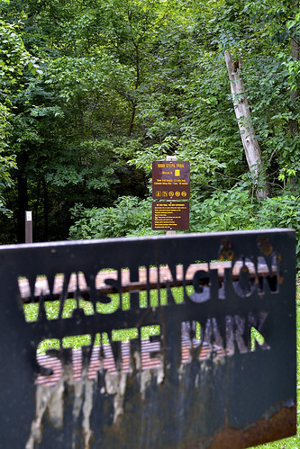
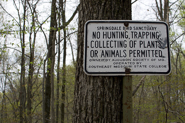
Panther Den Wilderness may be the smallest wilderness area in the state of Illinois, but it packs in some of the most distinctive and maze-like rock formations you may ever see! This distinctive and unique area boasts over 820 acres of land and is bordered by Crab Orchard Wilderness, which offers an additional 4050 acres of Illinois wilderness to its north. Before you read on, you may want to brush up on Wilderness Areas (Let's Get WILD) is and print yourself off a map of the area.

How To Get There
Finding Panther Den Wilderness may be, in itself, a bit of an adventure. If you have been searching for directions I'm sure you've encountered a thousand different versions out on the internet. Some talking about private land others talking about washed out creeks, heck some may even be saying you'd better just float on in from the north on one of the fingers of Devil's Kitchen Lake. I guess I'll go ahead and add another way to get there, ours was simple and fairly straight forward.

From Cape Girardeau, MO we started across the Emerson Bridge into Illinois and followed highway 146 East through Anna, IL turning left on Lick Creek Road near the outskirts of town. After traveling about eight miles down Lick Creek Road, we veered off to the left onto Grandview Road, following it until again veering left onto Hall Church Road. Follow Hall Church Road until you are able to turn right on Rocky Comfort Road, enjoy this last bit of paved road. Continue down Rocky Comfort Road for about three miles until you can make a right turn onto Panther Den ROAD. Welcome to the gravel my friend! Now, follow Panther Den ROAD for a bit over a mile or so, until you see
Panther Den LANE on the left. You'll notice this road is in pretty rough shape (or at least it was in 2013-14), keep to the right as it is a one lane road, and you will see the parking lot at the end of the road on the right.

Local Treks: Panther Den Trail Markers 001 & 371
Pay attention to the trail markers out here:
The Panther Den loop is 389,
the trail back to the lot is 371,
and the River to River Trail is 001.
See the Quick Trail Note below.
The Trail
One of the first things you may notice as you approach the trailhead is that there is a complete lack of information and maps on the Panther Den Informational Board (or at least there was on all of our visits in 2013-14). I don't know if all the information fell off, was stolen, or if a pack of wild dingos with a taste for maps and information strolled in and devoured all postings. So be sure to print off a map of the area before you leave home, read my cautionary tales below if you don't think having a map is important...

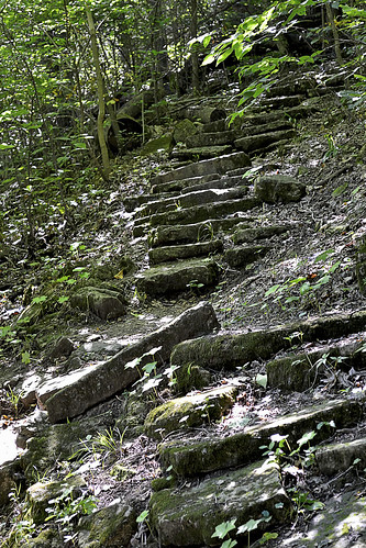
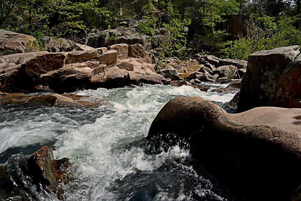
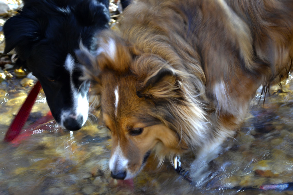
The trail itself begins as a mixture of gravel and dirt, featuring many planned switchbacks which help to reduce the wear and tear of erosion on the trail and wilderness. The switchbacks also make the hilly terrain a bit easier to traverse. The rolling downhill hike will bottom out with a small creek crossing, be alert here as we have found this a fantastic place to find local wildlife visiting for a refreshing drink. From here you'll travel up a small hill be sure to veer left at the trail intersection and that will take you to a welcome sign for the area. You can now follow the trail around the Panther Den or, better yet, go inside the magnificent sandstone formations for which the entire wilderness area is named!

Quick Trail Note:
The Panther Den loop makes use of the 389 white diamond trail markers/blazes, however these markers are sometime sparse and, I suspect, stolen by idiots. You may see markers up for 389-A and 389-B, both of which are small spurs, these spurs seem to be old, abandoned trails. My experience is that 389-A and 389-B are generally overgrown and hard to navigate (I became pretty lost on what I believe now to be 389-B). I'd suggest staying on the main 389 trail and then following the 371 trail marker back to the parking area. 001 is the designation for the River To River Trail, which runs through and connects Panther Den Wilderness and Crab Orchard Wilderness.
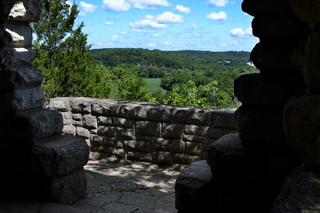
Enter The Den!
Local Treks: A "Room" at Panther Den
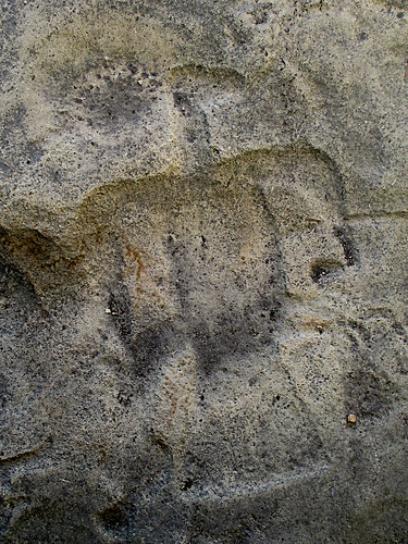
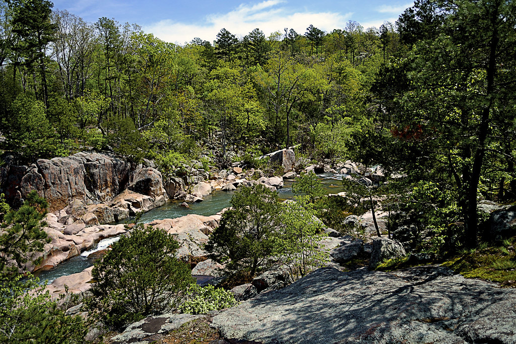
One of the many "rooms" within the
Panther Den rock formations.
Inside Panther Den, you'll find these huge sandstone formations seem to form rooms, hallways, and even floors. Some of these formations are so angular that you may have an "Ancient Aliens" like feeling, wondering if perhaps some ancient astronauts visited the area eons ago in order to lay down rock foundations and rooms to inhabit. One particular "room" in Panther Den seems to even have a poured foundation. In reality though, aliens didn't have anything to do with it, all of the formations are natural... Or are they?

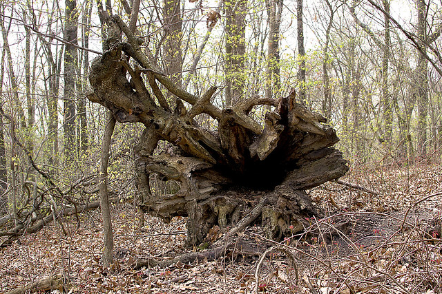
You can easily spend hours inside of Panther Den, leaping from cliff to cliff, poking into every crack and crag, squeezing through narrow crevices and splits or just running your hands over the smoothness of the sandstone. There are small waterfalls to be discovered, side trails to be explored, cairns to be constructed and plenty of places to hide as well; so you can jump out and scare the wits out of your friends and family. And, although you won't find any panthers in Panther Den (at least not since the 1870's) you may spot some other local wildlife such as whitetail deer, turkey, muskrats, beaver, and skunks. If you are really lucky, you may even get a rare glimpse of a bobcat or mink. So be sure to keep your eyes peeled!

Local Treks: Panther Den Meeting Cairn
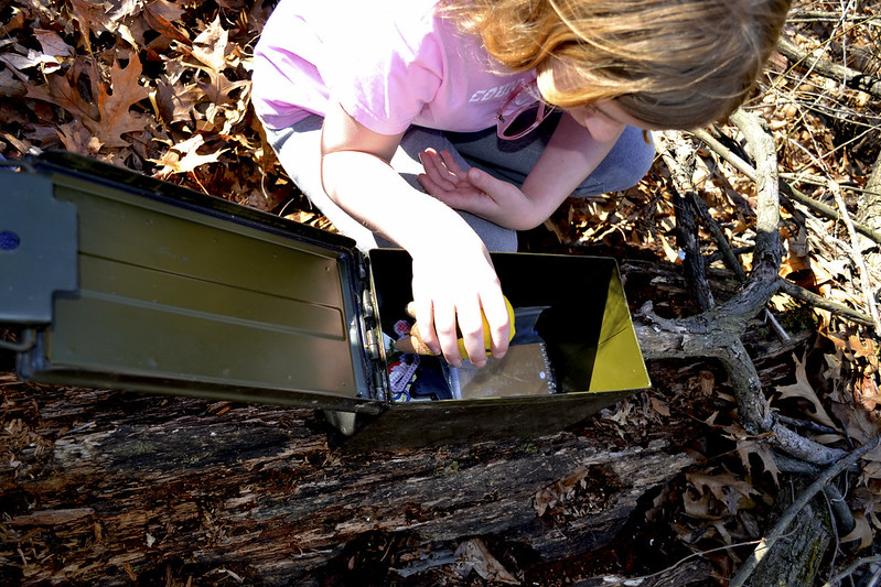
Be sure to set a meeting place up.
Just in case.
You will also find many sandstone "coveys" carved into the rock in the area around Panther Den. These sandstone overhangs offer shelter to an uncommon wildflower, French's shooting star (Dodecatheon frenchii). Unfortunately we didn't spot a single one on any of our hikes. But, if you would like to see or find one I would suggest hitting the area in May or June and seeking out sandstone overhangs near running water. Although the French's shooting star is not currently on Illinois Threatened and Endangered list, it is still considered a sensitive species in the state. So if you are lucky enough to find a colony of these beautiful little wildflowers, please take only pictures so that others may be able to enjoy their beauty as well.

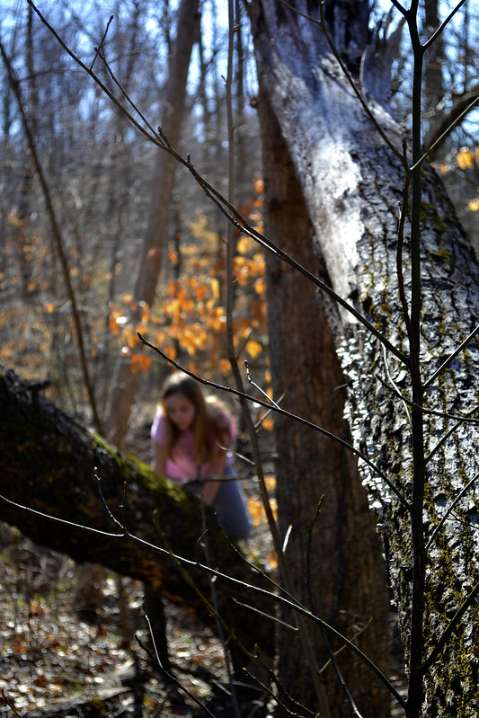
You may also want to stick together while exploring the inside of the formations, or at the least set a place and time to meet up in case someone gets separated. It is very easy to get lost within the maze-like formations of Panther Den. Children (and parents) may freak out if they suddenly find themselves separated from the rest of the group. If you become horribly lost remember that a distress signal in the woods consists of three successive sounds; be they yells, shots, claps, whistles, or any other signal.

Camping
There is so much to be explored in Panther Den that you may even consider camping within the area. If you do, remember that you are within a wilderness area. You do not need a permit and the US Forest Service asks only that you practice "Leave No Trace" ethics and camp a minimum of 300 feet from any established trails. Most of the "user" camps that you will encounter are far too close to established trails and have left obvious marks on the landscape. You are encouraged not to use these campsites so that these overused areas may recover. Of course, you may want to read up on what a wilderness is and always remember to practice your very best Wilderness Manners.

Now that I've told you of how beautiful and truly distinct Panther Den Wilderness is, I'd like to give you two quick stories of warning. 

Story One: Our First Trip
Local Treks: Panther Den Natural Hallway
On our first outing at Panther Den Wilderness we became lost. Very lost. Playing victim to many of the "trails" as we ventured further into the wilderness. We had inadvertently stumbled upon an old, abandoned equestrian trail that twisted and turned through rugged terrain. As I continued to notice the decline in the quality of the trail, I became (silently) alarmed. I could tell we were no longer on an established trail and we had taken so many lefts and rights, I could not recall from which way we had come. Luckily I had my phone, turned off, in my pocket. No bars. We continued to hike and I continued to quietly check my phone. A bar lit. I stopped and instantly hit the button for Google Maps. Once it loaded I found our heading and took note of where the trailhead was on that small, smart phone screen. Had it not been for that stroke of luck we may have been lost for hours in Panther Den Wilderness. This is the experience that taught me to never, ever, set out on a trail without a map and an idea of the route I wish to travel.

Story Two: Stranger on the Road
Local Treks: Kissing Trees at Panther Den
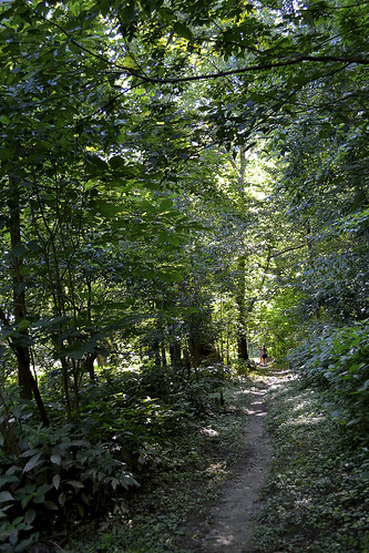
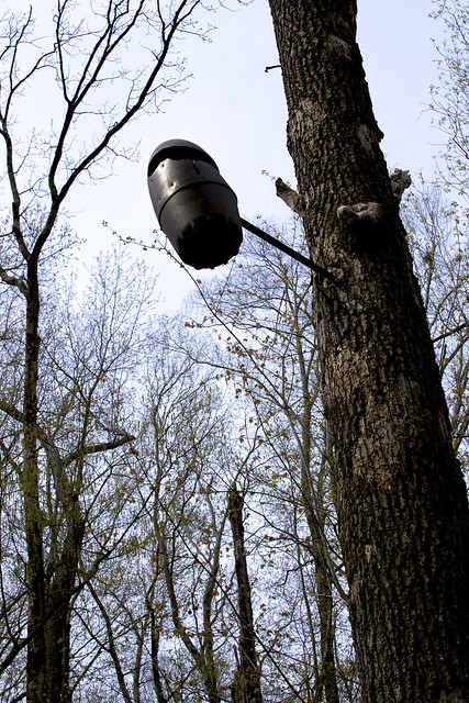
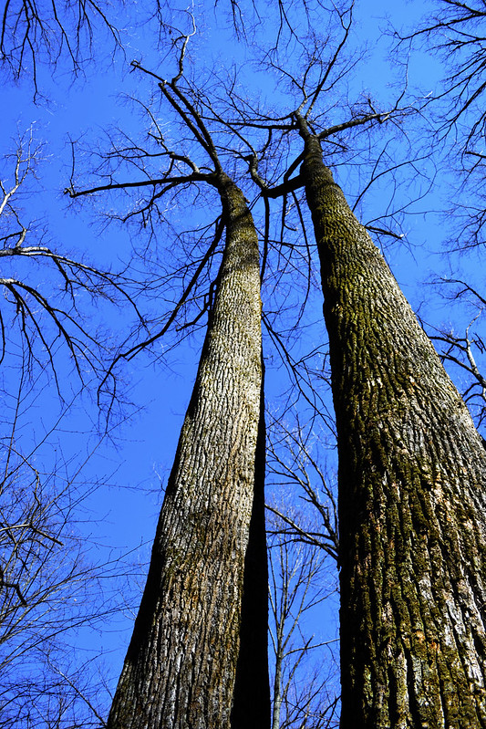
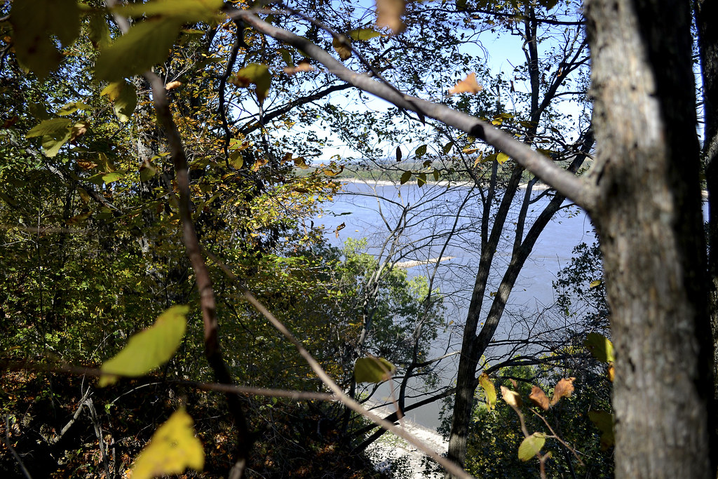
Panther Den Wilderness is for tree lovers...
On our second visit to Panther Den Wilderness we made our way down the gravel road toward Panther Den Wilderness, when we noticed a man wandering aimlessly nearly a mile from the trailhead. It was apparent to me that he was lost and I slowed down to see if he needed any assistance. He sheepishly admitted to us that he too had fell victim to one of the "false" trails of Panther Den and as we drove him back to the trailhead, he told us he had been wandering for hours, without a phone or map, happening upon the road by pure chance. I could tell he was embarrassed, as I had been just a few months prior, of becoming so lost. He was an outdoorsman, confident in his abilities to maintain a heading and follow a trail, it was this over confidence (which I too had suffered) that led to his unintended side adventure, and his catching a ride with us back to his truck. His last words to us were, "I can never let my wife know about this."

So now, please, take this map. Print it. Fold it. Put it in your pocket. It's simple. If you plan to visit Panther Den Wilderness and truly explore the area I cannot stress the importance of having a map on hand enough. Safely experiencing the beauty and sheer uniqueness of the area is worth the ink!


More Information:
CLICK HERE AND PRINT THIS MAP!
Visit Local Treks on facebook!
Wilderness Areas: Let's Get WILD!
Tips: How To Take A Great Dayhike  
Illinois Wildflowers (online guide with pictures)
A Conservation Assessment for the French's Shooting Star (warning: good read, pretty scientific)
National Geographic "Backyard Bird Identifier"

Wednesday, August 28, 2013

How To Take A GREAT Day Hike

Local Treks Hiking: Single Red Leaf

We've all been here. The TV weatherperson just called the upcoming weekend the "very best ever!" and the smiling sun graphic behind them has you wanting to get out, get in touch with nature, breathe in a bit of fresh air and nab some exercise while you're at it. If you're looking to hit every one of those points out of the park, get on out and take a day hike. If you follow a few simple steps, I'm sure you'll find that a day hike is simple, easy and TONS of fun.

Local Treks Hiking: Millstream View
Where do you want to go?

This is the most important question you can ask yourself before getting into the "meat" of your potential hike. Head to the internet and search your local state and national parks, or better yet read a review or two right here on the blog. If you haven't hiked much you may want to keep your hike short, seeking out 1-2 mile "loop" style trails, be sure to allow yourself plenty of time to soak in the beauty of your surroundings. A loop trail will make a circle and upon completion should take you right back where you started, at the trail head.It is always best to find a topographic map as well, be sure to look at the elevation as every mile hiked up 1000 feet will feel like three miles hiked flat.

Local Treks Hiking: Climbing Tree
Wear the right clothes.

I like to wear loose fitting clothes, not so loose that they may get in my way in an attempt to trip me, but loose enough that they don't bind me or feel restrictive when I walk, climb or scramble over rocks and boulders. If you want your clothing to run double duty for you be sure to wear light colored clothing, to help avoid ticks. You may also want to spray your clothing down with an insect repellent that contains 20% DEET or make your own homemade bug repellent to keep nasty insects at bay as well, keep in mind, insect repellant doesn't last forever, you'll have to re-apply (usually after 2-3 hours). You may find some good deals on outdoor clothing online, I've found some good deals at The Clymb (you'll need to register though).

Local Treks Hiking: Hiking Shoes
Wear the right shoes.

You don't have to wear hiking boots when hiking, in fact, I don't even own a pair. Personally, I prefer a pair of trail running shoes (or just regular tennis shoes), they are light, responsive and I've found that they grip the trail and rocks quite well. Just be sure that these shoes are comfortable and for the love of Pete, don't ever, ever, ever wear a brand spanking new pair of shoes or boots into the woods. You're begging for them to be ruined and get some wicked blisters as well, always be sure to "wear in" your shoes before really tackling any trail mileage.

Local Treks Hiking: Little Grand Canyon Trail

Find some hiking buddies.

If you're able, grab a few friends and take them with you, bonus points are given (but not rewarded) for nabbing up pals that are experienced hikers. Better yet hop on the Local Treks facebook page and see if anyone else is interested in meeting up! For my fellow hikers that love to take to trail with friends of the hairy and four-legged design, pay special attention when researching your hike as not all state or national park areas allow for pets, even leashed. Let other folks know that you are leaving, even if you're heading out with a group, be sure to indicate where you are heading and what time you expect to be back.

But, I "Vant to be alone"...

Ok there Garbo, not everyone enjoys the outdoors with others. I know that some seek the solace and tranquility that can only truly be attained through absolute "aloneness" and from time to time I dig doing this myself. But before you leave, be sure to let friends and family know where you are going, what time you expect to return and tell them you'll call them once home. Should something happen to you while you're out hiking you'll thank your lucky stars you did this.

Local Treks Hiking: Cut Tree Trail

Pack smart and pack light.

Going on a day hike with a 25 pound pack on your back, most likely, isn't going to result in a "good time". No one is the same, so be sure to make a checklist of what you need to take with you. When I hit the trail I take a small backpack (the same type that kids truck their books to and from school with, a cheap old Jansport):
  • A pocket knife: Conveniently placed, you guessed it, in my pocket...
  • A lighter: I don't smoke, but should something go wrong I want to be able to start a fire, for signaling, warmth or cooking. Also conveniently placed in my pocket.
  • A cell phone: Turned off and placed in my pocket. Nothings more annoying to you or other hikers than your ringtone of awesomeness over the sounds of nature.
  • A compass: It's always comforting to have one of these with you, learn to use a compass and map (it's easy) correctly. Placed in my pocket.
  • A printed map of the area: This is a must. Don't hike without a map of the area, it's that simple. If you get lost this could save your bacon. Maps usually have interesting sites and attractions marked as well, so it helps to keep an eye out for landmarks and potential, slightly off trail, sites. Folded and stuck in my pocket.
  • Water: I've heard that 3 liters per hiker is adequate, I take a 2 liter Stanley vacuum bottle filled with ice water and another 1.5 liter stainless steel water bottle on my hikes and that is plenty of water for me. When hiking with the family, I'm the mule, although my wife will carry water as well. Please don't drink the water on your hike unfiltered, unless you absolutely dig diarrhea, and cramps, and pain, and possible death.
  • Food/Snacks: I love peanut butter crackers. Love em. They make it into every single pack I take with me. I generally only pack food that can be consumed and safely carried at room temperature, so apples, beef jerky (mmmmm), trail mix, pears, oranges, fruit snacks, etc. However, just because you're eating a piece of fruit doesn't make you immune to "pack out what you pack in", keep those cores and peels until you can dispose of them properly in a trash can.
  • A small, but effective first aid kit: Here's what I have in mine; Band-aids, a few Ibruprofen, antibacterial ointment, rain poncho (can double as a little shelter if absolutely needed), 10' of para-cord, gauze, and medical tape.
  • A camera: It's simple. I don't hit a trail with out either my Nikon D3100 (and maybe a lens or two) or my little Canon point and shoot, depending on the length and difficulty of the hike.
Local Treks Hiking: Hypno Toad

Thank you for reading, hopefully this will help you the next time you decide to hit the trail.

Am I missing something? If you have any questions or comments or if you have something for me to add to the list above, just let us know, either here on the blog or on the Local Treks Facebook page.

Cheers!
More Information:
Map Compass 101 on YouTube by Packrat556
Leave No Trace - Wikipedia (Pack In, Pack Out)
The Clymb: A site to find good deals on outdoor products and clothing

Thursday, August 22, 2013

Washington State Park: Take 1000 Steps Back In Time


Washington State Park in DeSoto, Missouri, is absolutely amazing. Today the park features a park store, water craft rentals (canoes, rafts, tubes, and kayaks), gravel river banks to river swim from, rental cabins, campgrounds, swimming pool, playgrounds, trails and so much more; it is hard to imagine that it was once home to a group of Mississippian Indians over 600 years ago. It was these Native Americans that literally left their mark on the area in the form of fantastic petroglyphs, which are (for the most part) still undecipherable even today and the petroglyphs here make up 2/3 of the known Missouri carvings! For the outdoor trekkers you'll find the park is home to three trails: the 1.5 mile 1000 Steps Trail, the 2.5 mile Opossum Trail and the 6 mile Rockywood Trail (backpackers will find a camp on this trail). Although the family and I wanted to "hit em all", for our visit, we concentrated on taking time exploring the petroglyphs, park amenities and then took foot to the 1000 Step Trail.

The 1000 Steps Trail begins just across
the lot from the Thunderbird Lodge.
To reach the 1000 Step Trail follow the signs to the Thunderbird Lodge, which is an outstanding example of the African American Civil Conservation Corps handiwork, and park in the lot there. Now, I absolutely must give out a bit history here, because this trail is so unique and beautiful that credit simply has to be given to the Civil Conservation Corps (CCC). The African American Civil Conservation Corps Company 1743 began developing the park land soon after the land was aquired in 1936. Without their skill and stone-masonry most of the buildings (including the Thunderbird Lodge where the company's main camp was located) would not exist and the 1000 Steps Trail would not have a single hand carved step to its name. You will pass by many examples of their work throughout the park, but will find three awesome examples on this hike; Thunderbird Lodge, the steps themselves on the trail and a gorgeous overlook shelter that practically begs you to take a photo of the Big River and the lush valley that contains the float-tastic river. These buildings were placed on the National Register of Historic Places in 1985. Ok, now let's get to hiking!

The steps blend perfectly with the woods,
complimenting them rather than competing.
After checking out the Thunderbird Lodge, and maybe booking a float trip for later, you will quickly find the trail head for the 1000 Step Trail just across the parking lot from the lodge. The hike begins quite easy, with a well maintained dirt path (watch out for tree roots) that skirts the road and provides a ground level view of the Big River out in the distance. You will soon reach the loop portion of the trail where we took the left path and followed the Yellow (1000 Step Trail) Blazes. The trees that quickly envelop you are large and seemingly ancient, providing much needed shade for a summer's hike and (I would imagine) would provide a beautiful palate of oranges, reds and yellows during the fall. As we progressed you will see small examples of the CCC's attention to detail, with rocks that line the trail fading in and out, and small bridges that cross spans that are easy to hop. As you continue on and the Big River begins to disappear and the hardwood and pine woods surround you, the first of many CCC placed steps will reveal themselves, yet seem dissolve into the very environment in which they are contained, a perfect example of man working in coordination with nature. Now, while climbing these steps you will quickly notice the carpet of moss, lichens and plant-life, these may make the steps slippery so climb with a touch of caution.

As you make your way on the trail (primarily uphill that is), you may find turkey, deer, mischievous squirrels and other small mammals, as well as small toads and frogs (always a family favorite!), but keep a particular keen eye out during summer as the eastern collared lizard can be found skittering and leaping, upright on their hind legs, from rock to rock. The hardwood forest, consisting of towering Oak, Hickory, Kentucky coffee, sugar maple and slippery elm, has a good undergrowth of pawpaw trees, and if you're lucky you may even find a bit of fruit on one of those pawpaws (if the squirrels and deer haven't found them first). About halfway along the loop, the forest will begin to thin as you approach an opening near the nature center and the restrooms (both constructed by the CCC), during this bit of the hike you may find some wonderful wildflowers, including: Blue-Eyed Marys, Bluebells, Trilliums, Violets and Poppies a particularly lucky and keen eye may even find a rare Primrose, Fremont's Leather Flower and the ever so delicate Blue-Violet Nemastylis.

After searching for wildflowers and re-emerging into the forest, be sure to take the right fork to stay on the 1000 Steps Trail, unless you're looking for a place to picnic, then head left, as it takes you to a nice picnic shelter. As you continue on the trail you will soon come to one of the best scenic overlooks I've visited. The view allows for a panoramic glimpse of the Big River and the valley through which it runs and, when under clear blue skies that contrast the lush green of the valley, it's a hard view to beat. Better yet, you can enjoy the view from the quaint CCC constructed overlook building, which melds in perfectly with the surrounding bluffs upon which the site rests. At the overlook building you can also catch a refreshing breeze and closely examine the skill with which each block was cut, placed and set.

You may even "off trail" as small trail runs near the overlook.
After giving your soul a chance to absorb a bit of the Big River horizon, you can continue down the trail which will take you down a dolomite bluff, where rocks have separated from the face and some have tumbled onto the path. Watch your footing here as the rocks can easily slide out from underfoot and send you swiftly to the sitting position, perhaps bruising your pride and your tailbone. As you continue, be sure to look at the path itself, the small rocks imbedded and loose on the trail may be hiding a plethora of quartz crystals in their geode like folds and holes. Just before the end of the trail there is a perfect place to sit on the steps and simply take in the last bits of the serenity that surrounds you, breathe it in, take a few pictures and head back to the trail head.

After hiking the 1000 Steps Trail, and really being introduced to all the outstanding things to do in the park, we can't wait to return to Washington State Park. Next up with most likely be a backpacking trip through Rockywood Trail to view the quarry used by the CCC for the local buildings and a search for the elusive Missouri tarantula!
The overlook absolutely BEGS you to take photos here!
As always, thank you for reading. If you're interested in meeting up for hikes, sharing your hiking experiences and find great locations to explore please visit us on Facebook and give us a like.
More Information:
Like Local Treks on Facebook
Flickr Gallery of photos
Washington State Park
City of DeSoto, Missouri Webpage
Area Events (DeSoto, MO)
Local Weather Conditions

View Larger Map

Friday, August 16, 2013

For the Birds: Juden Creek Conservation Area & More!

We had passed the bird house topped ancient gate and the small sign, pointing the way to Juden Creek hundreds of times. It seemed each time we took a jaunt to Trail of Tears State Park we would say, "We really should drop by there" and then pass on by... But, something was different on a particular Sunday, something made us turn in to Juden Creek Conservation Area, and I'm glad that whatever unforeseen force pushed us to visit the small park did, because the questions raised on our hike provided me a better vision and understanding of the area and even a bit of its history.

First, here's the HIKE!
In order to get to the trail head, you will take Hwy 177 (Big Bend Road) north through Cape Girardeau, MO. You'll then turn right (East) on old Missouri Route V, then turn right on Cape Rock road. You'll discover the parking lot for the trail on your right. This fairly worn trail will take you through Twin Trees Park, across a narrow band of Juden Creek Conservation Area, and then ending (somewhat abruptly) in the Kelso Sanctuary Natural Area. This trail does have inclines/declines to it and is not surfaced, so I would consider it to be a "moderate" hike.

As we approached the trail head we were instantly aware of the wildlife, particularly the numerous songbirds, who chirped and sang as we began our journey. It wasn't far up the short ascent that the canopy of the hardwood forest quickly enveloped us as we made our way through the Twin Trees Park portion of the trail. A quick survey of the American Beech that are scattered throughout the woods provided me an explanation of why so many songbirds were to be heard here, as they love to devour the fruit of this tree. Interesting note on these Beech trees is that this is about as far West as you will find them, and one of the few places that they grow naturally in Missouri.

As we continued we noticed TONS of wildflowers just beginning to emerge along the trail, with nearly every color of nature's vivid palette brilliantly brushed on to their petals. I would find out only later, that this area is known for the migratory birdwatching and the wildflowers. In fact, Wildflower Walks are sometimes provided during spring by the Cape Girardeau Conservation Nature Center so be sure to check their page if you're heading out there!

In the trees we would occasionally spot odd, dark, egg-shaped canisters that we assumed were installed to serve as bird houses, in order to attract even more birds to the area, so that they may sing even more songs for trail goers. Many of these bird house seemed to have their entrances widened via the teeth of some squirrels or perhaps they were there to attract a different type of wildlife and had the entrances widened by man. If you may know what these canisters are there for, or what particular birds they may be attracting, please let me know. Despite my lack of knowledge as to whether or not man had widened these holes there was a distinct sign of man's impact on the landscape, the ravages of a suspicious 2009 brush fire, can still be seen on many of the trees and shrubs that line a good portion of the trail as it passes through the Juden Creek area.

Springdale Bird Sanctuary? Hmm.....
As we continued something else caught my eye. We began to see a scattering of signs for the "Springdale Bird Sanctuary", firmly attached to trees, yet I had never heard of such a place. Many of the signs were weathered and bent, some with the paint peeling, and others peppered with pellet holes. I began to wonder if we had somehow ventured into another park or conservation area, or worse, if I had begun to tread (unknowingly) onto private property. After doing a quick search of the area, and finding no evidence of us being on private property, we continued on the trail, noticing a small pond, just barely noticeable through the trees that the trail seemed to be winding around. This particular area seemed absolutely THICK with pileated woodpeckers, who seemed to stay close enough for us to catch quick, brilliant glimpses of their beauty, but quickly flying away milliseconds before my camera could fully focus on them. We would discover yet another type of sign, one indicating a nearby survey marker, but we could not find the marker the sign was designed to protect (or perhaps it protected the marker too well). Our journey on the trail ended at an old building foundation, with a man gazing at us from his backyard... We decided then it was time to head back.

Note that this is NOT a loop trail, or at least, it was not a loop trail on our experience. We did not go off trail and stuck only to the most worn portion, upon finishing our exploration of the old building foundation and waving to the staring man in his backyard, we simply doubled back and made our way back through the woods to the parking lot. But as we headed back, my mind was awash in questions on exactly what Springdale Bird Sanctuary was and why there was a gate topped with a single bird house, so...

Warning... History stuff below:
Kelso Sanctuary Natural Area began its life in 1937 as the Springdale Bird Sanctuary, when Judge and Mrs. I.R. Kelso donated 20 acres of land to the Audubon Society of Missouri in June of 1937, an additional 7 acres was added soon after. At some time during the 1960's or 1970's the area changed names to the I.R. Kelso Wildlife Sanctuary and I assume later changed to its current designation. As of today, the area consists of 23 acres of wooded area (according to the Missouri Department of Conservation), which is owned by the Audubon Society of Missouri and managed by the Biology department of Southeast Missouri State University. I have also read that the University has leased the land from the Audubon Society of Missouri for a dollar per year since 1962, that sounds like a pretty good deal to me! The Kelso Sanctuary has had multiple bridges, all of which crossed Juden Creek, and all of which no longer exist due to flooding. However, only one (of two originally) of the small birdhouses still tops the gate that led to the entrance and can easily be spotted from Hwy 177 (Big Bend Road) as you approach the Juden Creek Conservation Area turn. Rumor has it that there is a geocache located nearby as well...

More Information:
Juden Creek Hiking Map
Juden Creek Conservation Area
Kelso Sanctuary Natural Area
Cape Girardeau Conservation Nature Center
Audubon Society of Missouri Checklist for Juden Creek
Juden Creek Hike Set on Flickr

f/8 and Be There (blog on Springdale Bird Sanctuary history by Fred Lynch of the Southeast Missourian Newspaper)
Southeast Missourian Photo Gallery of Juden Creek Fire (Photos by Kit Doyle)
This is NOT the Home of the Birds (blog entry by Ken Steinhoff)


View Larger Map

Friday, July 26, 2013

Get Into The Flow: Amidon Memorial Conservation Area

The Castor River Shut-Ins of Amidon
Gorgeous. Absolutely, unequivocal beauty. That is what I honestly think about the Castor River Shut-ins area of the Amidon Memorial Conservation Area. In fact, I'm not sure those words can even do it justice, we may need to come up with a new word, just to describe the beauty of the flowing waters and brilliant pink granite rocks that are found there.

In order to get to the lot that contains the trail head for the Cedar Glade Trail, you'll need to take Route J east of Fredricktown, MO to Route W (make a right), then head East on County Road 208 (CR 208). CR 208 will turn into a dirt/gravel road while you ride along, so don't fear any toothless banjo players, but you should always keep your eye out for em', just in case... As you scoot down CR 208 you will come to a fork in the road, and in the middle of that fork you'll see a real grist stone from one of the old mills that used to be located on the land here, so take a second to park along the side of the road and take a peek, it is a pretty nifty piece of history. Once you're finished checking out the grist stone, take the fork to the left, County Road 253 (CR 253) and then look for a parking lot on your right, there you'll find the trail head of the Cedar Glade Trail that will take you to the Castor River Shut-ins. Did I confuse you? Then take a peek at this area map, it may help sort it out for you and, of course there is a map at the bottom of this post that will take you to the Google Maps version.

I swear Hyatt's smiling big here...
Now, the Cedar Glade Trail, a 1 mile long loop trail, has a bit of a Jekyll and Hyde personality to it. The Dr. Jekyll side, or the "good" side, is a beautiful, wide and well trampled trail that leads from the parking lot to the Castor River Shut-ins. The hike takes you through a forest of mixed hardwood trees, dotted with short leaf pine growth, you may notice some extremely large oak trees which have fallen over, root ball included on the sides of the trail. I don't know exactly what caused these mighty hardwood trees to topple, but they certainly were old growth. Keep an eye out for turkey, squirrel and deer as the area contains a decent population of them out here, we even observed the ever elusive domestic short haired cat, which sent ol' Hyatt (our border collie) into a frenzy. The Dr. Jekyll portion will finally empty you out at the Castor River Shut-ins and I'm sure you'll be just as impressed with the river as we were.

The smooth granite boulders of the shut-ins.
Here you'll see the Castor River as it carves through the baby's bottom smooth pink granite. The rocks are gorgeous and the river may even have a bit of a blue or green tinge to it, making the whole scene absolutely picturesque. As always, beautiful smooth rock and water are a combination for slips and falls, so watch your step as you traverse the pink granite boulders. After you have, lets say, dipped your toes into the free flowing Castor River and felt the warmth of the summer sun as you rest on one of the pink boulders, you should be ready to take on the last bit of the Cedar Glade Trail... The Mr. Hyde portion.

Photos can't do justice to the scenery here.
The Mr. Hyde portion of the trail is the more "difficult" in terrain, as you will be walking on some of the smooth (and most likely wet) granite rock surfaces and navigating a bit of a loosely packed rock trail that heads up in elevation. The trail here is not as well maintained and some of the rocks will slip from underfoot as you make your way up, however, the pay off is nearly as grand as the view of the Shut-ins was for the first portion, this portion of the trail offers an over look that provides a vantage of all that you just observed up close and personal. As you finish the loop, be sure to visit the restoration of the glades areas here, you'll find some beautiful wildflowers blooming in spring!

Now, it is a short trail, and when it ends you will most likely want more, we certainly did. But don't worry, there is more to explore at Amidon, remember that fork in the road from earlier. Well what do you think is down the right fork? I hope to write more soon on that right fork of Amidon, such as a little spot to swim called "Hippie Hole" and some free range exploring. So get your bathing suit ready and I hope you're not afraid of some crawdads and bit of river crossing in a car!!

More Information:
Amidon Memorial Conservation Area
Amidon Area Map


View Larger Map

Friday, July 5, 2013

Going On A Treasure Hunt: Geocaching!


Adding a geocache search, or two, or three can
add even more excitement to your hike!
While I was typing up the paragraph on our search for the geocache on the Peewah Trail in Trail of Tears State Park, I was reminded of just how much fun we have, as a family, searching for these little bits of hidden treasure. I'll admit, even as a supposedly full-grown adult, my eyes light up just as much as my daughter's each time we find a geocache, and I'm always anxious to see what is inside! My daughter enjoys trading out one of her trinkets for one of those contained within the cache, while my wife and I most enjoy looking through the log, noting where all those who found the container before us are from while we marvel at just how wide this community has become. Since our family enjoys searching for these hidden gems and we love to see the community get a bit larger and the logs contained within the caches grow and grow, I figured that I should write up a little bit more than a simple paragraph on what geocaching is and how you can get in on the fun too!

So, I guess I should start with the basics. Geocaching is, for the lack of a better description, a world-wide treasure hunt, where you navigate to specific GPS (Global Positioning System) coordinates in order to find hidden containers that may be as small as a pill bottle to larger containers the size of a metal ammunition box. Now, if you're like me, that GPS coordinates line is staring you in the face... It's saying, "Hey bub, this is complicated, you need to have expensive GPS equipment if you want ANY chance of finding a geocache." But here's the deal, that smart phone you carry, the one that has the GPS chip built in, can get you within 10-20 yards (or closer) of any GPS coordinates out there, and better yet, you didn't have to spend an extra dime! In addition to your GPS device or phone, you'll need to have a pen (for autographing the log) and maybe a trinket of some type to trade. Now, on to apps for the smartphone crowd.

For Android users the best I've seen available (remember this is all personal opinion) is CacheSense, which is available in a 30 day demo form at CacheSense Demo, now, there are others available just hit up Google and search for something along the line of "best apps for geocaching" followed by what type of phone or mobile operating system you use. For iPhone (and android operating system) I found the Geocaching by Groundspeak to be very beginner friendly and fairly easy to operate, but again, there are many out there, so don't take my word for it. One big minus for me on the whole Geocaching app by Groundspeak is that it's nearly $10 for the app, that seems pretty steep, but it integrates seamlessly with their site. I would just suggest that whatever app you use have an "offline" mode, so that you won't lose your geocache just because you lost your signal. Then it is a simple as either manually plugging in the coordinates of the geocache or downloading a file from a website such as Geocaching.com. If you use Geocaching.com to get your information from you will need to make an account, it only takes a second and its free.

So, while you're on Geocaching.com simply move your mouse cursor over the "Play" button on the menu bar, then select "Hide & Seek a Cache". The page there is pretty darn self explanatory, type in an address, a zip code, state or other area and click on the "Go" button. When we first began, we only did caches that were easy, and we started on a public trail near our home so the walking was easy. So once you've picked out your first geocache target, find the coordinates for your anticipated treasure hunt and enter them into your GPS device or app! All that's left now is for you to get on out there and find that cache.

Once you've found the cache (congratulations by the way!) be sure to sign the log book or log sheet and take a second to look at the names and locations of the fine geocachers that have found the cache before you. If you'd like to trade out for an item that is contained in the cache, well, I hope you brought something along with you, because the rules are, whatever you exchange should be of equal or greater value that that which you take. We really dig taking a few of the little figures you find in the $0.50 machines in supermarkets and such, we've also found that these are taken pretty darn quick, especially zombies for some reason. So, once you've signed the log and traded for a bit of something, or maybe just took a picture of the contents, you may want to log the your geocache find online at Geocache.com. Here is a short video on how to log a geocache once you've found it:


I hope all this helps and I'm sure that adding a geocache or two on your next hike will pay back in TONS of fun, just be remember to bring a pen and perhaps a trinket to trade with you. Let me know if you have any questions or want any additional information and, as always, thanks for reading and happy trails!

More Information:
Geocache.com - A great source information of all things relating to geocaching, a must hit for anyone looking to start!
Top Five Android Geocaching Apps - You don't have to take my word for it
Top 6 Android Geocaching Apps - In case you don't want to take my word or the link above's word...
Top 5 iPhone Apps For Geocaching - for the iPhone folks

If you like what you're reading, please share it with others. Look below there, hit up the G+1 or share this blog on facebook, twitter or who knows... Cheers!

Wednesday, July 3, 2013

Trail of Tears State Park II: Peewah Trail


After experiencing the beauty of Trail of Tears State Park while exploring the three mile Sheppard's Point Trail, we knew that our family would be heading back soon, this time to tackle a more "formidable" foe... The nine mile long Peewah Trail. Now, I say that the Peewah Trail is ten miles, and it is, but the beauty of this trail is that it is split into two completely different trails with two seperate trail heads, that forms a full on (if a bit askew) figure eight. These two sections of the Peewah Trail are simply referred to as the East Loop and the West Loop.

The "boys", Hudson (brown & white) and Hyatt, taking in a quick refresher
from one of the numerous creek crossings on
the East Loop of the Peewah Trail
The East Loop: The East Loop is approximately 3.25 miles long and is easily identified by its yellow blazes. This loop climbs the ridges and bluffs that overlook the Mississippi to the East and even features a small spur that will take you out to a scenic overlook (located 1.5 miles East of the trail head for the East Loop) so that you can get a beautifully clear picture of the Mighty Mississippi, in fact, if you find that the scenic overlooks just off the roadside are full, this viewpoint and the vantage at Sheppard's Point are excellent alternatives, and all but guaranteed to be less crowded during Bald Eagle season. This trail is a perfect example of what goes up, must come down. As you follow the bluffs and ridges along the Mississippi eventually you'll come to the descent into the bottom-land, filled with wildflowers (in the spring/summer), giant cane and even a few creek crossings. Of course, with the creek crossings the possibility of washouts and flooding are a possibility depending upon the level of the Mississippi, so pay attention and use caution during any creek crossing. As you are on the Western side of the loop, keep an eye out for the black and white blaze, indicating the connector between the East Loop and the West Loop.

Twisted and snapped trees can be found
from the 2003 tornado damage.

The West Loop: To access the 5.75 mile long West Loop, you may hit the trail head, located along the Overlook Road, just north of Hill Road or you can hit the connector from the East Loop, mentioned above. As you hike through the region, marked clearly with red blazes, you will notice areas with beautiful oaks and hickories lining the ridgetops, while sweet gum and sycamore dominate the bottom-lands, with a health amount of native ferns thrown in just for measure. While taking in the beauty of these trees you may encounter areas that appear to be "stunted", but they are not, we had a tornado ravage the area in 2003 and this trail shows the clear evidence of the tornado's path. This is a perfect way to teach the destructive powers of a tornado, as the downed and twisted trees are still easily seen from the trail. Of course for a child, these downed trees provide a perfect and fun opportunity to increase their climbing skills too! This damage is a great example of the resiliency of the forest when taken care of.

Searching for
Now, for our family this was a pretty long hike and in order to spice up the nature for my then ten-year-old, we decided to search for a few geocaches while out on the trail. If you are unfamiliar with geocaching, or think I just made it up, head over to Geocaching-The Official Global GPS Cache Hunt Site for all the information you could ever want, and a quick and easy look up for geocaches near you or your prospective hikes. For our hunt, we simply took our car GPS unit into the field with us and used the coordinate look-up function to place the marker on our screen, of course your unit may be entirely different, but the fact is, we didn't need a fancy pants hand held unit and nearly all smart phones have a GPS function built in and numerous apps are available for you to use, such as the Geocaching Toolkit, I have used this one myself so I can vouch for it. Keep in mind, there is a Geocacher's Code of Ethics and be sure to bring along something to trade for an item that you may find interesting, be sure to read where others who have come before you are from, it is interesting to find so many others who found your little "secret" stash! Another quick note as you look over the geocache entries, a "Muggle" is someone that isn't out to find a geocache or someone unaware of geocaching even exists, I'm not a big fan of the Harry Potter series and it took me a bit to figure out what the heck a muggle was.

The West Loop has a few creek crossings as well, Indian Creek is prone to flooding its banks and flash flooding is always a possibility during rain storms, so please be careful as you cross these areas. As with any area rich in water and cover, there is a great chance to spot wildlife on both trails, keep an eye out for turkey, whitetail deer, foxes, fat little squirrels and more. Concerning the squirrels, keep an eye on the sky, as we were convinced that one particularly fat little bugger was chucking branches and nuts at us, funny till you catch one on the noggin.

You may notice on the Peewah Trail Map that the West Loop is nearly bisected by trail that leads to a backpack camp located dead center of the loop. We did not explore this camp, but I can assure you, we fully plan to! In fact, we hope to use this as a refresher before taking on some longer backpacking trips this fall and next spring, so stay tuned for more information as we experience it.

Overall both trails offer fantastic hiking, well maintained and clearly marked trails (provided you know what you are looking for, so please print out a map), some breathtaking views and scenic spaces. We only encountered one other group of people out on the trail, another family, and immediately after they were out of earshot we were instantly transferred back into the solitude and serenity of the wild acres. The boys enjoyed all the smells and nature along the trail, while we enjoyed the family togetherness you can only experience on a hike. Even though we went during the late fall/early winter period there was still PLENTY to see and take note of, however, this trail would be truly breathtaking in early fall as the leaves change and the bottom-lands truly come alive in the early spring with a plethora of local wildflowers in full bloom at that time. I certainly hope you'll make time to explore at least one of the two loops available on the Peewah Trail, I'm sure you'll find it just as enjoyable as we did.

As always thank you for reading and let me know if you have any questions on the trail. If you dig the blog be sure to give it a +1 up there or subscribe with your email address up top, it won't bug you until the next update then. Happy trails till next!

More Information:
Flickr Gallery of Shots
Click here for Peewah Trail Map
Click here for Trail Listing in Trail of Tears State Park
Trail of Tears State Park
429 Moccasin Springs
Jackson, MO 63755-8295
(573)290-5268(573)290-5268


View Larger Map

Sunday, June 30, 2013

Hike Through History: Trail of Tears State Park and Sheppard's Point Trail

Trail of Tears State Park, to me, is that "homely" girl in the sappy love movie. You know the one that no one pays any attention to and calls a geek, then, suddenly, she lets down her hair and takes off her glasses to reveal she's smokin' hot! For me, that is the tale of Trail of Tears State Park and this gal seems to have something for everyone: fishing, swimming, horse trails, picnicking, camping, backpacking, beautiful scenic overlooks, bird watching (people "flock" from all over to watch the Bald Eagle migration), Mississippi River access, hiking and so much more!


Now, I am no stranger to Trail of Tears, in college, friends and I would escape our campus confines and seek out the coolness of Lake Boutin for a dip or cast of the line, while partaking a few tasty cold beverages and observing the local bikini-clad "wildlife". Here's a quick note to those that may wish to also take a dip in Lake Boutin, wear shoes or water socks. There are still some old school pop tops (I put in this picture link because I realized a lot of folks may have no idea what that is) buried in some of the sand here so protect those tootsies! However, I was a trail virgin to over thirteen miles of pristine and well maintained trails the park harbored and after a quick internet search found that the three mile Sheppard's Point Trail could be a great "go to" hike for me and the family!
The parasitic beech drop.
Photo found on Wikipedia

Trail  of Tears State Park is very, very well marked and navigating from place to place within the park is very easy and directions are clear and evident. Upon arriving at the Sheppard's Point Trail Head, we noticed a few other cars, but we would never spot our fellow trail hikers (or hear them for that matter). We unloaded and leashed our "boys" Hudson and Hyatt, snatched our water bottles from the cooler, tightened up our laces and hit the dirt trail that headed straight into the hardwood forest. As we hiked, white oak, American beech, cucumber magnolia and beautiful tulip poplars lined the trail, as the dirt path took us to the tops of ridges and into deep valleys. Beneath the trees we saw brilliant green ferns and I took special note to look out for a rare plant, the parasitic beech drop, siphoning nutrients from the roots of the American beech.

The trail itself has some condition issues in spots (holes and root growth) and can be steep in places, but each incline of the trail is slowly adding up to one heck of a view! Nearly halfway through the hike is an awe inspiring vantage of the Mississippi River and a perfect place to take a quick rest and recharge while watching barges and tugboats navigate the mighty (and muddy) river. This point is also a prime observation point for bald eagles, particularly during the winter months. Also watch out below, there are some great drop offs that you can perch on to garner an even better view of the river, or peer directly over the edge to watch trains travel with their goods along the rails below.

After taking our break and watering both ourselves and the boys, we began to complete the Sheppard's Point loop and once back at the car, we all found that the trip was beyond enjoyable, if not a bit rough traveling up and down though. It seems as though we would be back, and soon to take a trip on another Trail of Tears hiking route... The Peewah Trail.

More Information:

Sheppard's Point Trail Map

Trail of Tears State Park
429 Moccasin Springs
Jackson, MO 63755-8295
(573) 290-5268(573) 290-5268


View Larger Map