Showing posts with label Local Trek. Show all posts

Thursday, August 22, 2013

Washington State Park: Take 1000 Steps Back In Time


Washington State Park in DeSoto, Missouri, is absolutely amazing. Today the park features a park store, water craft rentals (canoes, rafts, tubes, and kayaks), gravel river banks to river swim from, rental cabins, campgrounds, swimming pool, playgrounds, trails and so much more; it is hard to imagine that it was once home to a group of Mississippian Indians over 600 years ago. It was these Native Americans that literally left their mark on the area in the form of fantastic petroglyphs, which are (for the most part) still undecipherable even today and the petroglyphs here make up 2/3 of the known Missouri carvings! For the outdoor trekkers you'll find the park is home to three trails: the 1.5 mile 1000 Steps Trail, the 2.5 mile Opossum Trail and the 6 mile Rockywood Trail (backpackers will find a camp on this trail). Although the family and I wanted to "hit em all", for our visit, we concentrated on taking time exploring the petroglyphs, park amenities and then took foot to the 1000 Step Trail.

The 1000 Steps Trail begins just across
the lot from the Thunderbird Lodge.
To reach the 1000 Step Trail follow the signs to the Thunderbird Lodge, which is an outstanding example of the African American Civil Conservation Corps handiwork, and park in the lot there. Now, I absolutely must give out a bit history here, because this trail is so unique and beautiful that credit simply has to be given to the Civil Conservation Corps (CCC). The African American Civil Conservation Corps Company 1743 began developing the park land soon after the land was aquired in 1936. Without their skill and stone-masonry most of the buildings (including the Thunderbird Lodge where the company's main camp was located) would not exist and the 1000 Steps Trail would not have a single hand carved step to its name. You will pass by many examples of their work throughout the park, but will find three awesome examples on this hike; Thunderbird Lodge, the steps themselves on the trail and a gorgeous overlook shelter that practically begs you to take a photo of the Big River and the lush valley that contains the float-tastic river. These buildings were placed on the National Register of Historic Places in 1985. Ok, now let's get to hiking!

The steps blend perfectly with the woods,
complimenting them rather than competing.
After checking out the Thunderbird Lodge, and maybe booking a float trip for later, you will quickly find the trail head for the 1000 Step Trail just across the parking lot from the lodge. The hike begins quite easy, with a well maintained dirt path (watch out for tree roots) that skirts the road and provides a ground level view of the Big River out in the distance. You will soon reach the loop portion of the trail where we took the left path and followed the Yellow (1000 Step Trail) Blazes. The trees that quickly envelop you are large and seemingly ancient, providing much needed shade for a summer's hike and (I would imagine) would provide a beautiful palate of oranges, reds and yellows during the fall. As we progressed you will see small examples of the CCC's attention to detail, with rocks that line the trail fading in and out, and small bridges that cross spans that are easy to hop. As you continue on and the Big River begins to disappear and the hardwood and pine woods surround you, the first of many CCC placed steps will reveal themselves, yet seem dissolve into the very environment in which they are contained, a perfect example of man working in coordination with nature. Now, while climbing these steps you will quickly notice the carpet of moss, lichens and plant-life, these may make the steps slippery so climb with a touch of caution.

As you make your way on the trail (primarily uphill that is), you may find turkey, deer, mischievous squirrels and other small mammals, as well as small toads and frogs (always a family favorite!), but keep a particular keen eye out during summer as the eastern collared lizard can be found skittering and leaping, upright on their hind legs, from rock to rock. The hardwood forest, consisting of towering Oak, Hickory, Kentucky coffee, sugar maple and slippery elm, has a good undergrowth of pawpaw trees, and if you're lucky you may even find a bit of fruit on one of those pawpaws (if the squirrels and deer haven't found them first). About halfway along the loop, the forest will begin to thin as you approach an opening near the nature center and the restrooms (both constructed by the CCC), during this bit of the hike you may find some wonderful wildflowers, including: Blue-Eyed Marys, Bluebells, Trilliums, Violets and Poppies a particularly lucky and keen eye may even find a rare Primrose, Fremont's Leather Flower and the ever so delicate Blue-Violet Nemastylis.

After searching for wildflowers and re-emerging into the forest, be sure to take the right fork to stay on the 1000 Steps Trail, unless you're looking for a place to picnic, then head left, as it takes you to a nice picnic shelter. As you continue on the trail you will soon come to one of the best scenic overlooks I've visited. The view allows for a panoramic glimpse of the Big River and the valley through which it runs and, when under clear blue skies that contrast the lush green of the valley, it's a hard view to beat. Better yet, you can enjoy the view from the quaint CCC constructed overlook building, which melds in perfectly with the surrounding bluffs upon which the site rests. At the overlook building you can also catch a refreshing breeze and closely examine the skill with which each block was cut, placed and set.

You may even "off trail" as small trail runs near the overlook.
After giving your soul a chance to absorb a bit of the Big River horizon, you can continue down the trail which will take you down a dolomite bluff, where rocks have separated from the face and some have tumbled onto the path. Watch your footing here as the rocks can easily slide out from underfoot and send you swiftly to the sitting position, perhaps bruising your pride and your tailbone. As you continue, be sure to look at the path itself, the small rocks imbedded and loose on the trail may be hiding a plethora of quartz crystals in their geode like folds and holes. Just before the end of the trail there is a perfect place to sit on the steps and simply take in the last bits of the serenity that surrounds you, breathe it in, take a few pictures and head back to the trail head.

After hiking the 1000 Steps Trail, and really being introduced to all the outstanding things to do in the park, we can't wait to return to Washington State Park. Next up with most likely be a backpacking trip through Rockywood Trail to view the quarry used by the CCC for the local buildings and a search for the elusive Missouri tarantula!
The overlook absolutely BEGS you to take photos here!
As always, thank you for reading. If you're interested in meeting up for hikes, sharing your hiking experiences and find great locations to explore please visit us on Facebook and give us a like.
More Information:
Like Local Treks on Facebook
Flickr Gallery of photos
Washington State Park
City of DeSoto, Missouri Webpage
Area Events (DeSoto, MO)
Local Weather Conditions

View Larger Map

Friday, August 16, 2013

For the Birds: Juden Creek Conservation Area & More!

We had passed the bird house topped ancient gate and the small sign, pointing the way to Juden Creek hundreds of times. It seemed each time we took a jaunt to Trail of Tears State Park we would say, "We really should drop by there" and then pass on by... But, something was different on a particular Sunday, something made us turn in to Juden Creek Conservation Area, and I'm glad that whatever unforeseen force pushed us to visit the small park did, because the questions raised on our hike provided me a better vision and understanding of the area and even a bit of its history.

First, here's the HIKE!
In order to get to the trail head, you will take Hwy 177 (Big Bend Road) north through Cape Girardeau, MO. You'll then turn right (East) on old Missouri Route V, then turn right on Cape Rock road. You'll discover the parking lot for the trail on your right. This fairly worn trail will take you through Twin Trees Park, across a narrow band of Juden Creek Conservation Area, and then ending (somewhat abruptly) in the Kelso Sanctuary Natural Area. This trail does have inclines/declines to it and is not surfaced, so I would consider it to be a "moderate" hike.

As we approached the trail head we were instantly aware of the wildlife, particularly the numerous songbirds, who chirped and sang as we began our journey. It wasn't far up the short ascent that the canopy of the hardwood forest quickly enveloped us as we made our way through the Twin Trees Park portion of the trail. A quick survey of the American Beech that are scattered throughout the woods provided me an explanation of why so many songbirds were to be heard here, as they love to devour the fruit of this tree. Interesting note on these Beech trees is that this is about as far West as you will find them, and one of the few places that they grow naturally in Missouri.

As we continued we noticed TONS of wildflowers just beginning to emerge along the trail, with nearly every color of nature's vivid palette brilliantly brushed on to their petals. I would find out only later, that this area is known for the migratory birdwatching and the wildflowers. In fact, Wildflower Walks are sometimes provided during spring by the Cape Girardeau Conservation Nature Center so be sure to check their page if you're heading out there!

In the trees we would occasionally spot odd, dark, egg-shaped canisters that we assumed were installed to serve as bird houses, in order to attract even more birds to the area, so that they may sing even more songs for trail goers. Many of these bird house seemed to have their entrances widened via the teeth of some squirrels or perhaps they were there to attract a different type of wildlife and had the entrances widened by man. If you may know what these canisters are there for, or what particular birds they may be attracting, please let me know. Despite my lack of knowledge as to whether or not man had widened these holes there was a distinct sign of man's impact on the landscape, the ravages of a suspicious 2009 brush fire, can still be seen on many of the trees and shrubs that line a good portion of the trail as it passes through the Juden Creek area.

Springdale Bird Sanctuary? Hmm.....
As we continued something else caught my eye. We began to see a scattering of signs for the "Springdale Bird Sanctuary", firmly attached to trees, yet I had never heard of such a place. Many of the signs were weathered and bent, some with the paint peeling, and others peppered with pellet holes. I began to wonder if we had somehow ventured into another park or conservation area, or worse, if I had begun to tread (unknowingly) onto private property. After doing a quick search of the area, and finding no evidence of us being on private property, we continued on the trail, noticing a small pond, just barely noticeable through the trees that the trail seemed to be winding around. This particular area seemed absolutely THICK with pileated woodpeckers, who seemed to stay close enough for us to catch quick, brilliant glimpses of their beauty, but quickly flying away milliseconds before my camera could fully focus on them. We would discover yet another type of sign, one indicating a nearby survey marker, but we could not find the marker the sign was designed to protect (or perhaps it protected the marker too well). Our journey on the trail ended at an old building foundation, with a man gazing at us from his backyard... We decided then it was time to head back.

Note that this is NOT a loop trail, or at least, it was not a loop trail on our experience. We did not go off trail and stuck only to the most worn portion, upon finishing our exploration of the old building foundation and waving to the staring man in his backyard, we simply doubled back and made our way back through the woods to the parking lot. But as we headed back, my mind was awash in questions on exactly what Springdale Bird Sanctuary was and why there was a gate topped with a single bird house, so...

Warning... History stuff below:
Kelso Sanctuary Natural Area began its life in 1937 as the Springdale Bird Sanctuary, when Judge and Mrs. I.R. Kelso donated 20 acres of land to the Audubon Society of Missouri in June of 1937, an additional 7 acres was added soon after. At some time during the 1960's or 1970's the area changed names to the I.R. Kelso Wildlife Sanctuary and I assume later changed to its current designation. As of today, the area consists of 23 acres of wooded area (according to the Missouri Department of Conservation), which is owned by the Audubon Society of Missouri and managed by the Biology department of Southeast Missouri State University. I have also read that the University has leased the land from the Audubon Society of Missouri for a dollar per year since 1962, that sounds like a pretty good deal to me! The Kelso Sanctuary has had multiple bridges, all of which crossed Juden Creek, and all of which no longer exist due to flooding. However, only one (of two originally) of the small birdhouses still tops the gate that led to the entrance and can easily be spotted from Hwy 177 (Big Bend Road) as you approach the Juden Creek Conservation Area turn. Rumor has it that there is a geocache located nearby as well...

More Information:
Juden Creek Hiking Map
Juden Creek Conservation Area
Kelso Sanctuary Natural Area
Cape Girardeau Conservation Nature Center
Audubon Society of Missouri Checklist for Juden Creek
Juden Creek Hike Set on Flickr

f/8 and Be There (blog on Springdale Bird Sanctuary history by Fred Lynch of the Southeast Missourian Newspaper)
Southeast Missourian Photo Gallery of Juden Creek Fire (Photos by Kit Doyle)
This is NOT the Home of the Birds (blog entry by Ken Steinhoff)


View Larger Map

Wednesday, August 14, 2013

Tiny. Tenacious. Terrible. Ticks.

A blacklegged tick, photo provided by: CDC/ James Gathany; William Nicholson

Did you feel that? That little tickle, running up your leg, or maybe that traveling tingle up your neck... You can feel it now can't you? Even though your certain they aren't on you... They're tiny. They're tenacious. They're TICKS and if you're out in the woods (or even your own backyard) you'll most likely see them.

A questing Lone Star Tick.
Photo Courtesy: CDC/ Dr. Amanda Loftis,
Dr. William Nicholson, Dr. Will Reeves,
& Dr. Chris Paddock
What the heck are they?
Believe it or not, ticks are arachnids, relatives of those other infamous creepy crawlers, spiders! Most ticks will go through four life stages: beginning with an egg, emerging as a larva (which has only six legs, not eight), then an eight legged nymph, and finally a full on,  breeding adult. After emerging from their egg stage, ticks require a blood dinner or two at each stage to continue their parasitic little lives. In fact, most ticks cannot progress into the next life stage until they have fed. Being equal opportunity blood suckers, ticks will feed on mammals, reptiles, birds and amphibians, but they do prefer certain hosts during their different life stages, if you'd like to see if you are the current soup du jour as you take your trek, see this diagram courtesy of the Centers for Disease Control (CDC), but make no mistake, ticks are opportunistic and will take any host that will provide. Life for a tick is pretty simple, feed or die. In order to find a host, the tick will usually "quest". A questing tick will position itself on the edge of a leaf, stick, blade of grass, or other vegetation and then stretch out their first two pairs of legs and awaits a host to brush against them. Ticks don't just quest blindly, in fact, they use signals such as CO2 levels and (for some) their eyesight to decide where to "hang" around for a meal. To figure out what types of ticks you should keep an eye out for visit the CDC's Geographic Distribution page.


The easiest way to avoid ticks while
hiking is to simply stay on the trail,
avoiding weeds, leaf litter and
low lying branches that may contain
ticks.
How do I keep them off of me?
Good question. While there is no 100% sure fire way to keep ticks from burying their nasty capitulum (it looks a lot like a head) into your skin, you can certainly take steps to make yourself as a less appealing meal (like kids and broccoli). First you can avoid wooded areas and heavy leaf litter, ticks dig those places, along with dense areas of large leafed plants (it's nice and humid under there) such as the invasive Kudzu vine. To lessen your chances of picking up a blood sucking hitchhiker while hiking, walk in the center of the trail, avoiding contact with underbrush, weeds, leaf litter and low hanging branches whenever possible. You can also spray your skin and clothing down with an insect repellant that contains 20-30% DEET (follow the instructions on the can), and if you're looking for even more protection spray a bit of permethrin on your clothing (this is POWERFUL MOJO and will stay on the clothing for multiple washings, DO NOT SPRAY ON YOUR SKIN), and of course you could try out one of the homemade concoctions that are right here on the blog as well. Clothing helps, long sleeves, pants, a hat and even wearing light colored clothing will help lower the amount of ticks that can use you as a buffet. Ticks are generally most active during the warm months, April - September, but they are out there, looking for a meal, year round so always be vigilant.

Don't forget about your hairy buddy!
Photo Credit: CDC/ Dawn Arlotta / Cade Martin
1 o'clock...2 o'clock...
Tick Check!

As you hike be sure to take intermittent "tick checks" no longer than every two hours, paying special attention to your: underarm area, under socks, ears, belly button, behind your knees, around your waist (especially your belt area), and hair. Before you leave an area be sure to check yourself, pets and gear for ticks, they may be loose and seek you out later (maybe in the car...cringe!). Once home take a shower and perform another check in a full length mirror (if possible), paying particular attention to places you didn't want hanging out on the trail and your hair. Always be sure to trust your body, if you feel something crawling take note and examine to see if it is a tick (sometimes you may creep yourself out though and your body will "crawl" for a while after finding one). And if you have a hairy hiking buddy (or a dog), be sure to check your best buddy for ticks and give him (or her) a good washing when you get home, checking for ticks as you rub them down. For more ways to prevent ticks on your pets, visit the Center for Disease Control's page.

Apply steady, even pressure and pull tick
up and out. Illustration: CDC website
AHHH! It's on me, it's on me!
WHAT DO I DO?

First, keep calm, there's no reason to panic (unless the tick is over 20 pounds. In that case, call Guinness, then panic). If you are panicking, and happen to like Country music and Brad Paisley you could listen to this to calm yourself. There are plenty of tick removing methods out there (and even more old wives tales), but the most effective tick removal system to date requires only your fingers and a pair of pointy tweezers, pretty high tech, huh? With your tweezers in hand, here's what to do:
  1. Disinfect the pointy tweezers with a bit of rubbing alcohol or a bit of flame (allow tweezers to cool if flame is used). We use the pointy type because you run less of a risk of squishing the tick with the pointy ones than with the thick ended pairs.
  2. Use the tweezers to get a grip on the tick's "head" (capitulum), as close to your skin as possible. Try not to squeeze the tick's body, as that may lead to the tick secreting its body fluids into you.
  3. After establishing a decent grip on the parasite, pull up with steady, even pressure. DON'T twist the tick, DON'T jerk the tick, by manipulating the tick that way you may break off the tick's mouth parts leaving them lodged in your skin. Didn't listen to me or have the mouth parts break off anyway? Don't worry. Attempt to establish a grip on the severed mouth parts and remove them from your skin, again, use steady even pressure. If they still will not come out, leave the area alone and allow your skin to heal, if you notice any abnormalities contact your physician.
  4. After you've removed the blood sucker, be sure to wipe the area down with rubbing alcohol, iodine or some other disinfectant. I follow that up with a touch of triple antibiotic ointment and disinfect the tweezers as well.
  5. Keep an eye on the area. If you find yourself with a rash, fever, muscle/joint soreness, fatigue or other symptom call your doctor and be sure to tell them about your recent tick bite.
There are some old wives tales that claim to be best and I'm sure you've heard of them; burn them, rub alcohol on them, smother them with Vaseline, rub them down with Icy Hot ointment or other mentholated rubs, squirt them with nail polish remover and so on... Now, concerning those old wives tales of how to remove a tick, here's why you DON'T want to do them, those methods may actually induce the tick to VOMIT (regurgitate, puke, etc.) the contents of its stomach into your body. Gross you out? Good. Then just grab a pair of disinfected tweezers to get that sucker off of you.

A "Bulls Eye" rash, usually indicates the
presence of Borrelia burgdorferi the
bacterium responsible for Lyme disease.
Photo: CDC
Why that dirty little parasite!
What could it have given me?

Tickborne illnesses have many of the same symptoms, and these symptoms usually show themselves within 30 days.
  • A fever and/or chills - The degree and extent vary.
  • Aches and pains - The most common are headaches, fatigue and muscle pains. Joint pain is a common complaint additional symptom from those suffering from Lyme disease.
  • A rash - Treat any rash near the tick bite as serious and visit your doctor. Some tickborne illnesses have distinct rashes, that usually precede a fever.
  • An example of the Rocky Mountain
    Spotted Fever rash type.
    Photo: CDC
    • Lyme Disease: A "Bulls Eye" rash (see photo to above right) may appear 3-30 days after the tick bite. A fever is usually not far behind the appearance of the rash. 70-80% of patients will exhibit the rash if infected, so just because you don't see a rash doesn't mean you may not have it.
    • Southern Tick Associated Rash Illness (STARI): Shows a "Bulls Eye" rash similar to Lyme disease, and will originate from the bite site of the lone star tick.
    • Rocky Mountain Spotted Fever: Most often a rash of small, flat, pink, non-itchy spots begins to appear on the infected person's wrists, ankles and forearms 2-5 days after the bite. The rash may spread slowly to the trunk and the palms of the hands and soles of the feet. 10% of patients with Rocky Mountain Spotted Fever never develop a rash.
    • Tularemia: Those infected with Tularemia will usually form an ulcer at the tick bite site. The infection will sometimes spread to nearby lymph nodes as well, such as those located in the groin and armpit areas.
  • Paralysis - Tick paralysis is a very rare tickborne disease, thought to be brought about by toxins contained in the tick's saliva. The symptoms may be confused with other neurological diseases and maladies. Once the tick is found and removed the paralysis usually subsides within 24 hours.
So, if you begin to show any signs or symptoms above, immediately get thee to the doctor. All of the tick related illnesses are reversible and curable. For a more developed list of tickborne diseases visit the CDC's Tickborne Diseases of the U.S. page.

But don't stay out of the woods!
Ticks should not be any reason to keep you out of the woods or off the trails, with a bit of prevention and spot tick checks often, you can continue to enjoy the outdoors, all you really need is light colored clothing and insect repellent to keep your treks relatively tick free!

I hope you enjoyed this entry, if you have any questions or comments, post them below and don't forget to follow on facebook at: https://www.facebook.com/LocalTreks

Additional Information and Websites referred to:
Center for Disease Control & Prevention: Ticks
HowStuffWorks: "How Ticks Work"
Missouri Department of Conservation: Ticks

Friday, August 9, 2013

Groovin' At Hippie Hole: Amidon Memorial Conservation Area

Looking downstream at the Hippie Hole
Taking the Right Fork...
Just a few weeks ago I did a short write up on the Castor River Shut Ins of Amidon, which were located just off the left fork in the road as we entered the Amidon Memorial Conservation Area. It was a quick jaunt down the well groomed and maintained trail to get a look at those gorgeous, smooth pink granite boulders that had been shaped and sculpted for years by the Castor River. After finishing the Jekyll and Hyde trail that looped the left area, I left a little "cliff hanger"... What was down the right fork?

A firestruck tree we found searching
for the mystery concrete foundation.
Well, I suppose I'll retrace my steps a bit, and get you out to the area again with a bit of old fashioned written directions. From St. Louis, you'll take I-55 South to US 67 South towards Bonne Terre/Farmington. After about 50 or so miles you'll need to take MO-72/US-67 BUS toward Fredricktown. At the roundabout (traffic circle) you'll want to continue on Missouri Highway 72, and follow to US-72/Missouri OO where you'll turn right, continuing on US-72 until you see a turnoff on Route J, you'll turn left onto Route J and then keep an eye out for Route W, which you'll take a right on. Follow Route W until you reach County Road 208 (CR 208) and follow that until it turns to a gravel/dirt road and you reach a fork in the road at Amidon Memorial Conservation Area, this time, we'll bear right and continue on CR 208!

Not far down the road from the fork, you'll find a parking lot on your left. If you "dig" (no pun originally intended) gravestones and old family graveyard plots, you can park here and search out the two small cemeteries that are located in the field. We searched for them both, but were only able to find one. We discovered it by hiking directly west of the parking lot to a small grove of cedars. There, in the shade of the evergreens were a few gravestones, to be honest, I haven't investigated those that are entombed there... That may provide another bit of an adventure.

Taking a pause by Hippie Hole in the Fall.
If you hop back in your vehicle and continue down further on CR 208 you'll come to what the area map has labeled as a "Deep Fjord-Caution". This is, in fact, an unaided crossing of the Castor River, think you're up to it? Let me begin with one quick note, never, ever, ever cross flooded, deep or rapidly moving water. Do not cross it on foot, do not cross it in a car, do not attempt upon a lamb and do not cross with green eggs and ham. In all seriousness, don't cross it, you could die. Now, with the pleasantries of possible death taken care of let's get to how you might be able to tell all your friends that you crossed the Castor River in your car! It's simple, after you've established that the water isn't too deep or flooded, find a line and then slowly cross. Don't fire it up there Evel Knievel style and gun it in an attempt to skip across, if you do that you'll run a risk of driving the water into your engine and killing it, just take it easy with slow steady pressure and poof, you'll be safely across. If it looks too deep or you're just a bit frightened of crossing a river in your car (perhaps it's the thought that the river may end up running through your car), you can safely park your car off the road and walk across if you like. In fact, if you just want to play in the water, this crossing area is a great spot to cool off and search for some crawdads hiding underneath rocks. But the real refresher lies about a half mile upstream, at a place a local swimmer we met called the "Hippie Hole".

Keep your eyes up too, you never know what may be up there!
Once you've crossed the Castor River, keep an eye out for a possible second crossing over Stannett Creek very soon after, same rules apply to this crossing, be safe please. After the short crossing of Stannett Creek look for a gravel parking lot to your left, this will be were you may begin your short trek to the Hippie Hole! The trail head begins there at the parking lot and will begin by taking you just on the outskirts of a cleared field. Here wildflower abound during the spring and birds seem to be nearly everywhere. Once to the far edge of the field you will enter into a more wooded area, here the trail is clearly visible, but be careful of exposed roots from the trees that line the trail, they can easily trip you up. This trail will wind alongside the Castor River, with a full canopy of hardwood trees surrounding you as you get closer to Hippie Hole. When the canopy opens up and you hit a gigantic solid mass of pink granite (like in the picture up top) you've arrived at the Hippie Hole. This is a great place to take a dip or even a jump or two!

Love these big pink boulders!
Once you've arrived at the Hippie Hole the trail, for the most part, ends. But don't let that stop you if you're up for a bit of adventure! We continued on, constantly keeping the river within view through the trees, heading ever northward. A local swimmer we met upon our initial arrival had told us of an old building foundation, somewhere "up there" with full finger pointing proximity, and despite our best efforts, we were unable to find it during our extended hike. However, we did find some absolutely beautiful rocks, some chock full of quartz crystals of different colors, and plenty of huge boulders to climb, jump and impersonate Spiderman upon! Also, if you're quiet (and we were), you may even walk up on some whitetail deer in this area. We came across a small herd of 5-6 as we crested a hill, and all of us had a bit of a shock! There are also plenty of squirrels, birds, small reptiles and wild turkey that play in the woods here. You could hike up to the Castor River Shut Ins by just continuing to follow the river upstream a bit over a mile or so, as well if you like.

Now, I referred to this area Hippie Hole and I'm no local. I've heard there are some that call it different names, while others have Hippie Hole in a different location all together... All I can do is count on that one local swimmer's account for the naming of this area, but of course, his directions to that concrete foundation weren't so great, so he may have been a bit off... But with cool waters to tread in and rocks to take a plunge from, I'll just call it a great old fashioned swimmin' hole!

More Information:
Amidon Memorial Conservation Area Homepage
Amidon Area Map (may want to refer to this as you drive from Fredricktown to Amidon for directions*)
Audubon Society of Missouri Amidon Bird Check List

*Note on map below... Google seems to use different terminology on some roads/rural highways, the path below should still get you to the area from St. Louis.

View Larger Map

Friday, August 2, 2013

An Absolute Hidden Gem: Cathedral Canyon (Dark Hollow or Lower Rock Creek)

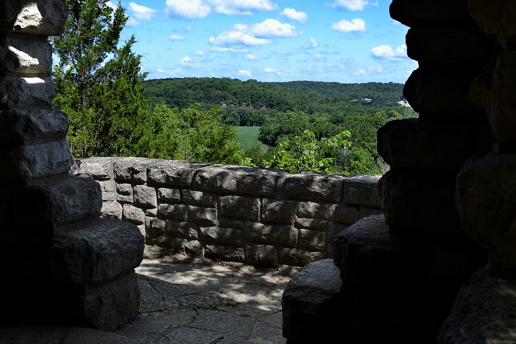
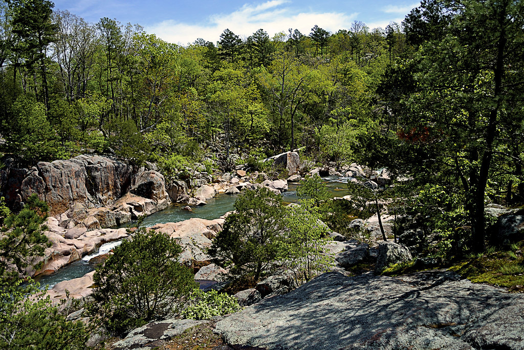
A birds eye view from a bluff overlooking Lower Rock Creek.

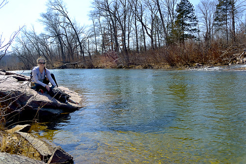
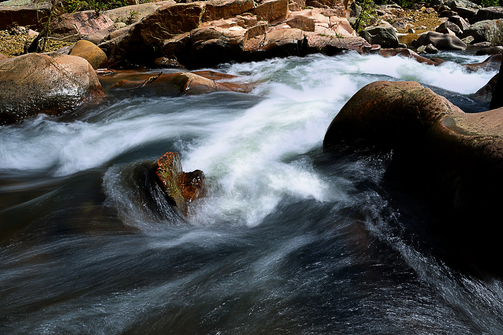
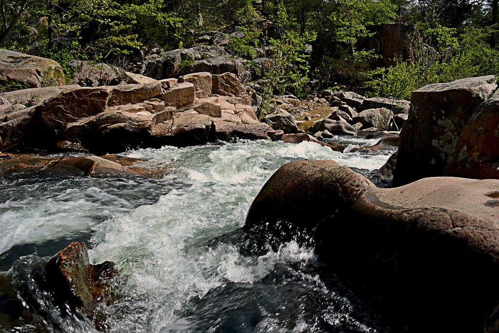
Cathedral Canyon is a gorgeous and seemingly remote part of the Mark Twain National Forest, that goes by many names.  I prefer to call the area Cathedral Canyon because the serenity and staggering beauty there may only be truly matched by a quiet cathedral. Other hikers and soul seekers may refer to it as Dark Hollow, Lower Rock Creek (this seems to be one of the most accepted names), or even the Trackler Mountain trail, I believe that no matter what you want to call this remote and relatively undisturbed forest, you'll leave calling it magical.

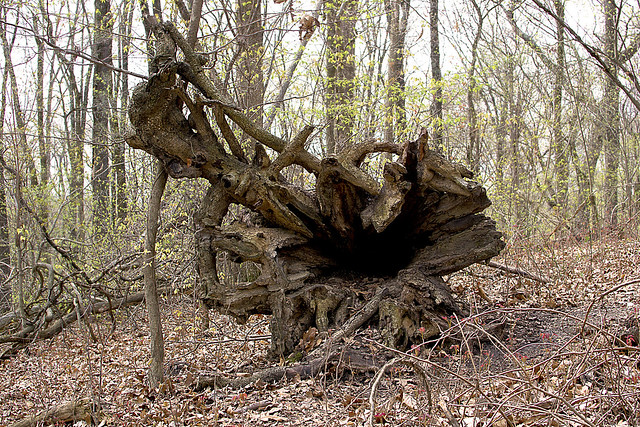
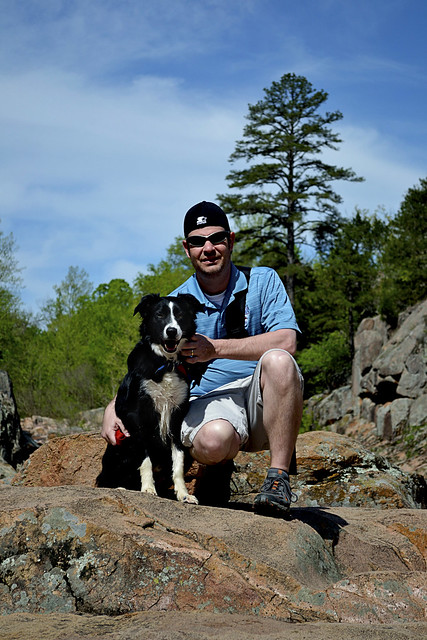
A little something left as thanks for a great hike!
Now, I'm going to be completely honest... I almost didn't write this post. The reason behind my potential omission was wholly selfish. Due to the sheer beauty of the area and the pure lack of any real, discernible trace of human influence on the landscape, I simply didn't want to let others know about it. On our hike we found no trash (so if you visit, please keep it this way), no well trampled trail and heard not a single unnatural noise or sound. So, I admit, I wanted to keep it secret, keep it hidden, keep it "remote" for just a bit longer, but that simply isn't fair to anyone (or the Mark Twain National Forest for that matter).

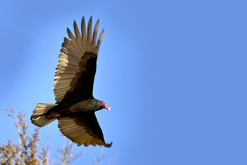
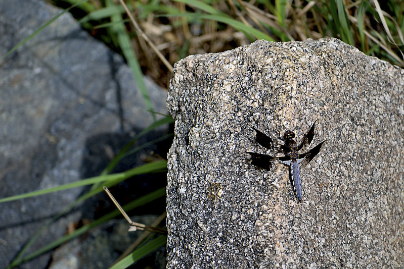
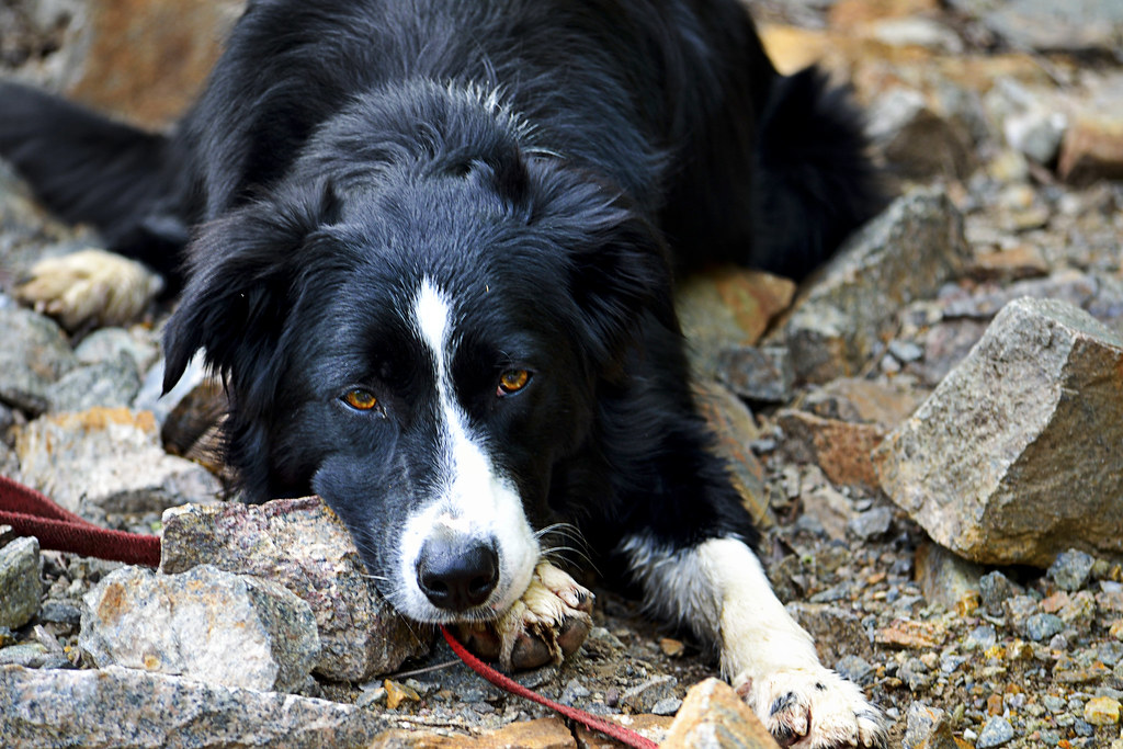
These guys (and gals) are everywhere in Lower Rock Creek.
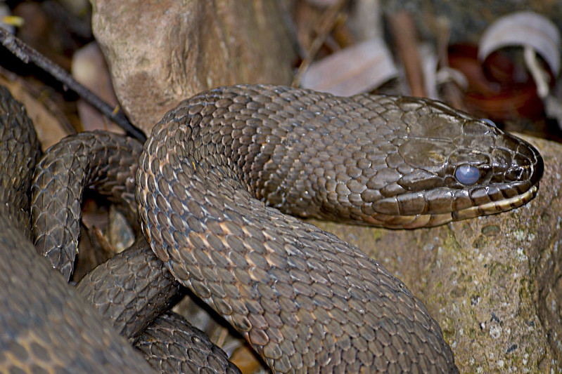
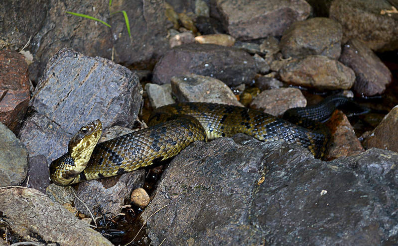
Since I've decided to share my precious hideaway, let me start with one reason you may not want to visit in spring, summer, and early fall... Snakes. And I'm talking a lot of snakes, lots and lots of poisonous snakes. So if you have an Indiana Jones like fear of our scaly, legless, cold blooded, slitherers, don't come here until winter or late fall (it's still beautiful then). On our hike we spotted a couple of copperheads, a timber rattlesnake and countless cottonmouths. The cottonmouths (water moccasins) were so thick, I nearly stepped on one while stepping over another. I am not exaggerating here, go ahead and Google it, I'll wait... See?

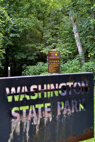
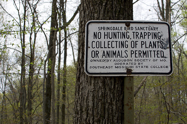
The gate and bullet ridden reflective sign
mark the trail head. Nothing says "C'mon in" like bulletholes!
Still here? Still Reading? Still want to go? Ok, I thought that may scare you, but you are very brave, very brave indeed! So onto the directions... Coming from St. Louis (I know, I usually start everyone at Cape Girardeau), you'll take I-55 South to highway 67. Take highway 67 South to highway E. When you hit Fredricktown, you'll go West (which is on the right) on highway E. Continue on highway E for about 10 or so miles, and be on the look out for County Road 511 (CR 511), it will be on your right. Turn right on CR 511, and travel about a mile, when you cross over a low water bridge take an immediate left on the unmarked road there. BE CAREFUL, this unmarked, heavily forested road is VERY, VERY rough! Find a place to park, out of the way of the way of the unmarked road, and walk to the "trail head" marked by a traffic style gate with a reflective sign on it.

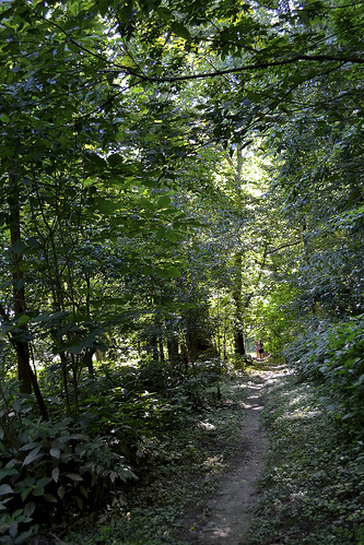
The beginning of the trail.
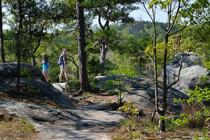
Once you've found the trail head, you will set trek on a 
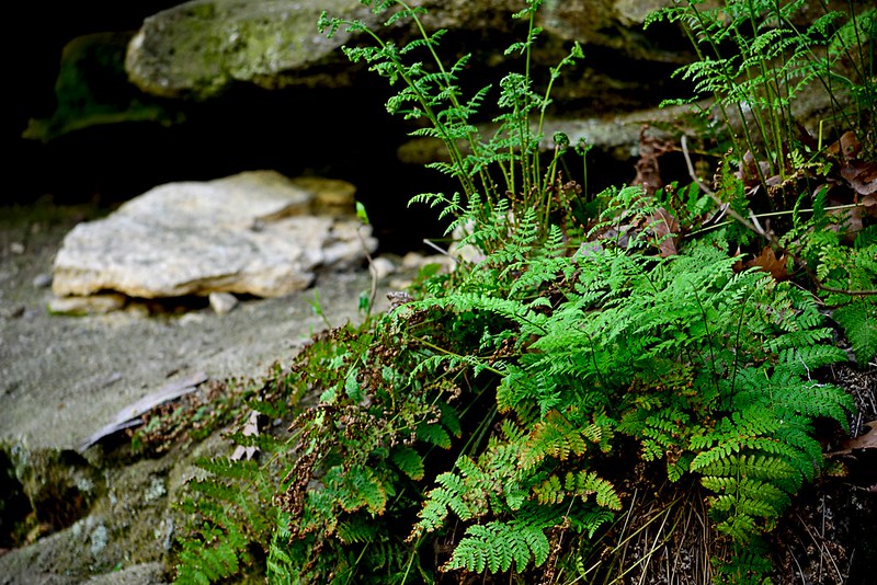
wondrous journey on a rarely traveled trail (some call this trail the Jeep trail or path) through an evergreen and deciduous forest that creates an exquisite canopy overhead. You will soon reach a small fork in the trail, mere yards after the gate, we took the left fork and it worked for us. As you travel be sure take note of your surroundings, look for 
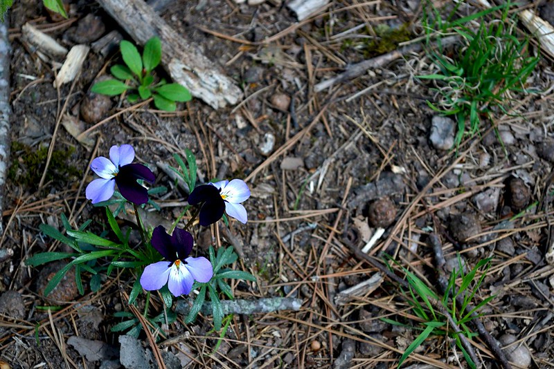
wildflowers, perhaps discover some wild blackberries (as we did), or Ozark witch hazel and listen for local wildlife (which may even included black bears, we didn't see any of these) moving through the undergrowth. I mention to be sure to take note of your surroundings because the trail may disappear from time to time, due strictly to the fact that not many travel or hike upon it, so do take note of interesting features (trees, flowers, rock formations, whatever floats your boat) and other hikers trail markings just in case, you may need them to navigate back later. The wooded portion of the trail winds for about a mile or so, then the canopy opens up and you will find yourself on the rocky banks of Lower Rock Creek!

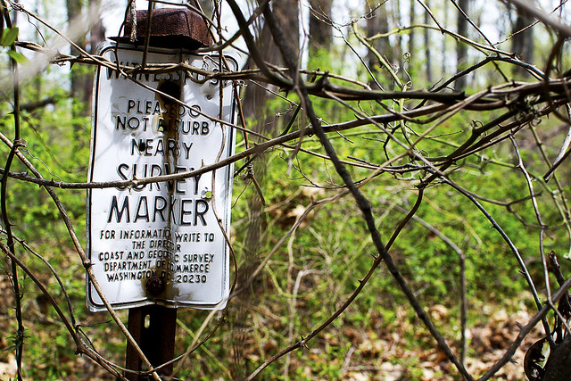
Be sure to search for a marker as you emerge from the trail to Lower Rock Creek.
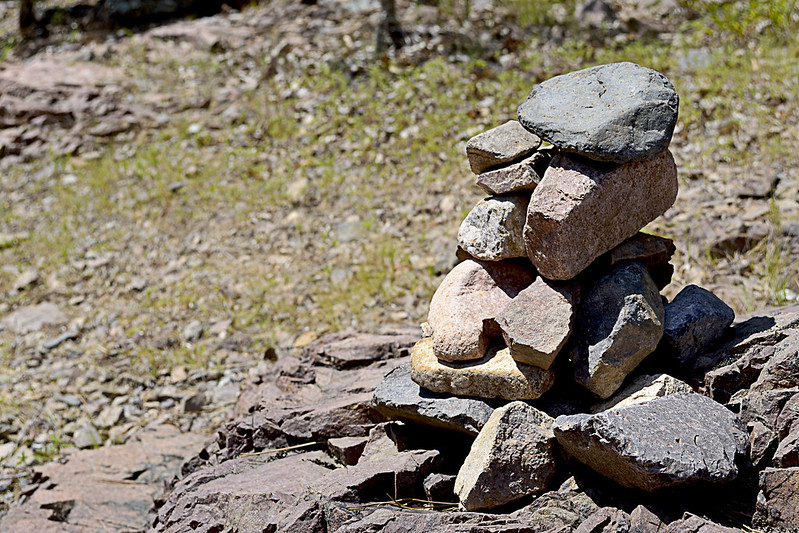
We used this existing rock cairn as our marker, thanks to whomever left it behind!
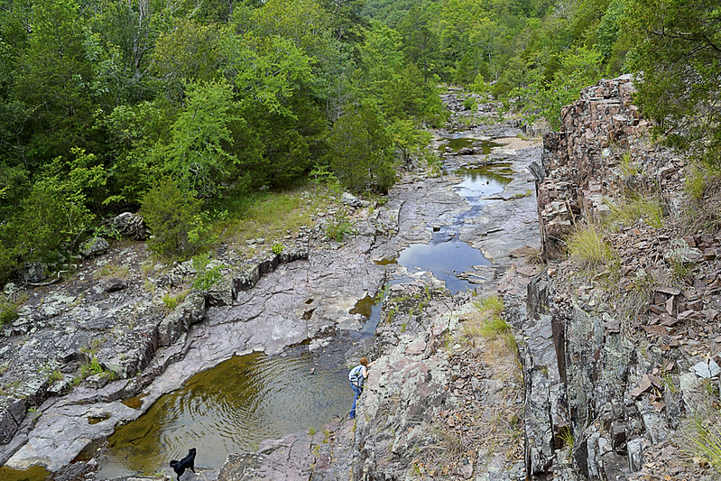
At this junction, given the remoteness of the area, my wife and I spied a rock cairn already built that conveniently marked where we had emerged from the trail so we took note straight away. This pile of rocks would be the marker we would search for to find our way back. If you aren't lucky enough to have a small cairn already built for you, heck, make your own, it's like nature's Jenga! Or you could place a dead branch pointing to the trail on the rocky shore as well, just be sure that you mark the trail so that you can return easily. Now, if you headed left, or downstream, you could actually follow the Lower Rock Creek until it runs into the St. Francois River and I'm pretty sure that could be a great hike in itself. However, we turned our sights upstream (right) as a steep and climbable bluff had quickly caught my attention.

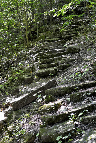
The step-like formations.
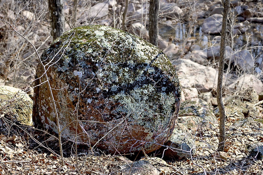
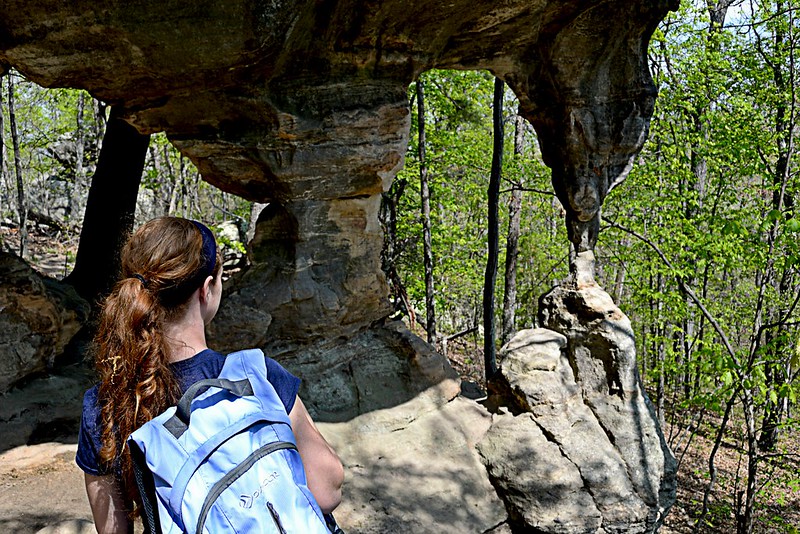
If you decide to climb a few of these bluffs as well, be very careful, in spots the rhyolite bedrock and pinkish colored igneous rock will slip and shatter underfoot and although it may not look like a long fall from the base of your climb, it will certainly not feel good to take rapid descent caused by a slip or fall to the creek floor. The sharp, angular fractures of the rock lining the canyon walls provide fantastic foot, toe and hand holds for your ascent though, just be sure they are solid before placing your full weight on them. If you've made it up to the top, be prepared for a fantastic view of the canyon floor and winding Lower Rock Creek. You may even chance upon a collared lizard or two up here.

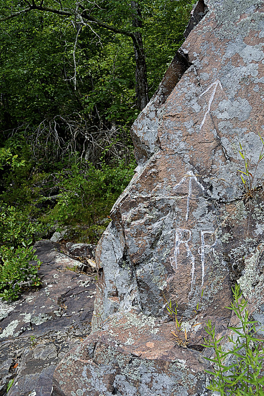
RR: Rattlesnake Ridge?
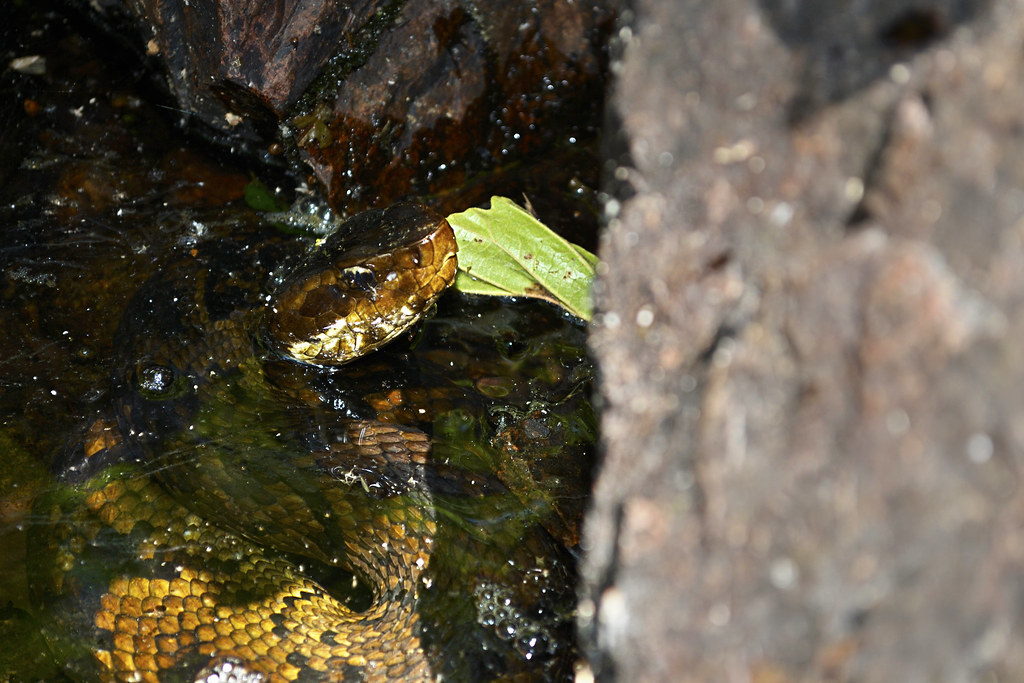
As we headed upstream the snakes became more and more prevalent, for a spell I was paying far more attention to the snakes than the scenery, simply because they seemed to be on every horizontal surface, basking in the summer sun. Interspersed with the cottonmouths were a copperhead and a timber rattle snake, the latter we found just before heading back into the forest on a trail marked by RR inscribed on a nearby rock. After a few jokes about the RR standing for Rattlesnake Ridge, we continued onto the trail. This trail quickly faded, within about 30 or so yards so of the marker, so we decided to gingerly create our own, winding up and down the hill side, seeking the easiest path sometimes following game trails (deer and other game always seem to find the easiest way about the area). We found more wildflowers and fantastic spots to climb rocks and boulders as we made our way further.
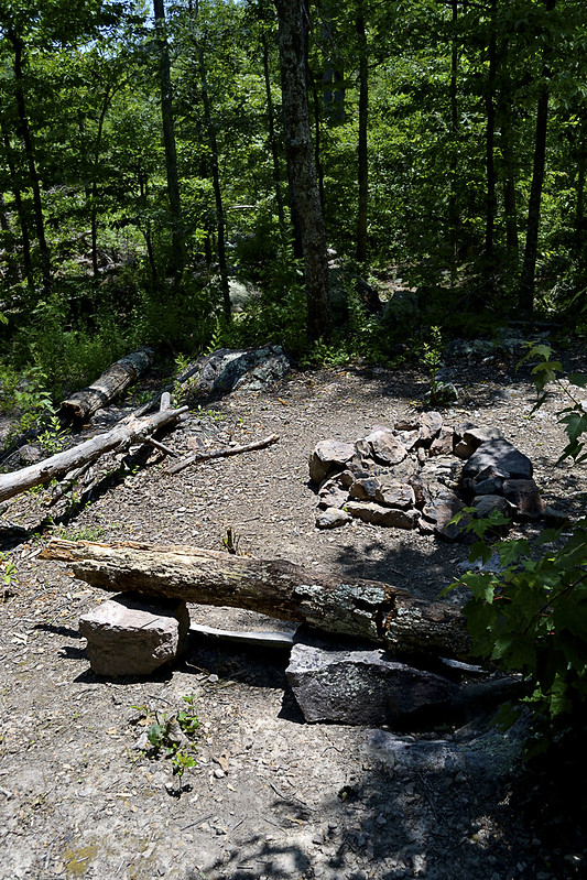
Time to camp!
Now, for all you campers out there (backpackers too) we came upon an absolutely beautiful spot to camp, complete with a rock lined fire pit, comfortable log bench and a smooth, level patch of earth just begging for a tent to be pitched. As we took our own rest here, enjoying a bit of trail mix and peanut butter crackers, I was struck by the views this site offered. The exposed bluffs glistened white in the sun's rays, dotted with evergreens, while the Lower Rock Creek provided a steady beat of water gurgling, with the songbirds providing chorus. For a moment I had reached outdoor nirvana, everything coming together perfectly, with pinpoint timing and I was able to share that with my wife... That's what hiking is to me. Finding those moments and being able to share them with someone else, with bonus points for being someone you love...

Well, we poked and prodded a bit around the campsite area and even found a small container that had some camping equipment (pots, pans, etc.) located near the camp site. Of course I had to take the short journey from the campsite to a nearly chest deep pool of water, created by huge boulders and the flow of the Lower Rock Creek, to take a bit of a refresher before we headed back downstream. The journey back was every bit as fun as the trip up, our eyes scanning for snakes lining the creek when not fully focused on the beauty that surrounded us.

The remoteness and serenity of this area is absolutely unsurpassed for me, I haven't been able to find a spot like this anywhere else. So untouched and unaltered, I have read elsewhere that the University of Missouri has described this area as the most significant remaining example of the St. Francois Mountain watershed landscape. I can't think of another place that I so desperately can't wait to return to, and once you've taken a trip here, I'm confident you'll be looking to schedule a return visit too! But you may not be telling all your friends... You may want to keep it, "secret".

As always, thanks for reading!


More Information:

View Larger Map

Friday, July 26, 2013

Get Into The Flow: Amidon Memorial Conservation Area

The Castor River Shut-Ins of Amidon
Gorgeous. Absolutely, unequivocal beauty. That is what I honestly think about the Castor River Shut-ins area of the Amidon Memorial Conservation Area. In fact, I'm not sure those words can even do it justice, we may need to come up with a new word, just to describe the beauty of the flowing waters and brilliant pink granite rocks that are found there.

In order to get to the lot that contains the trail head for the Cedar Glade Trail, you'll need to take Route J east of Fredricktown, MO to Route W (make a right), then head East on County Road 208 (CR 208). CR 208 will turn into a dirt/gravel road while you ride along, so don't fear any toothless banjo players, but you should always keep your eye out for em', just in case... As you scoot down CR 208 you will come to a fork in the road, and in the middle of that fork you'll see a real grist stone from one of the old mills that used to be located on the land here, so take a second to park along the side of the road and take a peek, it is a pretty nifty piece of history. Once you're finished checking out the grist stone, take the fork to the left, County Road 253 (CR 253) and then look for a parking lot on your right, there you'll find the trail head of the Cedar Glade Trail that will take you to the Castor River Shut-ins. Did I confuse you? Then take a peek at this area map, it may help sort it out for you and, of course there is a map at the bottom of this post that will take you to the Google Maps version.

I swear Hyatt's smiling big here...
Now, the Cedar Glade Trail, a 1 mile long loop trail, has a bit of a Jekyll and Hyde personality to it. The Dr. Jekyll side, or the "good" side, is a beautiful, wide and well trampled trail that leads from the parking lot to the Castor River Shut-ins. The hike takes you through a forest of mixed hardwood trees, dotted with short leaf pine growth, you may notice some extremely large oak trees which have fallen over, root ball included on the sides of the trail. I don't know exactly what caused these mighty hardwood trees to topple, but they certainly were old growth. Keep an eye out for turkey, squirrel and deer as the area contains a decent population of them out here, we even observed the ever elusive domestic short haired cat, which sent ol' Hyatt (our border collie) into a frenzy. The Dr. Jekyll portion will finally empty you out at the Castor River Shut-ins and I'm sure you'll be just as impressed with the river as we were.

The smooth granite boulders of the shut-ins.
Here you'll see the Castor River as it carves through the baby's bottom smooth pink granite. The rocks are gorgeous and the river may even have a bit of a blue or green tinge to it, making the whole scene absolutely picturesque. As always, beautiful smooth rock and water are a combination for slips and falls, so watch your step as you traverse the pink granite boulders. After you have, lets say, dipped your toes into the free flowing Castor River and felt the warmth of the summer sun as you rest on one of the pink boulders, you should be ready to take on the last bit of the Cedar Glade Trail... The Mr. Hyde portion.

Photos can't do justice to the scenery here.
The Mr. Hyde portion of the trail is the more "difficult" in terrain, as you will be walking on some of the smooth (and most likely wet) granite rock surfaces and navigating a bit of a loosely packed rock trail that heads up in elevation. The trail here is not as well maintained and some of the rocks will slip from underfoot as you make your way up, however, the pay off is nearly as grand as the view of the Shut-ins was for the first portion, this portion of the trail offers an over look that provides a vantage of all that you just observed up close and personal. As you finish the loop, be sure to visit the restoration of the glades areas here, you'll find some beautiful wildflowers blooming in spring!

Now, it is a short trail, and when it ends you will most likely want more, we certainly did. But don't worry, there is more to explore at Amidon, remember that fork in the road from earlier. Well what do you think is down the right fork? I hope to write more soon on that right fork of Amidon, such as a little spot to swim called "Hippie Hole" and some free range exploring. So get your bathing suit ready and I hope you're not afraid of some crawdads and bit of river crossing in a car!!

More Information:
Amidon Memorial Conservation Area
Amidon Area Map


View Larger Map

Friday, July 19, 2013

White Water and Rock Hounding: Silver Mines Recreational Area

A view of the breached dam at the Silver Mines Recreation Area.
Here's another great site that I discovered on a field trip in college, the Silver Mines Recreation Area, which is part of the Mark Twain National Forest, is located near Fredricktown and Ironton, Missouri. This area is named, ever so aptly, for the abandoned silver mines that are found here that were mined from 1877 through 1946 by the Einstein Silver Mining Company. Given that the operation spewed tons of rocks (leavings or tailings) from deep within the Earth as the miners searched for their target minerals of silver, tungsten and lead, this is a relative Shangri-la for rock hounds, who come from far and wide, rock hammers in hand to see what treasures they may unearth from the rubble. But those who are not out to hunt for minerals and stones may be after a different type of thrill, the thrill they find on the St. Francis River, the thrill of the only true "White Water" to be found in the state. I knew that the sound of rushing water and the possibility of finding some rare minerals would certainly interest my wife and daughter... and I couldn't have been more right.

A dragonfly paused long enough to give me this shot.
There are actually two hiking trails here, I'll send you to the one that is on the South side of the St. Francis River, that runs near the "Air Conditioner" mine and the tailings from the mine operations the North side is every bit as beautiful and slippery as the South, I just love rock hounding). After parking the car (be aware there is a day use fee of $2.00 per vehicle here, place your payment in the envelope and slip it into the locked container) you will make your way across the concrete walkway then head to the right to begin your one mile hike up to the dam. This hike is absolutely stunning, with gorgeous granite and felsite outcroppings and stunning views of the St. Francis River marking the trails progression. Be careful though, the same granite and felsite rocks that are so interesting to look at and examine may be the same formation may cause your rear become painfully acquainted with the hard ground and said rock, as these rocks can become quite slippery after rain or covered in early morning dew.

A member of the "indigenous" population takes a sun.
As you continue up, past the scenic overlook (which was in some disrepair on our visits there), be sure to stop by the "Air Conditioner" Mine and have a seat, especially on a hot Midwestern summer day! The air that comes from the mouth of this abandoned mine is more than cool enough to invigorate you for the rest of your short hike to the dam. You may not always be able to take a seat here though, as the available space at the mouth of the mine may be flooded with a foot or more of water, depending on the last time it rained in the area. Soon after taking a cooling break you will reach an area that is just pure rock, these are actually all tailings, from the mining of the area. This is a GREAT place to stop and begin exploring the different types of rocks and searching for some rare silver, quartz, or even small fragments of various gemstones.

Yes. That's a scorpion. In Missouri...
While you are exploring the abandoned tailings for interesting rocks and formations, BE CAREFUL! The native inhabitants of the area, which include snakes and small scorpions, may be hiding underneath rocks as you overturn them, use a stick... Please. This is the only place I have ever been, in Missouri, that I have actually found a scorpion (see the photo). I found this scorpion by picking up a rock, mere centimeters in front of its "face" and was beyond lucky not to have been stung. On a separate note, I believe that purple mineral found on the rocks there is flourite, and you'll find a great deal of that in the rocks here. Also be careful on the loose rock, period. It may shift at anytime and send you sliding down the hill. An amateur geologist also presented us with this small bit of knowledge (I can't vouch for the accuracy of it though), if you are looking for a bit of silver, most of it is contained in small veins you can find in the quartz rocks of the area. The silver here may appear dark or almost black to slightly silver metallic in color.

While rock hounding you may also keep an eye to the St. Francis River, particularly during the Spring, as you will undoubtedly be able to spot some crazy kayakers as they shoot out of the breach in the dam that used to span the river. These folks are amazing to watch and I've heard epic party details from when the American Whitewater Championships are in swing there during weekends in March. I never tire of watching the kayaks slice the water and navigate down the river through the dam.

Overall this is one of my favorite spots to visit and I certainly hope I didn't scare anyone with the shifting rocks, slippery outcrops, snakes and scorpions (dangers exist in all of the great outdoors), there is just so much to see and do. The whole family enjoys looking through the rocks, searching for that next shiny little "gem" and the wildlife certainly can keep you on your toes. When you couple that with magnificent views, a mine that can provide you a bit of A/C, a cooling river that you can take a wade in (but be careful of the current and dropoffs) and some wonderful plants and rock outcrops to explore, it's hard not to have a great family time!
All the action can exhaust even Hyatt, our border collie... And that's TOUGH!
Thank you for reading and, as always, let me know if you have any questions about the area or any experiences you would like to share! If you're "digging" (like the rock hound inference there?) the blog, be sure to give it a +1G up there and subscribe by just putting in your email address, you won't be bothered unless a new post goes up...

Happy trails and watch where you step!

More Information:


View Larger Map

Other Nearby Parks/Recreational Areas:


Friday, July 12, 2013

The Darn Near Perfect Hike: Pickle Springs Natural Area


Anyone who has hit the trail with their family knows, it isn't always perfect; someone usually is a bit tired, or a bit sore, or a touch cranky, or the weather may turn and sometimes the full beauty of the area (and the hike) simply isn't really revealed. However, I remember Pickle Springs to be darn near perfect and it would be this trip that truly solidified our family's love and appreciation of the outdoors and hiking. The weather, combined with the natural beauty that Pickle Springs Natural Area offers washed over each of us resulting in our family fully enjoying every single second of this hike, eager and excited to find what would lay around the next bend of the trail. I have a feeling, that if you time it just right, you too can experience a bit of that euphoria as well!

A small, but beautiful, group of Bird's Foot Violets
we found along the trail.
We ended up at Pickle Springs Natural Area simply by chance, that day we actually were looking to hike through Hawn State Park and the White Oaks Trail, but passed by the entrance and then turned into Pickle Springs Natural Area parking lot in order to reverse direction and head back. But instead of pulling back out of the lot, we decided to take a quick peek of Pickle Springs, and boy, am I glad we did! The two mile loop, "Trail Through Time", has just about everything that you could possibly pack into one trip; seasonal waterfalls, awe inspiring overlooks, incredible rock formations, ancient weathered trees, gorgeous wildflowers, babbling creeks, crystal clear spring water and so much more, all on an easy to navigate and well maintained trail that even features wooden bridges to help you over some troublesome creek crossings. The area was named a National Natural Landmark in 1974 and with so many unique features you will quickly realize why as you hike.

Ferns abound in the wet sandstone soil here.
As we began our trek, we opted to head right on the trail, toward Piney Glade, Rockpile Canyon and the Headwall Falls. It was quickly apparent to us that this trail was very well traveled, well packed with a bit of gravel thrown in for measure. The canopy of trees provided just the right amount of sunlight and warmth as we made our way through the forest and provided a perfect scene as the birds sang in the background. Headwall Falls were not really "Falling" but it was still an impressive formation of rocks and with frogs and toads abounding in the area my daughter had the time of her life chasing them about. I marveled at the ferns and mosses growing on the sandstone surface of the canyon while the steady beat of the water as it trickled off the edge and fell to the rocky floor where it would water a great gathering of lush green plants.

A pickerel in the hand is worth two in the spring...
Pickle Spring is itself an impressive sight, with the clear water flowing, while more water cascades over top, creating a mini-waterfall into the spring pool. The view from the bridge crossing the creek provides a perfect vantage of the spring and may even serve as a great place to dangle your toes into the water, Andy Griffith style. Here we found a great gathering of pickerel frogs who seemed to hop right into our hands! Continuing through it was a short trip up to Dome Rock, marked with so many shallow caves and crags, this rock just begs to be looked at closer.

Gathering inspiration at the Spirit Canyon overlook.
As you reach Spirit Canyon you will find Missouri's only native pine tree, the short leaf pine, growing in this area, along with white and black oak trees and many of these trees were growing as Missouri was thrown into the Civil War, according to the Missouri Department of Conservation. You may even chance upon a low blueberry bush, as they grow well in the somewhat acidic soil of the area here, if your lucky! As you actually step up to take in the Spirit Canyon view, know that this may be the best views I have experienced in my Missouri hikes, period. There is nothing "fancy" about the view, and I can't put my finger on exactly why I love this particular vantage point, but it has stayed with me and I can still picture it now in my head.

A view of the Double Arch, you can spend a great deal of time
here just snapping photos!
We continued to enjoy the hike, as it meandered near Bone Creek, crossing over the twin bridges and high crossing. Then as we neared the end of the loop we encountered some of the most interesting rock outcrops and formations I have seen. We "squeezed" through the keyhole and made our way past the Cauliflower Rocks, to the Double Arch and, if you're looking to take pictures be sure to save a few for here, as we spent a great deal of time right here, snapping away. As we finished our posing and preening for photos, we made our way out through The Slot and all walked back to the car with smiles I thought may need to be surgically removed.

According to many other hikers, the trail takes about an hour to complete, however, we took nearly two. With so much to see and so many places to spend "just one more minute" taking pictures it is easy to extend the traditional hiking time, and these days that time, spent with family having a great time, is overtime I look forward to and can't wait to do again.

I hope you enjoy the blog, let me know if you have any questions and thanks for reading!

More Information:
Pickle Springs Natural Area Website
Pickle Springs Topographic Map
 

View Larger Map