Showing posts with label #hiking. Show all posts

Wednesday, February 24, 2016

Elephant Rocks State Park: Home to Views, Trails, and... Elephants?

 I remember coming to Elephant Rocks State Park back when I was twelve years old with my parents, back in the *cough, cough* 80's... Marveling at the mammoth... er... Elephant sized pink granite boulders. Trying my hand at scaling those circus sized freaks, tracing carvings etched over 100 years ago by master masons with my fingers, gazing over the long abandoned quarry now filled with nearly a century's worth of rain, and exploring so much more. So returning as an adult was almost a homecoming, with the Elephants patiently waiting atop their weathered perch, welcoming me back to the park with a single question, "Are you ready to act like you're 12 again?" To their query, I answered quickly, "Yes", despite me putting on a couple of decades between visits.

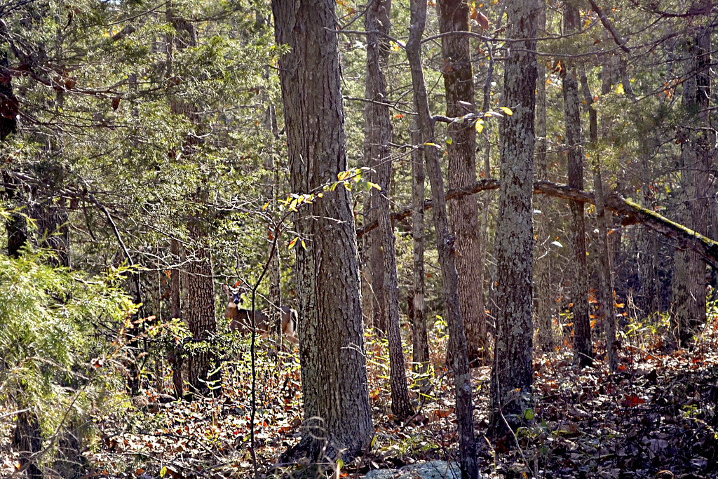
Hike and climb among circus sized granite giants
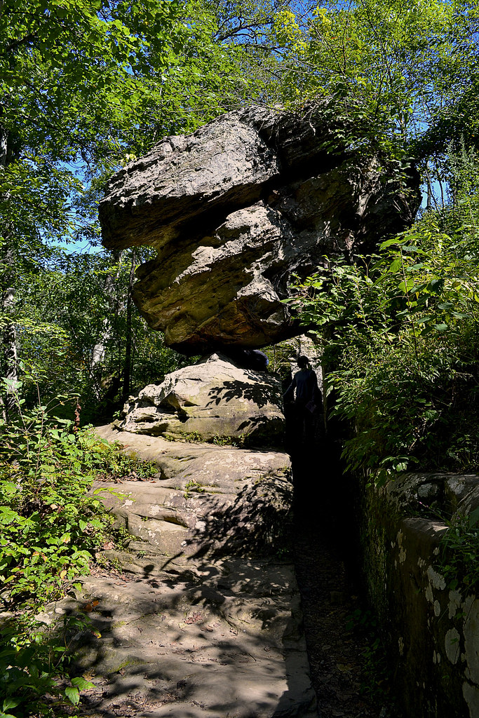
Elephant Rocks State Park draws its name from the colossal pink granite boulders, the largest of which has been named Dumbo and is estimated to tip the scales at 680 tons! You will find an area where these boulders seem to march like a line of elephants upon a barren granite hill which graces the center of the park. If you'd like to get really technical here these pink colossi are perched on a tor, which is Gaelic for rocky hilltop, so if that comes up in a final Jeopardy! round remember who to share your winnings with. On top of the tor, shown in the picture to the left, you may find interesting pools of water, seemingly carved directly out of the granite. These pools are actually referred to as tinajitas and are caused by physical and chemical weathering of the stone, sometimes these tinajitas may be several feet in diameter and provide a home to tadpoles or the hiker's arch-nemesis, mosquito larvae. I have seen some truly beautiful pictures of these circular depressions, filled with water and reflecting their surroundings, but alas... When we visited the park each of the tinajitas we visited were as dry as a bone.

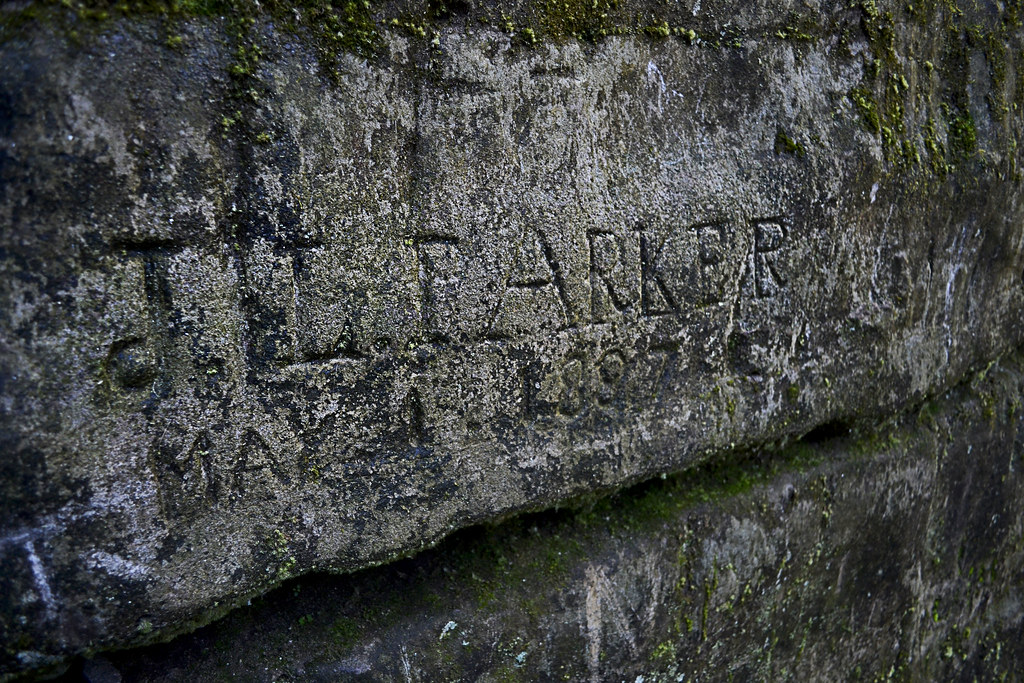
You may also notice many carvings upon the central tor and even on a few of the granite elephants that reside there. Many of the quarry workers would carve their names and date into the granite here when they received the rank of Master Stone Cutter and you will find many dates from the late 19th century, standing as silent testament to the achievements of the men who cut into their igneous bodies. You may also notice growths on some of the stone here as well, called lichens and mosses, generally you will find both of these in sunnier areas. The lichens and mosses found growing here are another piece of the puzzle that develops the unique pattern of weathering demonstrated upon the elephant rocks within the park.

Let your feet and fingers do the walking on the Braille Trail
It is around those stone circus attractions that you will find the first trail ever designed for outdoor lovers with visual or physical disabilities in Missouri, which is fondly referred to as the Braille Trail. The one mile long Braille Trail consists of a fully paved trail featuring signs with braille and regular text, you may even download a MP3 file from the Missouri Department of Conservation that provides audio for each of the interpretive signs along the trail. The Braille Trail loop (circular trail) is a fantastic way to explore the park and as you make your way along you will find spurs (offshoot trails) that lead to additional areas that you may explore, some of these spurs are handicapped accessible, but not all.

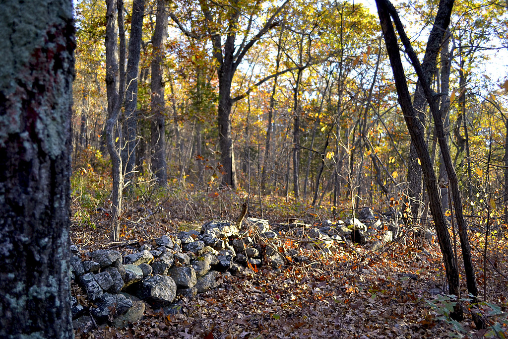
Explore the ruins and history of the old quarry
One such spur is the Engine House Ruins Trail, which is less than a half of a mile long and connects to the Braille Trail in two spots, so if you miss the first offshoot, you can catch the other.  Along this trail you will find the remains of the old Engine House, which was constructed here to repair and maintain the quarry's railroad engines. Here you can still find the old rails, now overgrown and sunken into the earth, that would have carried loads of granite from many of the local quarries to the larger railroads, such as the St. Louis, Iron Mountain and Southern Railroad, which were located some miles to the east. The building itself is eerily beautiful with the seemingly random pattern of mortared junctions really showcasing the individual stones fashioned to create it. It feels like you could almost hear the hissing of the old steam engines that would visit here if you listened closely enough...

"Missouri Red" quarried here is still found in Missouri & beyond
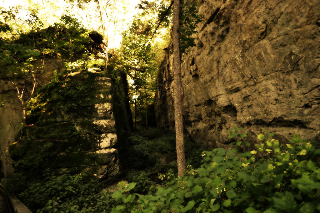
As you continue through the park you'll also find a spectacular overlook that provides a beautiful vantage of the old quarry that existed within the park. It has filled with decades of rain water and its steep sides clearly show the scars of the industry that shaped the entire area around the park, even factoring into the name of the nearby city of Graniteville, where you can find quarries that are still running today. It is in areas like this that a man could find himself taking home nearly $5.00 a day by cutting seventy blocks a day in the 1890's. The "Missouri Red", the trade name given to the granite products quarried from this area, can be found right here in Missouri, within the paving stones of some old St. Louis streets, the piers of the Eads Bridge and in the columns of the Missouri Governor's mansion, the granite was also shipped throughout the United States. As you soak in the eagle eye view available here take notice of the beautiful black oak and shag bark hickory trees that grow in the granitic soil here at Elephant Rock State Park.

Look for old "Plug and Feather" tools
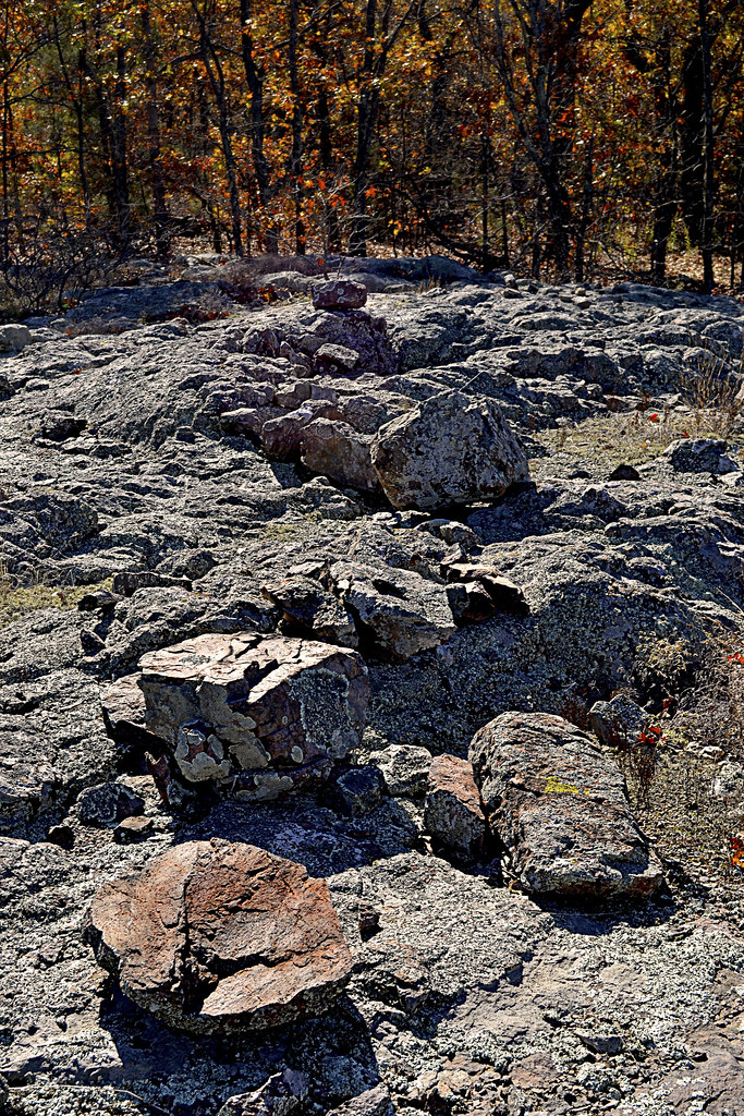
Traveling the Braille Trail around the over 131 acre state park, you'll notice large piles of granite scattered here and there. You will undoubtedly notice that many of these granite stones bear marks of an ancient technique for splitting the dense and tough stone called "plug and feather". The plug and feather technique has been used since the pyramid builders of ancient Egypt (and maybe even earlier). It is a brilliantly simple concept and requires only a few tools to pull off, a metal wedge (called a plug) and two metal shims (referred to as the feathers). A hole is drilled into the stone along a drawn line, which is where the stone cutter wishes the large block to split, then the feathers are inserted and the plug is then placed between the two feathers. Generally there will be multiple holes drilled and multiple pairings of feathers and plugs along the intended split line. At this point the stone mason will begin to strike each plug in succession moving down the intended split line, which causes the feathers to move outward from the center as the plug is driven, continuing to strike until the stone relents and fractures along the line. If you are careful and very observant you may even find some of the old feather and plugs that the quarry workers left behind in some of the holes! The picture to the right shows the fracture of the stone and unused holes as well where the masons looked to split the slab further. However, not all of the holes you find in these rock where placed there to split the stone, some are the results of core samples, taken to determine the quality of the granite.

Don't get lost in "The Maze"
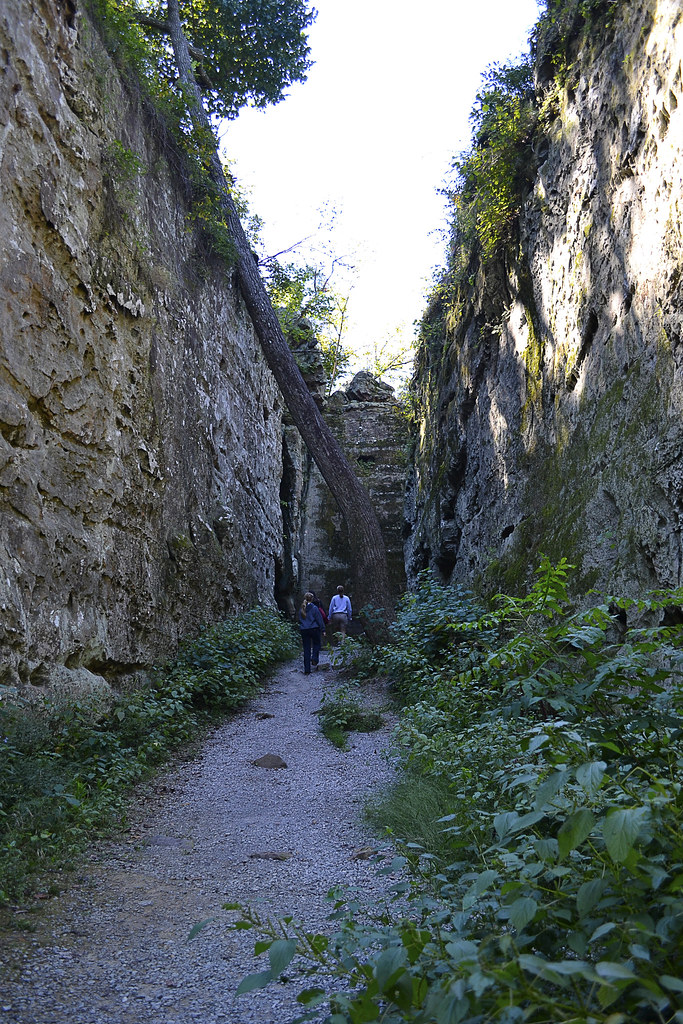
One of the last spurs that you will find off of the Braille Trail is an area nicknamed "The Maze" where you can wander and explore a section of the trail that features scattered boulders that would beckon "Climb me..." if they could speak. I spent a good amount of time here, bouldering, leaping, wedging myself into crags and cracks and generally acting like my old twelve-year-old self, however my now older body would have a serious discussion with me the following morning, just to remind me of how old I truly am. You could easily spend the bulk of your hike here trying to summit each of the boulders, each of which seems to present you with a different brain teaser of what method to use to climb them. Also keep in mind, it can be dangerous climbing on rocks and leaping from place to place. Any water on the surface of these stones can easily cause you to loose footing and slip as well, that beautiful pink granite makes a pretty slick wet surface, so be careful!

Pay homage to those who served in WWI
As you begin or end your journey on the Braille Trail you may notice a poem carved into a large granite rock face. The carving is weathered and somewhat hard to read, but if you concentrate and focus you will find that these poetic words were carved to pay respect to those who did not come home from World War I in 1918, "In honor of our nation's brave that sleeps over the wave, they died that we be free no more war to be 1918."

Pro-Tips for Elephant Rocks State Park
Elephant Rocks State Park is an extremely unique and beautiful park, so don't be surprised to find other outdoor enthusiasts filling the park on the same day you arrive. The entire area is particularly beautiful in the fall as the leaves begin to change, the black oak and shag bark hickory put on quite a display of oranges, reds, and every shade between. Be sure to bring a camera, you'll certainly want to take some pictures with these behemoths and maybe even shoot a quick selfie on some of the scenic overlooks from the tor (remember what a tor is... and remember to cut me in on that final Jeopardy! question...). Let the kids (and the kids at heart) play, explore and just generally have fun... But be careful, the beautiful pink granite here becomes slick as snot with a bit of water and remember falls onto solid rock hurt and can easily break bones. Finally, bring a picnic lunch. There are a great deal of picnic areas at Elephant Rocks, be sure to take some time out to reconnect with your loved ones and just sit back, eat and talk about just how awesome Elephant Rocks State Park is. Happy trails and thank you for reading!


Directions


More Information:
Local Treks on facebook 
Missouri Department of Conservation: Elephant Rocks Webpage
MO State Parks: Elephant Rocks Webpage
MO State Parks: Teacher's Guide to Elephant Rocks
MO State Parks: Elephant Rocks State Park Trails
MO State Parks: General Information
  - Braille Trail Map (1 mile)
  - Engine House Ruin Map (0.40 mile)
Missouri State Parks.net: Elephant Rocks
Wikipedia: Plug and Feather

Wednesday, September 2, 2015

Cache River State Natural Area: Much More Than "Mud & Muck"


When you think of a wetlands area, there is no doubt that you may quickly conjure up an image of Swamp Thing's eerie home immediately. Or, perhaps you envision a marshy bog filled with savage spiders, slippery snakes and man-sized mosquitoes, each lying in wait under an ever present layer of fog, lurking within their secret hiding places until deciding to lurch forth for you, their unsuspecting victim. But in reality, wetlands are beautiful areas that also provide a home to more than a third of the species on the U.S. Endangered Species List and serve a variety of services to us as well; such as recharging our ground water supplies, providing a filter which removes pollution, and trapping flood waters. But beyond those important ecological benefits, you will find that wetlands may provide another intangible benefit to you. You may find your own soul reinvigorated, if just given a chance to step beyond the "mud and muck" of Cache River State Natural Area...

Cache River State Natural Area

This Cherrybark Oak
Champion may be found
on the Todd Fink
Heron Pond Trail
The Cache River State Natural Area is an absolutely stunning example of a well restored wetlands area. You will find this gem nestled within a floodplain, which was sculpted by the mighty flood waters of the Ohio River ages ago. The Cache River Wetlands is now fed by the Cache River and it's many tributaries and stretches over 14,960 acres in Johnson, Massac, and Pulaski counties in Southern Illinois. This scenic area also plays as a featured stop to many migratory bird species, including bald eagles, great blue herons and (a personal favorite) snowy egrets. In addition to the myriad of migratory birds you will undoubtedly catch an earful of the areas most vocal inhabitants as choirs of spring peepers, bullfrogs, bird-voiced tree frogs, American toads and more amphibians all sing together from the bogs to the boughs and everywhere in between. As you hike on the trails and boardwalks below you may also want to keep a keen eye trained for some of the larger warm blooded residents as many white tailed deer, squirrels, raccoon, beavers, foxes and mink call the area home as well.

On our visit we were lucky enough to hike three areas within the Cache River State Natural Area (click to visit individual pages or read more below): Big Cypress Tree Trail (250 feet), the Section 8 Wood Nature Preserve Boardwalk (475 feet) and the Todd Fink-Heron Pond Trail (1.5 miles). Each of these short hikes were absolutely stunning and completely unique in their own way. These short journeys also seriously whet my appetite for a return to visit areas such as the Marshall Ridge Trail (2.8 miles), Lookout Point Trail (1 mile), and the Lower Cache River Swamp Trail (2.5 miles), but that will have to be another post at another time I suppose.

Big Cypress Tree Trail

Although missing some of its mighty boughs,
the state champion is still an impressive sight!
Beyond the wildlife that inhabits these wetlands, the area also boasts some truly spectacular plant life. Throughout the Cache Area Wetlands you will discover ancient cypress trees with their flared bases and many "knees", which were mere saplings over 1,000 years ago, now standing sentinel over the rich, black-water swamps that still nourish them. On the short, 250 foot Big Cypress Tree Trail you will find one very special bald cypress. This particular cypress tree has been so nourished by the rich waters that it has developed a remarkable base (also referred to as a buttress) of over 40 feet in circumference, which has earned it recognition as a state champion. As you make your way to the enormous namesake of this trail be sure to take note of the other plants such as majestic tupelo trees and low lying thickets of button-bush that share the landscape with the silent cypress colossus.

Section 8 Wood Nature Preserve Boardwalk

The murky waters of Section 8 are haunting.
There is something nearly hypnotic about the chorus song of nature, in particular the melodies of the amphibious inhabitants of the wetlands. The soprano trills of the tree frogs blend with the rich baritones of the southern leopard frogs, while the deep bass of the bullfrogs seem to keep the beat and complete the scale, providing the perfect background accompaniment as you stroll the wooden Section 8 Boardwalk (click here for more "Swamp Music":). As you make your way over the 475 foot long boardwalk you will be enveloped by the cypress, tupelo and other varieties of marsh loving trees, many of which you will be able to identify thanks to the wonderful interpretive panels that are available along the path. Then, as you look out upon the muddy and murky waters, perhaps wondering exactly what may lie beneath its calm surface, you may also catch sight of another state champion, this time a tremendous water tupelo, which can be found at the very end of the boardwalk. Unfortunately I just could not snap a good picture of it, or I would have provided one here for you... Now I guess you'll just have to take this serenaded trip as well. :)

Todd Fink-Heron Pond Trail

See that cool "Zipper" effect?
This short, 1.5 mile, trail begins simply enough. You'll find yourself descending into a mix of hardwood forest comprised of a mix of oak, hickory and sweet gum. As you reach the bottom of your descent you will come to a small truss bridge over which you will make your way over a convergence of Dutchman's Creek and the Cache River. If you find yourself crossing this bridge without setting an eye just upstream, toward the actual meeting of these two streams of water, you are missing a truly magnificent sight. For it is here, just upstream, where the relatively clear waters of Dutchman's Creek and the rich muddy flow of the Cache River slowly merge, becoming one, but not before the waters dance together, swirling and circling, ebbing and flowing, creating an absolutely hypnotic effect. The trail continues on just the other side of the bridge, and closely follows the snaking trail of the Cache River. As you continue your hike you will find a fork in the trail, it is here that you will want to journey to the left and in just a few short yards you will find the Heron Pond boardwalk.

The Heron Pond boardwalk winds its way out and into the very heart of its namesake pond. The waters here were more clear than we found at the Section 8 boardwalk, which allowed us glimpses of turtles, fish, insects, frogs and more as they swam among the giant tupelo trees and "knees" of the cypress here. In areas we found duckweed would obscure our little windows into the private underwater world of the swamps residents, occasionally these serene green mats of aquatic carpet would erupt with a violent "POP" as an underwater assassin would hungrily burst through the thin layer of duckweed in pursuit of an insect.

Now, after you've taken the journey on the Heron Pond boardwalk you may think that's it... But you'd be wrong. Remember that fork, where we turned left? You may be wondering what exactly would have happened had we turned right instead. Well let not your heart be troubled, because had you turned right at that fork you would have taken a trail that would have led you directly to yet another state champion tree! This time you would have discovered the state champion cherrybark oak tree that has grown to a circumference of over 22 feet and 100 feet high! You may never have quite so much fun feeling so very, very small and believe me, it's worth a quick visit to set your eyes upon this towering titan, plus it is only a few yards up that right path...

Cache River Wetlands Center 

You may want to begin your entire adventure to the Cache River Wetlands Area at the Barkhausen-Cache River Wetlands Center. Unfortunately the visitor center was closed when we visited the park on a Monday, but it certainly seems to have many offerings for you to peruse. It is located at 8885 State Route 37, Cypress, IL, 62923 and is now open to the public five days a week, Wednesday through Sunday from 9:00 a.m. to 4:00 p.m.


Directions


More Information:


Local Treks on facebook 
Cache River State Natural Area: Big Cypress Tree Trail - Looking for the state champion bald cypress? Take this trail!
Cache River State Natural Area: Section 8 Nature Preserve Boardwalk - Take a stroll directly through a swamp without even getting your feet wet!
Cache River State Natural Area: Todd Fink-Heron Pond Trail - Another state champion tree and awesome boardwalk trail!
Cache River State Natural Area homepage 
Hiking Maps of the Area
Barkhausen-Cache River Wetlands Center
Barkhausen-Cache River Wetlands Center flyer - This little beauty has many of the cool features of the center listed. 
Cache River State Natural Area Map
Color Brochure of the Area

Cache River State Natural Area: Todd Fink-Heron Pond


A Zipper Convergence

See that cool "Zipper" effect?
This short, 1.5 mile, trail begins simply enough. You'll find yourself descending into a mix of hardwood forest comprised of a mix of oak, hickory and sweet gum. As you reach the bottom of your descent you will come to a small truss bridge over which you will make your way over a convergence of Dutchman's Creek and the Cache River. If you find yourself crossing this bridge without setting an eye just upstream, toward the actual meeting of these two streams of water, you are missing a truly magnificent sight. For it is here, just upstream, where the relatively clear waters of Dutchman's Creek and the rich muddy flow of the Cache River slowly merge, becoming one, but not before the waters dance together, swirling and circling, ebbing and flowing, creating an absolutely hypnotic effect. The trail continues on just the other side of the bridge, and closely follows the snaking trail of the Cache River. As you continue your hike you will find a fork in the trail, it is here that you will want to journey to the left and in just a few short yards you will find the Heron Pond boardwalk.

Down On The Boardwalk

The Heron Pond boardwalk winds its way out and into the very heart of its namesake pond. The waters here were more clear than we found at the Section 8 boardwalk, which allowed us glimpses of turtles, fish, insects, frogs and more as they swam among the giant tupelo trees and "knees" of the cypress here. In areas we found duckweed would obscure our little windows into the private underwater world of the swamps residents, occasionally these serene green mats of aquatic carpet would erupt with a violent "POP" as an underwater assassin would hungrily burst through the thin layer of duckweed in pursuit of an insect.

But Wait! There's More!

Now, after you've taken the journey on the Heron Pond boardwalk you may think that's it... But you'd be wrong. Remember that fork, where we turned left? You may be wondering what exactly would have happened had we turned right instead. Well let not your heart be troubled, because had you turned right at that fork you would have taken a trail that would have led you directly to yet another state champion tree! This time you would have discovered the state champion cherrybark oak tree that has grown to a circumference of over 22 feet and 100 feet high! You may never have quite so much fun feeling so very, very small and believe me, it's worth a quick visit to set your eyes upon this towering titan, plus it is only a few yards up that right path...

Directions


More Information:


Local Treks on facebook 
Cache River State Natural Area: Much More Than Mud & Muck - An overall view of Cache River State Natural Area
Cache River State Natural Area: Big Cypress Tree Trail - Looking for the state champion bald cypress? Take this trail!
Cache River State Natural Area: Section 8 Nature Preserve Boardwalk - Take a stroll directly through a swamp without even getting your feet wet!
Cache River State Natural Area homepage 
Hiking Maps of the Area
Barkhausen-Cache River Wetlands Center
Cache River State Natural Area Map
Color Brochure of the Area

Tuesday, November 18, 2014

Buford Mountain Conservation Area: Take Time To Take It Slow


In today's world it seems nearly everything moves fast and sometimes it may seem to move too fast. The week may speed by in a blur, leaving you to wonder... What did I do this week? What did I accomplish? Where are my keys? After a week like this, it's time to slow down. Way down. I just so happen to know that Buford Mountain Conservation Area is an extraordinary place to do it, and I will assure you, when you've finished the 10.6 mile loop you'll know what you did, what you accomplished, but your keys... Well, that's on you.

The (3rd) Top of Missouri: Big Buford

Keep an eye out for this low stone wall as you scale Big Buford.
Buford Mountain Conservation Area is located just a few miles North of Ironton, Missouri off of the inconspicuous Route U. The mountain itself is actually more of a ridge, accentuated by a series of five high points along its spine. The first, and tallest point, on the trail has been nicknamed "Big Buford". As you climb its steep, rocky sides, keep an eye out for an old stone wall, evidence that early homesteaders laid claim to this area at one time, stone by stone. Big Buford peaks at 1740 feet above sea level, which happens to lay its claim to the 3rd highest peak in the state. How's that for a bit of an accomplishment? Hey, you didn't need any oxygen or Sherpas! Sure, not everyone may hold that to be a true Herculean feat, but I'll tell you what; after making the nearly 700 foot ascent to the wooded top of Big Buford over the winding rock and dirt surfaced trail, I'm pretty sure you'll feel a true sense of triumph. However, that sense of triumph may be slightly trumped by the fact that Big Buford is wooded, pretty heavily wooded in fact, and that makes for no sweeping vistas, no awe inspiring horizon to scan, no I Can See for Miles and Miles (I love The Who, don't you?) moment. But wait... Just put The Who on pause for a moment, because your Miles and Miles view exists just a bit further down the trail at a place called Bald Knob.

The "Moonscape": Peak Two

As you make your way toward the spectacular view at Bald Knob, you will first make your way over two more peaks and these aren't just "hike over" territory either. As you make your way down from Big Buford, keep your eyes open for the first of six wildlife watering holes which line this trail, placed there due to the lack of any real natural water source in the area. As the trail begins to once again gain elevation, you will find yourself near the second overall peak on the trail. It is here that the dense hardwood begins to make way for a very interesting formation of rock. It is here, at a touch over 1680 feet in elevation that the hardened granite stone of which the mountain is primarily composed of, known as ryholite, is completely exposed giving you access to your first encounter with one of a few "glades" located on the trail's route. It is this exposure that gave me a sense of what it must feel like to hike a bit on the moon, there is little vegetation, save for some lichen and moss growth upon the smooth stone floor, and I watched as the fall foliage, free from their tree moorings, swept across the desert like surface. I spent a few minutes here, one due to it being so beautifully stark and two... Well, I was a bit tired, that was two peaks one at 1740 and this one at 1680, in the span of about a mile.

The Fork: Peak Three

As you start descending from the "moonscape" second peak, you'll make your way past another wildlife watering hole and find yourself climbing back to around 1600 feet, by now I hope you've realized this trail is a quad burner. This third peak is similar to what you found at the top of Big Buford, a fairly heavily wooded peak with some large rocks scattered here and there. As you crest this third peak, you will soon find yourself at a fork in the trail that marks the beginning of the Buford Mountain loop. It is at this junction that you can continue left (Northwest) and head to Bald Knob or right (Northeast). Most visitors certainly bear on to the left trail and make their way toward the gorgeous view from Bald Knob, and that is the way I took. The trail is marked with directional arrows at this point too, although they may be somewhat obscured by forest growth. I'll be honest with you here as well, many hikers do not take the full 10.6 loop hike at Buford Mountain, many hike to Bald Knob and back, putting the total mileage at closer to 6.6 miles, which is still a pretty decent hike.

The View: Bald Knob


As you begin your climb up the fourth peak, you can begin to cue "Miles and Miles", because the forest canopy begins to quickly thin, and you enter another beautiful glade area as you near the top of Bald Knob. But, before you get to the official scenic overlook, you may find a less worn trail that leads off slightly to the West, following that faint trail led me to a wonderful appetizer of a view of the Belleview Valley below, complete with a small fire pit and boulders to perch upon. In fact, I thought I had stumbled upon the official Bald Knob view here and took a TON of pictures, not realizing that the actual infamous vista was really a few more yards to the North.

However, if you decide to stick to the main trail only, don't be worried, as you approach Bald Knob you will once again begin to real Bald Knob overlook. It is at this overlook, at this time, no doubt with "Miles and Miles" playing softly through your earbuds, that you will be granted one heck of a view. A view that stretches over miles of the Belleview Valley will sprawl below you and if you've made this trek in late October you nay be treated with the brilliant fall pallet of oranges, reds, tans, and violets of the foliage. Quite simply THIS is the view you are looking for, and it is gorgeous. The overlook comes complete with a "posing" boulder, which will allow you to gain even a bit more elevation from which to survey your new kingdom from 1560 feet above sea level and maybe even snap a selfie or two. Even my hairy hiking buddy, Hyatt, had to get in on the view, he perched on the boulder, flashed me a toothy smile and I just had to take his picture...
see markers and signage. In fact, there is a rather large sign, complete with arrow that directs you quite well to just the right spot to take it all in.

The Rest: Peak Five & The Valley

Can you spot the 4-pointer?
I'll be honest, after the view from Bald Knob the rest of the hike had a hard time keeping up. But honestly, I loved this hike. I had a hard time saying goodbye to the sweeping view offered at Bald Knob, but eventually made my way down the trail, passing another wildlife watering hole, and then back up to the fifth peak. At the top of peak five, many of the trees appeared dead, with brittle branches covered in lichens and moss, but the undergrowth was thick with many new saplings quickly reaching their way to the sun. I continued on and began to descend from the fifth peak and into the valley, which would comprise a good portion of the back side of the loop. As I neared the bottom, I was greeted by a large grove of cedars, and it was here that I nearly missed my turn to stay on the loop. There was a small arrow pointing to the East, but I missed it, luckily I caught a small break in identifying the trail seemed to split here. The odd thing about the split was that the "wrong" trail was better worn than the trail that continued the loop.

As I made my way through the valley, I concentrated on just taking it slow and taking it all in. Then, I came to notice a great deal of wildlife activity around me. Squirrels twittered at me from their lofty tree homes, I heard turkeys clucking in the distance and I was even lucky enough to happen upon a small four-point buck who was out grazing the plentiful acorns as noon neared. Which brings me to a quick warning, the MDC does allow hunting in this area, particularly hunting of squirrel, turkey and deer, so please be aware of any possible Missouri hunting seasons as you may want to postpone your hike or tread a bit more carefully and brightly than usual at those times.

Directions:


More Information:

Local Treks on facebook 
My Buford Mountain Flickr Album: More snaps from my hike through the area
Buford Mountain Conservation Area Summary Page: MDC Information
Buford Mountain Area Map: Provided by the MDC
Buford Mountain Area Information: Provided by the MDC

Google My Tracks Information:

Tuesday, November 11, 2014

Giant City State Park: Giant City Nature Trail


There are times in which Mother Nature takes the subtle approach. She gently nudges you, providing you a wondrous moment or a special little insight to what makes her tick. And then there are times that she gets right in your face, causing you to be unable to look away, and assuring that you notice her grandeur, her beauty, her utter uniqueness... As you set tread to the Giant City Nature Trail be prepared, Mother Nature is moving in close, she'll be sure that after this short one mile loop trail you'll be fully aware of her rare and unique beauty.

The beauty of the Giant City Nature Trail certainly lies within its unique "streets". These passageways wind through colossal slabs of sandstone, which loom far above you and sending trees which look to grown upon their surface to grow quickly or never find the sun. Each of these large sandstone structures seem to form buildings which line the streets, with lines so straight they seem as though they could have only been carved by a master stonemason, as nature so often abhors presumed conformity and conventionality. But it is this seeming conformity, these straight, towering angular blocks which dwarf you and your fellow hikers, that make this area so unique from the rest of the park. In fact, this area is a bit reminiscent of the Panther Den Wilderness, only the Giant City Nature Trail is far more accessible and has a well worn trail to follow.

These massive stone structures have, no doubt, awed mankind for millennia, with man obviously attempting to leave behind their marks upon the stone, the same way that the stone had left its lasting mark upon them. If you inspect the walls carefully you may come upon a pair of names carved upon the sandstone walls in 1862, by Theodore Wilson and his brother Albert during the Civil War. The pair's stoney autographs have become a popular carving to seek out and if you look very carefully, you may be able to even make out the haunting face in the rock wall that opposes it. During our visit, someone had defaced the the Giant City Trail "face" by painting an outline around the image, hopefully with time the paint used will fade and the face will again become a bit more eerie. Time may slip by quickly as you read the many inscriptions upon the walls, searching those breadcrumbs left which bare silent witness to those explorers who shared this same trail, same route, same beauty with you decades before.

After you have gazed and searched the etchings of visitors past, you will walk through a small walkway bordered by sandstone and under a precariously perched boulder. As you make your way through, it is hard not to have a quick second of doubt as to whether you should pass under or not, as I will admit, I had a quick thought of, 'what if today is the day that rock decides to fall'? It is also another great place to take a few more family photos and makes for a great "look at what I'm holding up" props. There are still plenty of Giant City buildings left to awe and amaze you, and you may even find the opportunity to scramble your way upon them to gain an additional view of the Giant City streets on which you have now tread.


Directions (click the Google Map below to enter in your address)

Giant City State Park
235 Giant City Road
Makanda, IL 62958
(618) 457-4836

More Information: 

Local Treks on facebook 
Giant City State Park Stonefort Nature Trail - Be sure to hit this trail too!
Giant City State Park Devil's Standtable - Another GREAT trail in Giant City

Giant City State Park - Official IDNR Homepage
Giant City Trails -  A list of all eight established trails
Giant City Visitor Maps - Maps provided by the IDNR of the entire park
More Photos From Giant City State Park - My Flickr Album for Giant City State Park

Thursday, August 14, 2014

Hawn State Park: The Happiness of Hawn


To me, the happiness of Hawn State Park lies completely in its pure variety of ways to enjoy it. Are you a rock lover? Visit Hawn to see one of Missouri's best examples of Lamotte Sandstone, an old, coarse-grained sandstone that overlies ancient igneous bedrock. Think Missouri State Parks should be "for the birds"? Well this location sees a great variety of our fine feathered friends, including pine warblers, chickadees, and short eared owls. Love the gentle gurgling of a crystal clear stream? You have to check out Pickle Creek, which has been designated an outstanding state water source due to its crystal clear waters, due in part to that Lamotte Sandstone above. Water lovers may also seek out the River Aux Vases, which meanders through the area, carving out steep valleys.

Then there are us hikers, and we're in for a particular treat as Hawn State Park presents us with four fantastic trails each of varying length and difficulty: the super short .70 mile Pickle Creek Trail, the 300 foot handicapped accessible Overlook Trail, the 9.75 mile Whispering Pines Trail, and the shorter 3.75 mile White Oaks Trail. Each of these well maintained trails allows us to take in all that Hawn has to offer including two backpacking camps on the Whispering Pines Trail for those who wish to take in the "wild" local nightlife, and that makes me happy!

This is the second time I've hiked the White Oaks Trail in Hawn State Park, once in the fall of 2013 with my family and now the summer of 2014 with only my four-legged hiking buddy Hyatt, and I enjoyed every step of each journey. As if the changing seasons couldn't possibly provide enough change and variety, the White Oaks Trail itself constantly changes scenery and trail conditions as you hike. Like a Hollywood star vying for your attention, this hike seems to constantly attempt to outdo itself searching for new, fresh looks to give you.

A GREAT Trailhead Begets a GREAT Journey

I'll start at the very beginning, because it is one of the most important parts of the trail to me, the trailhead. At the clearly marked White Oak trailhead I found a very well stocked information area, which offered literature on other Missouri State Parks, many area maps, a billboard with important informational postings, a very convenient vault toilet, and, on my summer trip, an absence of cars! It appeared as though I may have one of Missouri's prettiest State Parks, all to myself (well not completely myself I did share a bit with my canine companion).

Variety, Variety, Variety...

Just past the trailhead the White Oak Trail itself starts out a bit "rugged", featuring stones intertwined with rich, earthy roots comprising the first bit of surface. I found myself looking down frequently, to assure my footing along the first half mile of the trail due to the rocks and roots, despite the elevation changing very, very little, I'm always a bit overly cautious when hiking alone to not twist an ankle.

Continuing down the trail as you approach the first White Connector (WC1, which will lead you to the Whispering Pines Trail), the rocks and roots make way and the trail itself morphs into to a landlocked sandy beach-like trail, bordered by beautiful trees and undergrowth. As you continue to hike, past WC1, the sand particles become progressively larger and larger until they are no longer grains of sand but pebbles and small rocks. Then I catch one of my very favorite scents, pine, and the trail changes yet again, the scattered shortleaf pine needles cushioning my every step as I silently stride the trail's well worn path through majestic native shortleaf pines and cedars. It is here, among the piney giants, that I let a bit of nature's chorus swell around me, listening as the bird's tenor song crescendos, while rhythmic crickets keep measure. The only thing more amazing than the shifting scenery is that I have traveled only a mile to see it all!

Skullcap, it may sound scary it's actually quite beautiful.
Continuing down the trail you will find the second White Connector (WC2: which also leads to the Whispering Pines Trial), you'll want to continue to the right to stay on the White Oaks Trail. In just a few yards from WC2, you will find the official White Oaks Trail loop. The White Oaks Trail loop will continue your journey through ever changing surroundings featuring some creek crossings, rock overlooks, boulders on which to scramble and maybe even some sweet edibles such as wild blackberries, hiding in the underbrush. Also be sure to keep an eye out for some truly stunning wildflowers such as the wild yellow lady-slippers orchid (which I couldn't spy anywhere). But if you are lucky enough to find one of the yellow lady-slippers orchids, don't try to take it home, the orchid's roots are actually attached to fungal threads deep beneath the soil and once those threads are severed the orchid dies... plus you could net a $1,000 fine or win a fabulous stay in one of our finest concrete incarceration centers for digging them up as well (so I'd suggest taking lots of pictures instead, and maybe even sending some to us here).

With so much to see and do along the way, the White Oaks Trail is a great solo or family hiking destination. There are a plethora of opportunities to splash about in a creek, take a side "off-trail" adventure into the underbrush to forage, climb the branches of a gnarled old cedar tree, bound from boulder to boulder, perch upon rock ledges, and so much more that the 3.75 mile length may never even be noticed by most, resulting in less of the dreaded "are we there yet's". This trail is truly diverse, overwhelmingly beautiful and simply begging for you to enjoy. As always, thank you for reading and Happy Trails!

Something New: Google My Tracks

Below is a little something new I'm trying, Google's My Tracks. Hopefully you'll be able to garner at least a bit of information from the trail map below. Although the mileage at the White Oaks Trailhead stakes out the trail at 3.75 miles, My Tracks placed the mileage at 4.09 miles, maybe I took a bit of a wider trail than they measured, or perhaps my phone's GPS was off by a few feet here and there. I just hope you find the information below helpful and if you do, please let me know.


More Information: 

Local Treks on facebook 
White Oaks Trail Map (print it off and take it with you... just in case)
Hawn State Park homepage
How to Take a Great Dayhike
Tiny. Tenacious. Terrible. Ticks.
Missouri State Parks Homepage