Local Treks is a hiking blog dedicated to trails in Missouri, Illinois and more!
Showing posts with label hiking. Show all posts
Showing posts with label hiking. Show all posts
Wednesday, March 2, 2016
Taum Sauk Mountain State Park: Welcome to the Top of Missouri!
A little over a year ago I took on "Big Buford"... No, not the delicious arterial clogging burger they sell at Rally's/Checkers, but Buford Mountain, located just a few miles outside of Ironton, Mo. Buford Mountain is the 3rd highest point in Missouri and was a well earned victory as I took on it's 10.6 mile loop trail and enjoyed every single second of it. But I have to admit, the very second I finished the Buford Mountain trail loop and I began my ride home my mind was instantly alight with visions of taking on Taum Sauk Mountain, which is officially Missouri's highest point. I needed to make some calls, I would need oxygen, heavy parkas and perhaps a Sherpa or two... Right?
No oxygen tanks or Sherpa needed...
Taum Sauk Mountain makes up one of many mountains found in the St. Francois mountain range created by a Precambrian igneous uplift that is far, far older than the Appalachians. In fact, many geologists believe that Taum Sauk may be one of the few areas within the United States that has never been covered by ancient seas, most likely existing as islands during that time. Topping out at 1,772 feet, accomplishing Taum Sauk's summit was a bit easier than cresting Big Buford. To reach the official top of Missouri it was actually a short walk from the parking lot, only 1,000 feet down a paved trail, to a granite marker near a large boulder. I thought that may rob a bit of the "coolness" from the accomplishment, but honestly... It didn't. I was still at the top of Missouri, so a selfie was in order. But soon I thought, I really came to hike with my furry friend Hyatt, what should we do, where can we go? And it was then that I remembered, Taum Sauk Mountain State Park hosts not only the highest point in all of Missouri, but it also contains the state's highest waterfall, Mina Sauk Falls and I had heard tail that this trail was not quite as "accessible". So, after snapping a few pictures we made our way down the trail, anxious to view the falls.
Want to "earn it"? Take the Mina Sauk Falls trail...
I'll reiterate my desire to have a bit of a hike so that my hiker pride would feel as though the accomplishment of visiting Taum Sauk Mountain was not one of great ease, but earned through the sweat of my brow and the protesting of calves and quads. As I followed the trail to Mina Sauk Falls, it became apparent that this hike would be earned as the trail faded from paved trail, to rock lined trail, to gravel trail and finally to a foot worn path of Earth, leading through the forest toward our watery goal. Now, those who are "in the know" realize that Mina Sauk Falls only run in wet weather, which is one of the reasons I timed my trip here after we had received some rain during the week, so that foot worn path became very, very sloppy. In spots the trail greedily ate my entire shoe, replying only with a "splooch" as I pried my foot from its grip. My hairy buddy however, was absolutely in his element, galloping and prancing in the mud and muck as I could only think about how much fun it would be driving home with a wet and muddy pooch...
From the mud to stone...
The muddy, Oak and Hickory lined wooded trail gave way to our first glade, where a keen eyed hiker may find life better suited for a desert lying about the warm, barren rock. Lizards normally dart across this empty expanse, searching for their insect prey. But it was far too cold for our reptile friends to be emerging just yet. So we enjoyed the melodies of the feathered inhabitants, which drifted easily to our ears, serenading us as we made our way over the stony floor. As we moved forward along the trail I had to pay particular attention to my footing as the rock was very slippery in spots due to the rain water still draining from the mountain, so please, pay particular attention here for wet spots. I will readily admit, it was very hard to look down at my feet, concentrating on my footing with such a stunning view of the Arcadia Valley sweeping in a nearly full 360 panorama. I had to stop, pause and take in an eyeful, so I found myself a nice boulder to perch on and enjoyed a cool drink of water, allowing all my senses to be filled, enjoying the view as the songbirds created the score for this outstanding scene. But my hairy buddy was ready to go, so I was brought back to task by wet tongue and muddy paws upon me. Before we pressed on though I had to snap a photo... or two.
Onward to Mina Sauk Falls
The trail to the falls continued to waver from earth to rock and back again as it continued downhill, and was fairly well marked. However, at one particular point there seemed the foot worn trail led straight, and had it not been for a well placed timber, I would have missed my turn to remain on the trail, so do pay attention as the trail may fade in and out in spots. As the path began to follow the gentle curves of the mountain I could hear rushing water and my mind was awash in anticipation of what was just out of sight. As the trail led slightly back uphill and around a huge, precariously perched boulder, I caught my first sight of Mina Sauk Falls and the crystal clear waters cascading from the top of the fall, stream over a series of ledges and finally end its journey down 132 below. There is something about a waterfall that fills not only my senses, but also my soul. Honestly, I feel completely at peace and find absolute solace in listening intently to the crashing of the water while being cooled by the mist rising from the impact. After soaking in the falls, I realized that I had forgotten a few things, most notably the filter I use to create the cascading fall pictures and my tripod, however the falls washed away any concern of that and I snapped the photos I could with my camera but left with even more vivid pictures taken with my mind's eye. I followed the Ozark Trail down the mountain, being very careful to avoid loose and wet rock in order to gain different perspectives on the falls. It was at the base of those falls that I simply sat, for how long I honestly don't know, and watched the falls simply... fall. From here I could carry on for another mile and see another great wonder of the area, the Devil's Tollgate or journey another ten miles to reach Johnson's Shut Ins, but I was running short on time, so I began my ascent back up to the top of Mina Sauk Falls to begin my uphill return hike.
A tragic legend for the beautiful falls
As I made my way back down the mile and a half trail, I thought of the legend of Mina Sauk Falls. How the chief, Sauk-Ton-Qua and the Piankashaw Indians once called this wondrous land home. In fact it was chief Sauk-Ton-Qua for which this mountain was named, who the white man called Taum Sauk, because his name was hard to pronounce. The Piankashaw lived in peace on these lands, but would fiercely repel any invasions made by other tribes, in particular the advancements of the Osage. It was said that Sauk-Ton-Qua had a beautiful daughter, Mina Sauk, who fell in love with an Osage warrior. One day Mina Sauk was caught in the young Osage warriors arms and taken prisoner. Sauk-Ton-Qua sentenced the young man to death, despite his daughter's pleas to spare his life. It is said that later that day the young man was executed on the very slopes of Taum Sauk Mountain. He was tossed from the crest of the mountain, crashing from ledge to ledge below with the spears of warriors, until finally coming to rest at the base of the mountain, battered, bleeding and dying. As Mina Sauk watched her lover she could no longer contain her grief and as her Osage suitor lie at the bottom of the mountain, breathing his last breaths, she cast herself from the summit as well, plunging over Taum Sauk's ledges to her death. It was then, that the great spirit became so moved by the lovers deaths that the very Earth trembled and shook, and Taum Sauk Mountain began to crack. Then a flood of water streamed forth, flowing over the very same stones as the lovers, washing away their blood. Such a tragic legend to explain such beauty... There are other versions of this legend, some change the name of the daughter, others create the falls with a thunderous lightning bolt, but all seem to suggest the falls were created by the great spirit's response to the treatment of the young lovers.
Pro-Tips for Taum Sauk Mountain State Park
I truly enjoyed every second I spent at Taum Sauk Mountain, from the thrill of being taller than every single Missourian for a few brief seconds to experiencing the peace that streams from Mina Sauk Falls (despite the star crossed legend) I can't recommend this park enough. I would suggest that you aim to visit the park after there has been a period of rain, especially if you want to see Mina Sauk Falls and snatch your own moment of zen from this busy, noisy world. Be sure to wear a comfortable pair of shoes that you don't mind getting absolutely covered in mud and muck. Which brings me to this... Bring a towel for your car, especially if you are bringing a four legged companion, I'm still finding bits and pieces of Taum Sauk Mountain in my truck. Also, keep an eye out for the watchtower. I didn't see it, or know it existed until I had finished my hike, returned home and began to type up this entry. I'll certainly be looking to take some shots from it on my next visit! Finally, be sure you have enough time. I didn't expect the hike to Mina Sauk to take as long as it did, and once there I didn't have enough time to press on to the Devil's Tollgate. The area is rich in wildlife, views, sights and sounds so be sure to provide yourself ample time to really take it all in.
I can't wait to go back to Taum Sauk Mountain and I will certainly make time to search for the watchtower and also make my way further down the Ozark Trail to see the Devil's Tollgate. I hope you enjoyed the write up about the area and let me know if you have any questions or suggestions down there in the comments. As always, happy trails to you!
Directions
More Information:
Local Treks on facebook
MO State Parks: Taum Sauk Mountain Webpage
MO State Parks: Taum Sauk Mountain Hiking Trails
MO State Parks: Mina Sauk Hiking Trail Map
MO State Parks: Taum Sauk Section of the Ozark Trail Map
Missouri Department of Conservation: Taum Sauk Mountain Webpage
Labels:
falls,
fun,
Highest Point,
hike,
hiking,
Mina Sauk,
missouri,
Mountain,
nature,
outdoor,
ozark trail,
state park,
Taum Sauk,
trail,
walk,
waterfall
Wednesday, September 2, 2015
Cache River State Natural Area: Section 8 Nature Preserve Boardwalk
Taking A Musical Stroll
 |
| The murky waters of Section 8 are haunting. |
As you make your way over the 475 foot long boardwalk you will be enveloped by the cypress, tupelo and other varieties of marsh loving trees, many of which you will be able to identify thanks to the wonderful interpretive panels that are available along the path. Then, as you look out upon the muddy and murky waters, perhaps wondering exactly what may lie beneath its calm surface, you may also catch sight of another state champion, this time a tremendous water tupelo, which can be found at the very end of the boardwalk. Unfortunately I just could not snap a good picture of it, or I would have provided one here for you... Now I guess you'll just have to take this serenaded trip as well. :)
Directions
More Information:
Local Treks on facebook
Cache River State Natural Area: Much More Than Mud & Muck - An overall view of Cache River State Natural Area
Cache River State Natural Area: Big Cypress Tree Trail - Looking for the state champion bald cypress? Take this trail!
Cache River State Natural Area: Todd Fink-Heron Pond Trail - Another state champion tree and awesome boardwalk trail!
Cache River State Natural Area homepage
Hiking Maps of the Area
Barkhausen-Cache River Wetlands Center
Cache River State Natural Area Map
Color Brochure of the Area
Cache River State Natural Area: Big Cypress Tree Trail
 |
What Is the Cache River State Natural Area?
The Cache River State Natural Area is an absolutely stunning example of a well restored wetlands area. You will find this gem nestled within a floodplain, which was sculpted by the mighty flood waters of the Ohio River ages ago. The Cache River Wetlands is now fed by the Cache River and it's many tributaries and stretches over 14,960 acres in Johnson, Massac, and Pulaski counties in Southern Illinois. This scenic area also plays as a featured stop to many migratory bird species, including bald eagles, great blue herons and (a personal favorite) snowy egrets. In addition to the myriad of migratory birds you will undoubtedly catch an earful of the areas most vocal inhabitants as choirs of spring peepers, bullfrogs, bird-voiced tree frogs, American toads and more amphibians all sing together from the bogs to the boughs and everywhere in between. As you hike on the trails and boardwalks below you may also want to keep a keen eye trained for some of the larger warm blooded residents as many white tailed deer, squirrels, raccoon, beavers, foxes and mink call the area home as well.A Short Trail, Big On Visuals!
Beyond the wildlife that inhabits the Cache River State Natural Area, the area also boasts some truly spectacular plant life. Throughout the area you will discover ancient cypress trees with their flared bases and many "knees", which were mere saplings over 1,000 years ago, now standing sentinel over the rich, black-water swamps that still nourish them. On the short, 250 foot Big Cypress Tree Trail you will find one very special bald cypress. This particular cypress tree has been so nourished by the rich waters that it has developed a remarkable base (also referred to as a buttress) of over 40 feet in circumference and towers over 73 feet tall, which has earned it recognition as a state champion. As you make your way to the enormous namesake of this trail over the pavement, be sure to take note of the other plants such as majestic tupelo trees and low lying thickets of button-bush that share the landscape with the silent cypress colossus.You may even catch sight of some fellow nature lovers out paddling among the giant trees. Many come to the area and take paddling tours, which offer additional advantages here in the wetlands. There are local businesses that can even take you on a guided tour of these impressive swamps!
Directions
More Information:
Local Treks on facebookCache River State Natural Area: Much More Than Mud & Muck - An overall view of Cache River State Natural Area
Cache River State Natural Area: Section 8 Nature Preserve Boardwalk - Take a stroll directly through a swamp without even getting your feet wet!
Cache River State Natural Area: Todd Fink-Heron Pond Trail - Another state champion tree and awesome boardwalk trail!
Cache River State Natural Area homepage
Hiking Maps of the Area
Barkhausen-Cache River Wetlands Center
Cache River State Natural Area Map
Color Brochure of the Area
Friday, July 18, 2014
What Are Your Thoughts On Missouri's Deer Management?
These proposed regulation changes are up now, via the Secretary of State's Office at http://www.sos.mo.gov/adrules/moreg/current/v39n14/v39n14a.pdf (beginning on page 7) and primarily address the Missouri Department of Conservation's strategy to minimize the spreading of diseases such as Chronic Wasting Disease, in Missouri's deer population. Chronic Wasting Disease has been identified in some captive-deer operations and is always fatal, with no known cure as of now.
According to the Missouri Department of Conservation website (mdconline) the cliffnotes version of the proposed regulations include:
- Banning the imports of live deer from other states
- Requiring new and expanding captive-cervid facilities to improve their fencing
- All deer six months and older that perish in one of the captive facilities are to be tested for Chronic Wasting Disease
- Requiring captive facilities to establish better record keeping
- Prohibiting any new captive facilities to be built or established within 25 miles of confirmed Chronic Wasting Disease deaths
Keep in mind a healthy deer population is a huge boon to the state of Missouri, and with half a million deer hunters, two million wildlife watchers and many Missouri landowners who manage their property for deer all culminate in an annual economic benefit of a billion dollars!
More Information:
MDConline: Cronic Wasting DiseaseMDConline: Protecting Missouri's White-tailed Deer
Labels:
captive facilities,
chronic wasting disease,
deer,
deer management,
hiking,
hunting,
hybrid,
missouri,
mule deer,
outdoors,
proposed,
regulations,
white-tailed deer,
wildlife,
Wildlife Code of Missouri
Wednesday, July 16, 2014
Sam A. Baker Park: Shut Ins Trail
Sam A. Baker is a popular Missouri State Park, let me stress popular... and why the heck not?! This park really seems to have it all, from zipping along on bicycle trails, grilling hotdogs over a campfire, popping a tent at one of two huge camping areas, taking a cooling dip in the clear St. Francis River, to hiking on one of four trails, there is a little something for everyone. There is an added bonus to Sam A. Baker too, if you happen to forget something back at home, the area boasts a Park Store that has just about anything you may need. But keep in mind, with so much to offer at Sam A. Baker, there are many who seek to really take advantage of it, and by that I mean, it may be a bit... crowded.
First Impressions of the Park
My initial impressions of Sam A. Baker were fantastic, as we made our way down Highway 143 the trees began to envelop the road, creating a tunnel of green gently leading us toward our initial destination, Campground 1. The campground was very nice, and despite the recent rains, our campsite (number 5) was relatively dry with only a few low spots gathering puddles. After pitching the tent we decided to take a nice, leisurely stroll through the campground. Making our way just a bit to the South we found the cool St. Francis River, nearly a clear as a window, carving out its gravel banks and creating perfect places to wade and swim in its refreshing waters. As we explored the campground further we found a very well traversed and well maintained Paved Bike Trail to the North, which is quite a perk for the visiting camping jogger. This trail stretches 1.5 miles and travels from campground 1 all the way to the park store, it travels along State Highway 143 and allows for some picturesque views of Big Creek as well.It's All About the Amenities!
After exploring the campground we journeyed over to the park store (which is VERY handy if you have found yourself forgetting something at home) and the park lodge. As Sam A. Baker does not allow you to transport your own firewood into the park, due to the emerald ash borer, so if you plan to have a campfire, be sure to pick up some wood at the store. Then while you're out you may like to take a quick stop at the Park Office and Visitor Center. There they will provide recreational equipment, free of charge, that you may use by simply checking the items out. After taking quick tours of the amenities we returned back to our campsite, flush with wood for a cozy campfire, ice cold sodas and some delicious chips from the store."Nocturnal Calls" and Camping
Once back at our campsite we started up our fire (due to the damp wood this was quite the undertaking, thank the heavens for lighter fluid) and roasted up some hotdogs, marveled as the fireflies faint green glow lit the night, told a few stories and then decided to get a good rest so we could explore the park even more the next day. After zipping up the tent, lying atop my sleeping bag I soon found myself being "gently" lulled to sleep with the echoing "Whoo HOOO" and "I'm SOOOOO Drunk" mating calls of the Migrating Midwestern Hooter, which were interrupted only by the heavy and constant "Ker-Thunk!" of the all to closely located latrine door. We did have a laugh out loud moment as our border collie, Hyatt, spotted a huge raccoon that had made its way onto our picnic table and attempted to leap through the mesh window of our tent in order to chase the raccoon away.Upon awaking the next morning and with the migratory mating calls of the night now behind us, we decided to escape some of the more popular areas, in a desperate bid to get at least a small taste of the park's beauty without the crowds or noise. So we checked our area map and chose to set foot upon the Shut Ins Trail, a quick mile and a quarter hike out from just behind the Park Lodge, to see if we could find a slightly more secluded swimming hole.
The Shut Ins Trail
Final Thoughts
With so much to offer its no surprise that Sam A. Baker is so appealing to so many and there is no doubt that we'll return sometime and the 5.5 mile Mudlick Trail certainly looks very, very appealing, especially the Backpacker Camp located on a small spur of the Hike Only Section.. But the overall experience, for me, was it seemed simply too crowded. Sam A. Baker seemed (to me) more like a nature theme park than actual State Park and the campground, while very well maintained, was just a bit too... popular.More Information:
Sam A. Baker State Park HomepageSam A. Baker Hiking Trails
- Shut In Trail Map
Fishing Report and Prospects: St. Francis River (above Wappappello Lake)
Local Treks on facebook
Tiny. Tenacious. Terrible. Ticks. - A post on how to keep those bloodsuckers at bay!
How To Take A GREAT Day Hike - Hitting the trail? Then you may want to check out these tips.
Labels:
Backpack,
Camp,
Float,
hike,
hiking,
Lodge,
missouri,
Missouri Parks,
outdoor,
Park Store,
Sam A,
Sam A. Baker,
Sam A. Baker State Park,
St. Francis River,
state park,
trail,
wildlife
Friday, June 20, 2014
The 100 Missouri Miles Challenge. Think You Can Do It?
There is a lot to be proud of here in Missouri, and our State Parks and the miles and miles of well maintained hiking trails they offer are just one of the many, many cool things that many Missourians (including myself) may take for granted from time to time. Well, we may let our appreciation of the Missouri trail system slip from time to time, but American Trails (a national, non-profit organization that works on behalf of our country's hiking, biking, and riding trails) named little ol' MO the distinction of "Best Trails State" for 2013-14 and our Missouri State Parks had a HUGE impact in Missouri receiving that distinction as they accounted for nearly 1,000 miles of Missouri's trails! Now, be sure to keep in mind that the the Missouri Department of Conservation also oversees approximately 600 miles of trails and Federal Agencies (such as the National Park Service, US Fish and Wildlife, and US Forest Service) account for 700 miles of trails, so I'm certainly not calling them slouches as all.
Well, all this hub-bub about the quality of Missouri Trails set into motion a challenge from our Governor, Jay Nixon, to get Missourians off the couch and onto one of our awesome state trails in 2013. The gauntlet was tossed as he asked for residents to take in countless lungfuls of fresh air, some of the most spectacular scenery in the state, and memories that will reside with them for a lifetime as they logged 100 miles on Missouri's trails. The response was enormous and we racked up over 1.1 MILLION Missouri miles in 2013. The Governor is hopeful that we will beat that amount this year as the challenge was once again put forth on March 20th.
So if you plan to hike, run, walk, paddle, bike, hop, skip, jump, roll or plan any other form of locomotion on Missouri's trails why don't you join the challenge today? Just hop over to 100missourimiles.com today and sign up. There is still plenty of time for you to put in your own #100MoMiles!
More Information
How To: Take A GREAT Day Hike100 Missouri Miles Homepage
Missouri State Parks
Missouri Department of Conservation Homepage
Labels:
#100MoMiles,
100 Missouri Miles,
American Trails,
Challenge,
hike,
hiking,
MDC,
missouri,
National Park Service,
nature,
outdoor,
state park,
trail,
US Fish and Wildlife,
US Forest Service
Thursday, May 22, 2014
Come Fly With Me: MDC's Peregrine Falcon Web Cam
 |
| A screen capture from today May 22, 2014. All three chicks are mighty hungry! |
Right now is a prime time to watch as the baby peregrines and their appetites are getting bigger and bigger. Both mother SiouxZee and father Coal are always out finding more food in order to keep the babies growing.
 |
| A screen capture from FalconCam. Here the first chick to hatch is only 1 hour old. Found on MDC Online http://mdc.mo.gov/discover-nature/wildlife-cameras/peregrine-falcon-web-camera |
The site also includes a link to educational materials, where you can learn more about the fastest animals on Earth. You may also be interested in some of the questions that have been asked before, there are some egg-cellent (a horrible, nasty, disgusting pun, and for that I apologize) answers. If you have a question you can also email Jeff Meshach at the World Bird Sanctuary and see if he'll answer your questions too!
More Information
Monday, May 19, 2014
Rock Pile Mountain: A Great Place To Get "Lost"
A "Link" Between Gaming And Hiking...
4,238 Acres And This Is A SMALL Wilderness?
Rock Pile Mountain Wilderness holds the distinction of being Missouri's smallest wilderness area, weighing in at 4,238 acres of beautiful forest located outside of Fredricktown. The trailhead is located off of County Road 406 on Forest Road 2124 in Madison County. I can assure you, finding the trailhead for the wilderness may provide you a journey in itself! We traveled easily enough south, down Highway 67 from Fredricktown and turned right onto Highway C. Next we turned right on County Road 406, using the directions provided by the Mark Twain Forest recreational opportunity guide, however we found the very last portion of the directions very difficult to find... The left turn on Forest Road 2124. This road does NOT have a traditional style street sign, instead it is a very small, skinny, brown stake-like sign, that is off on the left side of County Road 406 by at least 5-8 yards. We passed this turn twice before finding it. Unfortunately, I didn't measure the distance, but if you turn on County Road 406 from C, it is approximately 2 miles down the dirt road and will be on your left, it does look like it is fairly well traveled.Road Conditions May Vary...
Some reports on other websites and resources put Forest Road 2124 in a nearly complete state of disrepair, some have tales of ditches large enough to swallow cars, mud so deep that the Swamp Thing dwells somewhere in their depths, and trees the size of Redwoods have fallen over the rural gravel road. When we visited on April 18, 2014 the road was in very good condition. In fact, I was a bit disappointed that the road wasn't a challenge to be overcome, I wasn't going to be able to use the drive as a badge of honor to earn. However, I will say this, I can CERTAINLY see how this road may fall into a state of utter decay, signs of downed trees did litter the ditches and clear ruts were left by water as it cascaded over the road in spots during previous rains, cutting portions of the road away. But we easily made it, in an old four cylinder, two-wheel drive RAV4, that was born in 1998. We didn't even need the extra clearance the aging RAV4 provided over a standard car on our trip. The small ruts were easily avoided and we putted right on up Forest Road 2124 to the trailhead at the top of Little Grassy Mountain.Be Sure To Bring Your Own Map.
As we neared the peak of Little Grassy Mountain, we were surprised to find another car parked just off the turnaround at the trailhead. Of all the reports I had read, none had ever mentioned bumping into another hiker while out on the trail. We pulled on in next to the other car (another, far newer RAV4), parked and began to stretch our legs, exploring the trailhead and reading the postings on the information board. I filled out a quick registration card and placed it in the collection box, near the information board. Honestly, there isn't much information available at the information board, and sadly I've become used to this in the Mark Twain National Forest. Please don't take this as a "knock" against the National Parks, but I've found them to be far more lacking in upkeep than our local State Parks, perhaps it is just that the Missouri Department of Conservation (MDC) does such a fantastic job of maintaining our local parks and trails that it makes the National Parks in Missouri look worse in comparison, but that is enough of a side tangent. There are NO maps available at the trailhead information board and some information seemed to have been torn off, but as I stated before, I expected this and in anticipation of finding another mapless information board, I had printed out two copies from the internet at home, marked them both up and brought them along with a compass.Just a few steps from the information board is a great place for a photo opportunity. A large stone with Rock Pile Mountain Wilderness boldly chiseled into it just begs for you to hop in front of it and snap a selfie! However, be careful near this rock, as it seems that this trailhead may also be a popular late night spot to do a bit of "celebrating", as broken shards of glass are as plentiful here as tile in a bathroom and on the topic of bathrooms, there are no facilities here, as it is a wilderness area. Also, be especially vigilant as you explore the trailhead if you have a dog, no matter how tough their pads are, they are no match for the slivers of broken glass here. Once we snapped our photos by the rock, we unloaded our packs from the car, strapped up,and were ready to embark upon our backpacking adventure through the Rock Pile Mountain Wilderness. We caught a quick view of a pseudo rock pile in a clearing, just before reaching the official trail and that made us a bit excited to see the real rock pile, for which the mountain and the wilderness area have been named.
Into The Wilds We Go!
As we pass the patented National Forest sign, indicating the entrance to the Rock Pile Mountain Wilderness, the trail begins as a well worn dirt and stone trail, curving into an elongated C on our map as it winds down the Little Grassy Mountain. The "maintained" portion of the trail stretches for two miles and can be difficult to spot from time to time. As we hiked I noticed many false and game trails that lead to the east and west that could easily trick an unsuspecting hiker into following them for yards, or possibly miles. Because of all the false trails, I checked my compass frequently and compared my surroundings to the map I had packed and marked before venturing out. At approximately the one and a half mile mark on the maintained trail you reach the summit of a small hill, the rock formations and pines here provide a perfect place to take a quick rest, snatch a snack, enjoy a breeze and breathe in the lightly pine scented air. It is also a great place to find yourself veering off trail, completely by accident. It was here that we met a local hiker, out to enjoy the weather and a crisp hike through the wilderness. As we hiked, I corrected his path a few times, as he nearly went off course here at the top of the hill.We Meet Another Trekker.
Given the difficulty of being assured we were following the trail, our new found hiking partner let us in on some great bits of insight pointing out a few local landmarks by which I could triangulate myself on my map should we become very lost. In fact, on the map, as we descended down the hill, he noted the way the "maintained" trail bent, to the southeast, just before ending and then pointed at purple markings on the trees. Those purple markings indicated the private property lines of the adjacent landowners, and also provided a great way to know that we were quickly approaching the backwoods trail in less than a quarter of a mile or so. It also helped me to gather a specific measurement of how far we had hiked and the near exact point of our location on the map. He also pointed out orange blazes on trees noting they had been left there by the local fire department who had been called out to Rock Pile Mountain to rescue lost hikers the year before.Watch Out For Obstacles, Remember That Map?
 |
| Scribbling on your map is a'ok! I had to remind myself of downed trees and other landmarks. |
Remember: Getting Away From It All Is Only Fun If You Get Back...
Where we were actually at was the first of three official splits in the trail, shown on the map. Once we navigated back to our last known good location we opted to circle the downed trees to the west this time and sure enough, we were able to pick back up on the trail. With a quick check of the compass and glance at the map, we knew we were back on course to make it to the summit of Rock Pile Mountain. We were also lucky enough to spot the actual split, buried under a few trees, marked by an aged fence post with a rock set atop it. Although we would not see our local hiking companion again, we would spot evidence of his trail as we continued.I've Never Been Happier To See A Color.
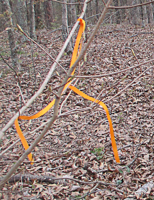 |
| My new favorite color! Follow Me Orange. |
Our Final Destination And A Possible Ancient Relic.
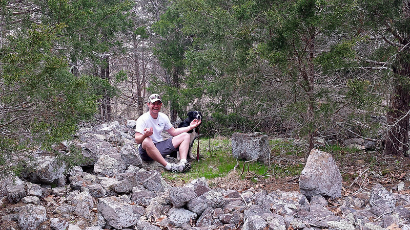 |
| Finding a spot of enlightenment and my center, in the Rock Pile. |
Overall Thoughts: I LOVE This Place.
Overall, our hike to Rock Pile Mountain was fantastic. We could not have asked for a better day and botanists would fall in love with the variation in local trees here; as the wilderness supports basswood, butternut, Kentucky coffee tree, walnut, sugar maple, and magnificent white and red oaks. If you find yourself hiking in Spring, as we did, you'll also notice as you near the man made ponds the sing-songs of frogs as they serenade in hopes of a mate. Evidence of white-tailed deer, turkey, and other large game abound, we spotted many tracks for the deer and heard them as they escaped, just out of view, on our return hike. Another thing to watch out for, although we found no tracks or evidence, are black bears. There have been quite a few spotting of these bears in the Rock Pile Mountain Wilderness, so please keep this in mind, particularly if you are camping in the area as you should suspend your food items in a bear bag, high in a tree. The last thing you would want during a wonderful camping trip would be a humongous hairy camp crasher.Keep In Mind: I'm A Wilderness Fan-Boy...
I'll admit, I'm partial to wilderness areas. I enjoy the relative solitude, the complete lack of crowds and the feeling of truly being alone and yet one, with nature. The lone hiker we encountered was the solitary exception to the general experiences I've had in the Missouri and Illinois wilderness areas and the other hikers (remember the newer RAV4 at the trailhead?) we never spotted, and once our traveling companion went out of sight at the downed trees, we never spotted him again either. In our wilderness areas I find that the birds sing a bit bolder, nature takes an extra second before darting for cover, the general fresh air seems fresher, and Rock Pile Mountain Wilderness was certainly no exception. I can't recommend this area enough if you're looking to get away for a day hike or if you're planning a remote backpacking trip, just don't forget to print a map and take a compass. Remember, GPS devices may run out of battery, so if you're using one be sure to bring extra batteries. In fact, that is the reason that I did not take many pictures during our visit here, I had reserved my phone for an emergency only, turning it off as we hit the trail in order to conserve all battery life. I hope you decide to visit this great wilderness area, I'm sure you'll enjoy it just as much as we did!One Last Thing...
All packs are not created equal. One thing to keep in mind, if you are back packing like we did, keep your load light and properly adjusted or, well, there's a picture below. My fingers became pretty swollen due to hiking with too much weight on my shoulders and not enough on the hip belt. Hopefully you'll get as big of a snicker at this as my wife did... Happy trails to you!More Information:
Local Treks on facebookMark Twain National Forest: Rock Pile Wilderness
Rock Pile Mountain Wilderness on Wilderness.net
Mark Twain National Forest Brochure of Rock Pile Mountain Wilderness (with trail map)
Mark Twain National Forest Recreational Opportunity Guide for Rock Pile Mountain Wilderness (with trail map and driving directions as well)
Official USGS Rock Pile Mountain Quadrangle Map (use with the trail maps above)
- Note the USGS map above is a HUGE file and in pdf format.
Wilderness Areas: Let's Get WILD! (post on wilderness manners and what to expect in a wilderness)
The Official USGS Maps Page (helpful for all types of maps, and FREE!)
Tiny. Tenacious. Terrible. Ticks. - A post on how to keep those bloodsuckers at bay!
How To Take A GREAT Day Hike
Coordinates:
Trailhead GPS Location: 37°27.811' N, 90°24.311' W (taken with Samsung Galaxy S4)
Rock Pile GPS Location: 37°25.222' N, 90°25.199' W(taken with Samsung Galaxy S4)
Labels:
Backpack,
Camp,
dayhike,
forest,
Fredricktown,
hike,
hiking,
Little Grassy Mountain,
Madison,
Mark Twain National,
missouri,
National Forest,
nature,
outdoor,
Rock Pile Mountain,
Wilderness
Sunday, April 20, 2014
Millstream Gardens: Well Shut Me In!
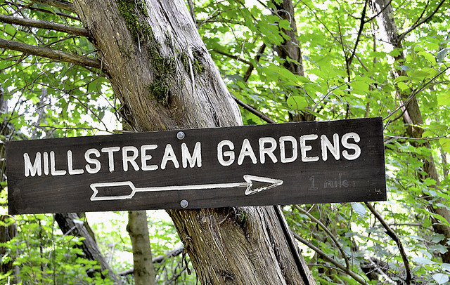 |
| More of my pictures from Millstream Gardens Atta'Way----> |
As you enter the Millstream Gardens Conservation Area, located just off of hwy 72 between Arcadia and Fredricktown, MO, you will come to a fork in the road. Turning left at the fork takes you to the "official" trail head for the Millstream Gardens trail. From the official trail head the hike runs for about one and a half miles through the woodlands and along the St. Francois River, connecting Millstream Gardens to the Silver Mines Recreation Area. This trail is not a loop trail, so once you've made the journey to the Silver Mines, you'll be heading on back on the same trail, making the trip a three mile trek.
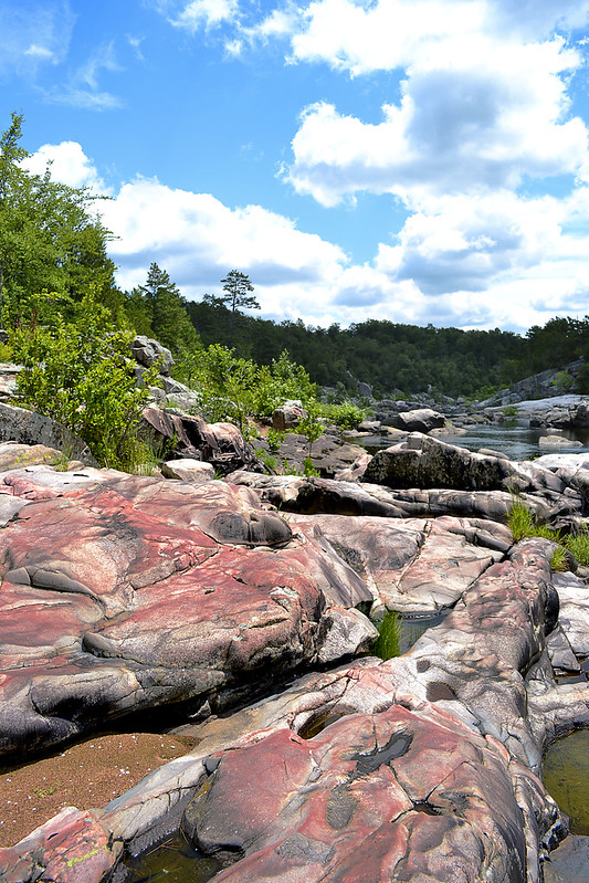 |
| Local Treks: Tiemann Shut-Ins |
 |
| Who's a happy boy? |
Heading East from the overlook you will find the beginning of the Millstream Gardens hiking trail, which is unpaved. As you make your way down the dirt path the trail you will find signs calling attention to landmarks such as Shark's Fin rock, a large angular rock, jutting up from St. Francis River, perhaps to take a bite or two out of some of the kayakers as they shoot the rapids. Other labeled points of interest you will find in this beginning section of the trail are Pine Rock Overlook and Double Drop Rapids. Pine Rock Overlooks provides a perfect perch to steal a few photos of the shut-ins as well. As you continue, ever eastward, you will begin to leave the Tiemann Shut-Ins area and enter the more heavily wooded portion of the trail.
 |
| I caught this bug nabbing a snack! |
The trail through the wooded area is relatively flat, with only a few hills that reside near the midway point of the hike. In the "hilly" areas, be careful of your footing as there is loose rock and occasional water trickling through or over the trail. When you find yourself approximately three quarters of a mile east from the Tiemann Shut-In patio, you may notice a lonely concrete foundation, just before the trail begins to follow the St. Francis once again. I scoured the area for any indication as to what the foundation may have been, but only confounded myself more, spotting three cylindrical concrete forms 15-20 yards to the east of the foundation on the north side of the trail. I've continued to look online and even ask locals around the area, but have yet to discover what the foundation may have been prior. The trail may seem to "split" here at the foundation, but the path that leads west is just a slight spur that will take you to a scenic little area of the river, that features a splendid view of a tall bluff that forces the St. Francis River to flow on its northern side.
From here the trail continues eastward to the Silver Mines and Mark Twain National Forest. As the trail nears the banks of the St. Francis be aware that you may have to make slight deviations from the path, as rising water sometimes pools in these areas or deposits branches, twigs, trees and other objects that may block your path. Don't be too wary though, you will not have to step more than a few yards from the clear trail in order to get around these small "trail-blockers". If you've brought a picnic lunch the large open field at the Silver Mines provides not only a wonderful place to take in the scenery and spot TONS of wildflowers, but also many picnic tables as well so that you may sit alongside the St. Francis River, take a reprieve and prepare for the wonderful return trip to Millstream.
In fact, upon your return to Millstream you may want to take the path that leads west from the Tiemann Shut-Ins overlook. This trail will lead you to another perfect picnic spot, this one featuring a vista over looking the St. Francis River, a picnic pavilion, and one of the most twisted pine trees I've ever seen, just check it out below!
 |
| Enjoy a picnic with a view of the river and one TWISTED pine! |
As with any trip into the woods there are ticks in this area, so you may want to brush up on what keeps them at bay and how to remove one should it embed. And of course if you're taking children along, you may want to check out some tips on how to take a GREAT Day Hike. Thanks for reading, be sure to leave a comment down below or check us out on facebook!
More Information:
Mill Streams Garden Conservation Area on mdconline
Millstream Gardens Area Map
My Flickr Gallery of Images
Local Treks on facebook
White Water and Rock Hounding: Silver Mines Recreational Area
Tiny. Tenacious. Terrible. Ticks. - How to keep those bloodsuckers at bay!
How To Take A GREAT Day Hike
Labels:
boulder,
camping,
climb,
conservation,
Garden,
Granite,
hike,
hiking,
kayak,
Local Trek,
Millstream,
oak,
outdoor,
pine,
rock,
Shut ins,
St. Francis River,
trail,
walk
Monday, March 10, 2014
Panther Den: Don't Forget Your Map!
How To Get There
Finding Panther Den Wilderness may be, in itself, a bit of an adventure. If you have been searching for directions I'm sure you've encountered a thousand different versions out on the internet. Some talking about private land others talking about washed out creeks, heck some may even be saying you'd better just float on in from the north on one of the fingers of Devil's Kitchen Lake. I guess I'll go ahead and add another way to get there, ours was simple and fairly straight forward.
From Cape Girardeau, MO we started across the Emerson Bridge into Illinois and followed highway 146 East through Anna, IL turning left on Lick Creek Road near the outskirts of town. After traveling about eight miles down Lick Creek Road, we veered off to the left onto Grandview Road, following it until again veering left onto Hall Church Road. Follow Hall Church Road until you are able to turn right on Rocky Comfort Road, enjoy this last bit of paved road. Continue down Rocky Comfort Road for about three miles until you can make a right turn onto Panther Den ROAD. Welcome to the gravel my friend! Now, follow Panther Den ROAD for a bit over a mile or so, until you see
Panther Den LANE on the left. You'll notice this road is in pretty rough shape (or at least it was in 2013-14), keep to the right as it is a one lane road, and you will see the parking lot at the end of the road on the right.
| Pay attention to the trail markers out here: The Panther Den loop is 389, the trail back to the lot is 371, and the River to River Trail is 001. See the Quick Trail Note below. |
One of the first things you may notice as you approach the trailhead is that there is a complete lack of information and maps on the Panther Den Informational Board (or at least there was on all of our visits in 2013-14). I don't know if all the information fell off, was stolen, or if a pack of wild dingos with a taste for maps and information strolled in and devoured all postings. So be sure to print off a map of the area before you leave home, read my cautionary tales below if you don't think having a map is important...
The trail itself begins as a mixture of gravel and dirt, featuring many planned switchbacks which help to reduce the wear and tear of erosion on the trail and wilderness. The switchbacks also make the hilly terrain a bit easier to traverse. The rolling downhill hike will bottom out with a small creek crossing, be alert here as we have found this a fantastic place to find local wildlife visiting for a refreshing drink. From here you'll travel up a small hill be sure to veer left at the trail intersection and that will take you to a welcome sign for the area. You can now follow the trail around the Panther Den or, better yet, go inside the magnificent sandstone formations for which the entire wilderness area is named!
Quick Trail Note:
The Panther Den loop makes use of the 389 white diamond trail markers/blazes, however these markers are sometime sparse and, I suspect, stolen by idiots. You
may see markers up for 389-A and 389-B, both of which are small spurs, these spurs seem to be old, abandoned trails. My experience is that 389-A and 389-B are generally
overgrown and hard to navigate (I became pretty lost on what I believe now to be 389-B). I'd suggest staying on the main 389
trail and then following the 371 trail marker back to the parking area. 001 is the designation for the River To River Trail, which runs through and connects Panther Den Wilderness and Crab Orchard Wilderness.Enter The Den!
| One of the many "rooms" within the Panther Den rock formations. |
You can easily spend hours inside of Panther Den, leaping from cliff to cliff, poking into every crack and crag, squeezing through narrow crevices and splits or just running your hands over the smoothness of the sandstone. There are small waterfalls to be discovered, side trails to be explored, cairns to be constructed and plenty of places to hide as well; so you can jump out and scare the wits out of your friends and family. And, although you won't find any panthers in Panther Den (at least not since the 1870's) you may spot some other local wildlife such as whitetail deer, turkey, muskrats, beaver, and skunks. If you are really lucky, you may even get a rare glimpse of a bobcat or mink. So be sure to keep your eyes peeled!
| Be sure to set a meeting place up. Just in case. |
You may also want to stick together while exploring the inside of the formations, or at the least set a place and time to meet up in case someone gets separated. It is very easy to get lost within the maze-like formations of Panther Den. Children (and parents) may freak out if they suddenly find themselves separated from the rest of the group. If you become horribly lost remember that a distress signal in the woods consists of three successive sounds; be they yells, shots, claps, whistles, or any other signal.
Camping
There is so much to be explored in Panther Den that you may even consider camping within the area. If you do, remember that you are within a wilderness area. You do not need a permit and the US Forest Service asks only that you practice "Leave No Trace" ethics and camp a minimum of 300 feet from any established trails. Most of the "user" camps that you will encounter are far too close to established trails and have left obvious marks on the landscape. You are encouraged not to use these campsites so that these overused areas may recover. Of course, you may want to read up on what a wilderness is and always remember to practice your very best Wilderness Manners.
Now that I've told you of how beautiful and truly distinct Panther Den Wilderness is, I'd like to give you two quick stories of warning.
On our first outing at Panther Den Wilderness we became lost. Very lost. Playing victim to many of the "trails" as we ventured further into the wilderness. We had inadvertently stumbled upon an old, abandoned equestrian trail that twisted and turned through rugged terrain. As I continued to notice the decline in the quality of the trail, I became (silently) alarmed. I could tell we were no longer on an established trail and we had taken so many lefts and rights, I could not recall from which way we had come. Luckily I had my phone, turned off, in my pocket. No bars. We continued to hike and I continued to quietly check my phone. A bar lit. I stopped and instantly hit the button for Google Maps. Once it loaded I found our heading and took note of where the trailhead was on that small, smart phone screen. Had it not been for that stroke of luck we may have been lost for hours in Panther Den Wilderness. This is the experience that taught me to never, ever, set out on a trail without a map and an idea of the route I wish to travel.
Story Two: Stranger on the Road
| Panther Den Wilderness is for tree lovers... |
So now, please, take this map. Print it. Fold it. Put it in your pocket. It's simple. If you plan to visit Panther Den Wilderness and truly explore the area I cannot stress the importance of having a map on hand enough. Safely experiencing the beauty and sheer uniqueness of the area is worth the ink!
More Information:
CLICK HERE AND PRINT THIS MAP!
Visit Local Treks on facebook!
Wilderness Areas: Let's Get WILD!
Tips: How To Take A Great Dayhike
Illinois Wildflowers (online guide with pictures)
A Conservation Assessment for the French's Shooting Star (warning: good read, pretty scientific)
National Geographic "Backyard Bird Identifier"
Labels:
blog,
camping,
creek,
directions,
hike,
hiking,
leave no trace,
Local Trek,
lost,
map,
Panther Den,
sandstone,
trail,
trees,
US Forest Service,
warning,
Wilderness,
wildlife,
woods
Subscribe to:
Comments (Atom)


