Monday, November 3, 2014

Giant City State Park: Stonefort Nature Trail


Fried Chicken. More importantly, and according to a family friend, the World's Very Best Fried Chicken served in an all you can eat family style. That, is what truly brought me to Giant City State Park, located just outside of Carbondale, IL. But what I found, besides the absolutely delicious fried chicken, was an astoundingly gorgeous and completely unique area, filled with a hiker's wish list of things to do, see, explore and, of course, eat!

With so many different trails to explore in Giant City State Park I've decided to break them up into more easily "digestible" single review trails, starting here with the Stonefort Nature Trail...

We began our whole excursion in Giant City State Park pondering exactly what a "Stonefort" was, and since we all had a different idea of what it may actually be we decided to make the Stonefort Nature Trail our first official stop. Little did we know, but we actually caught a glimpse of the Stonefort Nature Trail's breathtaking observation point from atop an 80 foot sandstone bluff as we entered the main park.

So, Exactly What Is A "Stonefort"?

This one-third of a mile loop trail took us on a tour of an ancient "stonefort", one of ten wall-like structures, constructed entirely of heavy stone, believed to have been erected in the Late Woodland period between 600AD - 900AD in Southern Illinois. Each of these ancient arrangements have been discovered on top of hills or promontories and were once believed to have been used as some type of stone fortification, thus giving them the name "Stonefort". These unique walls, consisting of heavy stones, are now believed to have been constructed as meeting places or perhaps ceremonial locations. The original wall that sat atop this particular trail was actually removed, dismantled by early European settlers to the area, who used the heavy stones as building materials. The low stone base is all that really remains of the original site, however, in 1934 the Civilian Conservation Corps (whom I can't thank enough) rebuilt the wall into the site that we see today. During the reconstruction of the wall, the CCC found many Native American artifacts including a good deal of pottery. "I personally love sites like this that carry that hint of ancient mystery, sites such as this and Rock Pile Mountain always pique my curiosity of early Native Americans and, while marveling at their accomplishments and ingenuity, I also find myself theorizing on what these sites may have been used for.

But What About The Actual Trail?

The Stonefort Nature Trail itself is well worn, with many roots and rocks embedded in its surface, which some may find a bit difficult to walk on. The trail also winds it's way up the side of a small hill, where you instantly come upon the structure itself upon arriving at the top. If you continue the loop, around the top of the hill, you will come to a spectacular overlook from an 80 foot sandstone bluff which overlooks the park's entrance. A word of warning for those of you with small children and faint hearts, it is a STEEP, LONG drop to the bottom of this bluff and there are no handrails. The trail also narrows a bit here making it a somewhat dangerous portion of the trail. For those that continue along the loop, you'll find another overlook along the way along with a carpeting of moss, ferns and wildflowers, sheltered beneath a wide canopy of local hardwoods an evergreens. This trail is well worth the short hike, even if you decide the breathtaking 80 foot overlook perhaps steals a bit too much of your breath.

Directions (click the Google Map below to enter in your address)

Giant City State Park
235 Giant City Road, Makanda, IL 62958
(618) 457-4836

More Information: 

Local Treks on facebook 
Giant City State Park Devil's Standtable Nature Trail - Be sure to hit this trail too!
Giant City State Park - Official IDNR Homepage
Giant City Trails -  A list of all eight established trails
Giant City Visitor Maps - Maps provided by the IDNR of the entire park
More Photos From Giant City State Park - My Flickr Album for Giant City State Park

Thursday, August 14, 2014

Hawn State Park: The Happiness of Hawn


To me, the happiness of Hawn State Park lies completely in its pure variety of ways to enjoy it. Are you a rock lover? Visit Hawn to see one of Missouri's best examples of Lamotte Sandstone, an old, coarse-grained sandstone that overlies ancient igneous bedrock. Think Missouri State Parks should be "for the birds"? Well this location sees a great variety of our fine feathered friends, including pine warblers, chickadees, and short eared owls. Love the gentle gurgling of a crystal clear stream? You have to check out Pickle Creek, which has been designated an outstanding state water source due to its crystal clear waters, due in part to that Lamotte Sandstone above. Water lovers may also seek out the River Aux Vases, which meanders through the area, carving out steep valleys.

Then there are us hikers, and we're in for a particular treat as Hawn State Park presents us with four fantastic trails each of varying length and difficulty: the super short .70 mile Pickle Creek Trail, the 300 foot handicapped accessible Overlook Trail, the 9.75 mile Whispering Pines Trail, and the shorter 3.75 mile White Oaks Trail. Each of these well maintained trails allows us to take in all that Hawn has to offer including two backpacking camps on the Whispering Pines Trail for those who wish to take in the "wild" local nightlife, and that makes me happy!

This is the second time I've hiked the White Oaks Trail in Hawn State Park, once in the fall of 2013 with my family and now the summer of 2014 with only my four-legged hiking buddy Hyatt, and I enjoyed every step of each journey. As if the changing seasons couldn't possibly provide enough change and variety, the White Oaks Trail itself constantly changes scenery and trail conditions as you hike. Like a Hollywood star vying for your attention, this hike seems to constantly attempt to outdo itself searching for new, fresh looks to give you.

A GREAT Trailhead Begets a GREAT Journey

I'll start at the very beginning, because it is one of the most important parts of the trail to me, the trailhead. At the clearly marked White Oak trailhead I found a very well stocked information area, which offered literature on other Missouri State Parks, many area maps, a billboard with important informational postings, a very convenient vault toilet, and, on my summer trip, an absence of cars! It appeared as though I may have one of Missouri's prettiest State Parks, all to myself (well not completely myself I did share a bit with my canine companion).

Variety, Variety, Variety...

Just past the trailhead the White Oak Trail itself starts out a bit "rugged", featuring stones intertwined with rich, earthy roots comprising the first bit of surface. I found myself looking down frequently, to assure my footing along the first half mile of the trail due to the rocks and roots, despite the elevation changing very, very little, I'm always a bit overly cautious when hiking alone to not twist an ankle.

Continuing down the trail as you approach the first White Connector (WC1, which will lead you to the Whispering Pines Trail), the rocks and roots make way and the trail itself morphs into to a landlocked sandy beach-like trail, bordered by beautiful trees and undergrowth. As you continue to hike, past WC1, the sand particles become progressively larger and larger until they are no longer grains of sand but pebbles and small rocks. Then I catch one of my very favorite scents, pine, and the trail changes yet again, the scattered shortleaf pine needles cushioning my every step as I silently stride the trail's well worn path through majestic native shortleaf pines and cedars. It is here, among the piney giants, that I let a bit of nature's chorus swell around me, listening as the bird's tenor song crescendos, while rhythmic crickets keep measure. The only thing more amazing than the shifting scenery is that I have traveled only a mile to see it all!

Skullcap, it may sound scary it's actually quite beautiful.
Continuing down the trail you will find the second White Connector (WC2: which also leads to the Whispering Pines Trial), you'll want to continue to the right to stay on the White Oaks Trail. In just a few yards from WC2, you will find the official White Oaks Trail loop. The White Oaks Trail loop will continue your journey through ever changing surroundings featuring some creek crossings, rock overlooks, boulders on which to scramble and maybe even some sweet edibles such as wild blackberries, hiding in the underbrush. Also be sure to keep an eye out for some truly stunning wildflowers such as the wild yellow lady-slippers orchid (which I couldn't spy anywhere). But if you are lucky enough to find one of the yellow lady-slippers orchids, don't try to take it home, the orchid's roots are actually attached to fungal threads deep beneath the soil and once those threads are severed the orchid dies... plus you could net a $1,000 fine or win a fabulous stay in one of our finest concrete incarceration centers for digging them up as well (so I'd suggest taking lots of pictures instead, and maybe even sending some to us here).

With so much to see and do along the way, the White Oaks Trail is a great solo or family hiking destination. There are a plethora of opportunities to splash about in a creek, take a side "off-trail" adventure into the underbrush to forage, climb the branches of a gnarled old cedar tree, bound from boulder to boulder, perch upon rock ledges, and so much more that the 3.75 mile length may never even be noticed by most, resulting in less of the dreaded "are we there yet's". This trail is truly diverse, overwhelmingly beautiful and simply begging for you to enjoy. As always, thank you for reading and Happy Trails!

Something New: Google My Tracks

Below is a little something new I'm trying, Google's My Tracks. Hopefully you'll be able to garner at least a bit of information from the trail map below. Although the mileage at the White Oaks Trailhead stakes out the trail at 3.75 miles, My Tracks placed the mileage at 4.09 miles, maybe I took a bit of a wider trail than they measured, or perhaps my phone's GPS was off by a few feet here and there. I just hope you find the information below helpful and if you do, please let me know.


More Information: 

Local Treks on facebook 
White Oaks Trail Map (print it off and take it with you... just in case)
Hawn State Park homepage
How to Take a Great Dayhike
Tiny. Tenacious. Terrible. Ticks.
Missouri State Parks Homepage

Friday, July 18, 2014

What Are Your Thoughts On Missouri's Deer Management?


We always love coming across a family of deer quietly grazing or stealthily slipping through the forest as we hike through their home. When I see these majestic creatures it always reminds me why we always attempt to leave no trace. In order to keep Missouri's deer population (which includes white-tailed deer, mule deer, and their hybrids) the Missouri Conservation Commission has recently approved proposed regulation changes to the Wildlife Code of Missouri regarding the operation of local hunting preserves and wildlife breeding facilities.

These proposed regulation changes are up now, via the Secretary of State's Office at http://www.sos.mo.gov/adrules/moreg/current/v39n14/v39n14a.pdf (beginning on page 7) and primarily address the Missouri Department of Conservation's strategy to minimize the spreading of diseases such as Chronic Wasting Disease, in Missouri's deer population. Chronic Wasting Disease has been identified in some captive-deer operations and is always fatal, with no known cure as of now.

According to the Missouri Department of Conservation website (mdconline) the cliffnotes version of the proposed regulations include:
  • Banning the imports of live deer from other states
  • Requiring new and expanding captive-cervid facilities to improve their fencing
  • All deer six months and older that perish in one of the captive facilities are to be tested for Chronic Wasting Disease
  • Requiring captive facilities to establish better record keeping
  • Prohibiting any new captive facilities to be built or established within 25 miles of confirmed Chronic Wasting Disease deaths
Now is your time to let the Missouri Department of Conservation know if you agree with these proposed regulations. You may share your comments online with them at mdc.mo.gov/deerhealth.

Keep in mind a healthy deer population is a huge boon to the state of Missouri, and with half a million deer hunters, two million wildlife watchers and many Missouri landowners who manage their property for deer all culminate in an annual economic benefit of a billion dollars!

More Information: 

MDConline: Cronic Wasting Disease
MDConline: Protecting Missouri's White-tailed Deer

Wednesday, July 16, 2014

Sam A. Baker Park: Shut Ins Trail


Sam A. Baker is a popular Missouri State Park, let me stress popular... and why the heck not?! This park really seems to have it all, from zipping along on bicycle trails, grilling hotdogs over a campfire, popping a tent at one of two huge camping areas, taking a cooling dip in the clear St. Francis River, to hiking on one of four trails, there is a little something for everyone. There is an added bonus to Sam A. Baker too, if you happen to forget something back at home, the area boasts a Park Store that has just about anything you may need. But keep in mind, with so much to offer at Sam A. Baker, there are many who seek to really take advantage of it, and by that I mean, it may be a bit... crowded.

First Impressions of the Park

My initial impressions of Sam A. Baker were fantastic, as we made our way down Highway 143 the trees began to envelop the road, creating a tunnel of green gently leading us toward our initial destination, Campground 1. The campground was very nice, and despite the recent rains, our campsite (number 5) was relatively dry with only a few low spots gathering puddles. After pitching the tent we decided to take a nice, leisurely stroll through the campground. Making our way just a bit to the South we found the cool St. Francis River, nearly a clear as a window, carving out its gravel banks and creating perfect places to wade and swim in its refreshing waters. As we explored the campground further we found a very well traversed and well maintained Paved Bike Trail to the North, which is quite a perk for the visiting camping jogger. This trail stretches 1.5 miles and travels from campground 1 all the way to the park store, it travels along State Highway 143 and allows for some picturesque views of Big Creek as well.

It's All About the Amenities!

After exploring the campground we journeyed over to the park store (which is VERY handy if you have found yourself forgetting something at home) and the park lodge. As Sam A. Baker does not allow you to transport your own firewood into the park, due to the emerald ash borer, so if you plan to have a campfire, be sure to pick up some wood at the store. Then while you're out you may like to take a quick stop at the Park Office and Visitor Center. There they will provide recreational equipment, free of charge, that you may use by simply checking the items out. After taking quick tours of the amenities we returned back to our campsite, flush with wood for a cozy campfire, ice cold sodas and some delicious chips from the store.

"Nocturnal Calls" and Camping

Once back at our campsite we started up our fire (due to the damp wood this was quite the undertaking, thank the heavens for lighter fluid) and roasted up some hotdogs, marveled as the fireflies faint green glow lit the night, told a few stories and then decided to get a good rest so we could explore the park even more the next day. After zipping up the tent, lying atop my sleeping bag I soon found myself being "gently" lulled to sleep with the echoing "Whoo HOOO" and "I'm SOOOOO Drunk" mating calls of the Migrating Midwestern Hooter, which were interrupted only by the heavy and constant "Ker-Thunk!" of the all to closely located latrine door. We did have a laugh out loud moment as our border collie, Hyatt, spotted a huge raccoon that had made its way onto our picnic table and attempted to leap through the mesh window of our tent in order to chase the raccoon away.

Upon awaking the next morning and with the migratory mating calls of the night now behind us, we decided to escape some of the more popular areas, in a desperate bid to get at least a small taste of the park's beauty without the crowds or noise. So we checked our area map and chose to set foot upon the Shut Ins Trail, a quick mile and a quarter hike out from just behind the Park Lodge, to see if we could find a slightly more secluded swimming hole.

The Shut Ins Trail

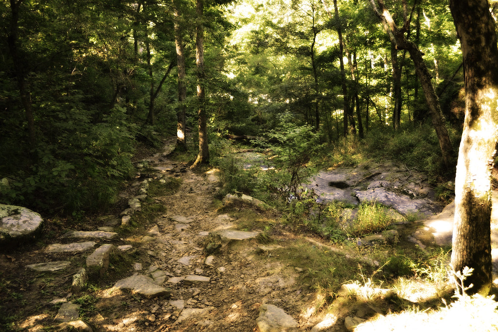
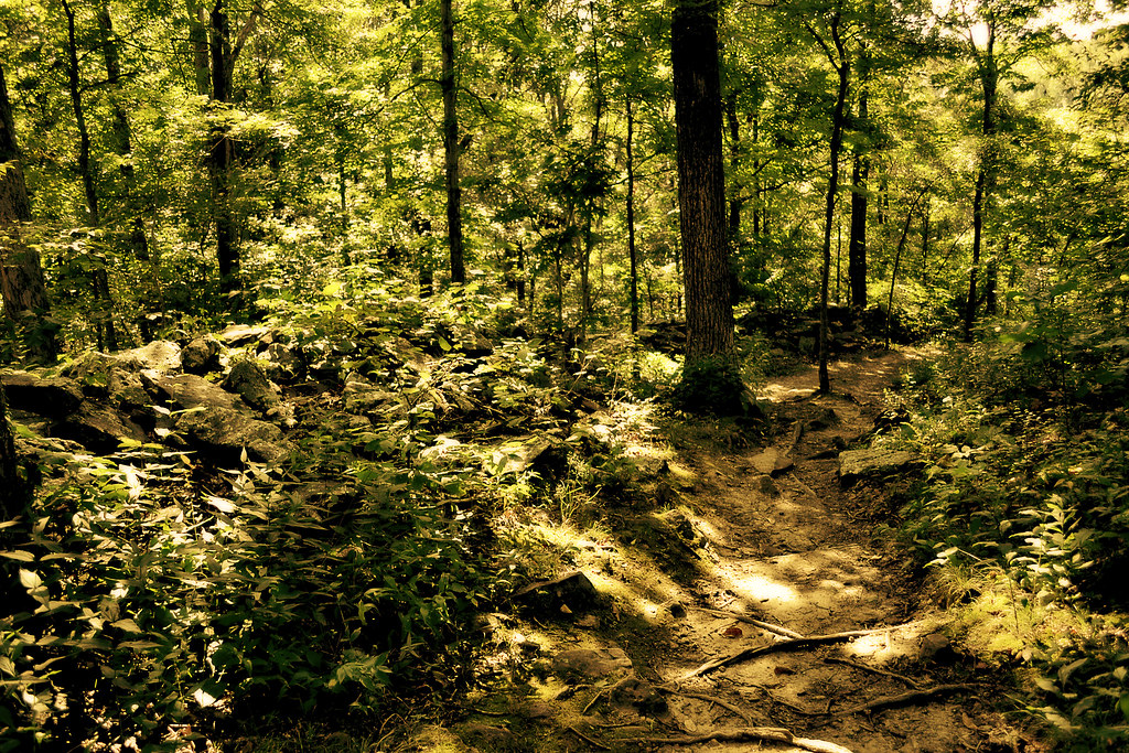
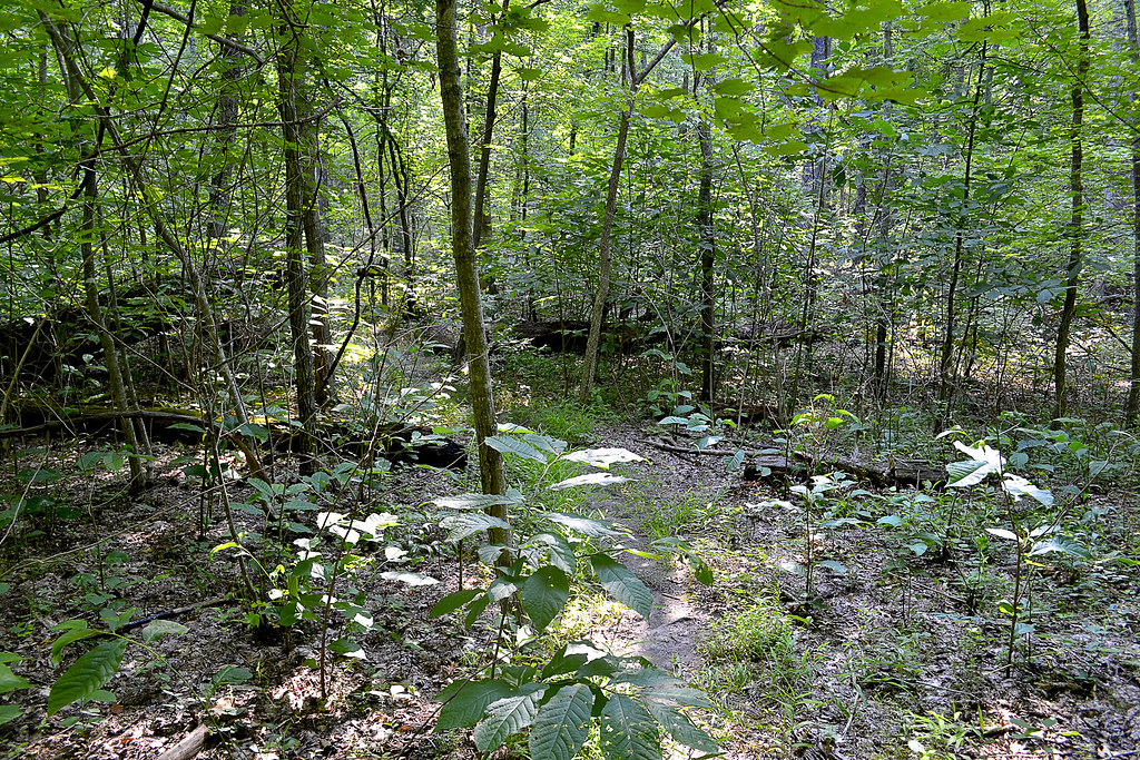
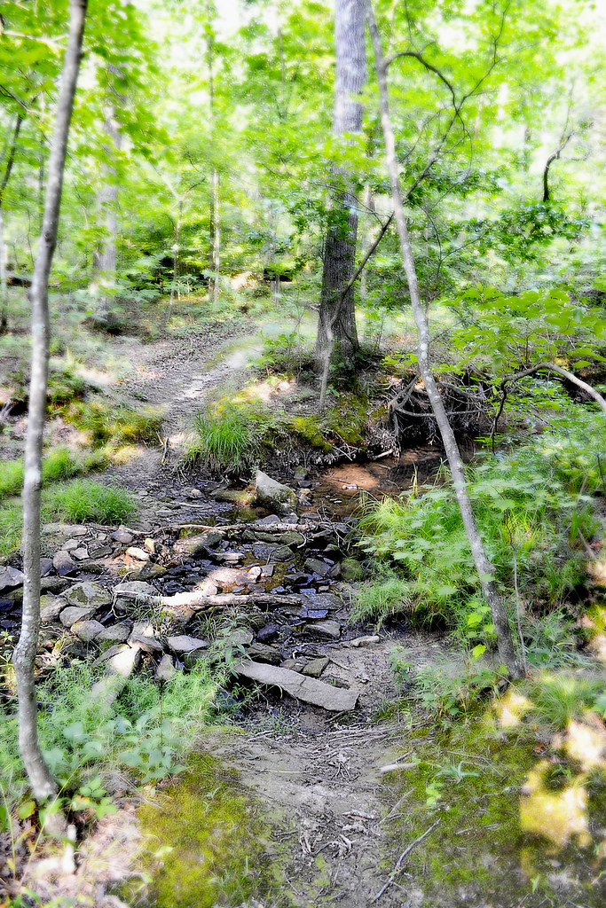
The Shut Ins Trail is wonderfully maintained; consisting of a well worn dirt path, sometimes sprinkled with gravel, and features low water bridges, handrails, and steps along the way. Children will find an easy hike on most of this route, and there are plenty of sights to see and share on your way along the path. We began our journey by heading downhill along the blue blazed trail with (what I believe to be) Big Creek bordering us just to the East. As we hiked about half a mile through the Sycamores, Cottonwoods and Sweet Gums we came upon a small off-shooting path, which we decided to investigate. Boy am I glad we did, because at the end of that path we found a gorgeous little waterfall, that wound its way through and over the large, moss covered dellenite boulders.

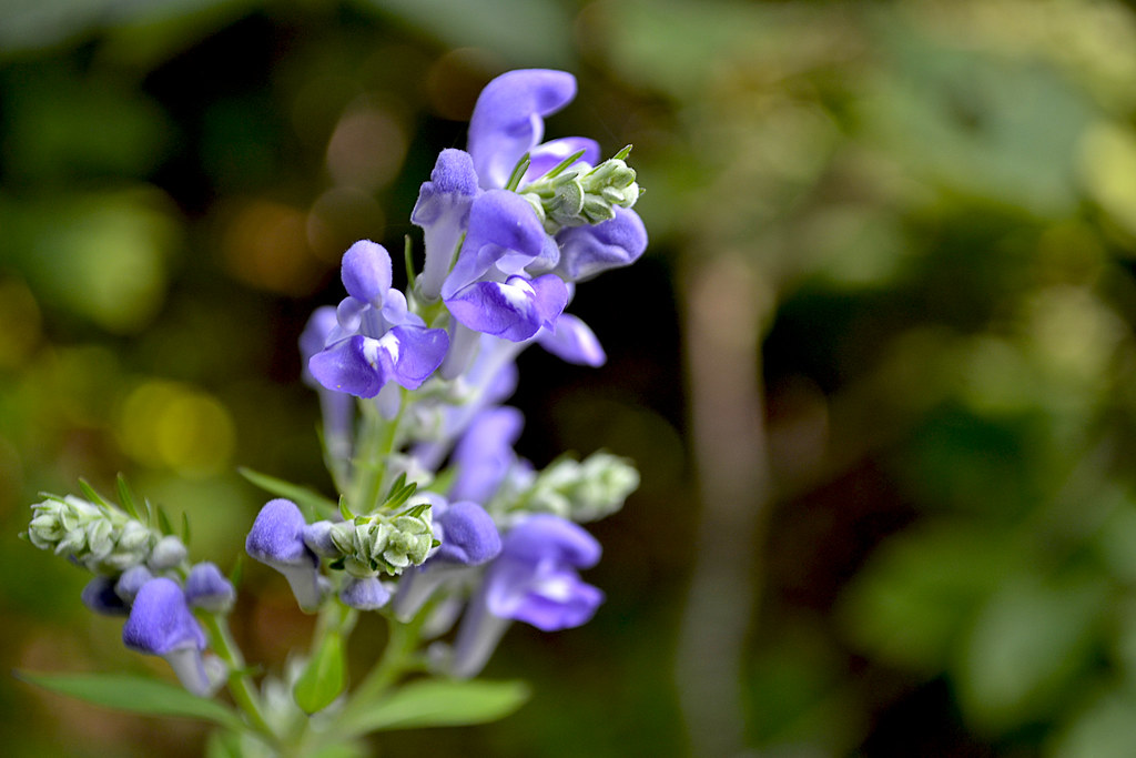
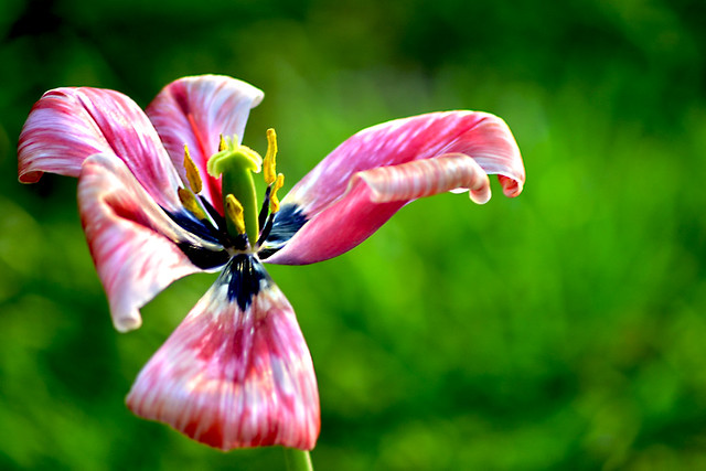
After getting our fill of scrambling over the boulders we headed back to the main trail and continued on, with all of summer's colors seemingly on display as wildflowers competed for our attention along the trail. We followed the trail for nearly another half mile until we came to a fork, one path leading to the Big Creek shut ins (to the right) and another path leading up the hill toward a connection with the Mudlick Trail. The path that led to the Mudlick Trail boasted a Shelter, which marked the intersection of the two trails, but also heads up a steeper incline. After a short bit of consideration we chose to head towards the Big Creek shut ins for a refreshing dip. Seriously, could there have been any other decision to be made on a hot summer's day?

The Big Creek shut ins seemed almost too good to be true, the area was wide, with water plenty deep enough for swimming and there were some low, flat cliffs that just begged to be jumped off. In fact, the water was at an almost perfect depth that day, but if you choose not to swim you could easily wade the shut ins, whose water was just a bit over chest high on our visit. We quickly found it was too good to be true, such a naturally beautiful swimmin' hole had spoken out and many had answered its call, within just a few minutes of our arrival the Big Creek shut in transformed from a peaceful watery respite to a rowdy outdoor roadhouse complete with Swazye'esque mullets to boot. We swam for a bit more then decided to make our way back to camp for a spot of lunch. As we headed back down the trail, making our way toward the Park Lodge, we passed a steady stream of like minded visitors who may have been just like us, looking for that little hide-a-way in the middle of a very, very popular Missouri State Park.

Final Thoughts

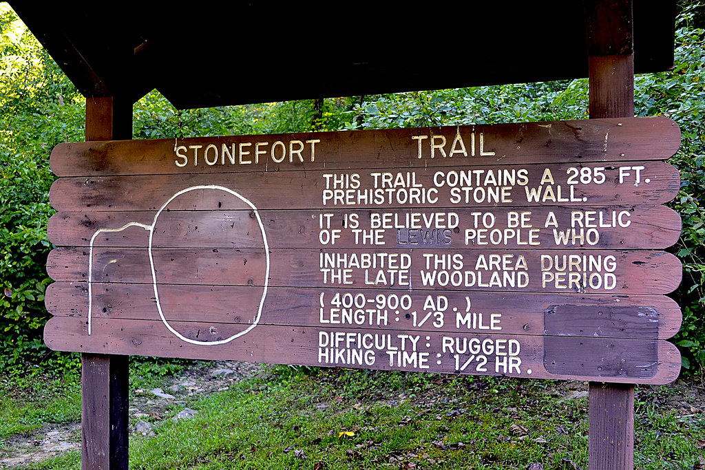
With so much to offer its no surprise that Sam A. Baker is so appealing to so many and there is no doubt that we'll return sometime and the 5.5 mile Mudlick Trail certainly looks very, very appealing, especially the Backpacker Camp located on a small spur of the Hike Only Section.. But the overall experience, for me, was it seemed simply too crowded. Sam A. Baker seemed (to me) more like a nature theme park than actual State Park and the campground, while very well maintained, was just a bit too... popular.

More Information: 

Sam A. Baker State Park Homepage
Sam A. Baker Hiking Trails
 - Shut In Trail Map
Fishing Report and Prospects: St. Francis River (above Wappappello Lake)
Local Treks on facebook 
Tiny. Tenacious. Terrible. Ticks. - A post on how to keep those bloodsuckers at bay!
How To Take A GREAT Day Hike - Hitting the trail? Then you may want to check out these tips.

Friday, June 20, 2014

The 100 Missouri Miles Challenge. Think You Can Do It?


There is a lot to be proud of here in Missouri, and our State Parks and the miles and miles of well maintained hiking trails they offer are just one of the many, many cool things that many Missourians (including myself) may take for granted from time to time. Well, we may let our appreciation of the Missouri trail system slip from time to time, but American Trails (a national, non-profit organization that works on behalf of our country's hiking, biking, and riding trails) named little ol' MO the distinction of "Best Trails State" for 2013-14 and our Missouri State Parks had a HUGE impact in Missouri receiving that distinction as they accounted for nearly 1,000 miles of Missouri's trails! Now, be sure to keep in mind that the the Missouri Department of Conservation also oversees approximately 600 miles of trails and Federal Agencies (such as the National Park Service, US Fish and Wildlife, and US Forest Service) account for 700 miles of trails, so I'm certainly not calling them slouches as all.

Well, all this hub-bub about the quality of Missouri Trails set into motion a challenge from our Governor, Jay Nixon, to get Missourians off the couch and onto one of our awesome state trails in 2013. The gauntlet was tossed as he asked for residents to take in countless lungfuls of fresh air, some of the most spectacular scenery in the state, and memories that will reside with them for a lifetime as they logged 100 miles on Missouri's trails. The response was enormous and we racked up over 1.1 MILLION Missouri miles in 2013. The Governor is hopeful that we will beat that amount this year as the challenge was once again put forth on March 20th.


So if you plan to hike, run, walk, paddle, bike, hop, skip, jump, roll or plan any other form of locomotion on Missouri's trails why don't you join the challenge today? Just hop over to 100missourimiles.com today and sign up. There is still plenty of time for you to put in your own #100MoMiles!

More Information

How To: Take A GREAT Day Hike
100 Missouri Miles Homepage
Missouri State Parks
Missouri Department of Conservation Homepage

Friday, May 30, 2014

Too Hot? Take In Some Nature Art This June.

Sorry, not by Marcus Janzow. But I wanted to have some type of picture here.
I'll admit, Midwestern Missouri summer days can be absolutely brutal and if it's too hot outside for you perhaps you may want to take in some local art at the Cape Girardeau Nature Center. Beginning in June you can see photographer and wildlife biologist, Marcus Janzow's photography exhibit, titled "Diverse Landscapes of Southeast Missouri".

Janzow concentrated on areas in Southeast Missouri, and the Missouri Department of Conservation hopes that after seeing the beautiful exhibit that you will want to get out and visit the areas photographed. And to be inspired by his photos simply stop by the (fully air conditioned) Cape Girardeau Nature Center during regular business hours in June, Tuesday through Saturday from 8 a.m. - 5 p.m. If you find it  cool enough you may even want to take to one of the trails located right outside of the Nature Center's doors as well, like the White Oak Trace trail.

Of course, I certainly hope you get out there and take to a trail to experience the great Missouri trail system as well, and I'd always love to see your pictures!

For more information on the June exhibit visit the Missouri Department of Conservation's release page here: http://mdc.mo.gov/node/28356.

Thursday, May 22, 2014

Taking In A Meteor Shower: The Camelopardalids Meteor Shower

The Geminid Meteor Shower 2012 (Jeff Dai) @ nasa.gov
*UPDATE Friday, May 23 10:53 pm CST: Listening live to the coverage on slooh.com they are advising to keep an eye out for the show to begin at around 2-4 a.m. Eastern or 1-3 a.m. Central... I really advise listening to the coverage, very intelligent, very informative.

Astronomers are predicting that this Friday and Saturday's Camelopardalids meteor shower may be this year's most extraordinary universal display. Currently the experts are predicting between 100-400 meteors per hour, which is far more than normal showers and dwarfs the most recent Lyrid shower which peaked at a measly 20 or so meteors per hour and we are in a PRIME spot here in the states to take it all in!

Not actually 209E/LINEAR, but you
get the idea... right?
Halleys Comet: nasa.gov
The Camelopardalids meteor shower is brought to you by it's proud momma, a comet named 209P/LINEAR which has a rather melodic sound to it doesn't it? This comet will be streaking near Earth on May 29, blowing us a flame streaking kiss from a scant 8.3 million kilometers away. It's due to this petite (209P/LINEAR is only 600 meters around, slim and trim by comet standards) comet's passing that we will find our Earthly trajectory passing right in her debris field, which is what will actually create this spacial display. The meteors we'll see this year are actually left over interplanetary grains, pebbles, rocks and junk from previous 209P/LINEAR visits, ejected over years from her nucleus. This year we'll find ourselves going through many of her old debris fields and as all of bits and bobs smack our atmosphere here on Earth it burns up, creating those sweet flaming meteors that may make some of us think of Aerosmith.

Easy Step By Step Directions For Viewing Camelopardalids

  1. Pray for a clear night.* Don't pray? Then wish. Don't wish? Then birthday's must stink at your house...
  2. Wait until dark on Friday, May 23. Take note of where the sun set.
  3. Open your front door.
  4. Walk outside.
  5. Put down a blanket and take a seat.
  6. Face where the sun went down.
  7. Turn 90 degrees to your right, it should face you north.
  8. Look up. If you don't see anything, try repeating the steps above every 30 minutes or so.
  9. Commence your thoughts of how small you are in relation to the cosmos or how cute Liv Tyler was in Armageddon as the meteors streak across the sky.
*Didn't get a clear night? Don't worry, you can hop online and watch the show live over on Slooh Community Observatory's webpage. Go ahead and put down your blanket, turn out the lights and pop that cold beverage anyway as you watch.

More Specific Directions For Viewing Camelopardalids

For best viewing any meteor shower your should try to get as far away from artificial light sources as possible, so go out and ruin Make Out Point for a night, sending those teens to smooch somewhere else, or just take a drive out from town, find a quiet public place that is open and sit on your hood to enjoy the show (I'm talking about the meteors here, not the smooching teenagers). If the furthest you can roam from home is your own porch or yard, just turn out as many lights as possible and find the darkest area of your own personal space.

Once you've procured your favorite spot, and perhaps laid down a blanket, or popped a cold beverage it's time to terrify the children with stories of how the meteors are actually brain eating aliens preparing to land, bent on world domination and hungering for the fresh grey matter of children. No, on second thought don't do that last step... Terrifying children, although fun, can have horrible results on their adult lives.

From Nasa's Image Gallery
Now, the meteor shower is named Camelopardalids after the relatively obscure constellation of, you guessed it, Camelopardalids or "the giraffe" (you thought camel, didn't you?). Given that this is the first time I've ever heard of this particular constellation, I wanted to get a better bead on exactly where to look for the meteors, and as luck would have it, the giraffe is pretty darn close to that blazing star Polaris, better known as the North Star. So, now I know to find the brightest star in the heavens and fix my gaze that-a-way. However, with the prediction of so many meteors, you should be able to find the most active area relatively easily.

So, you've waited for dark, found a nice spot, laid down your blanket, popped open a cold beverage and found the brightest star in the sky... What's next? Well, give your eyes a few seconds to adjust, watch for streaks, say ooh and aah, and maybe take a few pictures. Wondering how to take pictures of the meteor shower, well that's a bit out of my wheelhouse, here's a good article though. The last thing to do, and this is completely optional (but I feel very important); have someone else there to revel and marvel in the celestial beauty, wonder and amaze at how distant rocks and debris can put on such a splendid show, seemingly just for you.

Useless Trivia That May Make You Sound Smart

Up there a few paragraphs above I told you the meaning of the name Camelopardalids is the giraffe. But, I'm sure that you looked at that name and thought, "How the heck did they get giraffe from Camelopardalids?" Well, here's the skinny and I'm not talking about the knobby knees of the giraffe here. The name camelopardalids is actually Roman, and it comes from their attempt to describe this crazy animal they had found in Africa. This animal, which was "part leopard" and "part camel" became the camelopardalids. As G.I. Joe would say, "knowing is half the battle", use this information tonight to sound super smart as you take in the shower.

Happy meteoric trails and thanks, as always, for reading!

More Information

Slooh Community Observatory Homepage - A great place to watch the meteors, should clouds try to ruin your night.
Steve's Digicams: Digital Photography 101: How to photograph meteor showers
Sky and Telescope: Ready for May's Surprise Meteor Shower?
NASA's Sweet Gallery of Meteor Shower Images - To get you in the mood